February 04 , 2023.
Indonesia , Merapi :
Report on the activity of Mount Merapi from January 27, 2023 to February 02, 2023, Published on February 03, 2023
RESULTS OF OBSERVATIONS
Visual
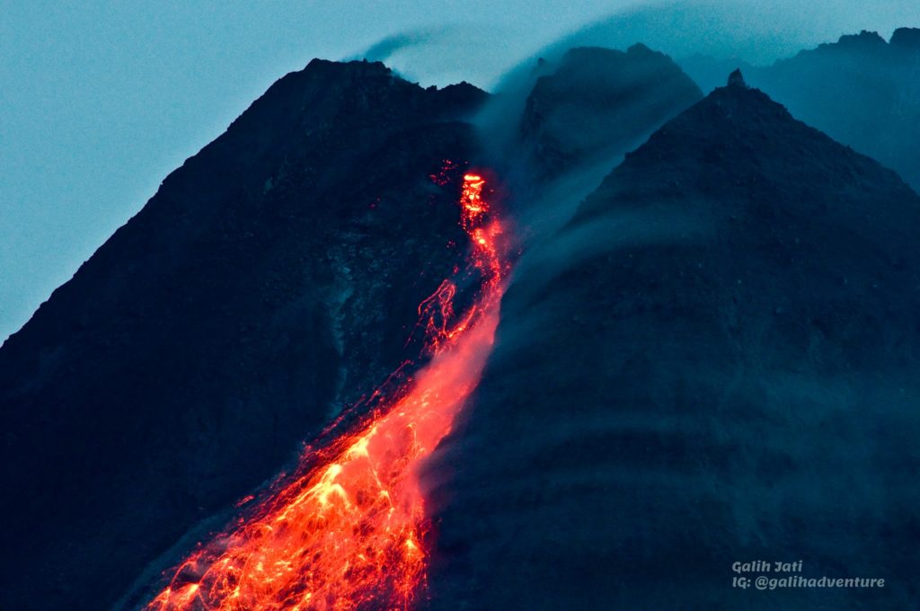
The weather around Mount Merapi is usually sunny in the morning and afternoon, while the evening is foggy. White smoke, thin to medium thickness, low pressure and 50 m high was observed from the Mount Merapi observation post in Selo on February 02, 2023 at 09:10 WIB.
This week there were 6 southwestward lava avalanches (first to Kali Bebeng then Kali Sat/Putih) with a maximum slip distance of 1800m. The sound of avalanches was heard from Pos Babadan 5 times with low to medium intensity
On the Central dome and the South-West dome no significant change was observed. Based on aerial photos from January 13, 2023, the volume of the Southwest dome was measured at 1,598,700 m3 and the central dome at 2,267,400 m3.
Seismicity
This week, the seismicity of Mount Merapi showed:
16 deep volcanic earthquakes (VTB)
707 deep volcanic earthquakes (VTA),
194 avalanche earthquakes (RF),
4 emission earthquakes (DG),
9 tectonic earthquakes (TT).
61 multi-phase (MP) earthquakes
The intensity of this week’s seismicity is still quite high.
Deformation
The Mount Merapi deformation that was monitored using EDM and GPS this week showed a shortening rate of 0.6 cm/day.
Rain and lahars:
This week, there was rain with a rain intensity of 10 mm/h for 155 minutes in Pos Kaliurang on January 28, 2023. No increase in the flow of rivers descending from Mount Merapi was reported.
Conclusion
Based on the results of visual and instrumental observations, it is concluded that:
-The volcanic activity of Mount Merapi is still quite high in the form of effusive eruption activity. The state of the activity is defined at the « SIAGA » level.
Source : BPPTKG
Photo : , Yohannes Tyas Galih Jati
Chile , Lascar :
Volcanic Activity Report (RAV), Volcanological Observatory of the Southern Andes – Ovdas.
Seismic activity:
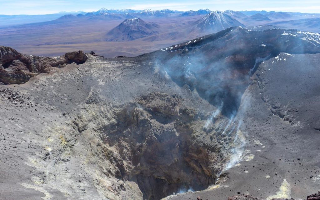
Over the past 24 hours, the seismic record from Lascar Volcano continues to be weak. During the previous days and when it was possible to analyze the recordings, the seismicity of the fluids showed characteristics in their signals with monochromatic tendencies in their frequencies.
The VT type earthquake with the highest energy was located 0.8 km south of the active crater at a depth of 4.6 km.
Other Notes:
No deformation is recorded to highlight thanks to the GNSS instrumental network.
No new satellite thermal anomaly was detected (Source group MIROVA(3)).
The average SO2 flux was 35 t/d on February 2, measured with DOAS equipment.
No new SO2 satellite anomaly detected (date of last image: February 2) (mounts-project.com).
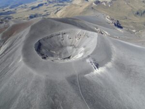
On the February 2 Skysat Collect satellite image, the dome is observed nestled inside the active crater, covering an area of 6,290 m2, which compared to the January 30 image shows a growth of 308 m2/day .
Specific hazard / risk
The potential impacts associated with the presence of a lava dome inside the active crater derive from its possible total or partial destruction, by an event with explosive characteristics. In this scenario, the occurrence of pyroclastic flows and ballistic pyroclastic ejections in the current danger zone is expected.
Source : Sernageomin.
Photo : Vulcanopro.
Colombia , Purace / Los Coconucos volcanic chain :
Weekly bulletin of activity of the Puracé volcano – Volcanic chain of Los Coconucos.
The activity level of the volcano continues at the yellow Activity Level or (III): changes in the behavior of volcanic activity.
From the analysis and evaluation of the information obtained through the monitoring network of the Puracé volcano – Los Coconucos volcanic chain, during the week of January 24 to 30, 2023, the COLOMBIAN GEOLOGICAL SERVICE – Volcanological and Seismological Observatory of Popayán reports that:
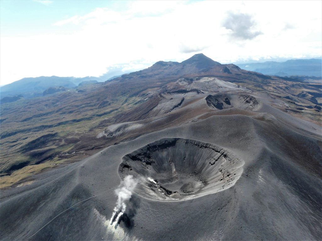
During the week evaluated, stable behavior was recorded, with a total of 775 seismic events, of which 131 were associated with rock fracturing processes (type VT) and 644 with fluid dynamics in volcanic conduits.
The geodetic network of GNSS (Global Navigation Satellite System) stations monitoring ground deformation continues to record a process related to inflation.
By monitoring the surface activity with the images obtained during the week thanks to the Mine, Lavas Rojas and Cerro Sombrero web cameras, a degassing of the volcanic system was highlighted, with a white column preferentially oriented towards the North-West. .
Regarding the monitoring of volcanic gases, it should be noted that the weekly measurements recorded a maximum flow of 3787 t/day for SO2 and a concentration of 10,000 ppm for CO2, important values in the degassing process of this volcanic system. .
Electromagnetic field and infrasound wave monitoring sensors did not record variations associated with changes in volcanic activity.
It is then concluded that variations in volcanic activity continue to be recorded, in line with the behavior expected in a level of activity III (yellow level), which could evolve towards states of greater activity.
Source et photo : SGC.
Hawaii , Kilauea :
Friday, February 3, 2023, 8:12 AM HST (Friday, February 3, 2023, 18:12 UTC)
19°25’16 » N 155°17’13 » W,
Summit Elevation 4091 ft (1247 m)
Current Volcano Alert Level: WATCH
Current Aviation Color Code: ORANGE
Activity Summary:
The summit eruption of Kīlauea Volcano, within Halemaʻumaʻu crater, continued over the past 24 hours. All recent eruptive activity has been confined to the crater. No significant changes have been observed at the summit or in either rift zone.
Halemaʻumaʻu crater Lava Lake Observations:
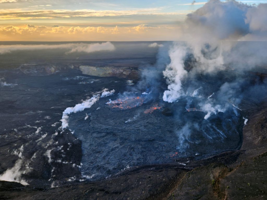
Eruption of lava in the eastern portion of Halemaʻumaʻu crater floor continued over the past 24 hours. The eastern lake remains stable and two of the smaller floating islands within it became submerged over the past day. Some lava crust is starting to form against the north and east levees, but the levees still define a 25 acrea area of activity. The small southern lava fountain is active and back to normal height of 1-2 m (3-6 ft). The smaller western lake in the basin of the 2021–2022 lava lake as well as the two smaller lava ponds remain active and unchanged.
View of the ongoing eruption at Kīlauea’s summit around 7:30 a.m. HST on February 2, 2023, looking to the south/southeast. Lava lake activity continues, and a large overflow from the central pond was active during the morning overflight.
Summit Observations:
Summit tiltmeters have been flat (no inflationary or deflationary trends) over the past day. Volcanic tremor remains above background levels. A sulfur dioxide (SO2) emission rate of approximately 3,000 tonnes per day (t/d) was measured on January 20, 2023.
Source : HVO
Photo : USGS / K. Lynn.
Mexico , Popocatepetl :
February 03, 11:00 (February 3, 17:00 GMT)
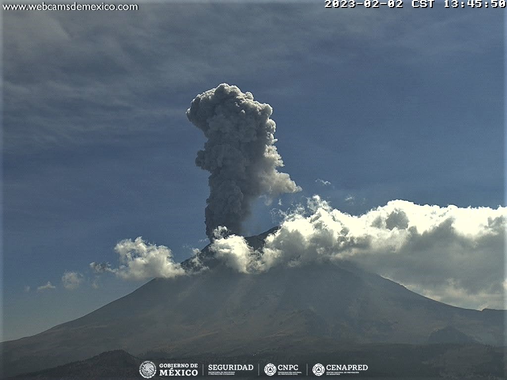
In the past 24 hours, according to the monitoring systems of the Popocatépetl volcano, 173 exhalations accompanied by water vapor, other volcanic gases and ash have been detected, as well as a minor explosion yesterday at 5:41 p.m. Additionally, 82 minutes of tremor were recorded.
During the morning and at the time of this report, an emission of water vapor, volcanic gases and ash was observed in a South-West (SW) direction.
Yesterday, a slight fall of ash was reported in the municipalities of Amecameca, Ecatzingo, Ozumba and Tepetlixpa, State of Mexico and Tetela del Volcán, Morelos. Likewise, during the morning, a slight fall of ash was reported in the municipality of Ecatzingo, State of Mexico by the National Center for Communications and Civil Protection Operations (CENACOM).
CENAPRED insistently reiterates the recommendation not to climb to the crater of the volcano because there is a possibility of explosions, as has been seen on several occasions in the past, which involve the emission of incandescent fragments and in the event of strong rains, to move away from the bottom of the ravines because of the danger of mudslides and debris.
The Popocatépetl volcanic alert traffic light is in YELLOW PHASE 2.
Source et photo : Cenapred.

