January 10 , 2023.
Hawaii , Kilauea :
Monday, January 9, 2023, 9:00 AM HST (Monday, January 9, 2023, 19:00 UTC)
19°25’16 » N 155°17’13 » W,
Summit Elevation 4091 ft (1247 m)
Current Volcano Alert Level: WATCH
Current Aviation Color Code: ORANGE
Activity Summary:
The summit eruption of Kīlauea Volcano, within Halemaʻumaʻu crater, continued over the past 24 hours. All recent eruptive activity has been confined to the crater. No significant changes have been observed at the summit or in either rift zone.
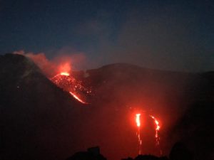
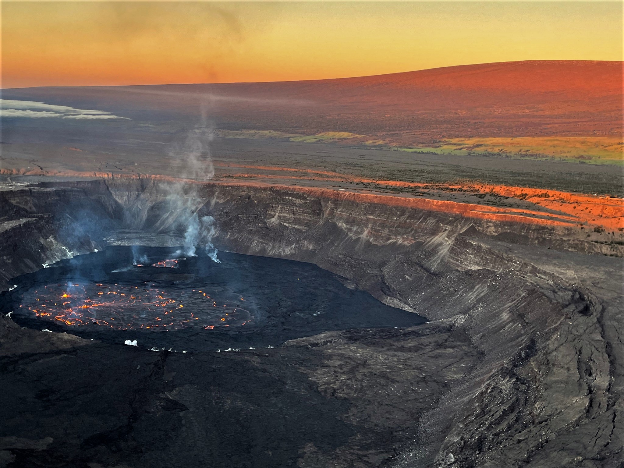
Photo of Halema‘uma‘u crater, at the summit of Kīlauea, taken from the southeast corner of the crater during an early morning helicopter overflight on Sunday, January 8, 2023. The eruption within Halema‘uma‘u that began on January 5, 2023, continues, with activity concentrated primarily in the eastern part of the crater. Here, an active fountain can be seen in the middle of the photo.
Halemaʻumaʻu Lava Lake Observations:
Eruption of lava from vents on the central eastern portion of Halemaʻumaʻu crater floor continued over the past 24 hours. Activity is concentrated in the eastern half of the crater and within the basin in the western half of the crater that was the focus of activity in 2021–2022. The active lava area in the eastern half of the crater now has one dominent fountain, and the active area has shrunk slightly over the past 24 hours
Summit Observations:
Summit tiltmeters recorded inflation over the past 24 hours. Volcanic tremor remains above background levels. A sulfur dioxide (SO2) emission rate of approximately 4,000 tonnes per day (t/d) was measured yesterday, January 8, 2023.
Rift Zone Observations:
No unusual activity has been noted along the East Rift Zone or Southwest Rift Zone; low rates of ground deformation and seismicity continue along both. Measurements from continuous gas monitoring stations downwind of Puʻuʻōʻō in the middle East Rift Zone remain below detection limits for SO2, indicating that SO2 emissions from Puʻuʻōʻō are negligible.
Source : HVO.
Photos : USGS / J.M. Chang , USGS.
La Réunion , Piton de la Fournaise :
Seismicity
In December 2022, the OVPF-IPGP recorded at the level of the Piton de la Fournaise massif in total:
• 35 superficial volcano-tectonic earthquakes (0 to 2.5 km above sea level) under the summit craters;
• 2 deep earthquakes (below sea level);
• 1202 landslides.
The month of December 2022 will have been marked by low seismicity at the level of Piton de la Fournaise with an average of 1 volcano-tectonic earthquake per day.
Most of these events were located below the eastern rim of the Dolomieu crater.
The month of December will also have been marked by numerous landslides (in the Cratère Dolomieu, in the ramparts of the Rivière de l’Est and at the level of the flow of the eruption of September-October 2022).

Deformation
With the end of the last eruption on October 5, 2022, a resumption of inflation of the whole building was recorded until October 23.
During the month of December, no significant deformation of the building was recorded. However, since December 30, the inflation of the volcano has resumed with a source of pressure located under the summit.
CO2 concentration in the soil:
Since mid-May, a downward trend in CO2 flows has been recorded in the distal field and in the proximal field. The eruption of September 19 – October 5, 2022 began after a significant decrease in CO2 fluxes, certainly suggesting the gradual transfer of magma to shallow crustal levels. Between the end of the last eruption, on October 5, and the first days of December, CO2 fluxes remained stable. Since the beginning of December, a new increase in CO2 emissions in the ground has started both in the near field and in the far field.
Source et photo : OVPF.
Read the full article : https://www.ipgp.fr/sites/default/files/ovpf_202030103_bullmensu_1.pdf
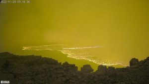
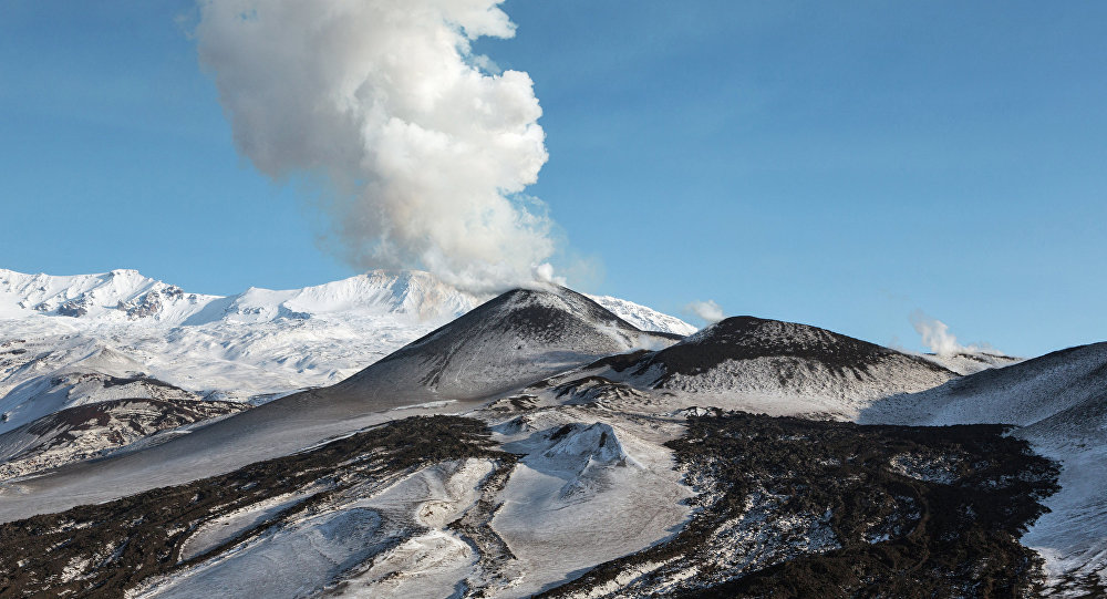
Russia / Kuril Islands , Ebeko :
VOLCANO OBSERVATORY NOTICE FOR AVIATION (VONA)
Issued: January 09 , 2023
Volcano: Ebeko (CAVW #290380)
Current aviation colour code: ORANGE
Previous aviation colour code: orange
Source: KVERT
Notice Number: 2023-08
Volcano Location: N 50 deg 41 min E 156 deg 0 min
Area: Northern Kuriles, Russia
Summit Elevation: 1156 m (3791.68 ft)
Volcanic Activity Summary:
A moderate explosive activity of the volcano continues. According to visual data by volcanologists from Severo-Kurilsk, an explosion sent ash up to 4 km a.s.l., an ash cloud is drifting to the east of the volcano.
A moderate eruptive activity of the volcano continues. Ash explosions up to 6 km (19,700 ft) a.s.l. could occur at any time. Ongoing activity could affect low-flying aircraft and airport of Severo-Kurilsk.
Volcanic cloud height:
4000 m (13120 ft) AMSL Time and method of ash plume/cloud height determination: 20230109/2306Z – Visual data
Other volcanic cloud information:
Distance of ash plume/cloud of the volcano: 5 km (3 mi)
Direction of drift of ash plume/cloud of the volcano: E
Time and method of ash plume/cloud determination: 20230109/2306Z – Visual data
Source : Kvert
Photo : Sputnik . Alexandre Peraguis
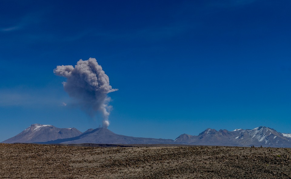
Peru , Sabancaya :
Analysis period: from January 01, 2023 to January 08, 2023, Arequipa, January 10, 2023.
Alert level: ORANGE
The Geophysical Institute of Peru (IGP) reports that the eruptive activity of the Sabancaya volcano remains at moderate levels, that is to say with the recording of an average of 51 daily explosions, with columns of ash and of gas up to 2.3 km altitude above the summit of the volcano and their subsequent dispersion. Therefore, for the following days, no significant change is expected in eruptive activity.
The IGP recorded and analyzed the occurrence of 537 earthquakes of volcanic origin, associated with the circulation of magmatic fluids inside the Sabancaya volcano. An average of 51 explosions was recorded daily, in addition to recording Volcano-Tectonic (VT) type events associated with rock fracturing inside the Sabancaya volcano.
Monitoring the deformation of the volcanic structure using GNSS techniques (processed with fast orbits) does not show any significant anomalies. However, in general, an inflation process was observed in the northern sector (surroundings of the Hualca Hualca volcano). Visual surveillance identified columns of gas and ash up to 2.3 km above the summit of the volcano, which were scattered towards the southwest, west and northwest sectors of Sabancaya . Satellite recordings have identified the presence of 5 thermal anomalies, with a maximum value of 45 MW, associated with the presence of a lava body on the surface of the crater of the volcano.
RECOMMENDATIONS
• Keep the volcanic alert level orange.
• Do not approach within a radius of less than 12 km from the crater.
Source : Cenvul
Photo : Pixabay
Indonesia , Marapi :
An eruption of G. Marapi occurred on Tuesday January 10, 2023 at 09:12 WIB with an ash column height observed at ± 300 m above the summit (± 3191 m above sea level). The ash column was observed to be white / gray with a thick intensity oriented to the North-East and South-East. This eruption was recorded on a seismograph with a maximum amplitude of 4 mm and a duration of 81 seconds.
VOLCANO OBSERVATORY NOTICE FOR AVIATION – VONA
Issued : January 10 , 2023
Volcano : Marapi (261140)
Current Aviation Colour Code : ORANGE
Previous Aviation Colour Code : orange
Source : Marapi Volcano Observatory
Notice Number : 2023MAR018
Volcano Location : S 0 deg 22 min 52 sec E 100 deg 28 min 23 sec
Area : West Sumatra, Indonesia
Summit Elevation : 9251 FT (2891 M)

Volcanic Activity Summary :
Eruption with volcanic ash cloud at 02h12 UTC (09h12 local).
Volcanic Cloud Height :
Best estimate of ash-cloud top is around 10211 FT (3191 M) above sea level or 960 FT (300 M) above summit. May be higher than what can be observed clearly. Source of height data: ground observer.
Other Volcanic Cloud Information :
Ash cloud moving from northeast to southeast. Volcanic ash is observed to be white to gray. The intensity of volcanic ash is observed to be thick.
Remarks :
Eruption recorded on seismogram with maximum amplitude 4 mm and maximum duration 81 second.
Source et photo : Magma Indonésie.