August 25 , 2022.
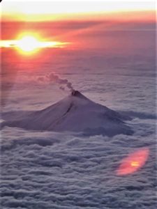
Samoa Islands , Ta’u :
14°13’48 » S 169°27’14 » W,
Summit Elevation 3054 ft (931 m)
Current Volcano Alert Level: ADVISORY
Current Aviation Color Code: YELLOW
There has been no significant change to the earthquake activity beneath or around Taʻū and Ofu-Olosega Islands since yesterday’s update. USGS staff have installed two advanced seismometers on Taʻū island and another is being installed on Ofu island today. USGS earthquake experts are currently reviewing and evaluating the data quality as it becomes available.
Over the past several days approximately 20 earthquakes per hour have been recorded. Though the exact count isn’t available, the number of recorded earthquakes in the past 24 hours appears slightly lower. Preliminary estimates place the source of the earthquakes closer to Taʻū Island than Ofu-Olosega. Estimated magnitudes of most of the largest earthquakes are between magnitude 2 and 3.
At 8:33 p.m. Samoa Standard Time yesterday evening, August 23, residents of the Manuʻa islands and Tutuila island reported a widely-felt earthquake. Light to moderate shaking, with a maximum Intensity of V on the Modified Mercalli Intensity Scale, was reported during the earthquake .This earthquake is one of the largest recorded to date since instruments were installed in the Manuʻa islands beginning the second week of August. The magnitude, which is likely magnitude 3 or larger, will be determined at a later date if possible when the American Samoa seismic network has been calibrated. Reports of booming sounds continue to be investigated but to date have not correlated with specific seismic events.
USGS scientists are monitoring the earthquakes with microseismometers (small and basic earthquake detectors) placed on Tutuila, Taʻū, and Ofu-Olosega Islands. Larger, more sophisticated, and accurate seismometers are being installed this week to form a basic network. Data from the new network will help to accurately locate the earthquakes and develop better assessments of possible future hazards.
Source : HVO.
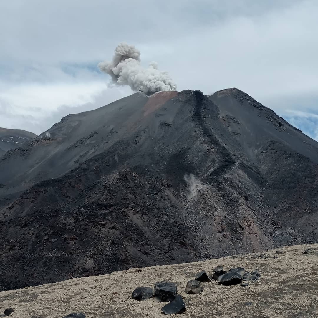
Chile , Nevados de Chillan :
Seismology
The seismological activity of the period was characterized by the recording of:
37 volcano-tectonic earthquakes (VT) associated with brittle rupture processes; the most energetic earthquake had a local magnitude (ML) equal to 2.5, the location of which was estimated with a depth of 3.5 km and an epicentral distance of 1.8 km to the East-North- East relative to the active crater.
Long period (LP), explosion (EX) and tremor (TR) seismicity continued to be recorded, associated with fluid dynamics within the volcanic system. 696 LP-type earthquakes were classified, including 170 related to surface explosions, due to the presence of acoustic waves and/or gaseous emissions (it should be noted that the observation of the two characteristics mentioned here is made difficult by bad weather, which could induce a decrease compared to the ideal count for this type of event). The size of the largest LP earthquake estimated from the reduced displacement parameter (DR) reached a value equal to 245 cm2. Regarding TR type seismicity, 255 episodes were identified, the most important of which reached a DR of 113 cm2. The analysis of the total seismic energies does not show a general increase which is linked to the increase in the volume extruded at the surface during this fortnight, showing a significant change in behavior compared to the previous effusive increases.
Fluid Geochemistry
Data on sulfur dioxide (SO2) emissions obtained by optical differential absorption spectroscopy (DOAS) equipment, corresponding to the Philippi and Chillán stations, installed 1.5 km to the South-South-East (SSE) and 2.7 km east-southeast (ESE) of the active crater, respectively, showed an average value of 507 ± 83 t/d, with a maximum daily value of 1017 t/d, recorded on 9 august. The increase in SO2 emission rates, observed since the previous period, is maintained, associated with an increase in the availability of sulfur dioxide in the vicinity of the volcanic complex, consistent with the acceleration in the rate of extrusion of dome 4 .
Satellite thermal anomalies
Three thermal alerts were recorded in the area associated with the volcanic complex during the period, with a maximum Volcanic Radiative Power (VRP) of 15 MW on August 10, linked to explosive activity, a value considered moderate according to the data processed. by Middle Infrared. Observation of Volcanic Activity (MIROVA). An increase in the power of these anomalies is observed during the reported period, with a total radiant surface estimated at 1,800 m2, limited to the active crater.
Satellite geomorphological analysis
According to the analysis with the Planet Scope OrthoTile, Sentinel 2 L2A and SkySat Collect satellite images, a greater development of the active crater is observed towards the North-East rim, increasing its surface area by approximately 4000 m2, since the month of may. At the same time, a further development of Dome 4 is identified, reaching an area of 2900 m2; with a strong presence of cracks and fractures on its surface, mainly with a North-East / South-West orientation and oblique to this direction to the second order. The main cracks have an extension of 30 m. The surface of dome 4 corresponds to the thermal anomalies of Sentinel 2 L2 A, the distribution changes are limited and remain within those associated with this particular effusive body. Around Dome 4 there are areas of unconsolidated material that show impact crater morphologies and a gassing center.
Source et photo : Sernageomin.
Read the article: https://rnvv.sernageomin.cl/rnvv/TI_Santiago_prod/reportes_LB/2022/RAV_20220824_%C3%91uble_v15.pdf
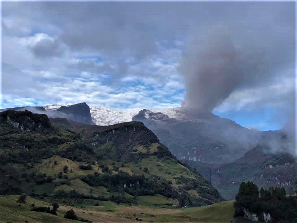
Colombia , Nevado del Ruiz :
Bulletin of activity level of the Nevado del Ruiz volcano.
The activity level continues at Yellow Activity Level or (III): changes in the behavior of volcanic activity.
Regarding the monitoring of the activity of the Nevado del Ruiz volcano, the COLOMBIAN GEOLOGICAL SERVICE reports that:
Seismicity related to fluid dynamics inside volcanic conduits showed an increase in both the number of earthquakes recorded and the seismic energy released, compared to the previous week. In general, the seismic signals associated with this process presented moderate energy levels, and were located mainly in the Arenas crater. Thanks to the cameras installed in the area of the volcano and the report of the officials of the National Natural Park of Los Nevados, on the ground, the gas and ash emissions associated with some of these seismic signals have been confirmed. Likewise, the relative temperature changes of the material observed in the gas and ash columns.
Seismicity associated with rock fracturing also showed an increase in the number of earthquakes recorded and seismic energy released, compared to the previous week. This seismic activity was located mainly in the northeast sector, in the Arenas crater, and to a lesser extent in the southeast and southwest sectors. The depth of the earthquakes varied between 0.2 and 7.2 km. The maximum magnitude recorded during the week was 1.3 ML (Local Magnitude), corresponding to the earthquake of August 17 at 05:51 (local time), located in the Arenas crater at a depth of 2.0 km.
This week, seismicity related to the processes of ascent, establishment, growth and evolution of a lava dome at the bottom of Arenas crater was also recorded.
Deformation of the volcanic surface continues to show minor changes. The volcano continues to emit water vapor and gases, mainly sulfur dioxide (SO2).
The column of gas and steam reached a height of 3,200 meters measured at the top of the volcano on August 18.
Concerning the analysis of the samples taken from the pyroclastic deposits, associated with the ash emissions on August 4 and 5, on solar panels located in the area of the station of multiparameter volcanic monitoring of Bruma, located 2.2 km northwest of the Arenas crater, it is reported that the results obtained, as well as the compositional and granulometric analysis which is carried out continuously on samples collected from the emissions of ashes, suggest an origin possibly linked to partial rupture processes of the lava dome located at the bottom of the Arenas crater.
Source : SGC.
Photo : Ramirez Jorge .
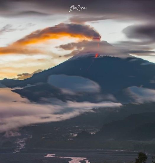
Ecuador , Sangay :
DAILY REPORT OF THE STATE OF SANGAY VOLCANO, Wednesday August 24, 2022.
Information Geophysical Institute – EPN.
Surface Activity Level: High, Surface Trend: No change.
Internal activity level: High, Internal trend: No change.
Seismicity: From August 23, 2022, 11:00 a.m. to August 24, 2022, 11:00 a.m.:
There are no seismicity data.
Explosions (EXP) 183
Long Periods (LP) 45
Emission Tremors (TREMI ) 49
Rains / Lahars:
No rain was recorded. **In the event of heavy rains, these could remobilize the accumulated materials, generating mudslides and debris that would descend on the flanks of the volcano and flow into the adjacent rivers.**
Emission / ash column:
This morning, a continuous emission of steam and ash from a height of less than 500 meters in a southwesterly direction was observed. The Washington VAAC published 3 ash emission reports with heights of 870, 1,470 and 1,770 meters to the west and southwest of the volcano.
Other Monitoring Parameters:
The FIRMS system records 14 thermal anomalies and MIROVA records 1 high thermal anomaly (188 MW) and 2 moderate during the last 24 hours.
Observation:
During the night, an incandescence was observed in the crater as well as rolling blocks on the eastern flank. Surface activity is mainly characterized by continuous emissions of gas and ash with heights of less than 500 meters towards the southwest.
Alert level: Orange.
Source : IGEPN.
Photo : AlexBoasphoto
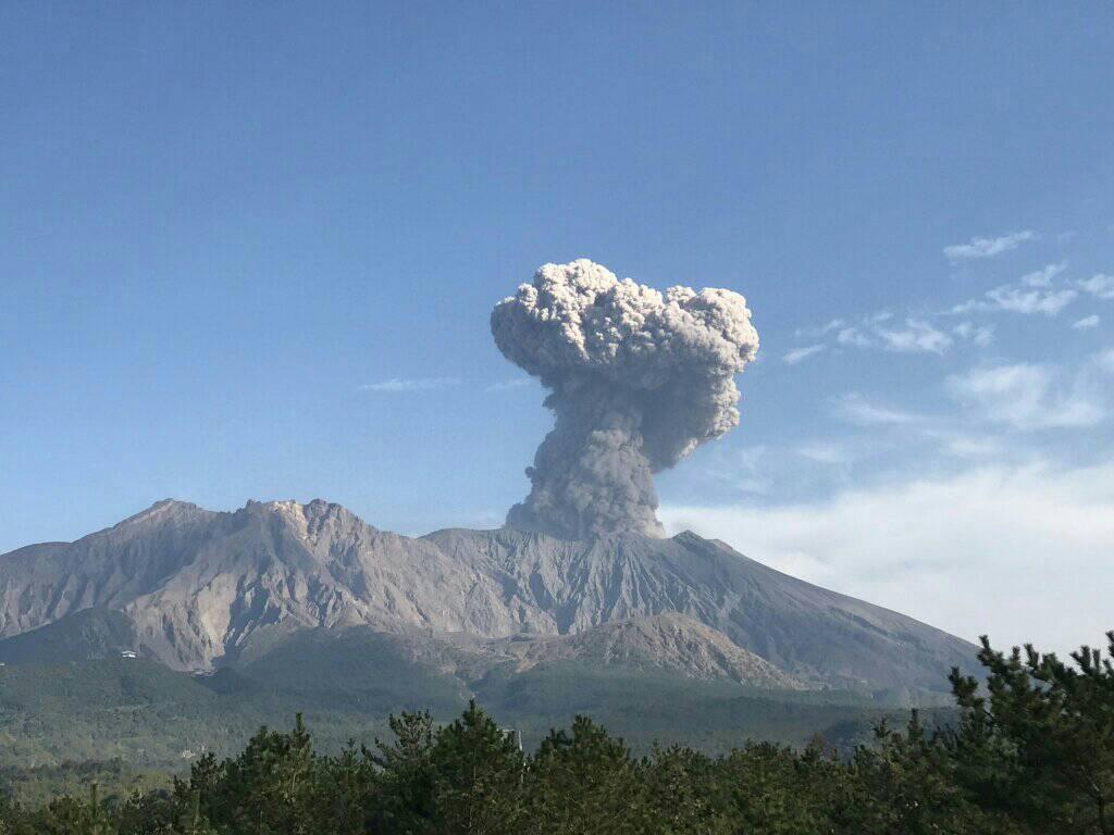
Japan , Sakurajima :
JMA reported that 00h09 on 15 August an explosion at Minamidake Crater (at Aira Caldera’s Sakurajima volcano) generated an ash plume that rose 2 km above the crater rim. Sulfur dioxide emissions were slightly high at 1,500 tons per day, measured during a field visit on 16 August. Two eruptive events were recorded during 19-22 August. The Alert Level remained at 3 (on a 5-level scale), and residents were warned to stay 2 km away from the crater.
The Aira caldera in the northern half of Kagoshima Bay contains the post-caldera Sakurajima volcano, one of Japan’s most active. Eruption of the voluminous Ito pyroclastic flow accompanied formation of the 17 x 23 km caldera about 22,000 years ago. The smaller Wakamiko caldera was formed during the early Holocene in the NE corner of the Aira caldera, along with several post-caldera cones. The construction of Sakurajima began about 13,000 years ago on the southern rim of Aira caldera and built an island that was finally joined to the Osumi Peninsula during the major explosive and effusive eruption of 1914. Activity at the Kitadake summit cone ended about 4850 years ago, after which eruptions took place at Minamidake. Frequent historical eruptions, recorded since the 8th century, have deposited ash on Kagoshima, one of Kyushu’s largest cities, located across Kagoshima Bay only 8 km from the summit. The largest historical eruption took place during 1471-76.
Sources : JMA , GVP.
Photo : Rizal M.