August 24 , 2022.
Iceland , Meradalur :
Latest news on the eruption at Reykjanes peninsula , 23.8.2022
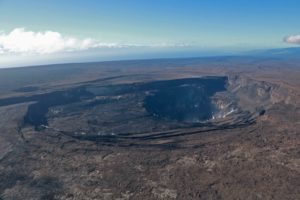
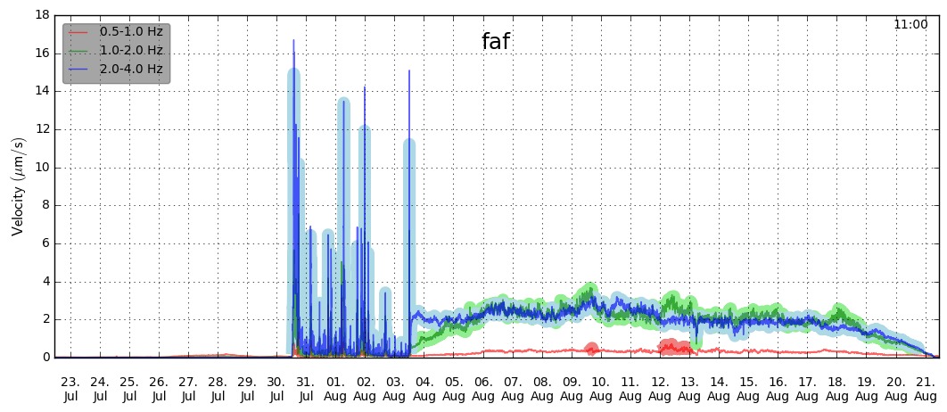
The eruption in Meradalir, which commenced on the 3rd of August, ceased to issue lava on the 21 of August. Volcanic tremor started to decrease steadily from the 18th and stopped completely during the night of 21st. The activity at the crater ceased at the same time, with no visible extrusion of fresh lava. The figure shows the tremor for the last month (from faf station operated by ISOR), where it is possible to identify the onset of the eruption, its progression and also decline.
A thermal anomaly within the area was still detectable on satellite images (Mirovaweb.it) during last night (23.08) as well as glowing lava in the lava field which was observed via web cameras. This cessation in activity likely marks a new phase in the Reykjanes volcano-tectonic unrest, but it is too premature to determine if and when the seismic activity will resume and when a new dike propagation or eruption will start again.
IMO emphasizes that volcanic hazards are still present in the area (including passive degassing and fresh lava) and people are asked to be careful when visiting the area and to follow instructions and advice as given by the local Police and Civil Protection authorities.
Source : Vedur is
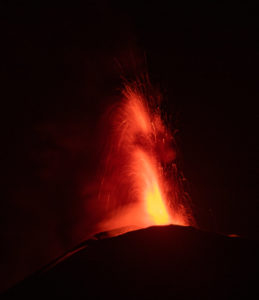
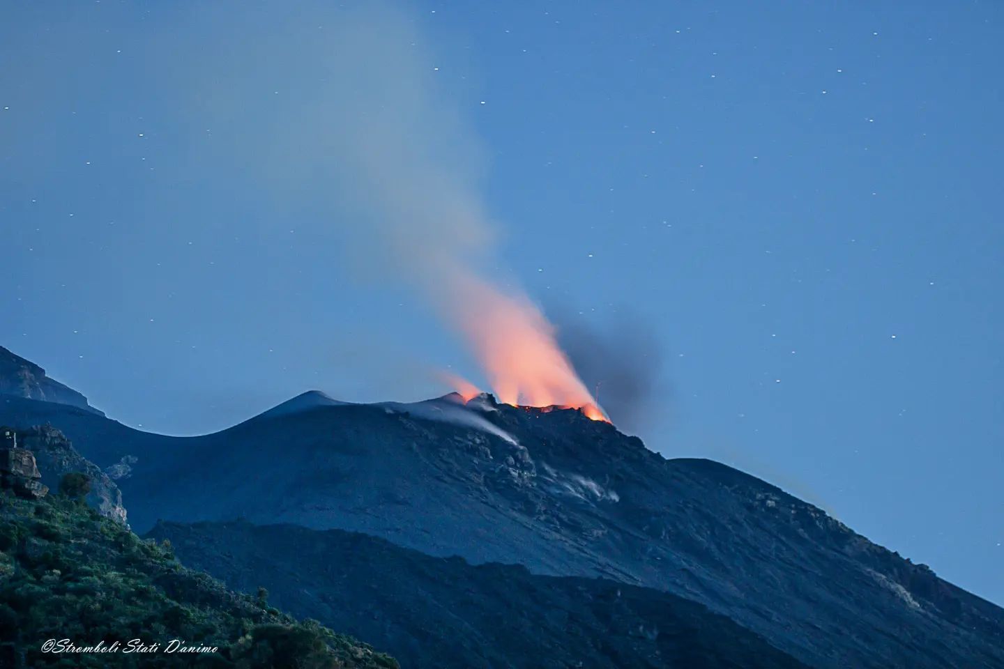
Italy , Stromboli :
WEEKLY BULLETIN, from August 15, 2022 to August 21, 2022. (issue date August 23, 2022)
ACTIVITY STATUS SUMMARY
In the light of the surveillance data, it is highlighted:
1) VOLCANOLOGICAL OBSERVATIONS: During the observation period, there is no update regarding the volcanological observations of Stromboli following problems in the acquisition of video signals caused by damage to the optical fiber connecting Punta Labronzo and COA. The latest updated data for the period from August 8 to 14, 2022, placed the total explosive activity at a medium-low level, with an intensity of explosions between low and medium in the areas of the North and Center-South craters .
2) SEISMOLOGY: The seismological parameters monitored do not show any significant variations.
3) SOIL DEFORMATIONS: The island’s soil deformation monitoring networks did not show any significant changes to report for the period under review.
4) GEOCHEMISTRY: SO2 flux at a medium-low and stable level
The flux of CO2 from the soils in the summit zone is on average values.
C/S ratio in the plume: there are no updates.
Isotope ratio of dissolved Helium in heat sinks: there are no updates.
5) SATELLITE OBSERVATIONS: The thermal activity observed by satellite in the summit area was weak.
N’OUBLIEZ PAS STROMBOLI…
VOLCANOLOGICAL REMARKS
In the period under observation, there is no update regarding the volcanological observations of Stromboli, due to problems in the acquisition of video signals caused by the
damage to the fiber optic linking Punta Labronzo and COA due to severe weather that hit the island on August 12, 2022. The latest updated data for the period August 8-14, 2022 places total explosive activity at a low medium-low, with low to medium intensity of explosions in the North and Center-South crater areas.
Source : INGV.
Photos : Stromboli stati d’animo
Italy , Vulcano :
WEEKLY BULLETIN, from August 15, 2022 to August 21, 2022. (issue date August 23, 2022)
ACTIVITY STATUS SUMMARY
In the light of the surveillance data, it is highlighted:
1) Temperature of the crater fumaroles: The temperatures recorded on the rim of the crater show stable and high values around 370°C.
2) CO2 flux in the crater area: The CO2 flux in the crater area remains stable at medium-high values.
3) SO2 flux in the crater area: SO2 flux at a high and increasing level
4) Geochemistry of fumarolic gases: No update is available.
5) CO2 fluxes at the base of the La Fossa cone and in the Vulcano Porto area: Stable values of CO2 fluxes in the Rimessa and Camping Sicilia sites; the values reach high levels at the Palizzi site; at the Faraglione site, there are stable values always close to the background level.
6) Geochemistry of thermal aquifers: in the waters of the well of Camping Sicilia there are stable and always high temperature values and medium-low conductivity values; in the Bambara well, the level values show a slight upward trend and the conductivity values are still at medium-high levels.
7) Local seismicity: Low occurrence rate of micro-shocks with a spectral peak greater than 1 Hz.
High daily frequency of low frequency events (VLP) with a moderate decreasing trend.
8) Regional seismicity: No fracturing event reached or exceeded local magnitude 1.
9) Deformations – GNSS: The network of GNSS stations has not recorded any significant changes.
10) Deformations – Inclinometry: No significant changes to highlight.
11) Gravimetry: No significant medium-long term variation was recorded.
12) Other Notes: Mobile GNSS. The GNSS mobile network acquires and transmits movements in real time at a frequency of 1 Hz. The historical series acquired so far do not show significant variations around the Porto di Levante area.

CRATER FUMAROLES TEMPERATURE.
Along the upper edge, the maximum emission temperature has extremely stable values, with an hourly maximum of 376°C and a weekly average of 374°C (T1). The fumarolic field presents homogeneous emission temperatures all along the summit fracture line, confirming a thermal anomaly still maintained by a stable vapor flow. The thermal signal from sensor T3 (fumerole F5) overlaps the temperatures recorded in T2 (fumerole F5AT).
The sensor placed on the inner side has not provided valid data for the past two weeks and requires extraordinary maintenance.
Source et photo : INGV.
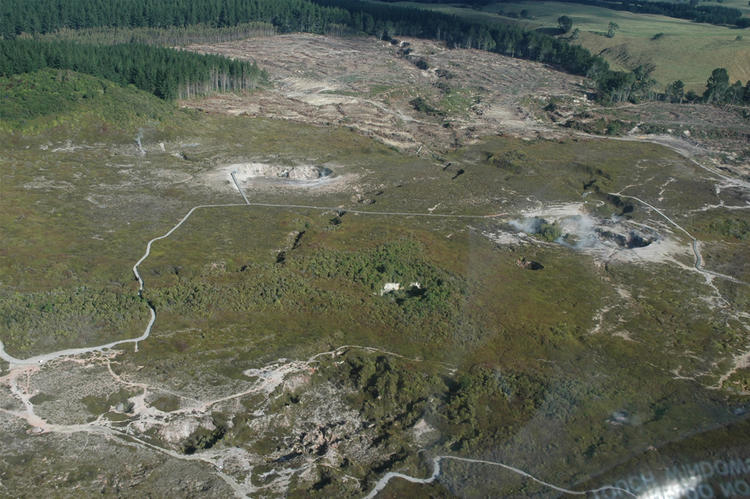
New Zealand , Lake Taupō :
The earthquake sequence beneath Lake Taupō continues. Ongoing ground deformation indicates a deformation source coincident with the seismically active region. The Volcanic Alert Level for Taupō Volcanic Centre remains at Level 0.
The earthquake sequence beneath the central part of Lake Taupō (Taupō-nui-a-Tia), that we reported on in our previous Volcanic Activity Bulletin, has continued at a rate of ~30 earthquakes per week. Since the start of the sequence in May 2022 this rate has been more or less constant, and we have now located over 490 earthquakes at less than 30 km depth.

Figure 1 shows earthquake locations for this sequence are forming two clusters in the central part of the lake. The smaller, western cluster is centred around Karangahape Cliffs and the larger, eastern cluster north-east of Horomatangi Reef. Shown in Figure 2 is the number of earthquakes detected and located in the dashed area outlined in the map each year since 2000. The two largest earthquakes since May were both magnitude 3.6, the first recorded on 17 May and the other on 11 July.

GeoNet continuously monitors ground deformation about Taupō. In addition to the 12 mm uplift seen from lake levelling data, deformation measurements around the lake from GNSS (GPS) instruments also show a signal indicating horizontal deformation. Numerical modelling indicates that the horizontal extension is consistent with a deformation source within the main region of seismic activity.
Taupō Volcanic Centre is part of the Taupō Volcanic Zone, a tectonically very active region with many known faults and active volcanism. Activity in this region is often related to a mix of regional deformation processes and the magmatic system under the volcanoes. While the observations beneath Lake Taupō to date represent an increase to the normal background activity, they do not stand out with respect to previous periods of unrest in 2008-2009 and 2019 (see Figure 2). We believe that the 2022 earthquakes and ground deformation are similar to those of 2008-2009 and 2019, which has helped to inform our view that Volcanic Alert Level 0 is currently appropriate for the Taupō Volcanic Centre. Therefore, the Volcanic Alert Level remains at 0.
Source : Geonet.
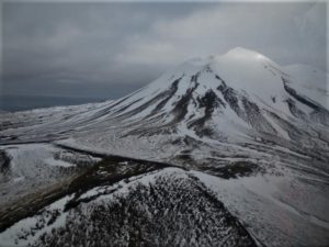
Photos : Geonet ( crater of the moon).
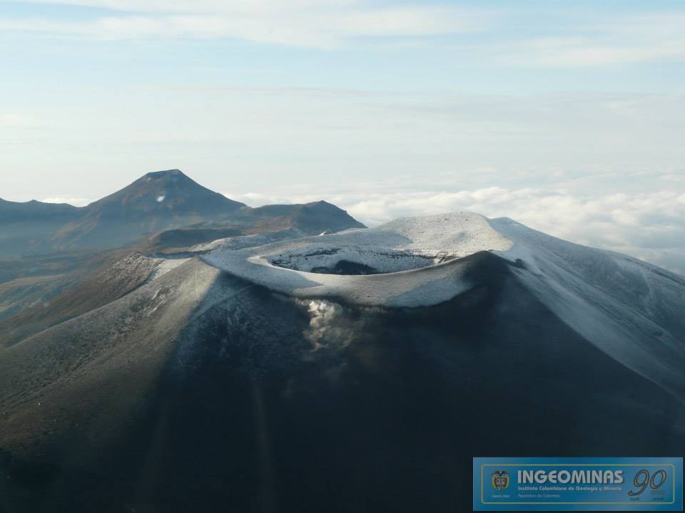
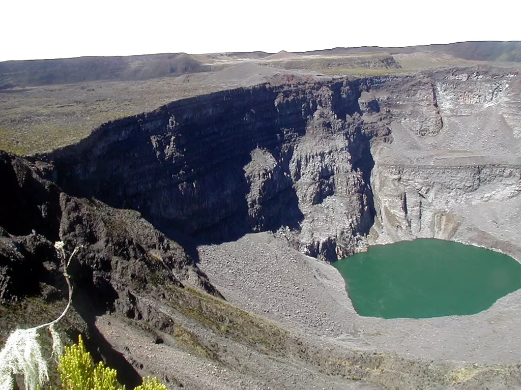
Colombia , Purace :
Weekly bulletin of the activity of the Puracé volcano – Los Coconucos volcanic chain
The activity level of the volcano continues at the Yellow activity level or (III): changes in the behavior of volcanic activity.
From the analysis and evaluation of the information obtained through the monitoring network of the Puracé volcano – Los Coconucos volcanic chain, during the week of August 16 to 22, 2022, the COLOMBIAN GEOLOGICAL SERVICE – Volcanological and Seismological Observatory of Popayan informs that:
During the period evaluated, 354 seismic events were recorded, of which 35 were associated with rock fracturing processes (type VT) and 319 with fluid dynamics in volcanic conduits; of these, 267 were classified as long-period events (LP type), two (2) events were associated with both failure mechanisms and fluid dynamics, for which they were classified as hybrid (type HB), seven (7) were classified as « tornillos » type earthquakes (type TO) and 43 as low energy tremor impulses (type TR).
-The geodetic network of GNSS (Global Navigation Satellite System) stations for monitoring ground deformation continues to record a process associated with inflation.
-In the monitoring of surface activity, the images obtained during the week thanks to the Anambío, Mina, Lavas Rojas, Cerro Sombrero and Curiquinga web cameras showed degassing of the volcanic system, with a white column oriented preferentially towards the North West.
Regarding the monitoring of volcanic gases, the sulfur dioxide (SO2) flux emissions recorded by the telemetric stations showed an increase, reaching flow values in the permanent stations with a maximum emitted of 2613 t / day for December 19 august. The other gas analysis instruments in the volcanic influence zone do not show any relevant changes for the evaluated period.
Magnetic field and infrasonic wave monitoring sensors did not record variations associated with changes in volcanic activity.
Source : SGC.
Photo : Ingeominas.
Comoros , Karthala :
The Comorian authorities launched the yellow alert plan on Monday after the Karthalan volcano awoke, while calling for calm and caution.
The Comorian Ministry of the Interior, through the General Directorate of Civil Security of the Comoros, triggered Monday evening « the yellow alert plan » following the seismic movements recorded since July 15 by the Volcanological Observatory of Karthala. However, the authorities reassure the population about « the control and monitoring of the movements in progress » by technicians connected to a network installed at the CNDRS.
Civil Security calls for serenity and especially caution in areas near the crater. “All measures have been taken for regular monitoring of seismic activity according to the established protocol. It’s nothing serious. But the yellow alert plan is to inform the public about the behavior of the volcano. There is no need to panic, ”assured the head of the Civil Security of the Comoros, Lieutenant-Colonel Tachfine Ahmed.
Culminating at 2,361 meters above sea level, the Karthala volcano overlooks Moroni, capital of the Comoros, inhabited by 111,329 inhabitants. The last large-scale movement of the Karthala volcano dates back to the end of 2005. It should be noted that the Piton de la Fournaise Observatory, located in Reunion, also recorded a resurgence of activity. Piton de la Fournaise and Karthala are both essentially effusive volcanoes.
PRESS RELEASE
The Ministry of the Interior in charge of civil protection brings to the attention of the population that since July 15, 2022, the Karthala Volcanological Observatory (OVK) has noted abnormal activity of the KARTHALA volcano, which manifested by a persistent seismic activity on its western flank.
In accordance with the specific Karthala relief plan, the Minister has triggered the Yellow Level Volcanic Alert also called Volcanic Vigilance. This level of alert demonstrates an abnormal situation which calls for vigilance which can be lifted in the event of a return to a stable situation.
At this stage of the situation, it is advisable to avoid any camping activity around the volcano, especially at late hours.
The Volcanological Observatory of Karthala is closely monitoring the evolution of the situation and invites the population to remain calm and to listen to the new instructions from the authorities.
Source : Outremers360.com , Commorian Ministry of Interior.
Photo : Nicolas-Villenueve-Universite-de-La-Reunion