July 10 , 2022.
Indonesia , Ili Lewotolok :
Mount Ili Lewotolok presented an eruption on Saturday July 9, 2022 at 07:33 WITA with the height of the ash column observed at ± 600 m above the peak (± 2023 m above sea level). It is observed that the ash column is gray to black with a thick intensity, oriented towards the Southeast. This eruption was recorded on a seismograph with a maximum amplitude of 34.2 mm and a duration of 35 seconds.
CLIMATOLOGY
The weather is sunny, the wind is weak in the West and in the North-West. The air temperature is around 22.7-32°C. Humidity 55.9-80.4%.

SEISMICITY OBSERVATION
10 emission earthquakes with an amplitude of 2.3 to 4.5 mm and a duration of 23 to 77 seconds.
2 non-harmonic tremors with an amplitude of 2 mm and a duration of 254.7 to 266.1 seconds.
1 continuous tremor with an amplitude of 0.5 mm, dominant value of 0.5 mm.
Recommendation
Currently, G. Ili Lewotolok is at status level III (SIAGA)
it is recommended not to carry out activities within a radius of 3 km around the summit / crater of Mount Ili Lewotolok, a radius of 3.5 km for the South-East sector, a radius of 4 km for the East and Northeast. Residents of Lamawolo Village, Lamatokan Village and Jontona Village should always be aware of the potential threat of incandescent lava and hot clouds from the eastern part of G. Ili Lewotolok peak/crater
Source : Magma Indonésie.
Chile , Laguna del Maule :
Seismology
The seismological activity of the period was characterized by the recording of:
2225 VT type seismic events, associated with rock fracturing (Volcano-Tectonic type). The most energetic earthquake presented a value of Local Magnitude (ML) equal to 2.8, located 8.5 km south-south-west of the center of the lagoon, at a depth of 3.5 km with reference to the average height of the lagoon.
76 LP-type seismic events, associated with fluid dynamics within the volcanic system (Long Period type). The size of the largest earthquake estimated from the reduced displacement (RD) parameter was equal to 6 cm2. No event presented the minimum energy to be located.
12 TR-type seismic events, associated with sustained dynamics over time, of fluids within the volcanic system (TRemor). The size of the largest earthquake assessed from the reduced displacement parameter (RD) was equal to 8.8 cm2.

Fluid Geochemistry
No anomalies were reported in the emissions of sulfur dioxide (SO2) into the atmosphere in the area near the volcanic complex, according to data published by the Tropospheric Monitoring Instrument (TROPOMI) and Ozone Monitoring Instrument (OMI) Sulfur Dioxide Group.
Satellite thermal anomalies
During the period, no thermal alert was recorded in the area associated with the volcanic system, according to the analytical processing of Sentinel 2-L2A satellite images, in combination with false color bands.
Geodesy
According to the data obtained from the geodetic monitoring network installed on the complex (5 GNSS stations and 4 electronic inclinometers), it was observed that the inflationary process monitored since 2012 continues, showing practically the same pattern of deformation as in recent months. . The uplift rates are slightly lower than the average recorded last year and for the last 30 days, the maximum uplift continues to be recorded at the GNSS MAU2 station, in the South West sector of the lagoon, with a rate of 1.4 ± 0.2 cm /month. The data obtained with the EI show variations without relevant trends and oscillations caused by temperature variations or snowfall.
Source : Sernageomin
Photos : RudiR , Franco Vera.
Guatemala , Fuego :
Weather conditions: Clear weather.
Wind: northeast
Precipitation: 1.60 mm
Activity:
The Fuego volcano observatory -OVFGO- reports a weak white fumarole at a height of 4,500 meters above sea level which is spreading west and south-west. 4 to 7 low to moderate explosions per hour have been recorded, these generate ash columns at a height of 4,500 to 4,800 msl (14,763 to 15,748 ft) which extend approximately 10 to 15 km towards west and southwest due to the wind pattern. During the night and early in the morning, incandescent pulses are observed at a height between 150 and 200 meters above the level of the crater.
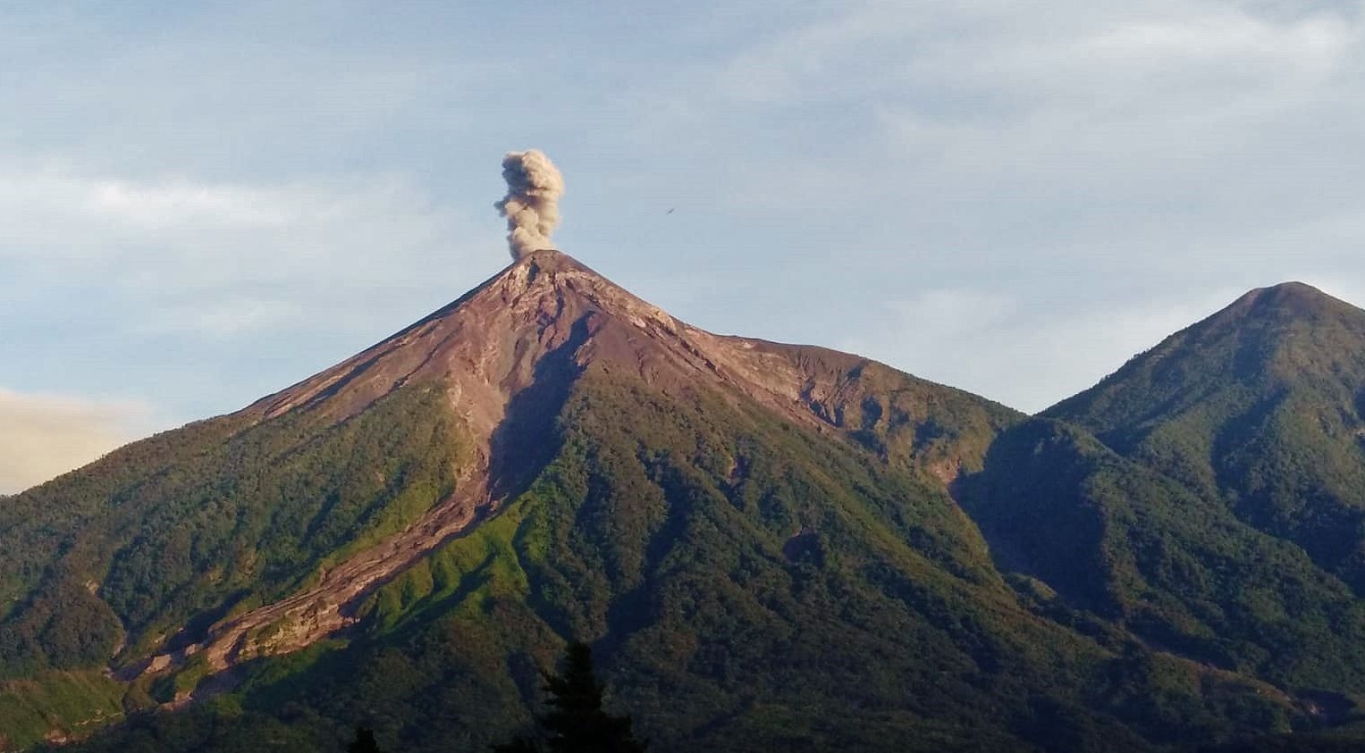
The explosions produce the descent of weak to moderate avalanches on the contour of the crater towards the ravines of Ceniza, Santa Teresa, Taniluya and Trinidad. Weak and moderate rumblings were generated which are at the origin of weak shock waves which vibrate the houses near the volcano. Following the explosions, ashfall is recorded in Panimaché I, Panimaché II, Morelia, Santa Sofía, Finca Palo Verde, Sangre de Cristo and other communities located west of the Fuego volcano. Light sounds similar to a train locomotive lasting 1-5 minutes are reported.
Source : Insivumeh
Photo : Conred via FDB.
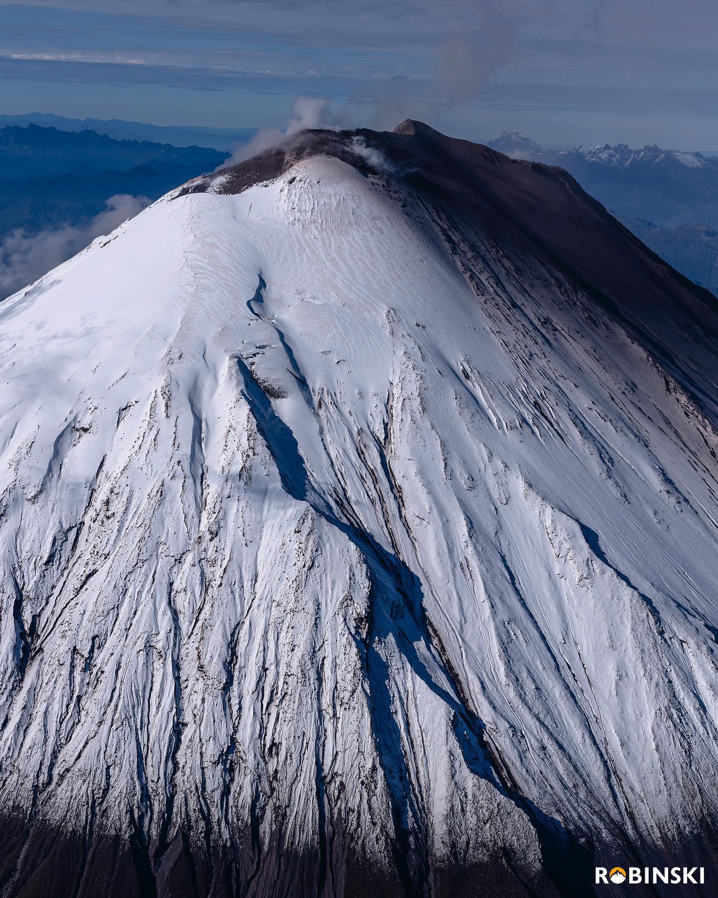
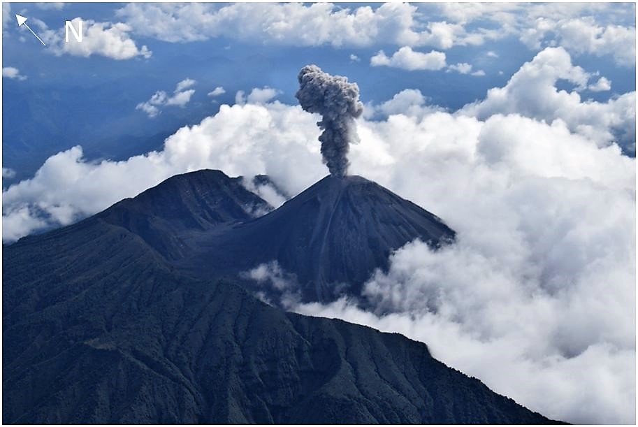
Ecuador , Sangay / Reventador :
DAILY REPORT OF THE STATE OF SANGAY VOLCANO, Saturday July 09, 2022.
Information Geophysical Institute – EPN.
Surface Activity Level: High, Surface Trend: Rising.
Internal activity level: High, Internal trend: No change.
Seismicity: From July 08, 2022, 11:00 a.m. to July 09, 2022, 11:00 a.m.:
Explosion (EXP) 375
Long Periods (LP) 29
Emission Tremors (TREMI ) 34
Lahars (LH): 1
Rains / Lahars:
Moderate rains were recorded overnight and early today. In the early morning, a high frequency signal was observed, possibly associated with a secondary lahar. **In the event of heavy rains, these could remobilize the accumulated materials, generating mudslides and debris that descend on the sides from the volcano and flow into the adjacent rivers.**
Emission / ash column:
No emission was observed by the cameras, due to the low visibility of the volcano sector. Washington’s VAAC also did not report any emissions.
Gas:
The MOUNTS system reported 207 tons of SO2, measured on 07/08/2022 at 1:11 p.m. TL.
Other Monitoring Parameters:
No thermal anomaly has been recorded in the last 24 hours.
Observation:
The volcano area remained cloudy most of the time. No ash fall report was received.
Alert level: Orange.
——————————————————————————————
DAILY REPORT OF THE STATE OF THE REVENTADOR VOLCANO, Saturday July 09, 2022.
Information Geophysical Institute – EPN.
Surface Activity Level: Moderate, Surface Trend: No change.
Internal activity level: Moderate, Internal trend: No change.
Seismicity: From July 08, 2022, 11:00 a.m. to July 09, 2022, 11:00 a.m.:
Explosion (EXP) 53
Long Periods (LP) 84
Emission Tremors (TREMI ) 31
Harmonic Tremors (TRARM): 5
Rains / Lahars:
Light rains were recorded from yesterday evening to today morning, according to the report of the Petroecuador SOTE guardian.
Emission / ash column:
Gas and ash emissions were observed up to 1000 meters above the level of the crater in a west and northwest direction. The Washington VAAC reported ash emissions with a maximum height of 988 meters above the summit in a westerly direction.
Other Monitoring Parameters:
No thermal anomalies have been reported in the last 24 hours.
Comments:
The volcano area was partially cleared late yesterday afternoon and early morning today. At night, an incandescence was observed at the top.
Alert level: Orange.
Source : IGEPN
Photos : Robinski via Marina Morozova , IGEPN.
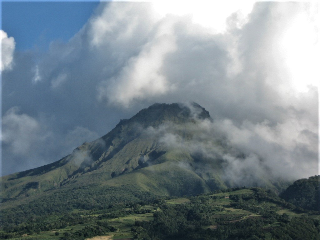
La Martinique , Montagne Pelée :
Weekly report on the activity of Mount Pelée for the period from July 01, 2022 to July 09, 2022.
Between July 1, 2022 at 4 p.m. (UTC) and July 8, 2022 at 4 p.m. (UTC), no volcano-tectonic earthquake was recorded by the OVSM.
The zone of degassing at sea at shallow depth between St Pierre and le Prêcheur is still observed. The IGP took fluid samples in order to understand the origin of this degassing and to assess its possible relationship with the Mount Pelée hydrothermal system.
An extension of two areas of degraded vegetation located between Morne Plumé and the Chaude River was observed during a helicopter flight carried out on February 9 and May 5, with the support of Dragon 972, and confirmed by analysis of satellite images. and drone (overflight of May 11).
The alert level remains YELLOW: vigilance.
Source : OVSM-IPGP.
Photo : Jmp48