September 27 , 2021 .
Spain / La Palma , Cumbre Vieja :
Information update: the deformation recorded by the Canarian Geodetic Network over the last 24 hours shows a process of deflation, which would indicate a drop in pressure in the magmatic system of Cumbre Vieja. This does not imply that the eruption is approaching its end, it will take more data and different parameters to make correct predictions on the medium term evolution of the eruptive activity. This activity is carried out in collaboration with the University of Nagoya (Japan).
In the last few hours, the magnitude of the volcanic tremor has dropped considerably at all stations of the Canarian Seismic Network in La Palma. We recall that the volcanic tremor is linked to the intensity of the Strombolian explosive activity that has characterized almost all the historical eruptions in the Canaries.
Lava advancing in two separate flows has already razed 461 buildings, with an affected area of 212.1 hectares across the island. Evacuees from Tajuya and Tacande de Abajo and part of Tacande de Arriba could return home this Sunday after seismic stabilization.
The eruption has forced around 6,000 people to evict so far, many of whom have lost their homes and businesses.
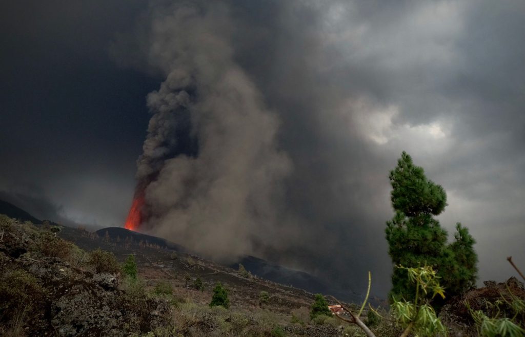
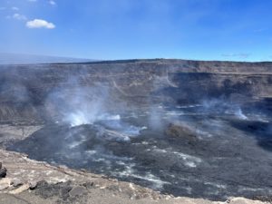
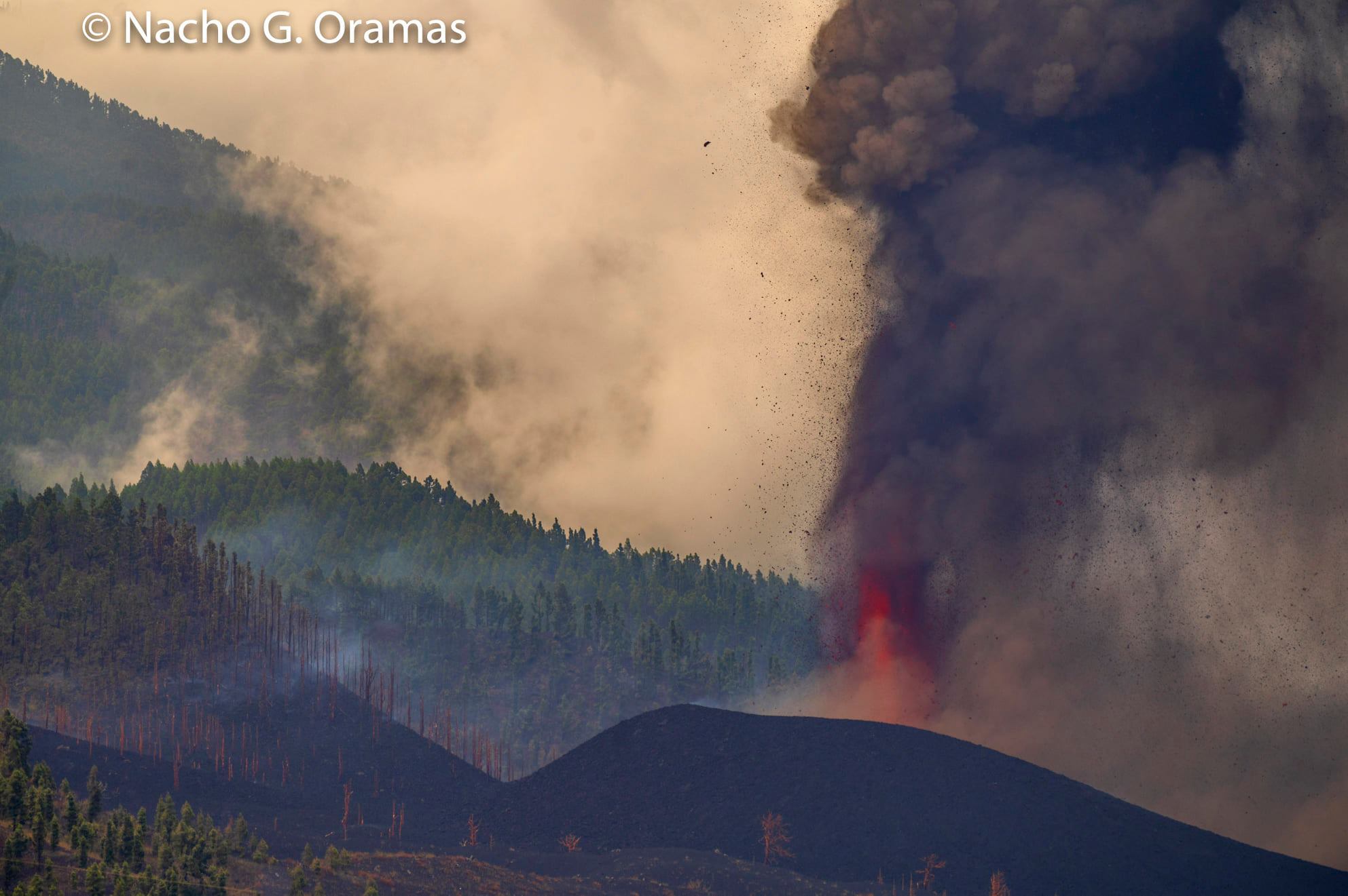
There is a flow to the north that flows smoothly and one to the south that moves at 30 meters per hour. This lava comes from more interior areas of the caldera and is around 1250 degrees in temperature. It sinks very quickly, but there comes a point when it becomes more viscous and suffers from slowdowns. The emission centers remain the same as yesterday. The ash fall affects the neighboring towns but also others in the east of the island, which receive this ash rain due to the wind coming from the southwest. All this does not affect the air quality in the inhabited area of the island. The air quality is always good.
The technical director of the Special Plan of Civil Protection and Emergency for Volcanic Risk of the Canaries (PEVOLCA), Miguel Angel Morcuende, reports that in the afternoon of today, the central area of Todoque, in the municipality of Los llanos de Aridane, evacuated a few days ago, was overtaken by the flow of the volcano, after 7 p.m., crossing the LP-213 road at the height of the locality, and flows about 150 meters to the West of the center of this locality.
Morcuende explains that the lava front was around 8:15 p.m. at about 1600 meters in a straight line from the coast, in a northeastern direction, on the edge of the Todoque mountain, but indicates that the trajectory of the lava will be adapted to the characteristics of the ground. This situation did not lead to further evictions as the direction of the casting is still in the established exclusion zone and all residents had already been evicted.
The technical director of the plan indicates that the lava follows the course of the main flow and that its average speed is around 100 m / h because it is hotter because it emanates from a greater depth of the volcano. – ten kilometers away – which increases its fluidity. In this regard, he points out that the front of the tongue is pushed by new lava which, although on the front of the flow cools, its interior remains very hot, around 1200 degrees, which makes it more fluid. The average height of the flow is about four to six meters in front of it, and the maximum width of the tongue is about 600 meters, he notes.
Morcuende recalls that we can continue to experience moments of higher explosiveness, which can be felt within a radius of about 5 kilometers around the emitting center and generate ash emissions.
Regarding the ash falls in other parts of the island, he explains that this circumstance will depend on the direction of the wind and recalls that, although it does not affect health, it is important, to avoid respiratory and eye problems, wearing FFP2 masks, goggles, gloves and long-sleeved clothing.
Sources : Involcan , El Pais ,
Photos : Involcan , Fran Pallero / diariodeavisos , Nacho González Oramas .
Video : Dron Services Canarias
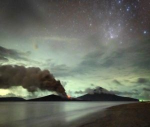
Nouvelle Zélande , White Island :
VOLCANIC ALERT BULLETIN
A recent observation flight measured a sharp decline in vent temperatures; however, gas emissions stay high. The volcano is still in a state of moderate to heightened unrest and the Volcanic Alert Level remains at Level 2.
Last week GNS scientists undertook a gas emission measurement flight, along with visual observations and temperature measurements from a helicopter.
The gas measurements showed emissions of Sulphur Dioxide (SO2) have increased to 680 tonnes per day from 450 tonnes per day in mid-August, a continuation of an increasing emission rate trend over the last few months.
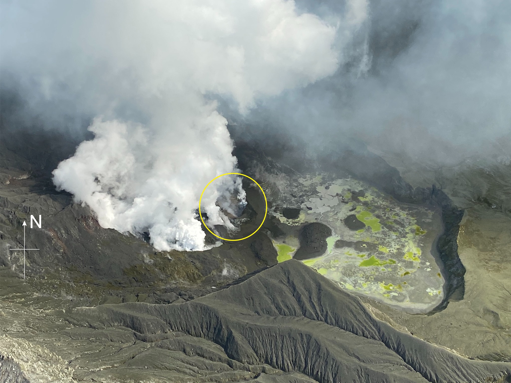
Temperatures measured in the active vent area have decreased from 650 °C seen in July and August, to maximum 189 °C in the measurements last week.
The minor deposits from the intermittent ash emission described in previous bulletins were visible but were confined to the area close to the active vents.
No ash emission was occurring during the observations made last week, however weak, intermittent ash emission is still possible.
Seismic activity remains similar to last week, with low levels of volcanic tremor and occasional low-frequency volcanic earthquakes.
Ground subsidence continues around the active vents, as measured by satellite remote sensing techniques, similar to the pattern of the last few months.
The drop in temperatures around the vent area is interpreted to reflect the infiltration of cooler ground and geothermal water into the active vent area, caused by decreasing gas pressure around the small volume of magma (molten rock) we believed intruded earlier in the year beneath the active vents.
Rising Sulphur Dioxide (SO2) gas emissions, however, may reflect a continued input of magma deeper into the system, into an area not affected by cooling from groundwater.
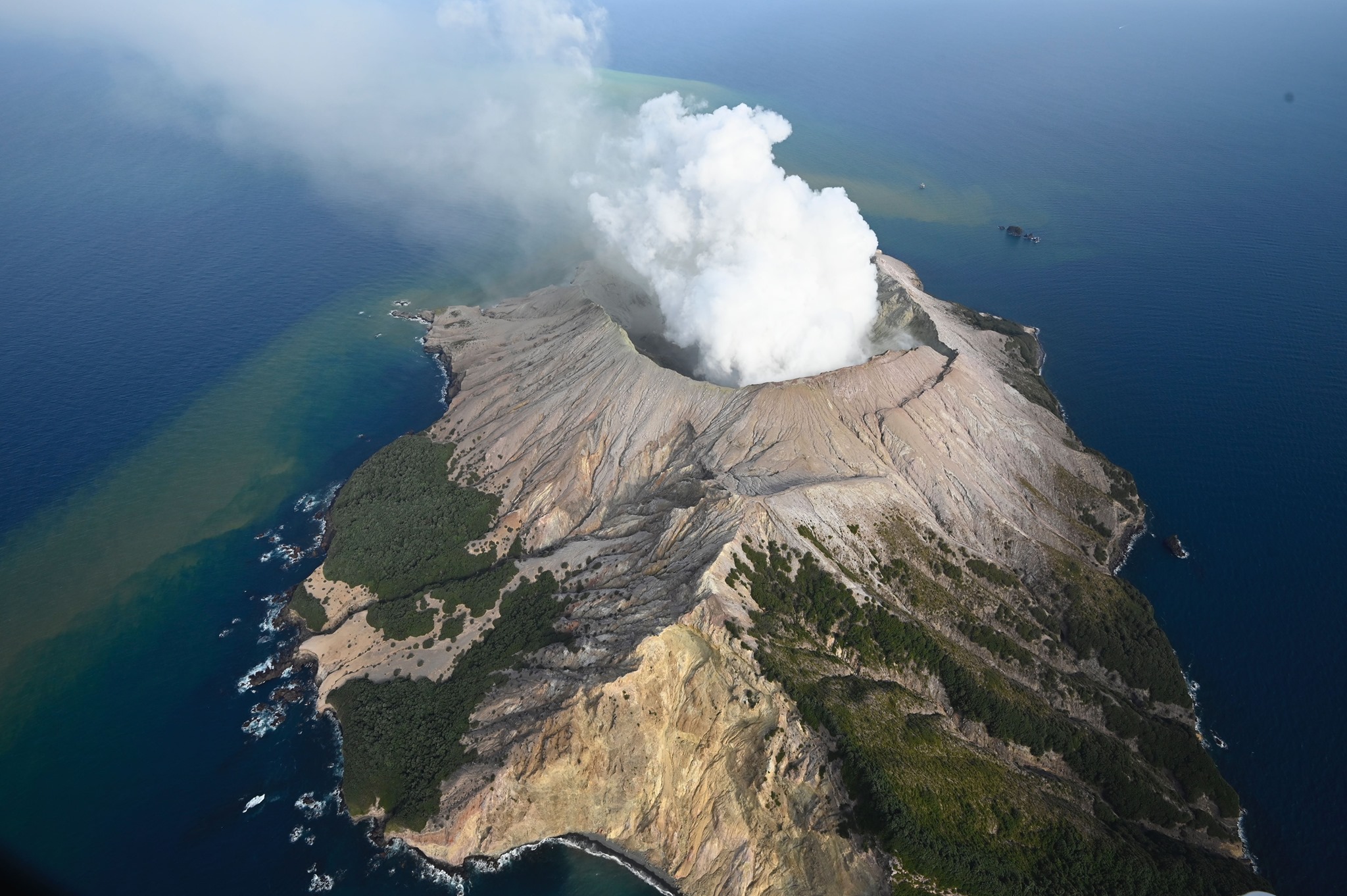
The current level of activity is consistent with moderate to heightened levels of unrest. As such the Volcanic Alert Level remains at 2 and the Aviation Colour Code remains at Yellow.
Equipment that provides real-time monitoring on the island is currently degraded and we are continuing to work on restoration options.
The Volcanic Alert Level reflects the current level of volcanic unrest or activity and is not a forecast of future activity. While Volcanic Alert Level 2 is mostly associated with volcanic unrest hazards (including discharge of steam and hot volcanic gases, earthquakes, landslides, and hydrothermal activity), potential for eruption hazards also exists and eruptions can still occur with little or no warning.
GNS Science and the National Geohazards Monitoring Centre continue to monitor Whakaari/White Island for further changes in unrest.
Source : Geonet / Craig Miller / Duty Volcanologist .
Photos : Geonet , George Novak .
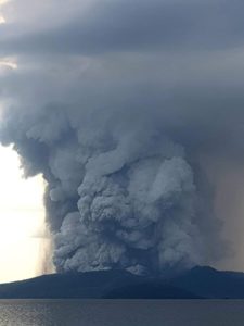
Mexico , Popocatepetl :
September 26, 11:00 a.m. (September 26, 4:00 p.m. GMT)
During the last 24 hours, according to the monitoring systems of the Popocatépetl volcano, 221 exhalations have been identified, accompanied by water vapor, volcanic gases and sometimes small amounts of ash. At 6:19 am yesterday a moderate explosion was recorded which projected incandescent fragments on the slope of the volcano. 100 minutes of low and medium amplitude tremor, and two volcano-tectonic earthquakes yesterday at 11:32 and 15:28, with a preliminary magnitude of 2.0 and 1.7 were recorded.
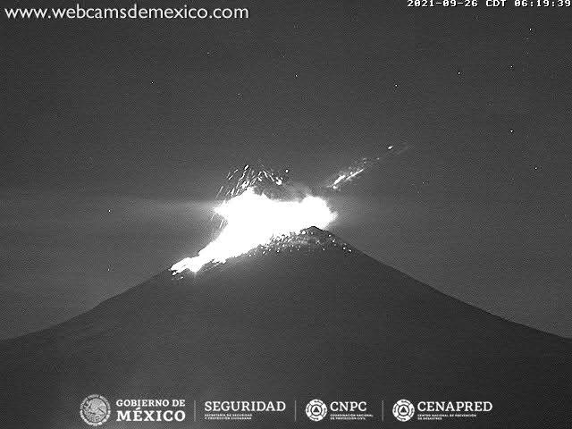
At the time of this report, a continuous emission of water vapor and volcanic gases is partially observed towards the west.
CENAPRED recommends NOT TO APPROACH the volcano and especially the crater, because of the danger of falling ballistic fragments and, in the event of heavy rains, to stay away from the bottom of the ravines because of the danger. mudslides and debris.
The Popocatépetl volcanic traffic light is in PHASE 2 YELLOW.
Source : Cenapred .
Alaska , Semisopochnoi :
51°55’44 » N 179°35’52 » E,
Summit Elevation 2625 ft (800 m)
Current Volcano Alert Level: WATCH
Current Aviation Color Code: ORANGE
Ash emissions have continued over the past 24 hours with occasional discrete low-level ash clouds drifting to the southeast observed in satellite and web camera data. Seismicity has remained elevated with these explosions detected on local seismic and infrasound networks.
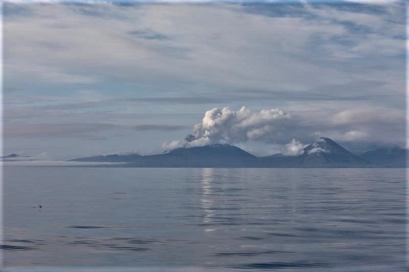
Small eruptions producing minor ash deposits within the vicinity of the active north crater of Mount Cerberus and ash clouds usually under 10,000 feet above sea level have characterized the recent activity, which shows no signs of abating. Small explosions may continue to occur and could be difficult to detect, especially during poor weather conditions.
Semisopochnoi Island is monitored by local seismic and infrasound sensors, satellite data, web cameras, and remote infrasound and lightning networks.
Source : AVO
Photo : Christ Aaron / U.S. Fish and Wildlife Service