July 10 , 2021.
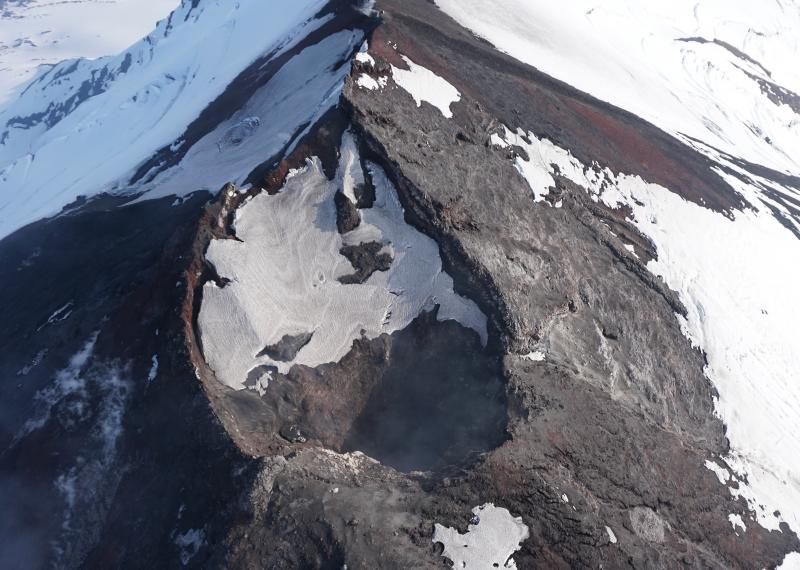
Chile , Copahue :
Special report on volcanic activity (REAV), Biobío region, Copahue volcano. July 2, 2021, 5:20 p.m. local time (Continental Chile)
The National Service of Geology and Mining of Chile (Sernageomin) publishes the following information obtained through the monitoring equipment of the National Volcanic Monitoring Network (RNVV), processed and analyzed at the Volcanic Observatory of the Southern Andes (Ovdas ):
This July 2, at 2:00 p.m. UTC thanks to surveillance cameras installed around the volcano, a gas emission of greater intensity than the passive emission usually observed in the volcanic system was observed. The emission was maintained for about 2 hours with subtle changes in the colouration of the column, testifying to the presence of fine ash, which was confirmed by the observation of a deposit on the south-eastern slope of the volcano.
The previous seismic activity started in late May with small sporadic increases in the continuous tremor possibly related to the dynamics of declining crater lake level. This seismicity has been maintained over the past four days, with a slight trend with reduced displacements of less than 2 cm2, which have rapidly diminished today, giving way to reported surface activity.
The processing and analysis of Sentinel 2-L2A and Planet Scope satellite images show a significant decrease in the volume of the crater lake, consistent with the increase in the tremor signal and with the reporting of a thermal alert in the area associated with the crater, with a Volcanic Radiative Power (VRP) of 3 MW, on July 2, a value considered low according to data processed by the Medium Infrared Observation of Volcanic Activity (MIROVA http://www.mirovaweb.it/) .
In addition, an anomaly was reported in the emissions of sulfur dioxide (SO2) into the atmosphere in the area near the volcanic building, corresponding to June 28, according to data published by Tropospheric Monitoring Instrument (TROPOMI) and Ozone Monitoring Instrument. (IMO) Sulfur Dioxide Group (http://so2.gsfc.nasa.gov/).
It is important to note that according to what has been observed in previous years, since 2018, the Copahue volcano exhibits cyclicity in its phases of instability, which are distinguished by an increase in its surface activity from July. During these periods, an increase in seismic signals was observed, associated with the reduction of the crater lake, which is accompanied by an increase in SO2 emissions and a subsequent increase in surface activity.
The above suggests that the current process would be associated with the early phase of a new cycle of minor volcanic activity, therefore, an increase in surface activity is expected, involving processes such as the appearance of a nocturnal incandescence and ash emissions, in accordance with what has been observed in previous cycles.
The volcanic technical alert remains at green level.
Source : Sernageomin.
Photo : Carpediem1971
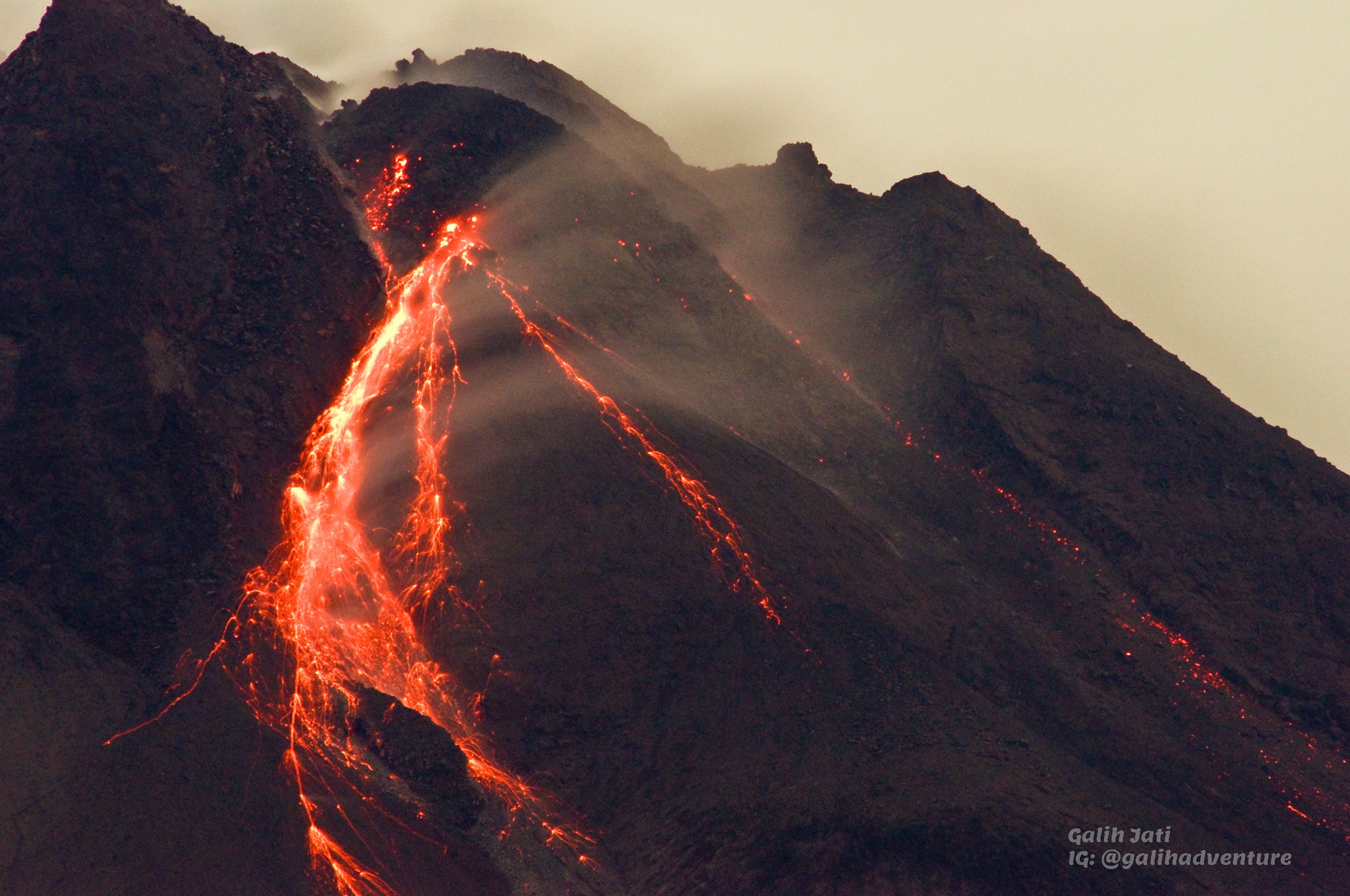
Italy / Sicily , Etna :
Press release on ETNA activity, 09 July 2021 00:47 (22:47 UTC).
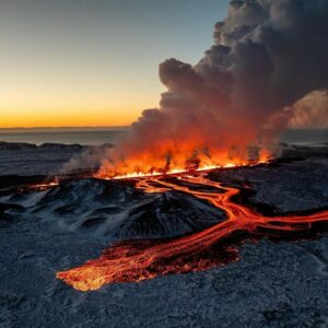
The National Institute of Geophysics and Volcanology, Osservatorio Etneo, reports that the Southeast Crater lava fountain is complete, while low ash emission continues. The explosive activity produced an eruptive cloud which reached about 11,000 m altitude, based on satellite images, moving first in a southerly direction then in a south-easterly direction, and a small flow of lava from the southern flank of the South East Crater cone. The flow, which headed towards the southwest, is currently still fed and is located at an altitude of about 2800 m. Reports have been received of fallout of volcanic material on the villages of Zafferana Etnea (East side), Fleri (South East side), Pedara and Cannizzaro (South side).
The amplitude of the tremor decreases rapidly while remaining in the high end. The signal source is located southeast of the Southeast Crater at a level of approx. 3000 altitude
The infrasound activity returned to low levels.
The stations of the inclinometric network recorded modest variations, with the exception of the stations of Cratere del Piano (CPN) and Pizzi Deneri (PDN), which showed variations of the order of 3 microradians and 1.5 microradians, respectively. . The signals from the GNSS network are still very disturbed.

12:40 (10:40 UTC):
Following what was communicated in the update of the previous volcanic activity, from surveillance cameras and inspections carried out this morning on the ground by INGV staff, it was observed that the lava flow emitted during the paroxysmal activity of the night in a southwest direction cools and reached an altitude of about 2300 m above sea level. It was also observed that the rolling of a few blocks of incandescent lava detached from the flow caused small fires in the brush below the lava front.
The amplitude of the tremor is low. The signal source is located in the Southeast Crater area at a level of about 2800 m. No relevant infrasound activity is noted.
The data from the inclinometric network and the GNSS network do not show any significant changes.
Further updates will be communicated shortly.
Source : INGV.
Photo : Gio Giusa.
Alaska , Pavlof :
AVO/USGS Volcanic Activity Notice
Current Volcano Alert Level: ADVISORY
Previous Volcano Alert Level: NORMAL
Current Aviation Color Code: YELLOW
Previous Aviation Color Code: GREEN
Issued: Friday, July 9, 2021, 11:40 AM AKDT
Source: Alaska Volcano Observatory
Notice Number: 2021/A468
Location: N 55 deg 25 min W 161 deg 53 min
Elevation: 8261 ft (2518 m)
Area: Alaska Peninsula
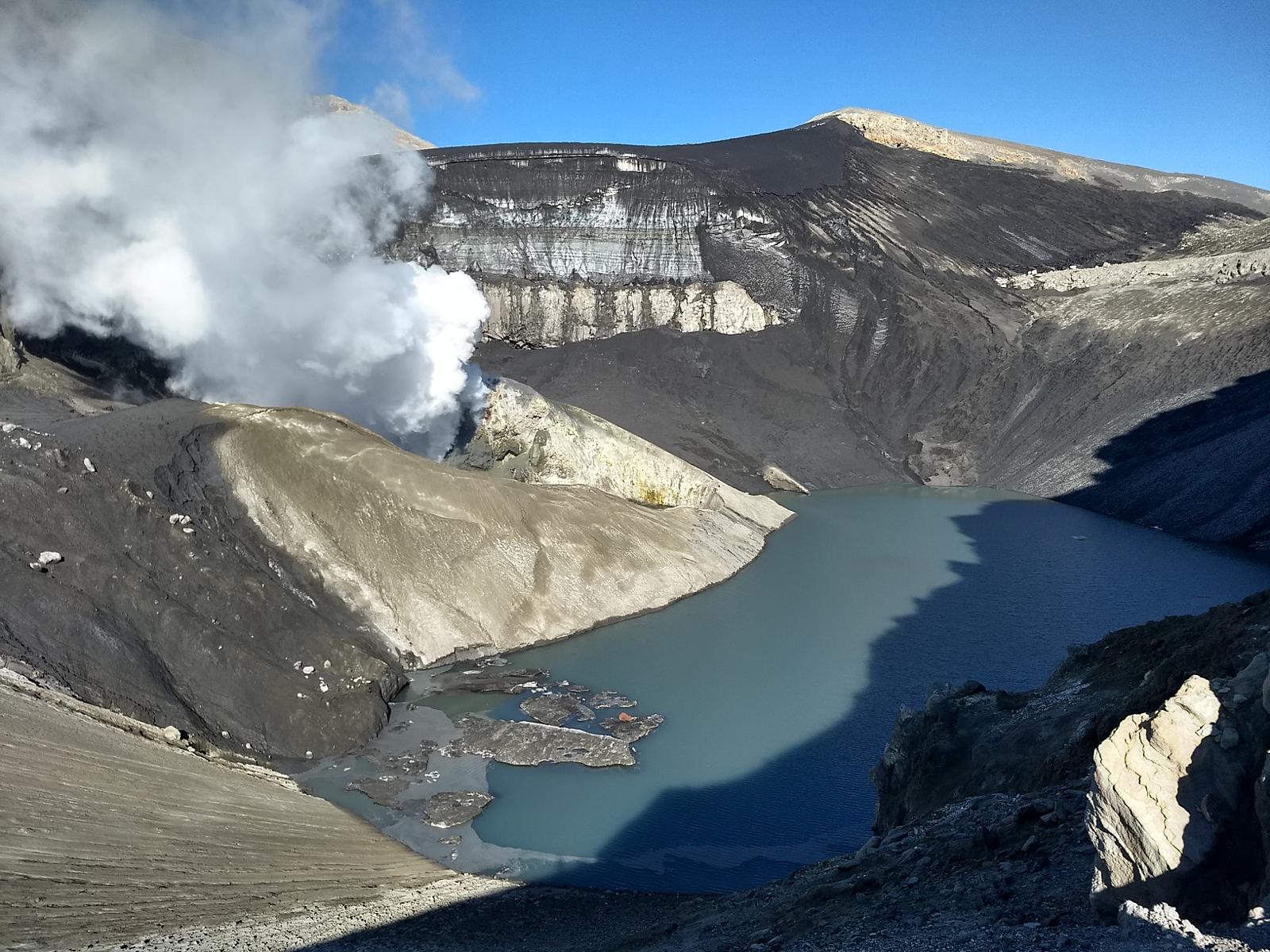
The view into Pavlof’s crater in July 2019. The March 2016 eruption heavily eroded the summit crater. Degassing and elevated temperatures continue to be found within the crater.
Volcanic Activity Summary:
Seismic activity has increased at Pavlof Volcano over the past 16 hours and is characterized by tremor. No eruptive activity or emissions from the summit have been observed. The seismic activity represents an increase from background levels therefore the Alaska Volcano Observatory is raising the Aviation Color Code and Alert Level to YELLOW/ADVISORY. This does not mean that an eruption is likely or imminent. However, past eruptions of Pavlof occurred with little or no warning.
Remarks:
Pavlof Volcano is a snow- and ice-covered stratovolcano located on the southwestern end of the Alaska Peninsula about 953 km (592 mi) southwest of Anchorage. The volcano is about 7 km (4.4 mi) in diameter and has active vents on the north and east sides close to the summit. With over 40 historic eruptions, it is one of the most consistently active volcanoes in the Aleutian arc. Eruptive activity is generally characterized by sporadic Strombolian lava fountaining continuing for a several-month period. Ash plumes as high as 49,000 ft ASL have been generated by past eruptions of Pavlof, and during the March 2016 eruption, ash plumes as high as 40,000 feet above sea level were generated and the ash was tracked in satellite data as distant as eastern Canada. The nearest community, Cold Bay, is located 60 km (37 miles) to the southwest of Pavlof.
Source : AVO
Photo : Fee, David , Volcano Observatory / University of Alaska Fairbanks, Geophysical Institute .
Indonesia , Merapi :
Mount Merapi Activity Report July 2-8, 2021
OBSERVATION RESULT
Visual
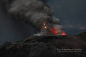
The weather around Mount Merapi is generally sunny in the morning and evening, while it is foggy in the afternoon. White, fine to thick, low pressure, 600m high smoke was observed from the Mount Merapi observation post in Kaliurang on July 8, 2021 at 6:34 a.m.
This week, hot avalanche clouds have occurred 17 times. Some were observed 8 times in the South-West with a maximum slip distance of 2,000 m and 5 times in the South-East with a maximum slip distance of 1,500 m. Lava avalanches have been observed 125 times in the Southwest with a maximum slide distance of 2,000 m and 59 times in the Southeast with a maximum slide distance of 1,800 m.
On July 8, 2021, aerial photos were taken with drones. The result of the analysis of the photos shows that the volume of the dome in the southwest sector is 1,815,000 m3. While the volume of the central dome is 2,741,000 m3.
Seismicity
This week, the seismicity of Mount Merapi showed
17 Hot Cloud Avalanches (AP)
187 shallow volcanic earthquakes (VTB),
7 low frequency earthquakes (LF),
771 multi-phase earthquakes (MP),
1,461 avalanche earthquakes (RF),
120 emission earthquakes (DG)
6 tectonic earthquakes (TT).
This week’s seismicity intensity was higher than last week.
Deformation
The deformation of Mount Merapi, which was monitored using EDM this week, showed a distance shortening rate of 4cm / day.
Rain and lahars
This week, there have been no reports of rain, lahars or additional flow in the rivers that originate on Mount Merapi.
Conclusion
Based on the results of visual and instrumental observations, it is concluded that:
The volcanic activity of Mount Merapi is still quite high in the form of effusive eruption activity. The status of the activity is defined in the “SIAGA” level.
Source : BPPTKG
Photo : Yohannes Tyas Galih Jati.
Nicaragua , Telica :
INETER reported that at 0500 on 29 June ash-and-gas emissions from Telica rose 200 m above the crater rim and drifted SW. The Washington VAAC noted that ash was emitted during 2-3 July. A few discrete emissions and ash near the crater were visible in webcam images on 2 July, and possible diffuse ash just W of the crater was seen in satellite images. Plumes likely rose to 1.2-1.5 km (4,000-5,000 ft) a.s.l. Another steam-and-ash plume drifted SW and then turned N. On 3 July possible ash plumes rose to 1.5 km (5,000 ft) a.s.l. and drifted WSW.
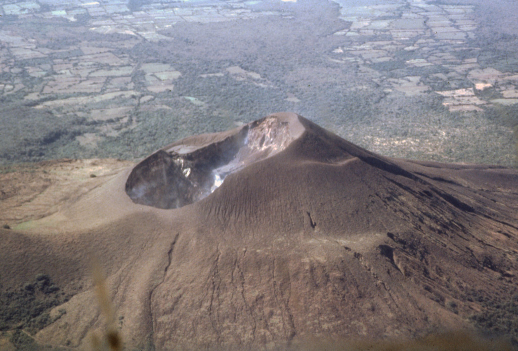
INFORMATION BULLETIN ON VOLCANIC ACTIVITY OF JULY 02, 2021
VOLCANO TELICA
The Telica volcano maintains low energy activity, which began on Tuesday 29, however, since the early hours of Friday it has significantly reduced ash exhalations with gas emissions.
The ash falls back into the crater (most of it) and due to the effect of the wind, a smaller amount is scattered along the slope of the volcano in a westerly direction, without affecting the communities.
The real-time seismic amplitude (RSAM) is found under the usual parameters of this volcano.
This activity is part of the normal behavior of an active volcano like Telica, it should continue in the coming days, and for the moment it does not represent a danger for the population.
Source : GVP , Instituto Nicaragüense de Estudios Territoriales (INETER).
Photo : Jaime Incer, 1991