February 21 , 2021 .
Italy / Sicily , Etna :
COMMUNICATION ON THE ACTIVITY OF ETNA [UPDATE n. 154]
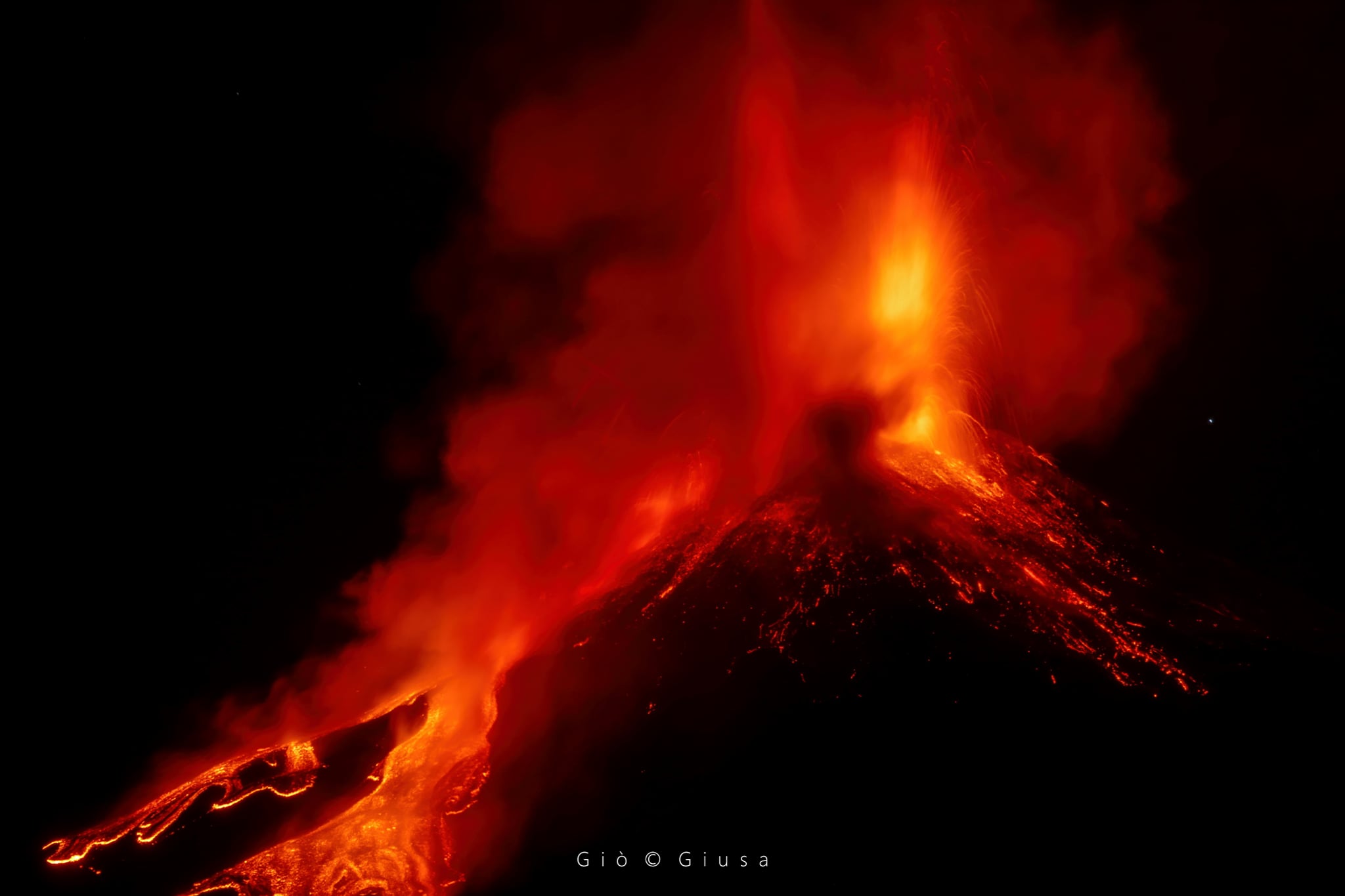
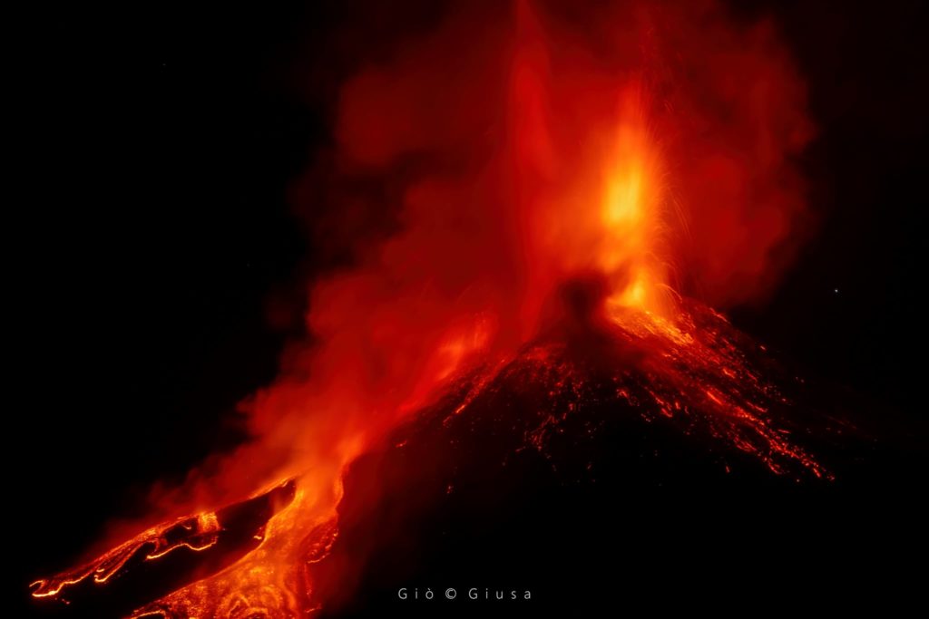
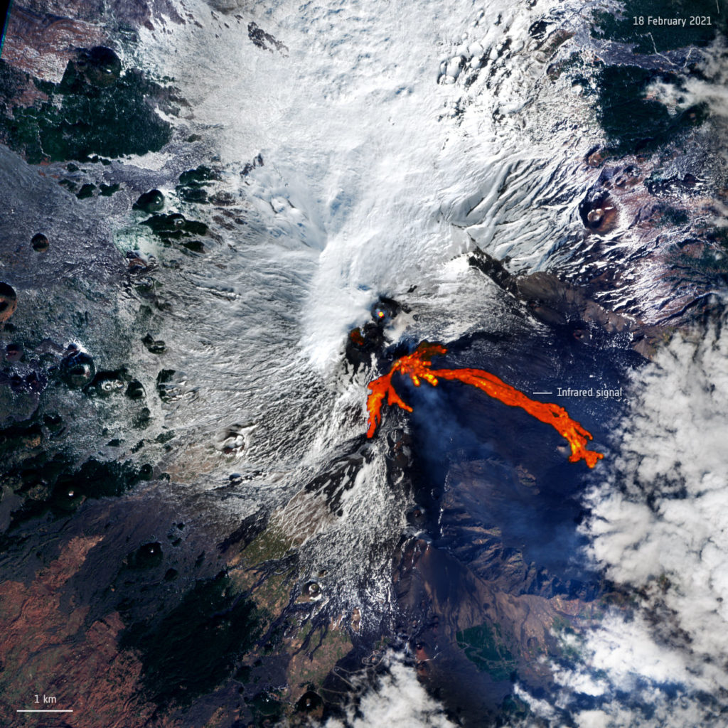
The National Institute of Geophysics and Volcanology, Osservatorio Etneo, announces that after the conclusion of the lava fountain (see update n ° 153), in the interval between 03:30 and 04:15 UTC, about twenty very violent explosions several vents on the Southeast Crater, which launched incandescent bombs at the base of the cone of the same crater. After 04:15 UTC, no eruptive activity took place at the Southeast Crater; the explosive activity observed in recent days continues at the level of the other summit craters.
In the hours which followed the activity of the lava fountains and until the present state, the average amplitude of the volcanic tremor remained mainly confined to the average level. Between 03:20 and 04:10 UTC, the mean amplitude of the seismic signal underwent a temporary significant increase caused by the occurrence of a series of very energetic explosive episodes generating very high amplitude infrasound signals.
After the activity of fountains, the source of the volcanic tremor was located under the summit area, between the craters of Bocca Nuova and Voragine, in a depth range of 2700 to 2900 m above sea level The infrasound activity, at this time, is very low in both the number and the energy of infrasound transients, which are located at the Southeast Crater, Bocca Nuova, and Northeast Crater.
From 01:15 UTC, the deformation data, after the attenuation of the variations recorded on the inclinometric network during the lava fountain, did not show any significant variations.
The results of laboratory analyzes indicate that the composition of the magma of the products emitted during the lava fountain of February 19 is similar to that of the fountains of February 16 and 18, remaining among the most primitive of the paroxysmal activity of the South Crater. Is from the past 20 years. Field surveys are in progress to sample the material that was emitted during the fountains of this last evening.
Source : INGV.
Photo : Gio Giusa , ESA – European Space Agency .
Philippines , Kanlaon :
KANLAON VOLCANO BULLETIN 22 February 2021 08:00 A.M.
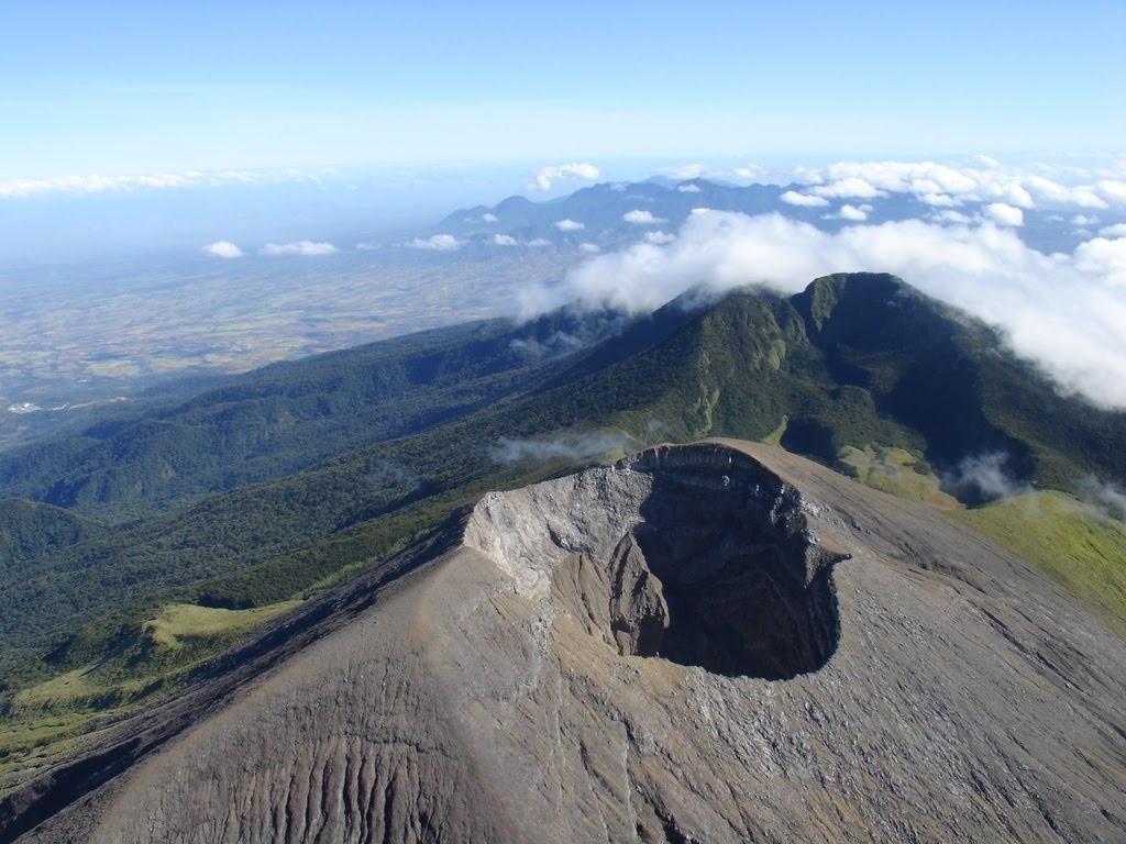
Kanlaon Volcano’s monitoring network recorded fourteen (14) volcanic earthquakes during the 24-hour observation period. Sulfur dioxide (SO2) emission was measured at an average of 587 tonnes/day on 17 February 2021. Ground deformation data from continuous GPS and electronic tilt measurements have been recording a slight inflation of the lower and middle slopes since June 2020. These parameters may indicate hydrothermal, tectonic, or deep-seated magmatic processes occurring deep beneath the edifice.
DOST-PHIVOLCS would like to remind the public that Kanlaon Volcano is at Alert Level 1, which means that it is at an abnormal condition and has entered a period of unrest. The local government units and the public are strongly reminded that entry into the 4-kilometer radius Permanent Danger Zone (PDZ) must be strictly prohibited due to the further possibilities of sudden and hazardous steam-driven or phreatic eruptions. Civil aviation authorities must also advise pilots to avoid flying close to the volcano’s summit as ejecta from any sudden phreatic eruption can be hazardous to aircraft.
DOST-PHIVOLCS is closely monitoring Kanlaon Volcano’s activity and any new development will be relayed to all concerned.
Source : Phivolcs .
Photo : Sunstar.
Guatemala , Pacaya :
SPECIAL VOLCANOLOGICAL BULLETIN, February 21, 2021, 12:34 p.m. local time.
THE STROMBOLIAN PHASE OF THE PACAYAN VOLCANO PERSISTS.
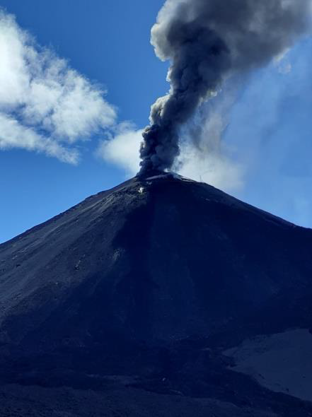
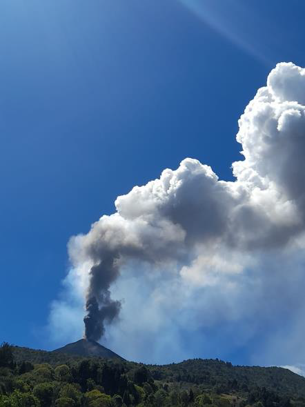
As was reported in the special bulletins of the Pacaya volcano and in the most recent of them BEPAC 033-2021, the Pacaya volcano, continues its eruption with a sharp increase in activity, with moderate explosions and some strong explosions , expelling ballistic projections and volcanic material at an elevation of approximately 3000 to 3200 meters (9,842 to 10,498 feet).
This is accompanied by columns of ash moving in a northwest, west and southwest direction for a distance of 15 kilometers, with reports of ash falling in San Francisco de Sales, El Cedro and others in the region, with the possibility of increasing its dispersal distance up to 30 kilometers.
The described activity generates rumblings and vibrations in the houses around the volcanic building. The OVPAC reports that the ballistic projections reach 300 meters around the Mackenney crater.
The activity of Pacaya is in a high period, therefore it can generate larger increases, so it is recommended to follow the instructions of the CONRED authorities and the Pacaya National Park.
INSIVUMEH, maintains surveillance through the PCG and PCG5 seismic stations, and OVPAC, instrumentally and visually monitors activity for any sudden change in activity.
Source et photos : Insivumeh .
Chile , Nevados of Chillan :
Special Report on Volcanic Activity (REAV), Ñuble region, Nevados de Chillán volcanic complex, February 22, 2021, 1:40 a.m. local time (Continental Chile).
The National Service of Geology and Mines of Chile (Sernageomin) publishes the following PRELIMINARY information, obtained thanks to the monitoring equipment of the National Volcanic Surveillance Network (RNVV), processed and analyzed in the Volcanological Observatory of the Southern Andes ( Ovdas):
On Monday February 22, at 00:30 local time (03:30 UTC), the monitoring stations installed near the volcanic complex of Nevados de Chillán recorded an earthquake linked to the fracturing of the rock (Volcano-Tectonic).
The characteristics of the earthquake after its analysis are as follows:
TIME OF ORIGIN: 00:30 local time (03:30 UTC)
LATITUDE: 36.871 ° S
LONGITUDE: 71.359 ° W
DEPTH: 3.3 km
LOCAL MAGNITUDE: 3.0 (ML)
OBSERVATIONS:
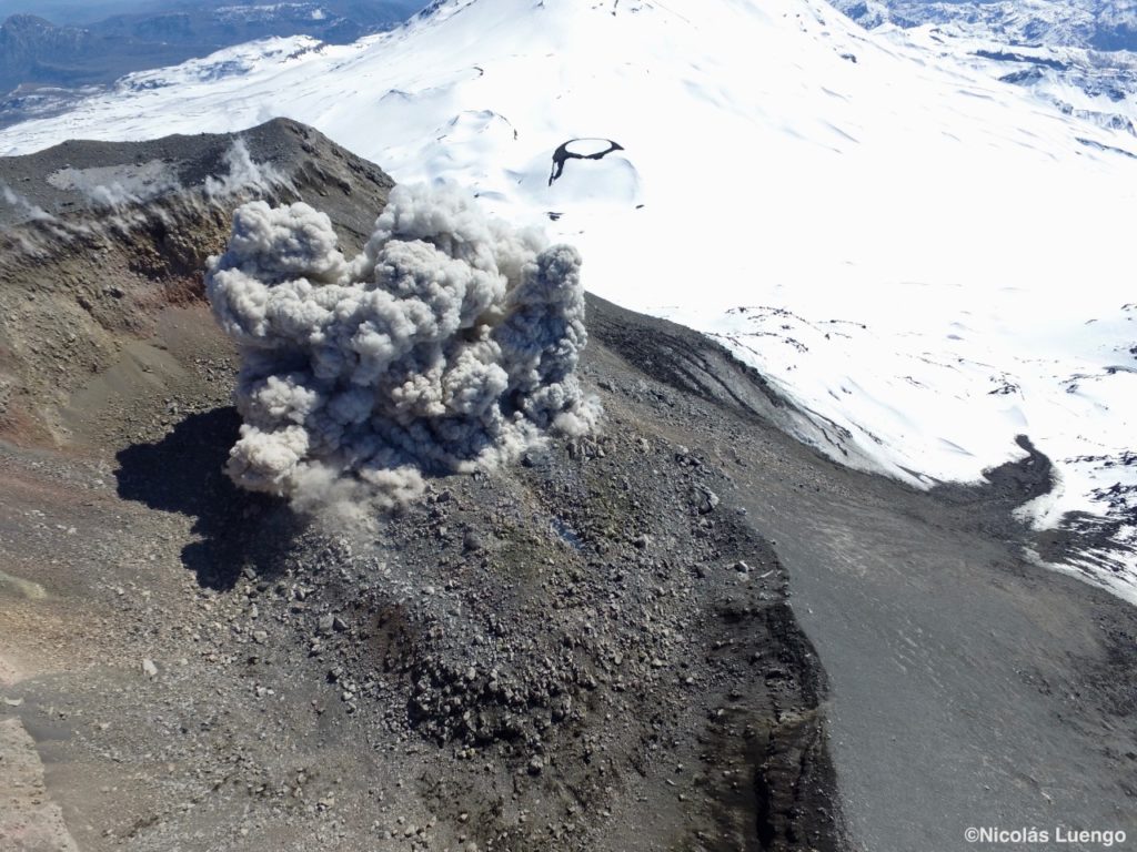
No surface activity associated with this seismic event was observed.
The volcanic technical alert remains at the Yellow level.
Source : Sernageomin .
Photo : Nicolas Luengo.
El Salvador , San Miguel ( Chaparrastique) :
Special report n ° 2
A watch is underway on the evolution of the seismicity of the San Miguel volcano.
Issue date and time: February 19, 2021, 3:30:00 p.m.
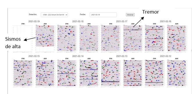
Data from monitoring carried out on the San Miguel volcano indicate that the seismicity continues with slight fluctuations. The number and size of long-lasting signal recordings (known as volcanic tremor) and discrete earthquakes have been less frequent.
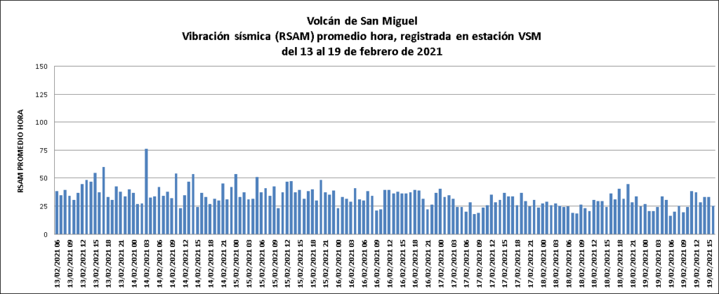
The sequence of seismograms from February 12 to 19 shows the seismicity of the volcano with slight modifications (see figure 1).
Figure 1. Seismicity recorded on the volcano, between February 12 and 19, 2021. It is observed that the signals of tremor and discrete earthquakes have decreased during the last hours. Earthquakes are caused by small rock fractures due to changes in fluid pressure. Source: MARN
Recorded earthquakes have a high frequency, indicating fracture processes of fragile rocks, associated with pressurization processes, the passage of fluids and magmatic gases.
The seismic vibration of the volcano, measured in RSAM units, remains well below the base threshold, fluctuating between 25 and 75 average hourly units, when the normal is 150 units (see figure 2).
Figure 2. The low values of the seismic amplitude of the volcano indicate that the system is partially open. Source: MARN
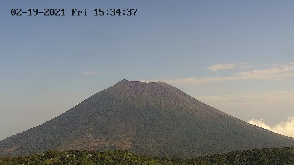
On the images of the volcano captured this Friday, February 19 (see figure 3), by the webcam located on the Pacayal volcano, no gas plume is observed.
Figure 3. Image of the San Miguel volcano seen on Friday, February 19 at 7:12 a.m. from the Pacayal volcano. Source: MARN
Comments.
The changes in seismicity that the San Miguel volcano often exhibits are linked to the dynamics of fluids coming from its magmatic system, causing high-frequency micro-earthquakes when the rock fractures, which in turn generates new cracks and allows the passage of gases and fluids.
The low values of the seismic amplitude (RSAM) of the volcano indicate that the system is partially open, supporting that the current activity of the volcano corresponds to processes of increasing gas flow.
In the event of gas and ash explosions, they would be displaced in the direction of the wind, to the northwest, west and southwest of the volcano.
Therefore, residents, tourists and climbers are called to stay away from the crater of the volcano, due to the presence of magmatic gases harmful to health and the threat of possible explosions, which can occur suddenly at through the crater.
The MARN Observatory of Threats and Natural Resources maintains a 7/24 surveillance of the volcano and close communication with the General Directorate of Civil Protection and Local Observers.
This report will be updated on Friday February 26th. In the event of a radical change in the activity of the volcano, a prior special report will be published.
Source : Marn.

