January 14 , 2021 .
Saint Vincent , Soufrière Saint Vincent :
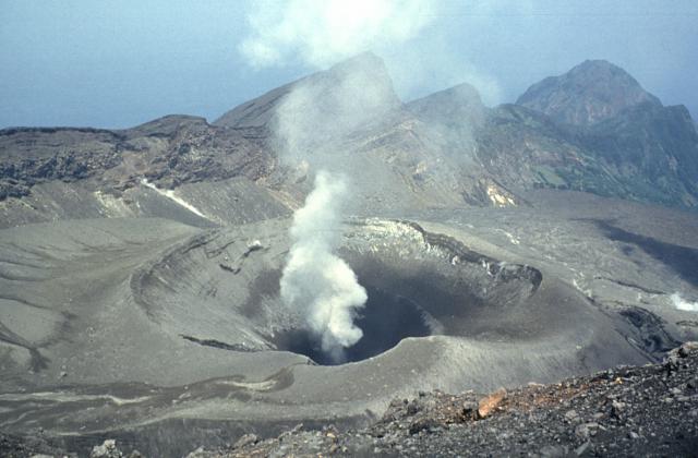
LA SOUFRIÈRE BULLETIN 13, JANUARY 13, 2021 8:00 PM
Heavy cloud did not allow for aerial reconnaissance today, arrangements have been made for aerial reconnaissance over the next few days via helicopter.
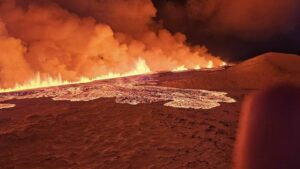
The dome that broke through the crater floor, on December 27, 2020, on the south-west perimeter of the existing dome, continues to grow within the crater of La Soufrière and has an ellipsoid shape with growth expanding in a westerly direction.
Lava broke the surface on December 27, 2020.
Alert level remains at Orange. The volcano continues to exude magma on the surface and steam can still be observed from the Belmont Observatory. Persons living in areas close to the volcano should expect strong sulphur smells for several days to weeks, depending on changes in wind direction.
Thomas Christopher and Dr. Adam Stinton, two scientists from the Seismic Research Centre (SRC) based at the Montserrat Volcano Observatory (MVO) arrived in St. Vincent and the Grenadines today on board the Regional Security Services (RSS) Aircraft. Their main mission will be to gather data from the dome and crater through temperature and photogrammetry and gas measurements using a MultiGAS and spectrometer.
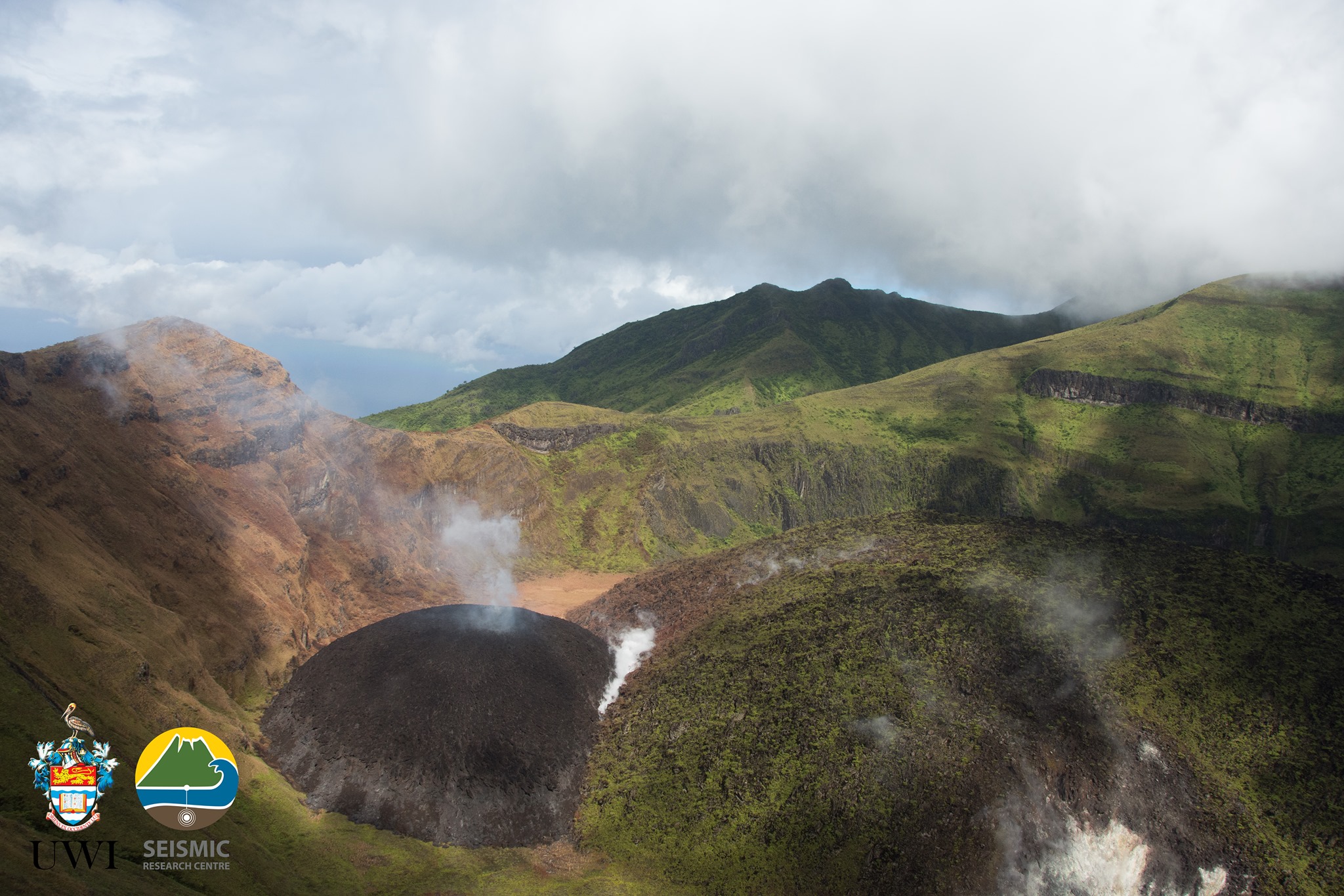
On January 6, 2021 the dome could be seen reaching the crater wall.
The Caribbean Disaster Emergency Management Agency (CDEMA) has finalized helicopter support for the Seismic Research Centre (SRC) Team to install equipment and collect samples from the summit of the volcano.
University of the West Indies Seismic Research Centre (UWI-SRC) and National Emergency Management Organisation (NEMO) reported that the lava dome in Soufrière St. Vincent’s main crater that first formed on 27 December continued to grow during 6-12 January. Observations were made during a field visit on 5 January, during a helicopter overflight on 6 January, and based on 9 January drone video. During that time the dome grew and expanded to the W, produced small, hot rockfalls, had a blocky appearance, and continued to emit gasses and steam. Gas-and-steam plumes were also visible from Belmont Observatory. The Alert Level remained at Orange (the second highest level on a four-color scale).
Sources : Nemo , GVP.
Photos : UWI.
Japan , Sakurajima :
JMA reported that during 4-11 January incandescence from Minamidake Crater (at Aira Caldera’s Sakurajima volcano) was often visible nightly. The sulfur dioxide emission rate remained high and reached extremely high levels of 5,000 tons per day on 6 January. An explosion at 1642 on 4 January produced an ash plume that rose 1.8 km above the crater rim and merged into weather clouds. An explosion at 1133 on 11 January generated an ash plume that rose 1.3 km. The Alert Level remained at 3 (on a 5-level scale).
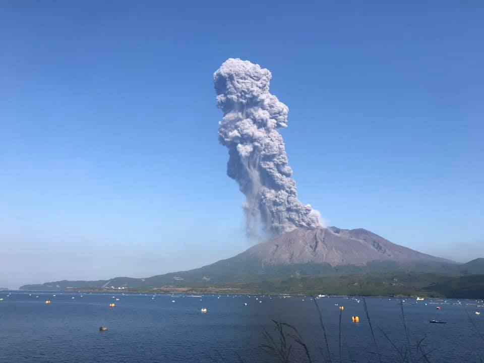
The Aira caldera in the northern half of Kagoshima Bay contains the post-caldera Sakurajima volcano, one of Japan’s most active. Eruption of the voluminous Ito pyroclastic flow accompanied formation of the 17 x 23 km caldera about 22,000 years ago. The smaller Wakamiko caldera was formed during the early Holocene in the NE corner of the Aira caldera, along with several post-caldera cones. The construction of Sakurajima began about 13,000 years ago on the southern rim of Aira caldera and built an island that was finally joined to the Osumi Peninsula during the major explosive and effusive eruption of 1914. Activity at the Kitadake summit cone ended about 4850 years ago, after which eruptions took place at Minamidake. Frequent historical eruptions, recorded since the 8th century, have deposited ash on Kagoshima, one of Kyushu’s largest cities, located across Kagoshima Bay only 8 km from the summit. The largest historical eruption took place during 1471-76.
Source: Agence météorologique japonaise (JMA) , GVP.
Photo : Koki Arima.
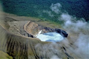
Guatemala , Pacaya :
Activity:
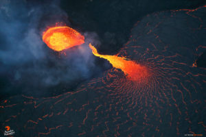
OVPAC observers report gray and blue degassing dispersing towards the South. A lava flow with a South-South-West direction with a length of 1350 meters is reported. On the western and southwestern flanks there are areas with high temperatures due to the active lava flows of the previous days. The PCG and PCG5 stations recorded weak explosions and tremors due to the rise of magma and gases towards the surface. (The recommendations of the special BEPAC bulletin n ° 002-2021 remain in force).
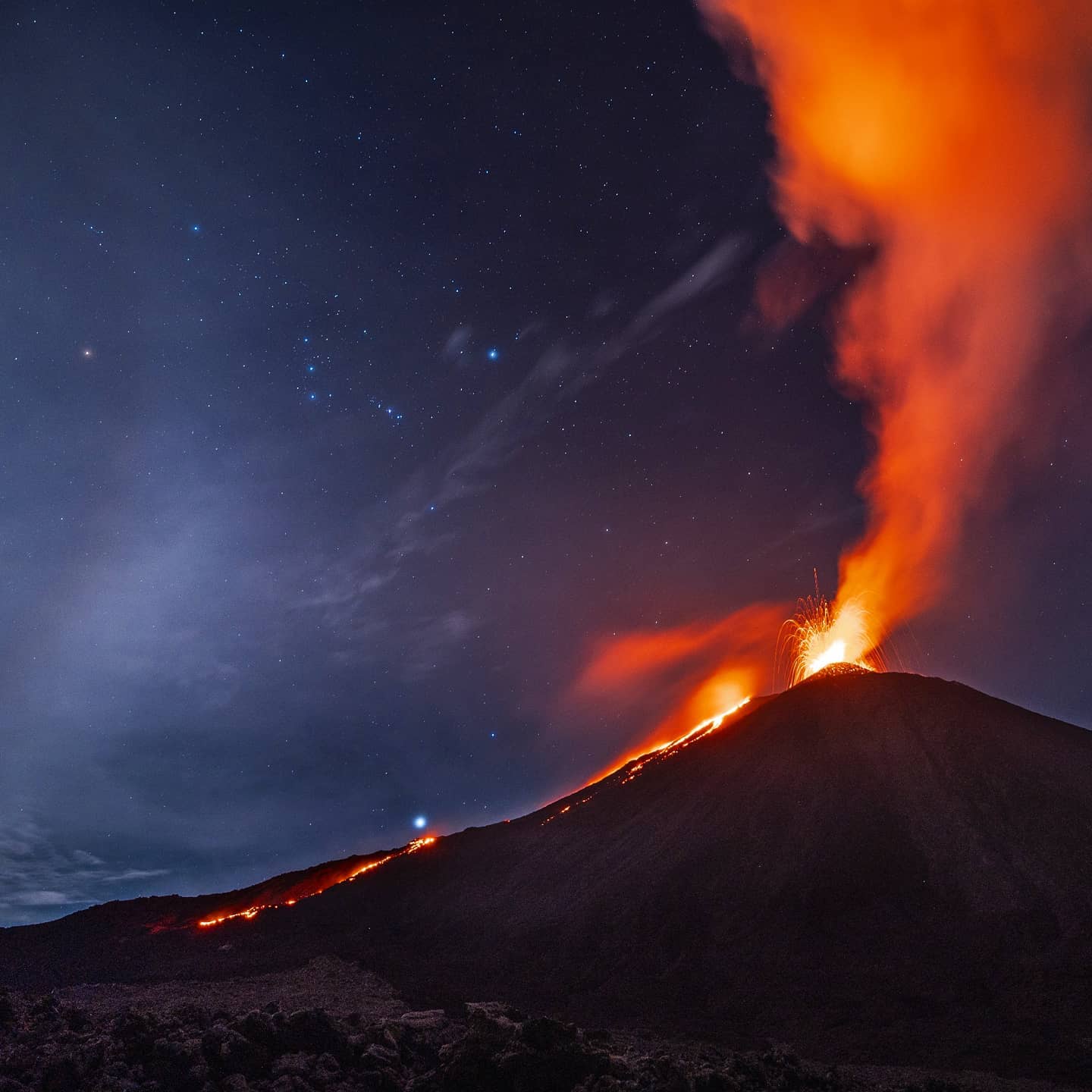
INSIVUMEH reported that the lava flow that began on 2 January from a vent on the SW flank, 200 m below Pacaya’s Mackenney Crater, formed 3-4 branches and was 400 m long by 6 January. Avalanches of material descended the W, SW, and S flanks. Strombolian explosions produced ash plumes that rose 100-150 m above the cone and drifted 10 km S and SW. Explosions on 7 January produced ash plumes that rose 300-500 m above the crater and ejected ballistics 300 m away from the crater. Explosions rattled structures in nearby villages. Two new lava flows emerged on the N flank at 0740; one traveled 50 m and the other 200 m. Active lava flows on the W and SW flanks were 550 m long. Overnight during 7-8 January a new lava flow on the SW flank descended 425 m. During 9-12 January Strombolian explosions continued to ejected material up to 300 m above the cone. The lava flow on the SW flank reached a length of 1.2 km on 9 January and 1.5 km by 10 January; it remained active through 12 January. Ash plumes drifted 10 km W during 10-11 January, and avalanches form the crater area descended the SW and S flanks.
Sources : Insivumeh , GVP.
Photo : Diego Rizzo via Sherine France.
Langila , Papua New Guinea :
Based on analyses of satellite imagery and wind model data, the Darwin VAAC reported that on 9 January a short-lived eruption at Langila produced an ash plume that rose 4.9 km (16,000 ft) a.s.l. and drifted W.
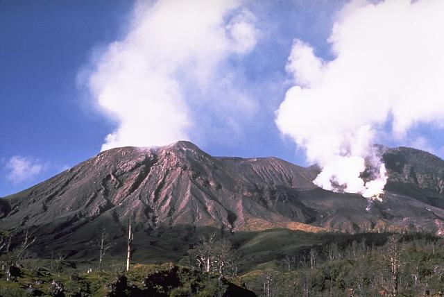
Langila, one of the most active volcanoes of New Britain, consists of a group of four small overlapping composite basaltic-andesitic cones on the lower E flank of the extinct Talawe volcano in the Cape Gloucester area of NW New Britain. A rectangular, 2.5-km-long crater is breached widely to the SE; Langila was constructed NE of the breached crater of Talawe. An extensive lava field reaches the coast on the N and NE sides of Langila. Frequent mild-to-moderate explosive eruptions, sometimes accompanied by lava flows, have been recorded since the 19th century from three active craters at the summit. The youngest and smallest crater (no. 3 crater) was formed in 1960 and has a diameter of 150 m.
Source : GVP.
Photo : GVP / Wally Johnson.
Japan , Suwanosejima :
JMA reported that incandescence at Suwanosejima’s Ontake Crater was visible nightly during 4-11 January. Two explosions on 5 January produced ash plumes that rose 1.2 km above the crater rim and ejected bombs 400 m away from the crater. Two explosions during 9-10 January generated ash plumes that rose 1 km and again ejected bombs 400 m away. The Alert Level remained at 3 (on a 5-level scale).
The 8-km-long, spindle-shaped island of Suwanosejima in the northern Ryukyu Islands consists of an andesitic stratovolcano with two historically active summit craters. The summit is truncated by a large breached crater extending to the sea on the east flank that was formed by edifice collapse. Suwanosejima, one of Japan’s most frequently active volcanoes, was in a state of intermittent strombolian activity from Otake, the NE summit crater, that began in 1949 and lasted until 1996, after which periods of inactivity lengthened. The largest historical eruption took place in 1813-14, when thick scoria deposits blanketed residential areas, and the SW crater produced two lava flows that reached the western coast. At the end of the eruption the summit of Otake collapsed forming a large debris avalanche and creating the horseshoe-shaped Sakuchi caldera, which extends to the eastern coast. The island remained uninhabited for about 70 years after the 1813-1814 eruption. Lava flows reached the eastern coast of the island in 1884. Only about 50 people live on the island.
Source : GVP.
Photo : Yukio Hayakawa, 1998 (Gunma University).