January 07 , 2021 .
Italy / Sicily , Etna :
COMMUNICATION ON THE ACTIVITY OF ETNA [UPDATE n. 113]
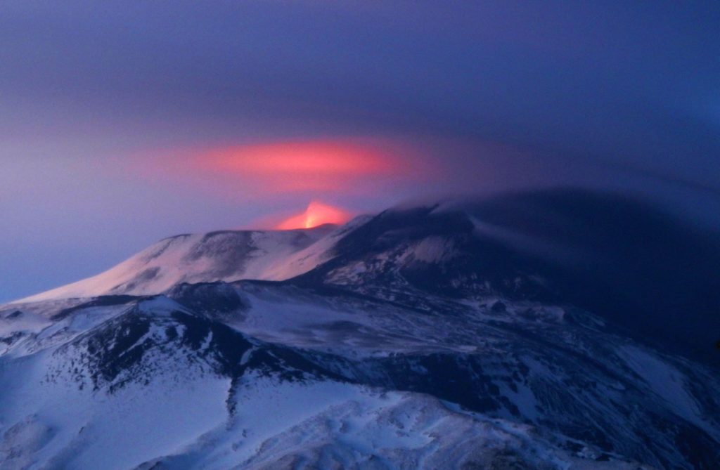
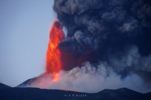
The National Institute of Geophysics and Volcanology, Osservatorio Etneo, announces that from 09:05 UTC on 06/01/2021, a gradual intensification of Strombolian explosive activity has been observed at the eastern vent of the Southeast crater . This activity produces abundant black ash which is dispersed towards the east. In addition, sporadic explosions in the crater of Voragine are observed. As for the other craters, the activity remains unchanged from the previous version.
As for the volcanic tremor, there are no significant variations compared to what was communicated previously, its amplitude fluctuates in the range of average values with a trend growth. The middle source is located in the area of the Southeast Crater between 2.8 and 3 km above sea level.
The infrasound activity of the last hours, probably also due to the presence of strong winds, did not show significant variations.
There are no significant variations in the deformation signals acquired by the permanent GPS and inclinometric networks.
Further updates will be communicated shortly.
Source : INGV .
Photo : INGV / Boris Behncke .
Saint Vincent and the Grenadines , Soufrière Saint Vincent :
LA SOUFRIERE BULLETIN # 8, JANUARY 5, 2021 8:00 PM
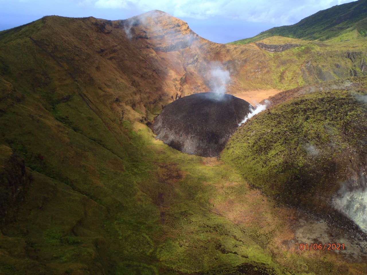
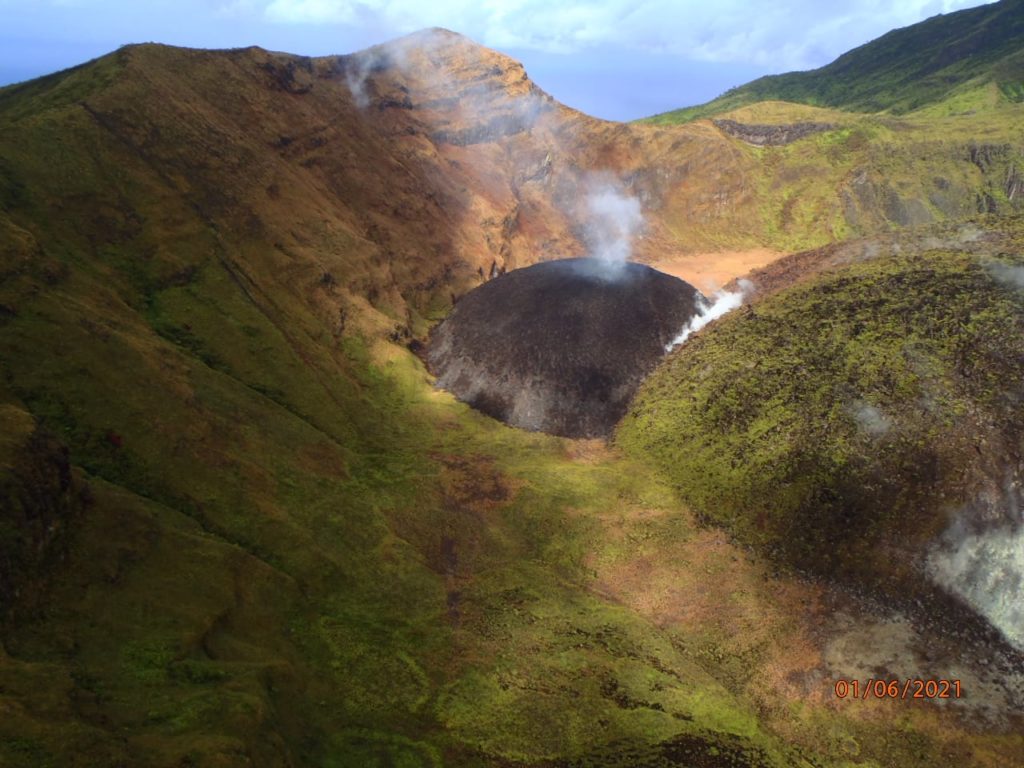
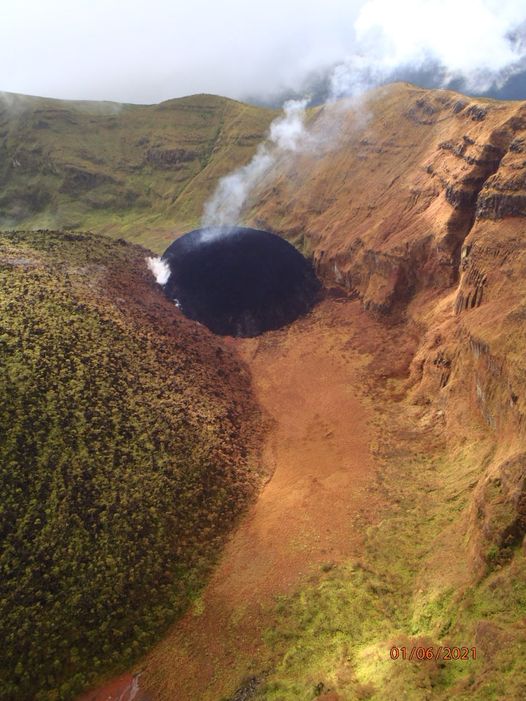
The team from The Seismic Research Centre, University of the West Indies, St. Augustine Campus (UWI-SRC) led by Vincentian Geologist Prof. Richard Robertson installed a monitoring station at Wallibou today. They made a trip to the crater rim, to take still photos and videos which will allow them to estimate the volume of material extruded and growth of the new dome. Based on observations today, the dome is slowly getting bigger.
The SRC Team will also conduct a reconnaissance of the La Soufriere Volcano on board the French Helicopter on Wednesday 6th January, 2021 through an arrangement between the Government of St. Vincent and the Grenadines and the Government of France, through the Embassy of France to the Eastern Caribbean States, to Barbados and the OECS in Saint Lucia.
The Regional Security System (RSS) Aircraft will also do a surveillance of the La Soufriere Volcano on Wednesday 6th January, 2021.
Aerial reconnaissance of La Soufriere was done today, however thick cloud cover was blocking the view of the new dome.
Alert level remains at Orange. The Volcano continues to exude magma on the surface and steam can still be observed from the Belmont Observatory. Persons living in areas close to the volcano should expect strong sulphur smells for several days to weeks, depending on changes in wind direction.
The Seismic Research Centre at the University of the West Indies (UWI-SRC) and National Emergency Management Organisation (NEMO) of St. Vincent and the Grenadines reported that during an overflight at 1600 on 31 December scientists confirmed that the new lava dome on the WSW edge of Soufrière St. Vincent’s 1979 lava dome continued to grow. Steam from the dome was visible from Belmont Observatory through 4 January. The Alert Level remained at Orange (the second highest level on a four-color scale).
Soufrière St. Vincent is the northernmost and youngest volcano on St. Vincent Island. The NE rim of the 1.6-km wide summit crater is cut by a crater formed in 1812. The crater itself lies on the SW margin of a larger 2.2-km-wide Somma crater, which is breached widely to the SW as a result of slope failure. Frequent explosive eruptions since about 4300 years ago produced pyroclastic deposits of the Yellow Tephra Formation, which blanket much of the island. The first historical eruption took place in 1718; it and the 1812 eruption produced major explosions. Much of the northern end of the island was devastated by a major eruption in 1902 that coincided with the catastrophic Mont Pelée eruption on Martinique. A lava dome was emplaced in the summit crater in 1971 during a strictly effusive eruption, forming an island in a lake that filled the crater prior to an eruption in 1979. The lake was then largely ejected during a series of explosive eruptions, and the dome was replaced with another.
Sources et photos : Nemo , GVP.
Indonesia , Merapi :
VOLCANO OBSERVATORY NOTICE FOR AVIATION – VONA.
Issued : January 07 , 2021
Volcano : Merapi (263250)
Current Aviation Colour Code : ORANGE
Previous Aviation Colour Code : unassigned
Source : Merapi Volcano Observatory
Notice Number : 2021MER01
Volcano Location : S 07 deg 32 min 31 sec E 110 deg 26 min 31 sec
Area : Special Region of Yogyakarta, Indonesia
Summit Elevation : 9498 FT (2968 M)
Volcanic Activity Summary :
Eruption with pyroclastic density current at 01h02 UTC (08h02 local). Eruption has stopped.
Volcanic Cloud Height :
Best estimate of ash-cloud top is around 10138 FT (3168 M) above sea level, may be higher than what can be observed clearly. Source of height data: ground observer.
Other Volcanic Cloud Information :
Pyroclastic density current heading southwest.
Remarks :
Pyroclastic density current was recorded in seismogram with max amplitude 28 mm and duration 154 s.
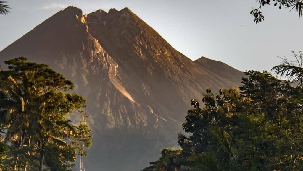
Level of activity at level III (SIAGA) since November 5, 2020 at 12:00 p.m. The Merapi volcano (2968 m altitude) is continuously erupting. The last eruption took place on June 21, 2020 with the height of the eruption column at 6000 m above the summit. It was observed that the color of the ash column was gray.
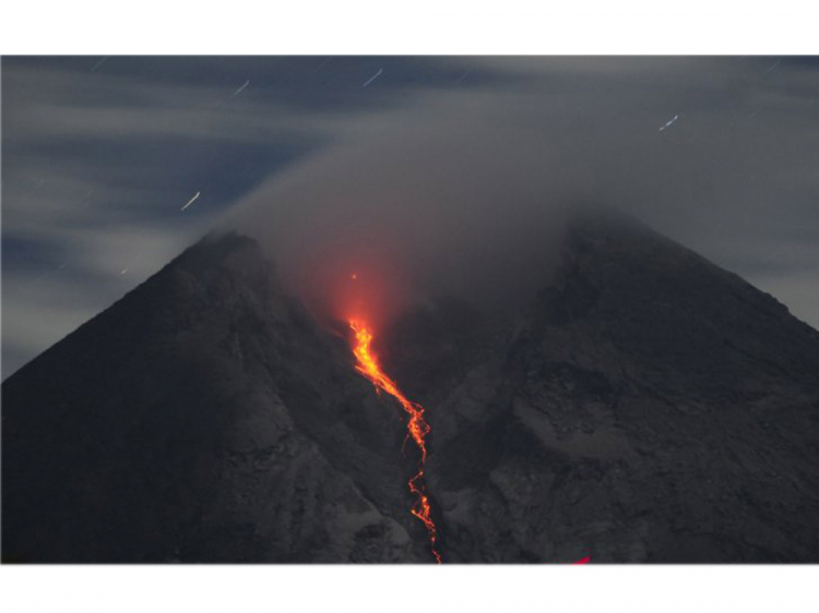
The volcano was clearly visible until it was covered in fog. Smoke from the crater was not observed. The weather is cloudy to rainy, with weak to strong winds to the east, south-east and west. There was a weak sound of avalanches from Pos Babadan. It was possible to observe 2 avalanches of incandescent lava, with a low intensity towards the Krasak river, over a maximum distance of 400 meters.
According to the seismographs of January 6, 2021, it was recorded:
91 avalanche earthquakes
102 emission earthquakes
273 hybrid / multi-phase earthquakes
60 shallow volcanic earthquakes
Source : Magma Indonésie , PVMBG.
Photos : Gunung merapi , Aloysius Jarot Nugroho.
Japan , Sakurajima :
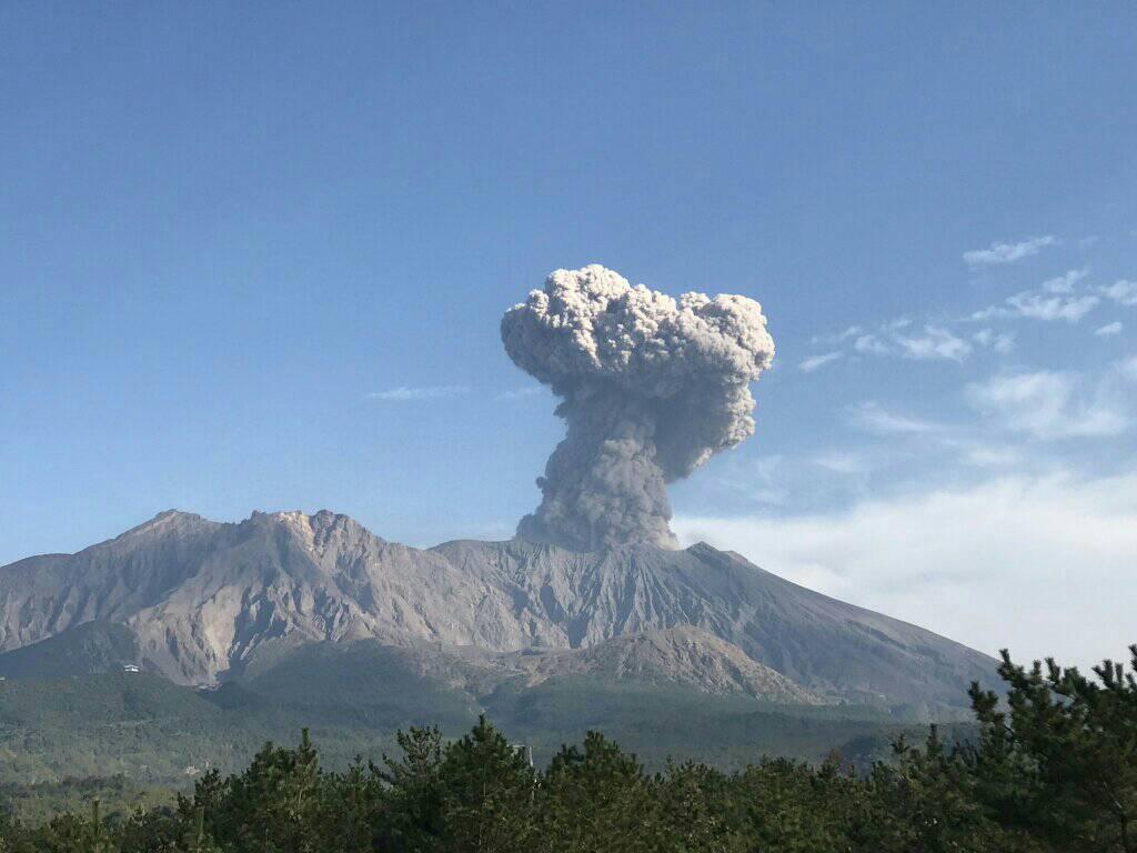
JMA reported that during 28 December-4 January incandescence from Minamidake Crater (at Aira Caldera’s Sakurajima volcano) was often visible nightly. The sulfur dioxide emission rate remained high. Four explosions were recorded during 28 December-1 January .
An explosion at 1614 on 29 December generated ash plumes that rose as high as 3.5 km above the crater rim and ejecting bombs 1.3-1.7 km away from the crater. Very small eruptive events were recorded during 2-4 January. The Alert Level remained at 3 (on a 5-level scale).
Source : GVP .
Photo : Rizal M.
Hawaii , Kilauea :
19°25’16 » N 155°17’13 » W,
Summit Elevation 4091 ft (1247 m)
Current Volcano Alert Level: WATCH
Current Aviation Color Code: ORANGE
Activity Summary:
Lava activity is confined to Halemaʻumaʻu with lava erupting from vents on the northwest side of the crater. Tuesday afternoon (Jan. 5), the lava lake was 192 m (630 ft) deep and perched 1-2 m (1-2 yds) above its edge. SO2 emission rates were still elevated.
Summit Observations:
Summit tiltmeters recorded weak deflationary tilt since Jan. 1. Seismicity remained elevated but stable, with steady elevated tremor and a few minor earthquakes.
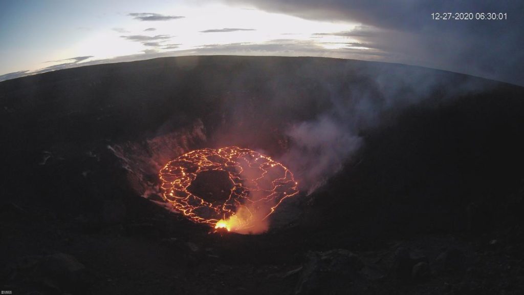
The KW webcam continues to document activity in Halema‘uma‘u crater at Kīlauea’s summit. The webcam is located on the west rim of the crater, and looks to the east across Halema‘uma‘u (in the images, north is to the left and south is to the right). The image, taken at just after 6:30 a.m. HST on December 27, 2020, HST shows the largest island in the lava lake oriented in an east-west direction along its long axis. Since then, the island has rotated.
Halemaʻumaʻu lava lake Observations:
The west vents spattered from the top of a small cone plastered on the northwest wall of Halemaʻumaʻu crater. This morning, lava is flowing down a narrow channel to the lake and feeding a small dome fountain in front of the west vents probably from a submerged portion of the vent.
As of Tuesday (Jan. 5), the lake was perched about 1-2 m (1-2 yds) above its narrow edges; overflows onto the narrow edge slowly elevated a low wall around the lake similar to the wall around an above-ground swimming pool.
The main island of cooler, solidified lava floating in the lava lake continued rotating counter-clockwise, in front of the west lava source filling the lake, while the 11 smaller islands moved a bit but remained in the east end of the lake.
Source et photo : HVO .

