December 12 , 2020.
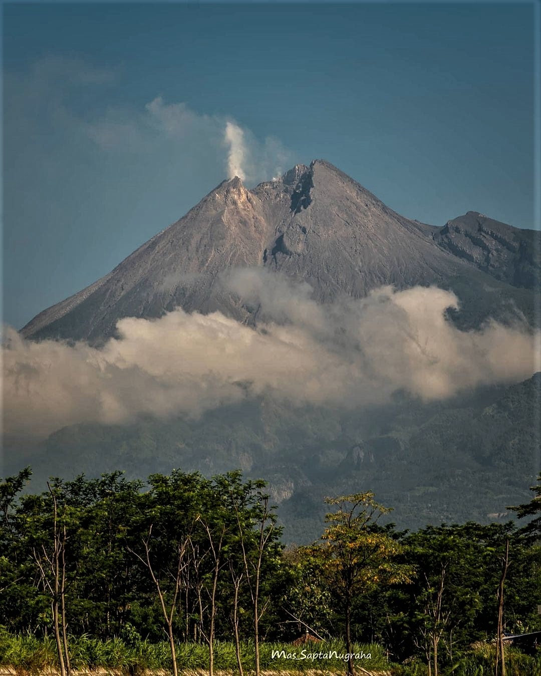
Indonesia , Merapi :
Mount Merapi activity report from December 4 to 10, 2020
I. OBSERVATION RESULTS
Visual
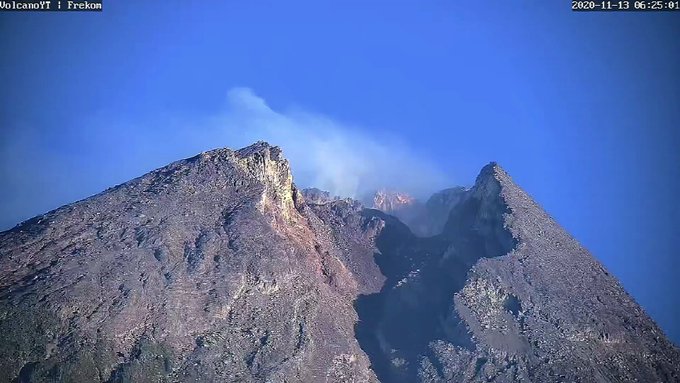
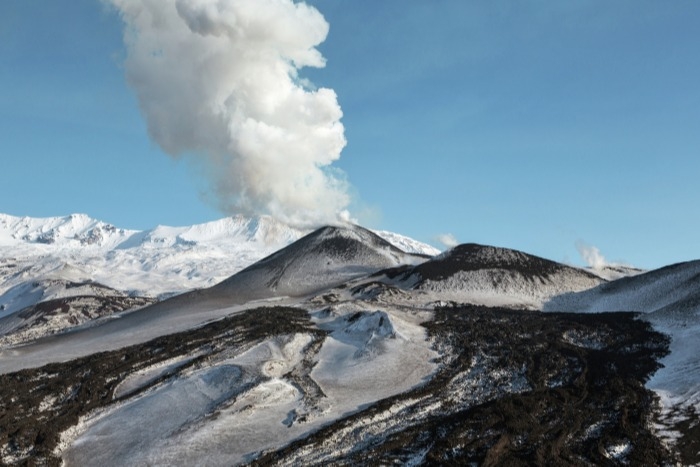
The weather around Mount Merapi is generally sunny in the morning, while the afternoon until evening is foggy. There is white smoke, weak to thick, with low pressure. A maximum smoke height of 400 m was observed from the Selo observation post on December 4, 2020 at 10:30 a.m. Avalanches were observed from the Babadan post with a sliding distance of ± 200 m upstream of K Lamat in the West sector on December 8, 2020 at 9:17 a.m.
Morphological analysis of the peak area based on photos of the Southeast sector from December 8 to November 29, 2020 showed a slight change in the morphology of the peak area. From the drone data dated December 5, 2020, it was found that no new material was observed (new lava dome).
Seismicity
This week, the seismicity of Mount Merapi recorded
232 shallow volcanic earthquakes (VTB),
1,692 multi-phase earthquakes (MP),
5 low frequency earthquakes (LF),
256 avalanche earthquakes (RF),
209 emission earthquakes (DG)
2 tectonic earthquakes (TT).
The seismic intensity this week is lower than last week.
Deformation
The deformation of Mount Merapi which was monitored using EDM this week showed a shortening rate of 9cm / day.
Rain and lahars
This week there was rain at Merapi Observation Post with the highest rainfall intensity of 61mm / hour for 115 minutes at Kaliurang Post on December 5, 2020. There were no lahars or additional flow in the rivers that descend from the Merapi.
Conclusion
Based on the results of visual and instrumental observations, it is concluded that:
1. The volcanic activity of Mount Merapi is still quite high, so the status of the activity is still at the “SIAGA” level.
2. Current potential hazards are in the form of lava avalanches, ejection of volcanic material in the event of an explosive eruption and a maximum slide distance of 5 km for hot cloud avalanches.
Source : BPPTKG
Photos : Mas Sapta Nugraha , Frekom.
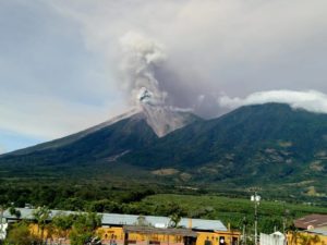
Guatemala , Santiaguito :
Special Volcanological Bulletin.
UPDATE ON VOLCANIC ACTIVITY AND ASH FALLS
The seismic stations of the volcanic monitoring network of the Santiaguito volcano have recorded an increase in activity since 4:30 am today. This increase is linked to the generation of avalanches with moderate to strong characteristics, as well as the descents of boulders and ash flows, caused by the extrusion and accumulation of lava in the Caliente dome in a West and South – West direction . This makes the said area unstable and can produce this type of volcanic phenomenon. This behavior of volcanic activity has persisted since May of this year.
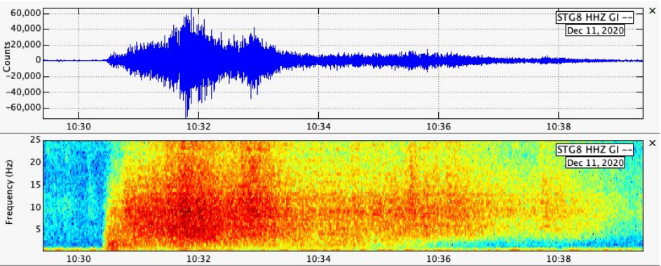
Figure n ° 1: Seismic recording of volcanic activity linked to the generation of avalanches and boulder and ash flows. So far, 13 similar events have been recorded. The hours correspond to UTC 0, 4:30 a.m. (local time UTC-6) = 10:30 a.m. on the graph.
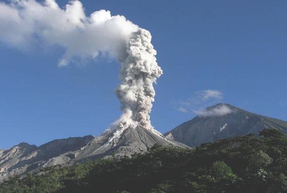
The above mentioned activity has the potential to generate fine ash which is borne and carried downwind, degassing and incandescence can be observed at night and early in the morning. During the last hours, moderate to heavy ash fall is reported in a southwest direction, reaching the areas of Finca Montebello, Loma Linda and San Marcos Palajunoj. It is not excluded that other areas of the South and South-East are also affected, such as Finca el Faro and El Palmar.
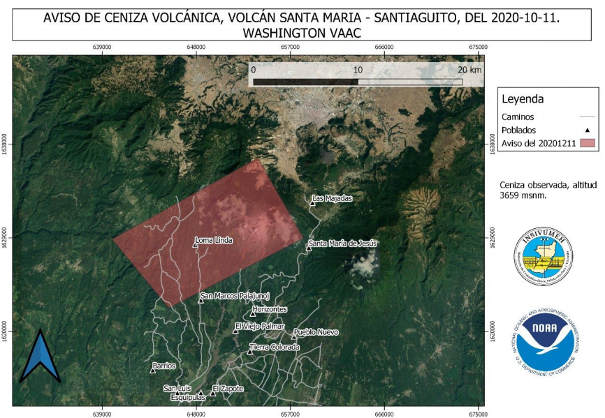
The Ash Dispersion Advisory Center (VAAC), reported the direction of ash dispersal today for the Santiaguito volcano, which could reach distances of between 15 and 20 kilometers south and west of the volcanic complex, as shown below.
Source : Insivumeh
Photo : La Hora.
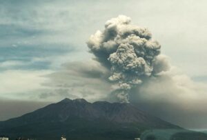
Russia / Kurile Islands , Ebeko :
VOLCANO OBSERVATORY NOTICE FOR AVIATION (VONA).
Issued: December 12 , 2020
Volcano: Ebeko (CAVW #290380)
Current aviation colour code: ORANGE
Previous aviation colour code: orange
Source: KVERT
Notice Number: 2020-239
Volcano Location: N 50 deg 41 min E 156 deg 0 min
Area: Northern Kuriles, Russia
Summit Elevation: 3791.68 ft (1156 m)
.
Volcanic Activity Summary:
A moderate eruptive activity of the volcano continues. According to visual data by volcanologists from Severo-Kurilsk, explosion sent ash up to 3 km a.s.l., an ash cloud is drifting to the east of the volcano.
This activity of the volcano continues. Ash explosions up to 19,700 ft (6 km) a.s.l. could occur at any time. Ongoing activity could affect low-flying aircraft and airport of Severo-Kurilsk.
Volcanic cloud height:
8200-9840 ft (2500-3000 m) AMSL Time and method of ash plume/cloud height determination: 20201212/0456Z – Visual data
Other volcanic cloud information:
Distance of ash plume/cloud of the volcano: 3 mi (5 km)
Direction of drift of ash plume/cloud of the volcano: E
Time and method of ash plume/cloud determination: 20201212/0456Z – Visual data
Source : Kvert.
Photo : RIA Novosti Alexander Piragis.
Mexico , Popocatepetl :
December 11, 11:00 a.m. (December 11, 5:00 p.m. GMT)
During the last 24 hours, according to the monitoring systems of the Popocatépetl volcano, 144 exhalations and 49 minutes of tremor have been identified, accompanied by emissions of volcanic gases and, on occasion, ash.
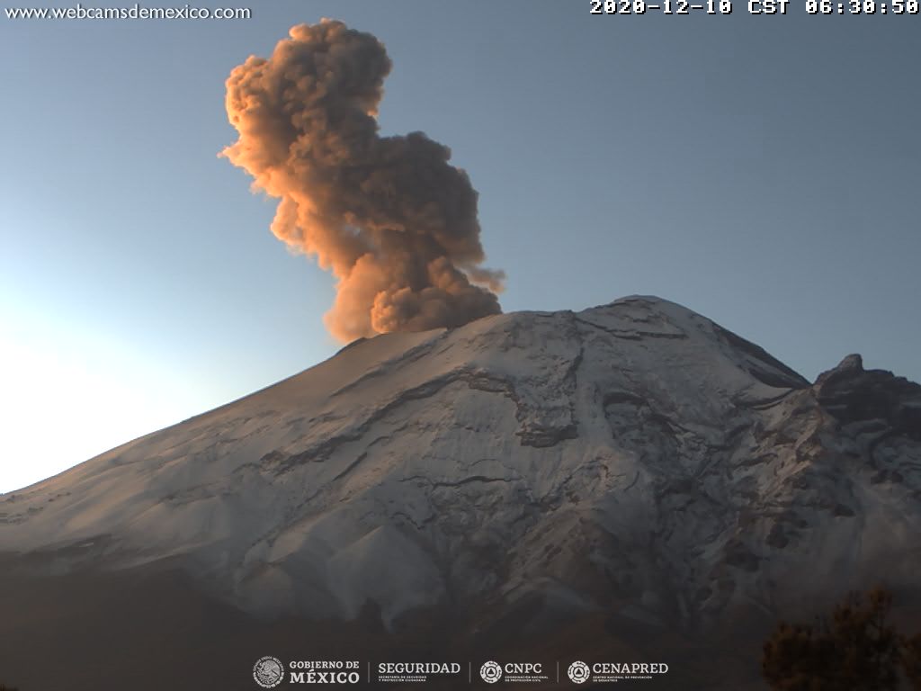
Since this morning and at the time of this report, we observe the continuous emission of volcanic gases and sometimes a small amount of ash, which disperses towards the east.
CENAPRED urges not to go as close as possible to the volcano and especially the crater, because of the danger posed by the fall of ballistic fragments and, in the event of heavy rains, to stay away from the bottom of the ravines because of the danger mudslides and debris.
The Popocatépetl volcanic alert semaphore is on YELLOW PHASE 2.
Source : Cenapred .