December 04 , 2020.
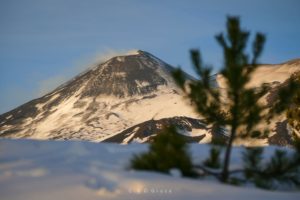
La Réunion , Piton de la Fournaise :
Activity bulletin from Friday, December 4 at 5:30 (local time)
Recommended alert level: Alert 1
Since 5:10 am local time, a seismic crisis has been recorded on the instruments of the Volcanological Observatory of Piton de la Fournaise. This seismic crisis is accompanied by rapid deformation. This indicates that the magma is leaving the magma reservoir and is spreading towards the surface. An eruption is likely shortly within the next few minutes or hours.
Additional information will follow concerning the sector impacted by this magmatic propagation towards the surface.

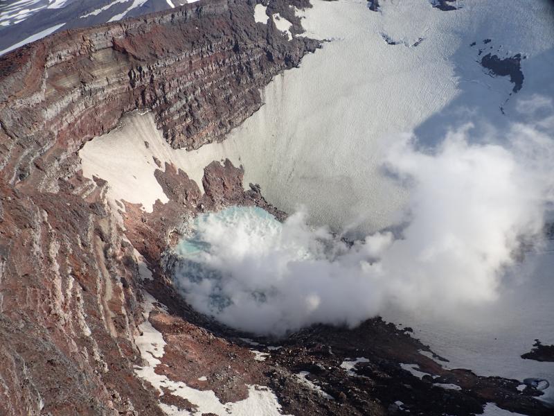
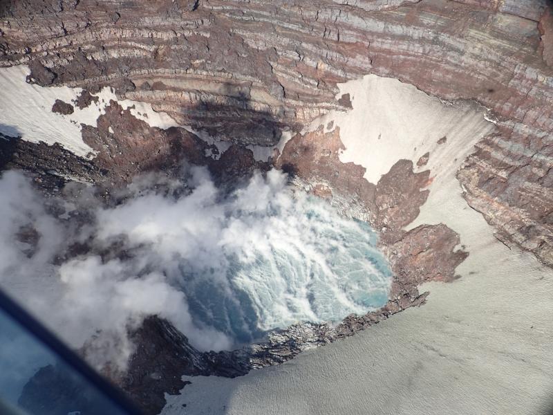
Activity Bulletin for Friday, December 4 at 8:15 (local time)
Alert level: Alert 1
The seismic crisis, which began on December 4, 2020 at 5:10 a.m. local time, ended around 5:54 a.m. local time.
This episode was accompanied by surface deformations which remained extremely weak and localized at the top of Piton de la Fournaise. Since then, no deformation has been observed and the seismicity has sharply decreased (4 earthquakes between 6 am and 7 am local time).
The cessation of the seismic crisis testifies to the cessation of the magma at depth.
Nevertheless, given the weakening of the environment during the last intrusive episodes, a rapid resumption of activity in the medium term remains possible.
Source : OVPF.
Read the articles : http://www.ipgp.fr/fr/ovpf/bulletin-dactivite-vendredi-4-decembre-a-815-heure-locale
Photo : OVPF.
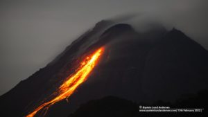
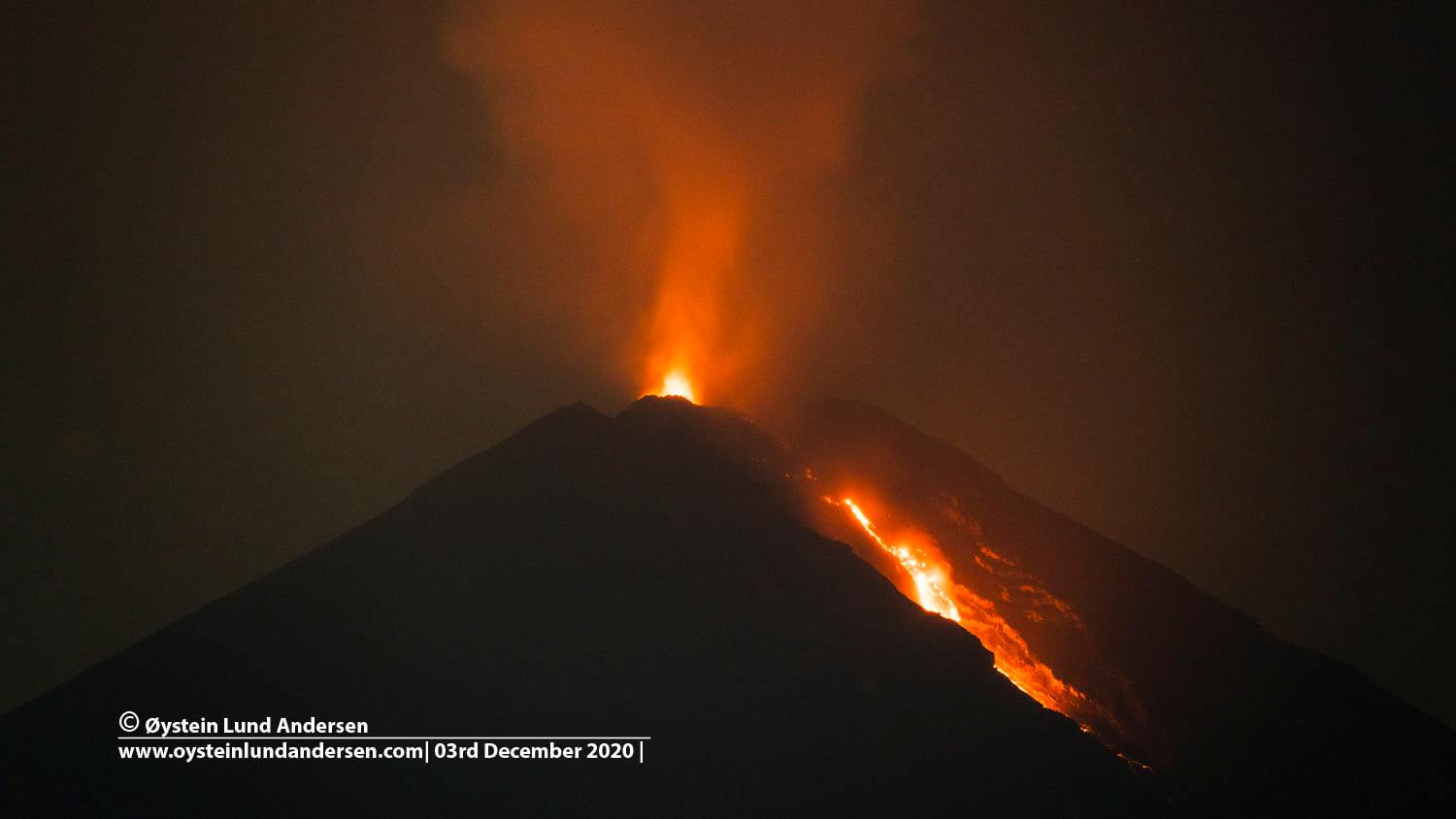
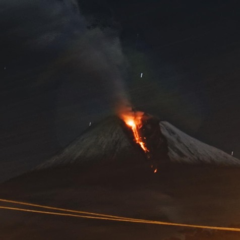
Indonesia , Semeru :
Level of activity level II (WASPADA). G. Semeru (3,676 m above sea level) is continuously erupting. It produces explosive and effusive eruptions, causing lava flows towards the southern and southeastern slopes, as well as explosions of incandescent rocks around the summit crater.
The volcano was clearly visible until it was covered in fog. A white fumarole of moderate intensity was observed, 100 meters above the summit. The weather is sunny to rainy, with light to moderate winds in the North, North-East, East, South and South-West. Air temperature 22-31 ° C. An eruption earthquake was recorded, but visually the height of the eruption and the color of the ash was not observed. There was an avalanche of lava but visually the distance and direction of the flow was not observed.
According to the seismographs of December 3, 2020, it was recorded:
6 eruption / explosion earthquakes
36 avalanche earthquakes
1 emission earthquake
3 Harmonic tremors
1 distant tectonic earthquake
1 flood signal / lahar.
Recommendation:
In Level II (WASPADA) status, people / visitors / tourists must not have activities within a radius of 1 km around the crater / summit of Mt Semeru and a distance of 4 km in the direction of opening of the crater in the South-South-East sector. They should be aware of the hot clouds of avalanches, lava avalanches and lahars along the river / valley which originate at the top of Mount Semeru. The recommended radius and distance will be continuously evaluated in anticipation of any change in hazard symptoms.
Be aware of the threat of lahars in the river / valley channels that originate from Mt Semeru (considering the large amount of volcanic material that has settled).
VONA: The latest VONA message received the color code ORANGE, published on December 1, 2020 at 03:25:00 WIB. Volcanic ash had been observed at an altitude of 5,676 m above sea level or about 2,000 m above the summit.
Source : PVMBG.
Photo : Oystein Lund Andersen https://www.oysteinlundandersen.com/
Hawaii , Kilauea :
19°25’16 » N 155°17’13 » W,
Summit Elevation 4091 ft (1247 m)
Current Volcano Alert Level: NORMAL
Current Aviation Color Code: GREEN
ACTIVITY SUMMARY
Kīlauea Volcano is not erupting. Earthquake activity increased below Kīlauea summit between November 29–December 3, 2020. Kīlauea summit ground deformation rates accompanying the earthquake activity had a brief excursion from trends observed in the past several months; other monitoring data streams remained stable. Seismicity and ground deformation rates have since decreased; Kīlauea monitoring data streams remain stable and show no signs of increased activity.
OBSERVATIONS
On November 29–30, 2020, the US Geological Survey Hawaiian Volcano Observatory (HVO) recorded over 80 earthquakes beneath Kīlauea summit, about 4 miles (6.5 km) southwest of Volcano. The seismic activity began late on the 29th, after 11:00 p.m. HST, and continued for approximately 11 hours. These earthquakes occurred in a cluster under Kīlauea caldera, about 1 mile (2 km) wide and 1–2 miles (1–3 km) below the surface.
On December 2, 2020, increased seismic activity under Kīlauea summit began shortly after 12:00 a.m. HST, and ramped up four hours later to an average rate of 10–12 earthquakes per hour. HVO recorded over 220 earthquakes for the entire 24-hour period. These earthquakes occurred in clusters under the Kīlauea caldera and upper East Rift Zone, at 1–3 miles (1–4 km) below the surface.

Dark brown colors dominated the central and western portions of the lake at Kīlauea’s summit. The greenish hues were present in areas that appear to be zone of hot water influx into the lake. USGS photo by M. Patrick.
.
These shallow earthquakes have not posed a hazard from ground-shaking. The largest event in the sequence was a magnitude-3 earthquake, with the bulk of the events being less than magnitude-1. Most of the events have not been widely reported by residents. Reported felt events were described as weak shaking, with a maximum Intensity of III on the Modified Mercalli Intensity Scale.
On the evening of December 2, Kīlauea summit tiltmeters experienced a transient episode of deformation, recording a notable tilt signal (10–14 microradians) within a few hours. Tiltmeters have since returned to measuring tilt rates similar to recent months. Other monitoring data streams for Kīlauea, including gas and imagery, show no signs of increased activity.
Clustering of shallow earthquakes in this region is not unprecedented following the end of Kīlauea’s 2018 lower East Rift Zone eruption and does not mean an eruption is imminent. HVO has recorded shallow earthquakes in this area for many decades across several eruptive cycles at Kīlauea. The recent seismicity demonstrates that magma continues to be supplied to the Kīlauea shallow magma storage system. These observations are within the expected behavior of an active volcanic system.
As of the afternoon of December 3, seismic activity and ground deformation rates at Kīlauea’s summit have decreased and returned to near background levels. Other monitoring data streams remain stable.
Source : HVO.
Photo : M Patrick , USGS.
Ecuador , Sangay :
DAILY REPORT OF THE STATE OF SANGAY VOLCANO, Thursday December 03, 2020.
Surface activity level: High, Surface trend: Increasing.
Internal activity level: High, Internal trend: Increasing.
Seismicity: From December 02, 2020, 11:00 am to December 3, 2020, 11:00 am:
Long period type events (LP): 21
Emission tremor (TE): 42
Explosions (EXP): 14
Rains / lahars:
In the morning, there were several episodes of rains in the area which did not generate signals associated with flows of mud and debris in the area.
** In case of heavy rains, lahars can be generated in the Volcán, Upano rivers and other tributaries **
Emission / ash column: Gas and ash emissions were observed yesterday afternoon. They exceeded 2000 meters above the level of the crater in a westerly direction. In the past 24 hours, the Washington VAAC reported 5 emissions observed by satellites, with recorded heights approaching 900 and 2,100 meters above crater level and the direction of these emissions varied from Northwest to Southwest. .
Other monitoring parameters: FIRMS recorded 33 thermal alerts on the Sangay in the last 24 hours.
MIROVA has recorded 1 moderate thermal alert on the Sangay in the last 24 hours
Observations: In the afternoon and night of yesterday, the volcano was mostly clear, allowing the described emissions to be observed and, at night, the rolling of incandescent material that descended was observed more clearly in the ravine on the south-eastern flank.
Alert level: yellow.
Sources : INSTITUT GÉOPHYSIQUE / ÉCOLE NATIONALE DE POLYTECHNIQUE.
Photo : david.ecua via Sherine France.
Alaska , Korovin :
AVO/USGS Volcanic Activity Notice
Current Volcano Alert Level: NORMAL
Previous Volcano Alert Level: ADVISORY
Current Aviation Color Code: GREEN
Previous Aviation Color Code: YELLOW
Issued: Thursday, December 3, 2020, 11:17 AM AKST
Source: Alaska Volcano Observatory
Notice Number: 2020/A1279
Location: N 52 deg 22 min W 174 deg 9 min
Elevation: 5030 ft (1533 m)
Area: Aleutians
Volcanic Activity Summary:
Unrest at Korvin Volcano that began in late October 2020 has subsided. Seismic activity has returned to background levels and satellite observations over the past several weeks have shown no signs of unrest. Thus, AVO is decreasing the Aviation Color Code and Alert Level to GREEN/NORMAL.
Korovin is monitored by local seismic and infrasound sensors, satellite data, regional lightning detection instruments, and reports from local residents. Observations of steaming are not unusual at Korovin and meteorological conditions can enhance its visibility.
Recent Observations:
[Volcanic cloud height] n/a
[Other volcanic cloud information] steam from the summit crater is common
Remarks:
Korovin Volcano is a 1553-m-high (5030 ft) stratovolcano located on the northern part of Atka Island in the central Aleutian Islands, about 21 km (13 mi) northwest of the community of Atka, 538 km (350 mi) west of Dutch Harbor, and 1760 km (1100 mi) southwest of Anchorage. The volcano has two distinct summit vents about 0.6 km (2000 ft) apart, that have been the sites of eruptive activity in historical time. The most recently active of the vents maintains a small, roiling, lake that occasionally produces energetic steam emissions. Thermal springs and fumaroles located on and near the volcano indicate an active hydrothermal system. Korovin has erupted several times in the past 200 years, including 1973, 1987, and 1998, and has likely had small ash emissions as recently as 2005. Typical recent Korovin eruptions produce minor amounts of ash and occasional but small lava flows. Reports of the height of the ash plume produced by the 1998 eruption ranged from 4900 to 10,600 m (16,000 to 35,000 feet) above sea level.
Source : AVO.
Photos : Kelly, Peter