October 03 , 2020.
La Réunion , Piton de la Fournaise :
Activity bulletin for Friday, October 2, 2020 at 11:00 a.m. (local time)
Alert level: Alert 1
Seismic activity is still recorded under the Piton de la Fournaise (summit area and east flank). Thus for the day of 01/10/2020, 8 superficial summit volcano-tectonic earthquakes, 35 deep volcano-tectonic earthquakes under the eastern flank, 1 long period earthquake, 14 earthquakes classified as « undetermined » (because of low magnitudes) and 52 Landslides / shallow collapses in the eastern flank sector were manually pointed out.
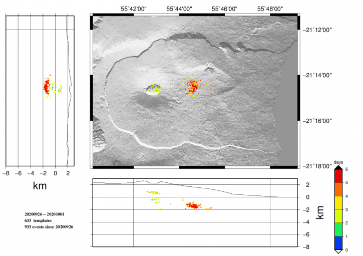
144 events of smaller amplitudes and not visible to operators were detected and automatically relocated (Figure 1).
Figure 1: Location map (epicenters) and north-south and east-west sections (showing the location in depth, hypocenters) of the earthquakes recorded and located by the OVPF-IPGP between 09/26/2020 and 10/01 / 2020 under the Piton de la Fournaise massif. Only localizable earthquakes have been shown on the map (© OVPF-IPGP).
During the day of 01/10/2020, the deformations continued on the eastern flank of the volcano but at a lower rate than the previous days, as well as the OVPF GPS station « GPNG » located in the upper part. des Grandes Pentes, at an altitude of 1,414 m, has continued its eastward slide of 3 cm, or about 73 cm in total since the start of the crisis, and has risen by about 26 cm since the start of crisis.
The CO2 concentrations in the soil are increasing in the far field (Plaine des Cafres sector), this increase is often associated with a rise of magma from the mantle level.
The persistence of seismicity and deformation under the eastern flank shows that the intrusion of magma towards the eastern flank is still active and that an eruption cannot be excluded. The observatory teams remain mobilized.
Activity bulletin for Saturday October 3, 2020 at 8:45 a.m. (local time)
Alert level: Alert 1
Seismic activity is still recorded under the Piton de la Fournaise (summit area and east flank). Thus for the day of 02/10/2020, 2 superficial summit volcano-tectonic earthquakes, 24 deep volcano-tectonic earthquakes under the eastern flank, 3 long-period earthquakes, 15 earthquakes classified as « undetermined » (because of low magnitudes) and 37 Landslides / shallow collapses in the eastern flank sector were manually pointed out.
During the day of 02/10/2020, no significant deformation occurred in the Grandes Pentes sector. On the other hand, the inflation (swelling) of the summit zone has resumed, testifying to the pressurization of a source under the summit, where the surface supply system is located (magmatic reservoir from which the magma intrusions depart towards the surface). This resumption of inflation is consistent with the increase in CO2 concentrations in the soil, which are increasing in the far field (Plaine des Cafres sector). This increase is often associated with a rise of magma from the mantle.
The persistence of seismicity shows that the intrusion of magma towards the eastern flank is still active and that an eruption cannot be excluded. The inflation of the summit area and the increase in CO2 concentrations show that a new intrusion cannot be excluded. The observatory teams remain mobilized.
Source : OVPF.
Read the article : http://www.ipgp.fr/fr/ovpf/bulletin-dactivite-vendredi-2-octobre-2020-a-11h00-heure-locale
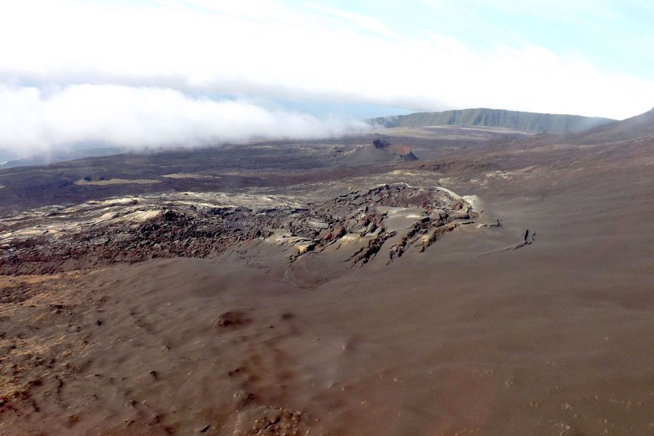
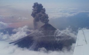
Photo :Piton de la Fournaise volcanological observatory
United States , Yellowstone :
44°25’48 » N 110°40’12 » W,
Summit Elevation 9203 ft (2805 m)
Current Volcano Alert Level: NORMAL
Current Aviation Color Code: GREEN
Recent work and news
In September, field crews began removing semi-permanent GPS stations from high-elevation sites prior to the onset of winter. Low-elevation sites will be recovered in October, and the stations will be redeployed starting in May 2021. Maintenance work was also completed on permanent GPS and seismic stations in several areas of Yellowstone National Park, ensuring that the networks will be operational through the coming winter months.
Steamboat Geyser continues to be active, with four eruptions during the month: September 1, 9, 16, and 26. This brings the total number of eruptions for the year to 38.
Seismicity
During September 2020, the University of Utah Seismograph Stations, responsible for the operation and analysis of the Yellowstone Seismic Network, located 205 earthquakes in the Yellowstone National Park region. The largest event was a minor earthquake of magnitude 2.8 located 9 miles south-southeast of West Thumb, Yellowstone National Park, on September 10 at 7:26 AM MDT.
A swarm of 125 earthquakes occurred September 10–16 about 9 miles south-southeast of West Thumb. The swarm included 29 events in the magnitude-2 range, with eight greater than M2.5, and 69 events in the magnitude 1 range.
Earthquake sequences like these are common and account for roughly 50% of the total seismicity in the Yellowstone region.
Yellowstone earthquake activity remains at background levels.
Ground deformation
Deformation rates and styles at Yellowstone, as recorded by continuous GPS stations, have not changed significantly in many months. Subsidence of Yellowstone Caldera, which has been ongoing since 2015, continued at an average rate of 2-3 cm (about 1 in) per year. In the area of Norris Geyser Basin, little deformation has been detected by a nearby GPS station since the start of 2020.
Source : YVO.
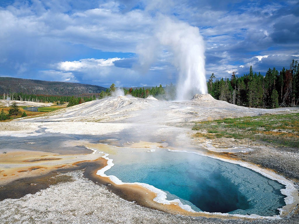
Photo : USGS
Russia / Kurile Islands , Ebeko :
VOLCANO OBSERVATORY NOTICE FOR AVIATION (VONA).
Issued: October 03 , 2020
Volcano: Ebeko (CAVW #290380)
Current aviation colour code: ORANGE
Previous aviation colour code: orange
Source: KVERT
Notice Number: 2020-182
Volcano Location: N 50 deg 41 min E 156 deg 0 min
Area: Northern Kuriles, Russia
Summit Elevation: 3791.68 ft (1156 m)
Volcanic Activity Summary:
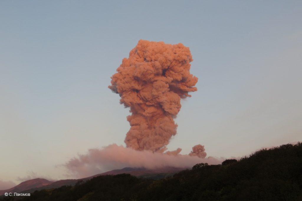
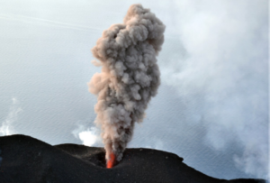
A moderate eruptive activity of the volcano continues. According to visual data by volcanologists from Severo-Kurilsk, explosions sent ash up to 2 km a.s.l., an ash cloud is drifting to the south of the volcano.
This activity continues. Ash explosions up to 19,700 ft (6 km) a.s.l. could occur at any time. Ongoing activity could affect low-flying aircraft and airport of Severo-Kurilsk.
Volcanic cloud height:
6560 ft (2000 m) AMSL Time and method of ash plume/cloud height determination: 20201003/0450Z – Visual data
Other volcanic cloud information: Distance of ash plume/cloud of the volcano: 3 mi (5 km)
Direction of drift of ash plume/cloud of the volcano: S
Source : Kvert .
Photo : S. Lakomov.
Hawaii , Kilauea :
19°25’16 » N 155°17’13 » W,
Summit Elevation 4091 ft (1247 m)
Current Volcano Alert Level: NORMAL
Current Aviation Color Code: GREEN
Activity Summary:
Kīlauea Volcano is not erupting. Monitoring data for the month of August show variable but typical rates of seismicity and ground deformation, low rates of sulfur dioxide emissions, and only minor geologic changes since the end of eruptive activity in September 2018.
Observations:
There were approximately 1450 earthquakes during the month of September at Kīlauea, an increase of roughly 35% from the number of earthquakes recorded in August.
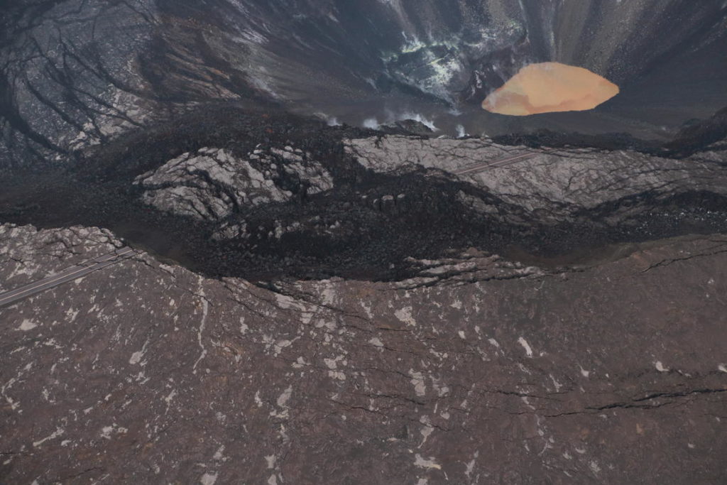
Portions of Crater Rim Drive, within Hawai‘i Volcanoes National Park, appear cracked, offset, and down-dropped in this photo, taken during an overflight of Kīlauea’s summit on September 23, 2020. To the north, Kīlauea’s summit water lake, within Halema‘uma‘u, is visible. USGS photo by K. Mulliken.
Over the past month, summit tiltmeters recorded 4 deflation-inflation events—a significant decrease from last month’s total. The long-term trend of deformation at Kilauea’s summit and middle East Rift Zone continue to show inflation, consistent with magma supply to the volcano’s shallow storage system. GPS stations on Kīlauea’s south flank continue to show elevated rates of seaward motion. HVO continues to carefully monitor all data streams along the Kīlauea East Rift Zone and south flank for important changes.
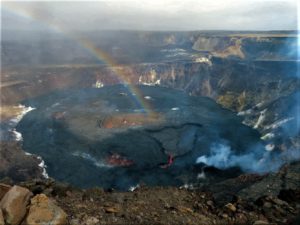
Sulfur dioxide emission rates are low at the summit, consistent with no significant shallowing of magma. Some amount of sulfur dioxide is being dissolved into shallow groundwater and the crater lake at the bottom of Halema‘uma‘u; work continues to try and quantify this process. As of September 29th, the lake depth was approximately 46 meters or 150 feet. The crater lake was last sampled by UAS in January and additional sampling with UAS is planned. Sulfur dioxide emission rates are below detection limits at Puʻu ʻŌʻō and the lower East Rift Zone
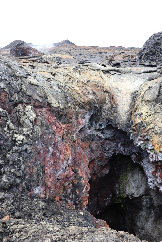
On September 3, USGS HVO geologists visited fissure 7 of Kīlauea’s 2018 lower East Rift Zone eruption. Geologists investigated and documented vent features, and collected samples for ongoing analyses of 2018 eruption dynamics. Fountains from fissure 7 left a hole over the vent area. From this hole, one of several fissure 7 fountains erupted during the 2018 volcanic crisis. In the background is fissure 8. The golden colored pāhoehoe draining into fissure 7 is from the end of fissure 8 activity.
Although not currently erupting, areas of persistently elevated ground temperatures and minor release of gases are still found in the vicinity of the 2018 lower East Rift Zone fissures. These include steam (water), very small amounts of hydrogen sulfide, and carbon dioxide. These conditions are expected to be long-term. Similar conditions following the 1955 eruption continued for years to decades.
Source : HVO.

