June 23 , 2020.
Iceland :
A strong earthquake swarm offshore North Iceland . Three earthquakes recorded above M5.0
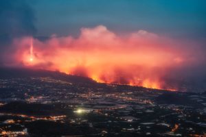
A strong earthquake swarm started on 19th of June offshore North Iceland, NE of Siglufjörður. Three earthquakes above M5.0 have occurred since the swarm started. On 20th of June a M5.4 earthquake occurred at 15:05 and a M5.6 at 19:26. Both these earthquakes were located around 20 km NE of Siglufjörður. The largest earthquake of the swarm occurred on 21st of June at 19:07 and was M5.8. It was located around 35 km NNE of Siglufjörður.
The IMO received hundreds of felt reports from all over the northern part of Iceland and even some from the capital area. Since the activity started IMO‘s seismic network has automatically located over 2500 earthquakes, thereof the three aforementioned above M5.0 and nine earthquakes ranging from M4.0 to M4.6. After the M5.4 event at 15:05 20th of June the Civil Protection‘s alert level was raised to uncertainty stage.
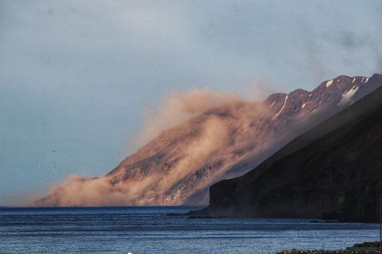
An eyewitness photograph of one of the landslides that occurred in one of the earthquakes. The landslides occurred in places where there are steep slopes and debris and landslides have taken place before. (Photo: Sigurgeir Haraldsson)
No damage on property has been observed in relation to the largest earthquakes but there were reports on smaller items falling from shelves. Following the M5.4 and M5.6 earthquakes on 20th of June landslides and falling rocks were observed close to epicenter of the events. The landslides occurred in places where there are steep slopes and debris and landslides have taken place before. The Icelandic Coast Guard flew an observation flight in the area with staff members from the IMO to inspect unstable slopes and recent landslides on 21st of June.
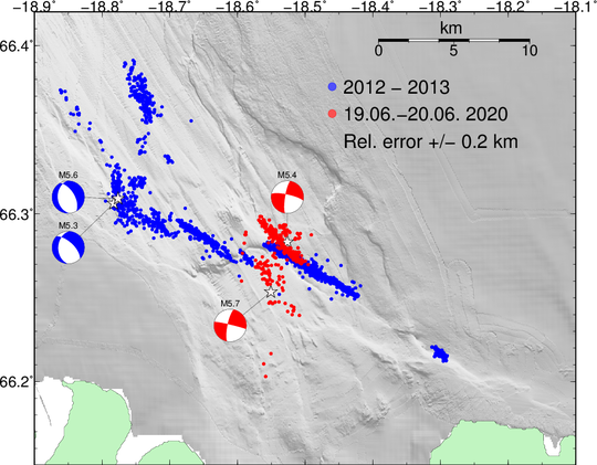
The earthquakes are of tectonic origin and located close to the junction of Húsavík-Flatey fault and Eyjafjarðaráll graben which are part of the Tjörnes Fracture Zone (TFZ). A strong earthquake swarm occurred last in this area in 2012-2013 and then four earthquakes above M5.0 were measured.
Compared to previous earthquake swarms in the area it is expected that this swarm will continue during the coming days. Previously earthquake swarms like this one have triggered a larger earthquake in the area. Therefore it cannot be excluded that a larger earthquake (>M6) can occur there, but in most cases activity like this ends without a larger event than already has occurred.
Source : Vedur Is .
Peru , Sabancaya :
Analysis period: June 15 to 21, 2020, Arequipa, June 22, 2020.
Alert level: ORANGE
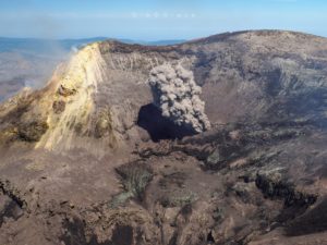
The Geophysical Institute of Peru (IGP) reports that the eruptive activity of the Sabancaya volcano remains at moderate levels, that is to say with the continuous recording of explosions with columns up to 2.7 km at – above the summit of the volcano and consequent emissions of ash and gases. Consequently, for the following days, no significant change is expected concerning the eruptive activity.
The IGP recorded and analyzed the occurrence of approximately 216 earthquakes of volcanic origin, associated with the circulation of fluids (magma, gas, etc.) within the Sabancaya volcano (Arequipa region). In addition, 8 low to medium intensity explosions were recorded on average daily.
The monitoring of the deformation of the volcanic structure, using GNSS data (processed with fast orbits), does not present any significant anomalies; however, slight inflation was recorded in the North and Southeast sectors of the Sabancaya.
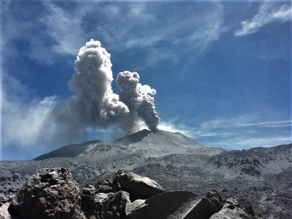
Visual surveillance identified columns of gas and ash up to 2.7 km altitude above the summit of the volcano, which were scattered towards the Southwest, South, Southeast and Northeast areas of Sabancaya.
Satellite surveillance identified the presence of 9 thermal anomalies with values between 1 MW-18 MW, associated with the presence of a lava dome in the crater of the volcano being destroyed due to explosive activity.
RECOMMENDATIONS
• Maintain the volcanic alert level in orange.
• Do not approach within a radius of less than 12 km from the crater.
Source : IGP.
Photo : archive ingemmet.
Peru , Ubinas :
Analysis period: June 15 to 21, 2020, Arequipa, June 22, 2020.
Alert level: ORANGE
Suggested alert level: GREEN
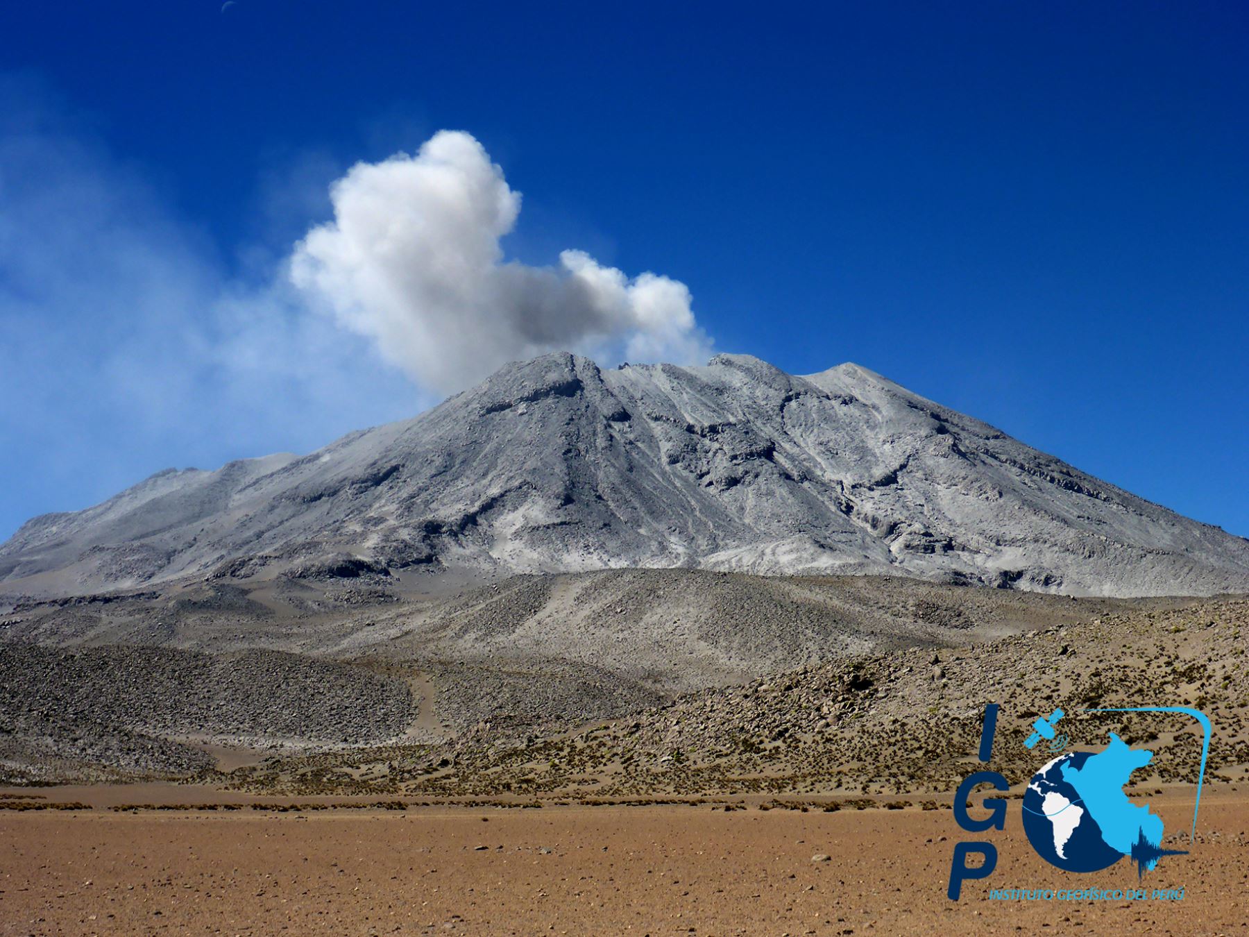
The Peruvian Geophysical Institute (IGP) reports that the Ubinas volcano (Moquegua region) recorded a slight increase in its seismic activity during the analysis period; consequently, it is suggested that the authorities and the population remain attentive to the bulletins published by the IGP.
Between June 15 and 21, the IGP came to identify in the Ubinas volcano area the occurrence of 61 earthquakes of magnitude less than M1.7, associated with rock rupture processes inside the volcano.
Similarly, 7 seismic signals were recorded, associated with the movements of volcanic fluids (water vapor and gas). There was no seismic activity related to the rise of magma.
Surveillance cameras recorded columns of gas and water vapor that reached heights of up to 1000 m above the summit of the volcano, emissions that were scattered to the northeast and southeast areas. East of the volcano.
Both for the monitoring of the deformation of the volcanic structure and for the satellite monitoring (SENTINEL, OMINASA (SO2 gas) and MIROVA (thermal anomalies), no anomalies were recorded during the analysis period.
Source et photo : IGP
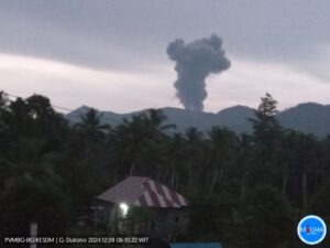
Indonesia , Semeru :
VOLCANO OBSERVATORY NOTICE FOR AVIATION – VONA.
Issued : June 22 , 2020.
Volcano : Semeru (263300)
Current Aviation Colour Code : ORANGE
Previous Aviation Colour Code : orange
Source : Semeru Volcano Observatory
Notice Number : 2020SMR67
Volcano Location : S 08 deg 06 min 29 sec E 112 deg 55 min 12 sec
Area : East java, Indonesia
Summit Elevation : 11763 FT (3676 M)
Volcanic Activity Summary :
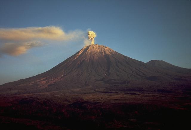
Eruption with volcanic ash cloud at 22h35 UTC (05h35local).
Volcanic Cloud Height :
Best estimate of ash-cloud top is around 12723 FT (3976 M) above sea level, may be higher than what can be observed clearly. Source of height data: ground observer.
Other Volcanic Cloud Information :
Ash-cloud moving to southwest.
Remarks :
Eruption recorded on seismogram with maximum amplitudo 20 mm and duration 94 second
Source : Magma Indonésie .
Photo : Thomas J. Casadevall, USGS — Smithsonian – Global Volcanism Program
Mexico , Popocatepetl :
June 22, 11:00 a.m. (June 22, 4:00 p.m. GMT).
In the past 24 hours, using the Popocatépetl volcano monitoring system, 73 exhalations have been identified, accompanied by volcanic gases and sometimes slight amounts of ash, the largest occurring yesterday at 2:33 p.m. and 2:42 p.m. with a column height of 1,400 and 1,500 m, respectively, dispersed in a southwest direction. In addition, 580 minutes of tremors were recorded.
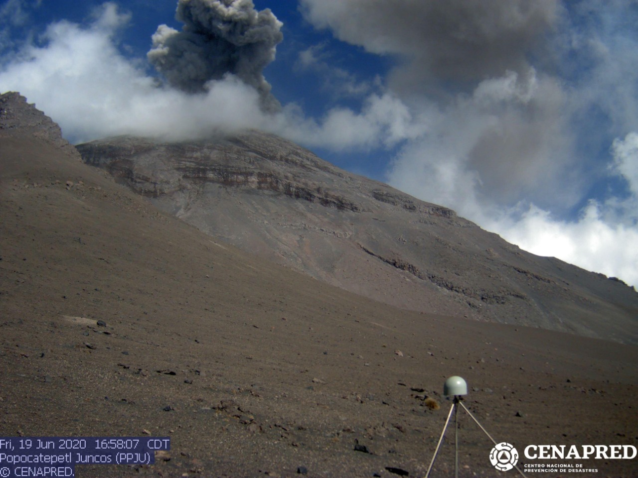
Since the morning, the crater of the volcano was not observed and also at the time of this report, due to the cloudy conditions, there is no visibility towards the crater, any emission of water vapor, gas and ash will scatter westward.
Any change in the activity of the volcano will be reported in due course. CENAPRED urges NOT to get close to the volcano and especially the crater, because of the danger involved in the fall of ballistic fragments and, in the event of heavy rain, to move away from the bottom of the ravines because of the danger of mud and debris.
The Popocatépetl volcanic alert signaling light is in YELLOW PHASE 2.
Source : Cenapred .