June 09 , 2020.
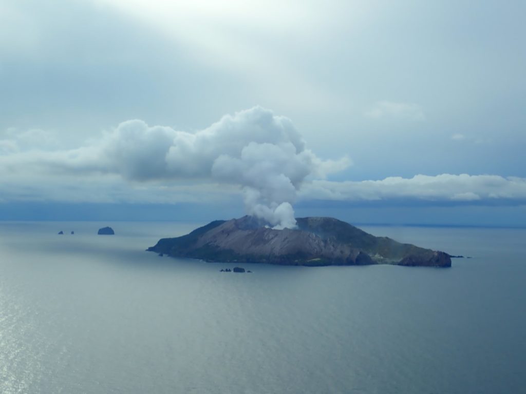
New Zealand , White Island :
Whakaari/White Island: New activity update, elevated unrest continues . Published: Tue Jun 9 2020 9:00 AM
Volcanic Alert Level remains at 2
Aviation Colour Code remains at Yellow
Last week scientists recorded a short-lived gas pulse that passed through the volcano from depth. This gas pulse was accompanied by minor ground uplift in the vent area and is likely linked to a fresh batch of magma at shallow depth below the volcano. The Volcanic Alert Level remains at Level 2 and the Aviation Colour Code at Yellow.
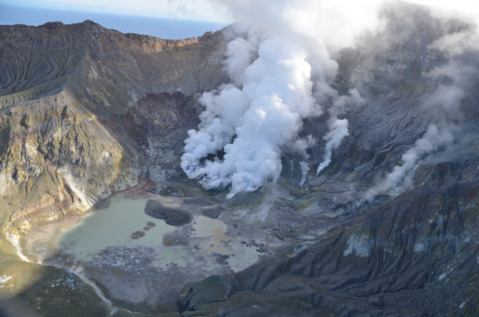
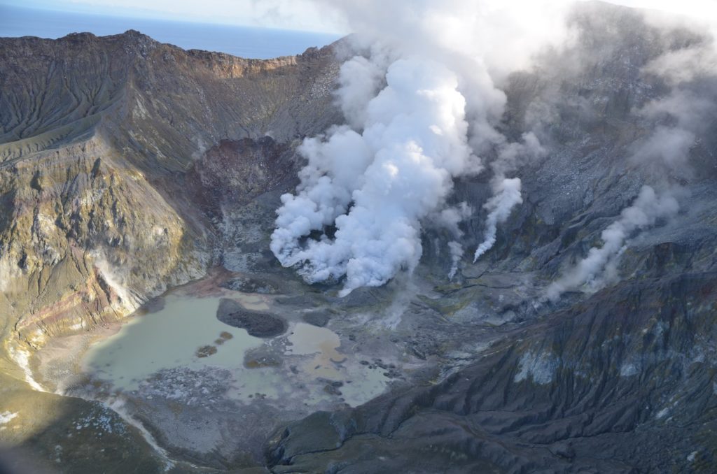
New observations and measurements were made during gas and observation flights over Whakaari/White Island in the past week. The observation flight showed continued high heat flow in the crater, while other activity largely remains within the range observed over the past few months.
Results from the gas flight on Wednesday 3 June 2020 show a decline in gas flux from the high levels recorded on a previous flight on 28 May, suggesting that the increased gas flux was short-lived. The 28 May flight recorded high gas flux values, similar to what we recorded in June 2019.
Gas flux increases are attributed to the intrusion of a new batch of the magma at shallow depth beneath the volcano.
While previous observations indicated a trend towards background levels that are typical for this volcano, this short gas pulse serves as a reminder that the volcano is still in an elevated state of unrest with shallow magma present.
Satellite-based measurements of ground deformation show the ground around the active vent area has overall subsided by several centimetres since the December 2019 eruption. However, the most recent data from last week showed a small, localised inflation in the vent area, most likely related to the observed increased gas flux.
Thermal infrared images taken during the observation flight on Wednesday 3 June show that the lava lobes (extrusions first observed in early January), are still very hot, at around 450 °C. Recent rainfall has increased the steam emissions and some water has ponded on the crater floor.
We are still observing occasional episodes of slightly elevated tremor, albeit overall tremor levels remain low and within background levels for the volcano. An eruption could occur with little precursory activity. Plausible triggers for an eruption remain the collapse of unstable material around the vents, sudden release of gas from the magma, and the rapid ingress of water onto the shallow magma body.
Should any explosive activity produce an ash cloud, the likelihood of ash affecting the mainland remains very low. Under suitable weather conditions, the gas and steam plume may be noticed on the mainland as weak acid rain.
Volcanic Alert Level 2 indicates moderate-to-heightened unrest with potential for eruption hazards, including unpredictable and life-threatening steam driven eruptions.
The Volcanic Alert Level reflects the current level of volcanic activity and is not a forecast of future activity.
Source : Craig Miller / Duty Volcanologist .
Peru , Sabancaya :
Analysis period: June 1 to 7, 2020. Arequipa, June 8, 2020. Alert level: ORANGE
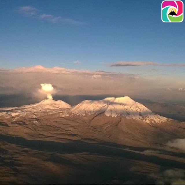
The Peruvian Geophysical Institute (IGP) reports that the eruptive activity of the Sabancaya volcano remains at moderate levels; that is to say with the continuous recording of explosions with columns reaching 1.5 km high above the summit of the volcano and consequent emissions of ash and gas. Therefore, for the following days, no significant change is expected regarding his eruptive activity.
During this period, the IGP recorded and analyzed the occurrence of approximately 598 earthquakes of volcanic origin, associated with the circulation of fluids (magma, gas, etc.) within the Sabancaya volcano (region of Arequipa). On average, 18 low to medium intensity explosions were recorded daily. Between June 2 and 5, earthquakes of magnitudes M2.9 to M3.6 occurred, located between 12 and 15 km southwest and northeast of the volcano, near the populated centers of Huambo , Maca and Pinchollo, which would be associated with the tectonic and volcanic activity of the region. The monitoring of the deformation of the volcanic structure, using GNSS data (processed with fast orbits), does not present any significant anomalies; however, slight inflation in the northern sector of Sabancaya has been recorded since May 23, probably linked to the eruptive activity of the volcano. Visual surveillance identified columns of gas and ash up to 1.5 km high above the top of the volcano, which were scattered towards the eastern and southeastern sectors of the Sabancaya. Satellite surveillance has identified the presence of 3 thermal anomalies with values between 1 MW and 13 MW, associated with the presence of a body of lava on the surface of the crater of the volcano.
RECOMMENDATIONS
• Keep the orange volcanic alert level.
• Do not approach within a radius of less than 12 km from the crater.
In case of ash fall, cover your nose and mouth with rags or wet masks. Keep doors and windows of houses closed.
Source : IGP Peru.
Chile , Nevados of Chillan :
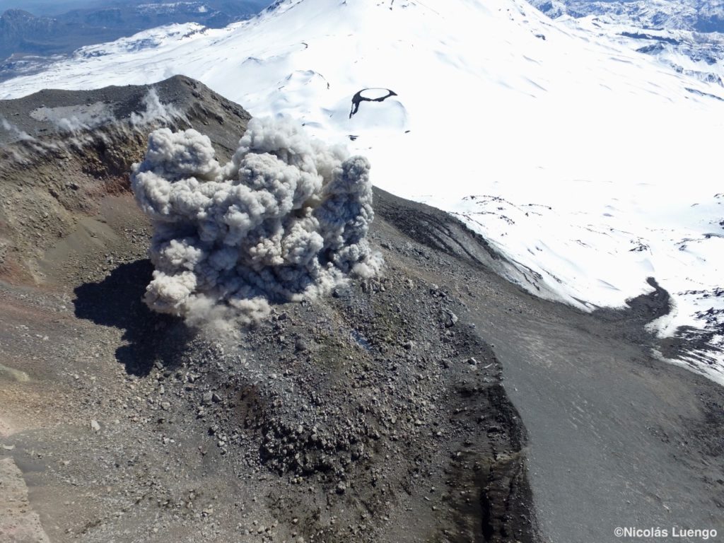
Special report on volcanic activity (REAV) Ñuble region, volcanic complex of Nevados de Chillán 08 June 2020, 06:25 Local time (continental Chile)
The National Geological and Mining Service of Chile (Sernageomin) publishes the following PRELIMINARY information, obtained thanks to the surveillance teams of the National Volcanic Surveillance Network (RNVV), processed and analyzed at the South Andean Volcanological Observatory (Ovdas):
Monday, June 08 at 05:30 local time (09:30 UTC) and 05:40 local time (09:40 UTC), the monitoring stations installed near the volcanic complex Nevados de Chillán recorded two (2) earthquakes associated with rock fracturing (Volcano-Tectonics).
The characteristics of earthquakes after their analysis are as follows:
TIME OF ORIGIN: 05:30 local time (09:30 UTC)
LATITUDE: 36 891 ° S
LONGITUDE: 71.351 ° W
DEPTH: 1.1 km
LOCAL MAGNITUDE: 3.0 (ML)
TIME OF ORIGIN: 05:40 local time (09:40 UTC)
LATITUDE: 36 872 ° S
LONGITUDE: 71 404 ° W
DEPTH: 3.0 km
LOCAL MAGNITUDE: 3.2 (ML)
OBSERVATIONS:
No surface activity was associated with the reported events.
The volcanic technical alert remains at the Yellow level.
Source : Sernageomin .
Photo : Nicolas Luengo.
Ecuador , Sangay :
DAILY REPORT OF THE STATE OF SANGAY VOLCANO, Monday 08 June 2020.
Surface activity level: High, Surface trend: No change.
Internal activity level: High, Internal trend: No change.
Seismicity: From 07 June 2020, 11:00 a.m. to 08 June 2020, 11:00 a.m .:
Long Period Type (LP): 10 events.
Explosions: 27.
Transmission tremor: 2
TUESDAY JUNE 2, 2020
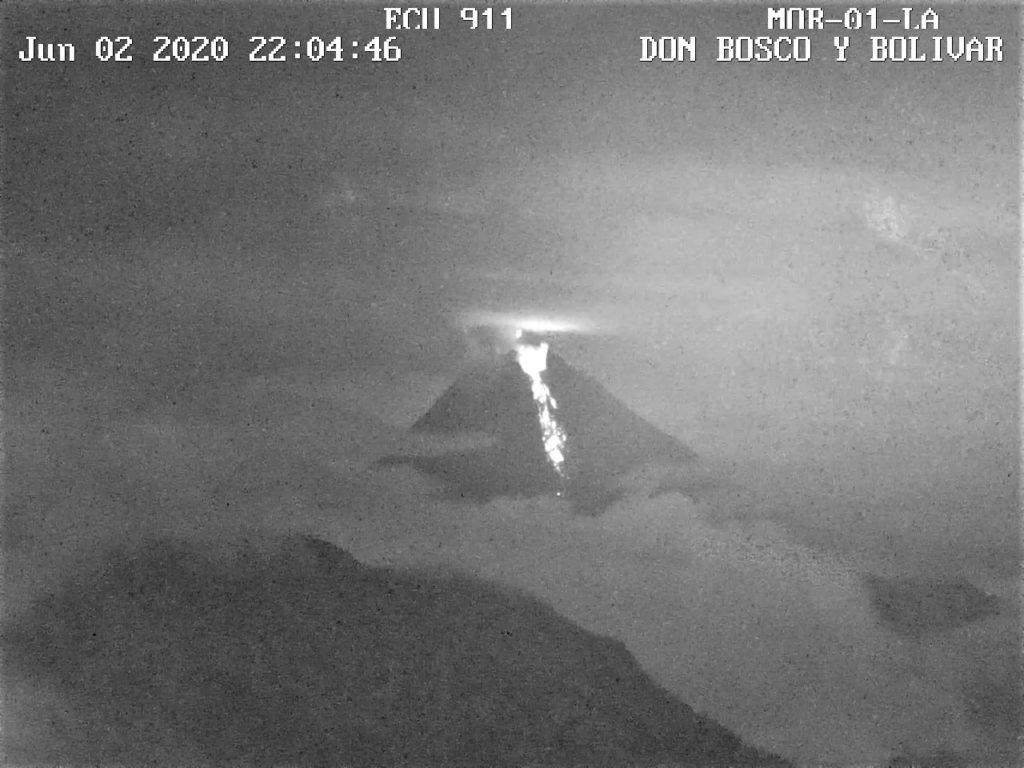
At 10:04 p.m., thanks to the ECU-911 cameras, it was possible to observe the presence of lava flows, incandescent materials and the remobilization of the deposits on the southeast flank of the Sangay volcano.
Rains / lahars: Rains have been recorded in the area. ** In the event of heavy rain, secondary lahars can be generated in the Volcán, Upano and other tributaries. **
Emission / ash column: VAAC alerts have been recorded for ash emissions up to 570 meters above the crater level with a southwest direction.
Other monitoring parameters: No changes.
Observations: In the morning, the volcano sector was in its upper cloudy part.
Alert level: yellow.
MONDAY JUNE 8, 2020
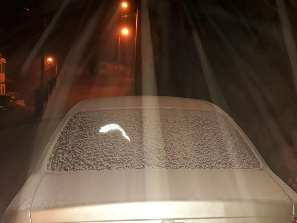
Today, evening of June 8, a report was received by telephone on the ash falls in the parish of Cebadas and in the canton of Alausí, located to the west and southwest of the Sangay volcano. These ashes would be associated with the eruptive activity of this volcano. This phenomenon persisted during the current eruptive period which started in May 2019. It is recommended to take the appropriate measures and not to be exposed to the fall of the ashes.
June 9 update. The ash fall associated with the Sangay volcano continues and is mainly directed towards the West due to the high wind speed. If this pattern persists, the ashes could reach the province of Guayas and perhaps the north of the province of Cañar. It is recommended to take the appropriate measures and not to expose yourself to the fall of the ashes.
Source : IGEPN.

