August 12 , 2019.
Back to business.
No volcanoes this summer, but the mountains of Montafon, Austria. Exceptional landscapes.
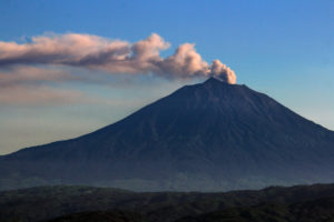
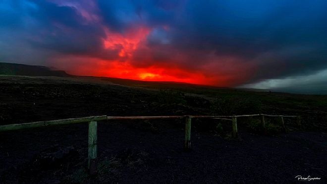
La réunion , Piton de la Fournaise :
A seismic crisis has been going on for more than 5 hours on the Volcano. Aline Peltier, director of the Volcanological Observatory of Piton de la Fournaise, takes stock of the situation.
A new seismic crisis started this morning at the Volcano. An eruption is possible in the next hours. Since 07H00 local time, a seismic crisis is recorded and it is accompanied by rapid deformation of the top of the Piton de la Fournaise.
Aline Peltier is the director of the Volcanological Observatory of Piton de la Fournaise. She takes stock at midday.
« There has been a significant crisis over the last 7 hours, there have been 1000 recorded earthquakes, the magma is leaving the reservoir and is spreading to the surface. »
An expected eruption: « By the end of the last eruption, July 30, all the signals were green which showed that there was accumulating magma. »
The possible scenarios: « There are two options: The crisis can last for several hours and either there will be an eruption, or it will be aborted and there will be what is called a magmatic intrusion. »
An eruption is likely in the near future.
Under these conditions, the prefect of Reunion decided to implement the alert phase 1 « probable eruption » of the specific device ORSEC volcano as of today at 07:00.
Activity bulletin of Sunday, August 11, 2019 at 16:00 (local time).
The seismic crisis started today at 07:00 local time continues. Between 07:00 and 15:00 local time 1162 volcano-tectonic earthquakes were recorded by the OVPF network (Figure 1).

Figure 1: Histogram of volcano-tectonic earthquakes under the volcano recorded on August 11 between 00h and 11h UTC time (15h local time). (© OVPF / IPGP)
The deformations and the seismicity show that the magma has spread deeply from the southeastern edge of the crater Dolomieu towards the eastern flank, south-east (Figures 2 and 3).
At present (4:00 pm local time), the spread continues in this direction.
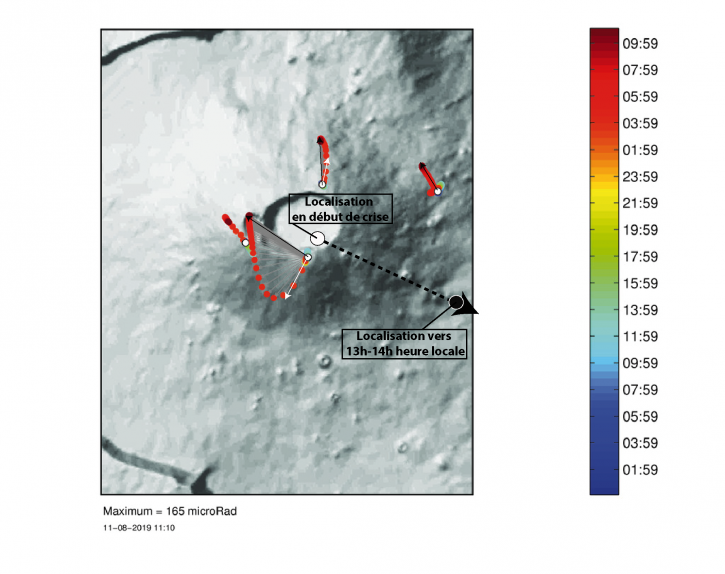
Figure 2: Variations of slope (in microradians) recorded on the OVPF top inclinometer network between August 10th and August 11th 10h (UTC time, 14h local time) 2019. The direction taken by the deep magma is indicated by the arrow. The colored bar represents the time in the last 36 hours. The white circle indicates the approximate location of the pressure source at depth to explain the slope variations recorded at the beginning of the crisis (white arrows). The black circle indicates the approximate location of the pressure source at depth to explain the slope variations recorded around 13h-14h (black arrows). (© OVPF / IPGP)
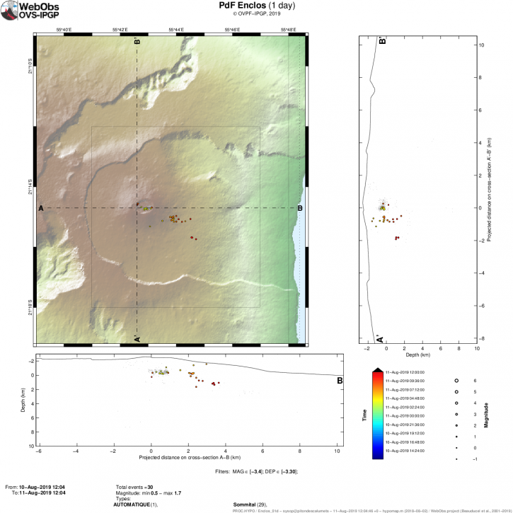
Figure 3: Map of location and east-west (bottom) and north-south (right) sections, earthquakes located since the beginning of the seismic crisis on August 11, 2019. Each earthquake is represented by a circle whose diameter depends on the magnitude and color of the time in the past day. Only earthquakes manually pointed and localized are represented on this map. (© OVPF / IPGP)
Additional information will follow in the event of a significant change.
Alert level: Alert 1.
Activity Bulletin from Sunday, August 11, 2019 to 17:00 (local time)
Following the seismic crisis started at 07:00 local time, the volcanic tremor, synonymous with the arrival of magma close to the surface, has been recorded since around 16:20 local time.
According to the OVPF records, the source of this tremor is located on the east, southeast flank within the Enclos Fouqué, in the Great Slopes area.
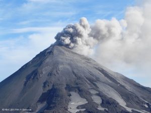
Run picture 974. Impossible to observe the eruption, this Monday morning. The sky is loaded on Pas-de-Bellecombe
No visual confirmation of a start of eruption could be made for the moment on webcams because of the bad weather conditions and we can not confirm the arrival of the lava on the surface. Nevertheless the presence of a tremor shows the emission of hot and incandescent gas on the surface, and the possibility of lava emission in the short term or already in progress.
Sources : OVPF , Aline Peltier, directrice de l’Observatoire volcanologique du Piton de la Fournaise , l’Info Re. La 1ere .
Lire : http://www.ipgp.fr/fr/ovpf/bulletin-dactivite-dimanche-11-aout-2019-a-16h00-heure-locale
Photo : Run picture 974 .
Indonesia , Slamet :
Increased the level of activity of G. Slamet – Central Java from Level I (normal) to Level II (WASPADA) on August 9, 2019.
The Slamet volcano is a cone-shaped stratovolcano with a maximum height of 3,322 meters. Geographically, the summit of Mount Slamet is located at 7 ° 14 ’30 « south latitude and 109′ 12 ’30 » east longitude. The level of activity of G. Slamet was at level I (normal) since September 9, 2015. The last eruption of Slamet took place from March to August 2014, in the form of an increase in activity followed by an eruption producing ashes and a burst of incandescent material around the crater (Strombolian type).
The monitoring of Mount Slamet volcanic activity was carried out from the Slamet Mountain PGA station in Gambuhan village, Pulosari district, Pemalang district, about 8.5 km north of Slamet.
Observation data:
Visual observations towards the top of G. Slamet from June 2019 to August 8, 2019 were generally correct. The smoke from the crater was white, of low to thick intensity, at a maximum height of 300 m above the summit.
Seismic records of the same period were dominated by swarms and tectonic earthquakes. From June to August 8, 2019, there were 5,151 earthquake swarms, five times more local tectonic earthquakes and 17 times more tectonic earthquakes. In addition to these earthquakes, tremor-type vibrations with a maximum amplitude of 0.5 to 2 mm were recorded at the end of July 2019. This tremor vibration still occurs until the moment of this report. The seismic energy detected increases gradually.
Measuring hot spring temperatures at three locations indicates a value of 44.8 at 50.8 ° C. This value on long-term observations fluctuates and shows an upward trend over previous measurements.
Analysis:
There is an increase in seismic activity and deformation that is quite significant, but visually there are no symptoms of eruption. Potential eruptions can occur at any time.
Potential danger:
The current potential threat to G. Slamet is a magmatic eruption causing an explosion of incandescent material that could strike the area around the summit within a radius of 2 km, or a phreatic eruption and ash rains around the crater, which may occur without any obvious volcanic symptoms.
Conclusion:
Based on the instrumental monitoring data, there is a significant increase and it was necessary to anticipate in case of eruption, so that the level of activity of G, Slamet is raised from level I (normal) to level II (Waspada ) from 9 August 2019 at 09:00.
Recommendation:
At level II (Waspada), it is recommended to the public and visitors / tourists not to be located / active within a radius of 2 km around the crater at the top of G. Slamet.
Regional governments, provincial and regency BPBDs must always coordinate their activities with Slamet’s PGA missions in Gambuhan village, Pulosari district, Pemalang district or the Volcanology and Geological Disasters Prevention Center. Bandung.
VOLCANO OBSERVATORY NOTICE FOR AVIATION – VONA.
Issued: August 10 , 2019
Volcano: Slamet (263180)
Current Aviation Colour Code: YELLOW
Previous Aviation Colour Code: unassigned
Source: Slamet Volcano Observatory
Notice Number: 2019SLA01
Volcano Location: S 07 deg 14 min 31 sec E 109 deg 12 min 29 sec
Area: Central Java, Indonesia
Summit Elevation: 10970 FT (3428 M)
Volcanic Activity Summary:
Increase on seismic activity. No sign of eruption yet.
Volcanic Cloud Height:
Ash-cloud is not visible
Other Volcanic Cloud Information:
Surface activity is white-thin gas emission with maximum height of 50 m from crater rim.
Remarks:
Seismic activity is dominated by gas emission earthquake and continuous tremor with maximum amplitude of 1 mm.
Source : PVMBG.
Photo : Vinchel Budihardjo. Gunung Bagging.
Kamchatka , Ebeko :
VOLCANO OBSERVATORY NOTICE FOR AVIATION (VONA).
Issued: August 12 , 2019
Volcano:Ebeko (CAVW #290380)
Current aviation colour code:ORANGE
Previous aviation colour code:orange
Source:KVERT
Notice Number:2019-115
Volcano Location:N 50 deg 41 min E 156 deg 0 min
Area:Northern Kuriles, Russia
Summit Elevation:3791.68 ft (1156 m)

Volcanic Activity Summary:
A moderate eruptive activity of the volcano continues. According to visual data by volcanologists from Severo-Kurilsk, explosions send ash up to 3.0 km a.s.l., an ash cloud drift to the southeast from the volcano.
A moderate eruptive activity of the volcano continues. Ash explosions up to 19,700 ft (6 km) a.s.l. could occur at any time. Ongoing activity could affect low-flying aircraft and airport of Severo-Kurilsk.
Volcanic cloud height:
9840 ft (3000 m) AMSL Time and method of ash plume/cloud height determination: 20190812/0325Z – Visual data
Other volcanic cloud information:
Distance of ash plume/cloud of the volcano: 3 mi (5 km)
Direction of drift of ash plume/cloud of the volcano: SE
Time and method of ash plume/cloud determination: 20190812/0325Z – Visual data
Source : Kvert.
Photo : Кирилл Баканов.
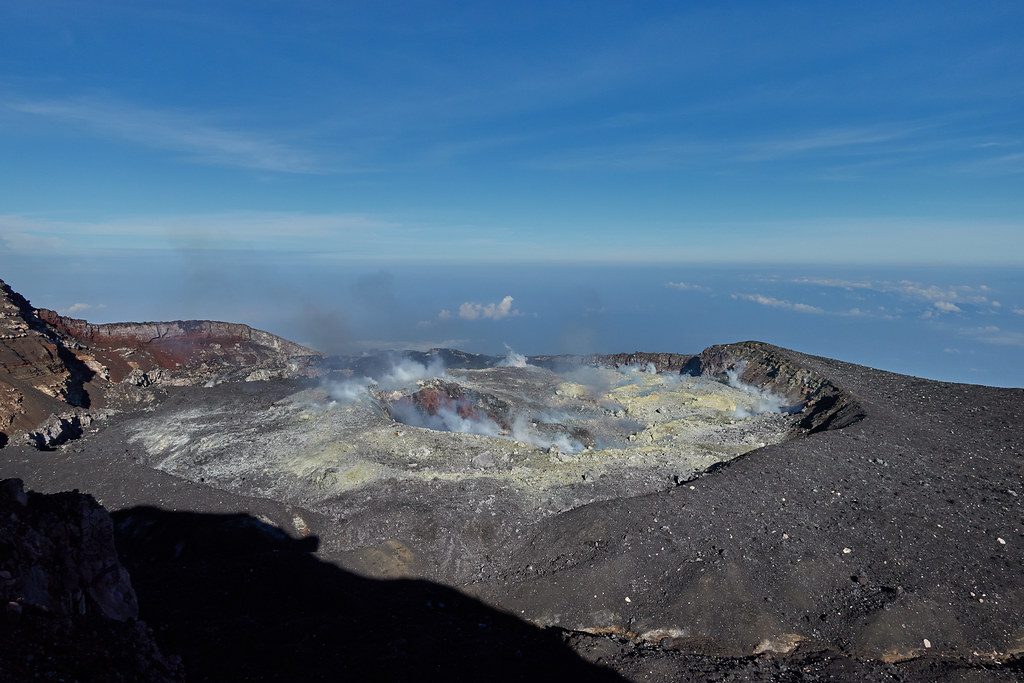
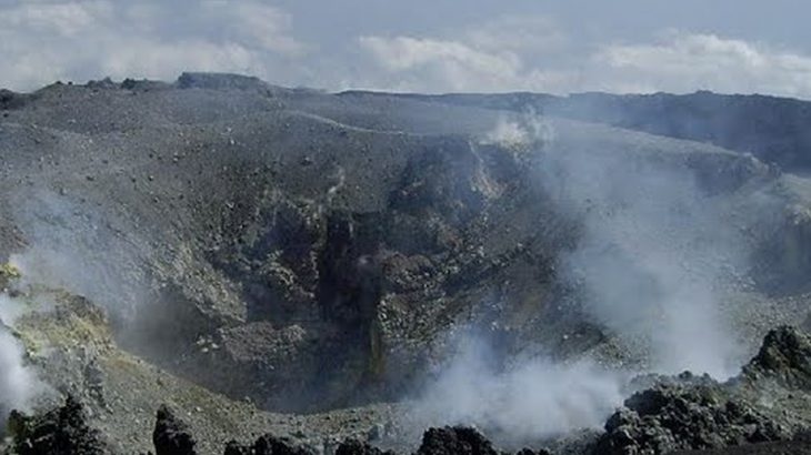
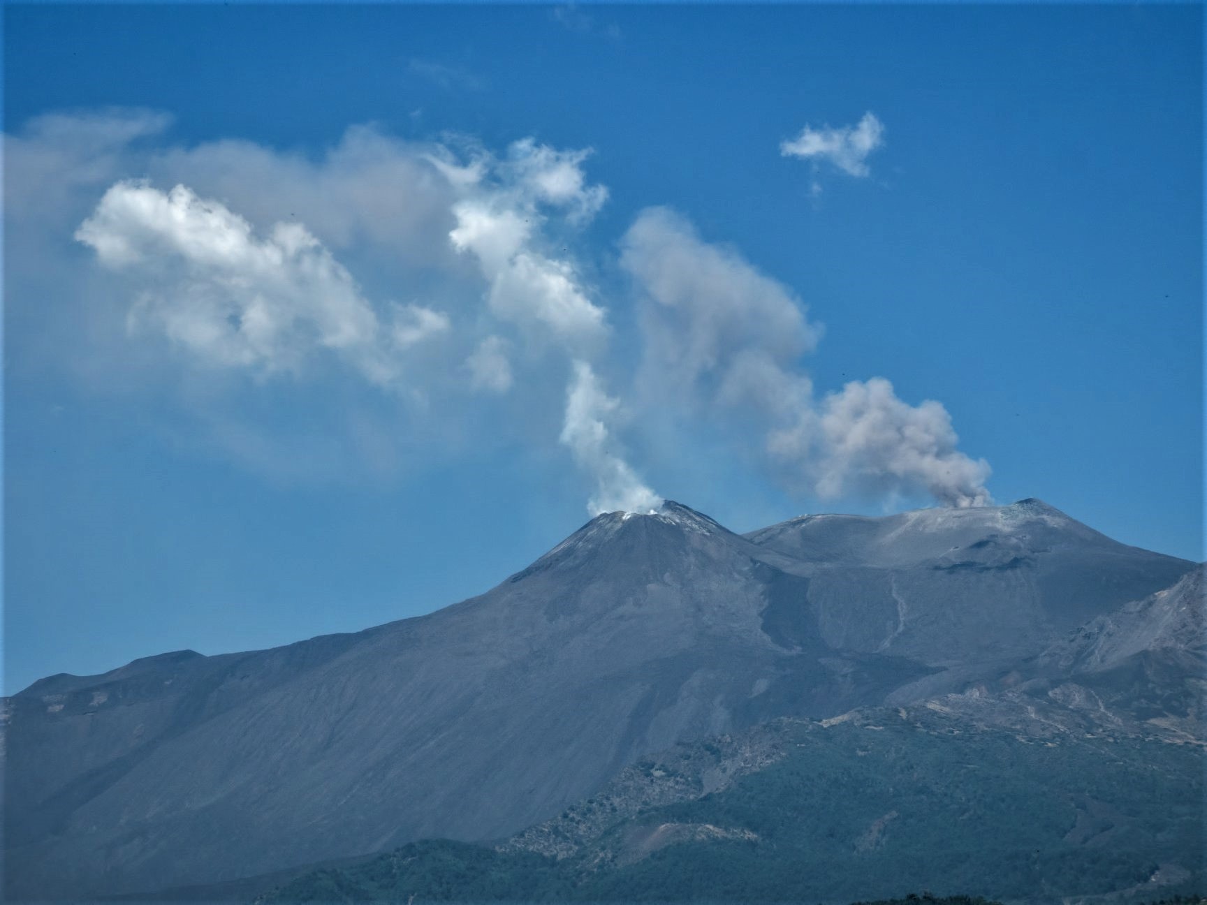
Italy / Sicily , Etna :
A portion of the internal wall of the Northeast Crater of Etna has collapsed.
Since 6 August, discontinuous emissions of ash have been observed at Etna’s Northeast Crater (NEC). At times, these emissions have been denser and more abundant, forming a plume that normally gets rapidly dilute near the eruptive vent mostly on the eastern and southern sides of the volcano.

It has probably been during these events that a large portion of the inner wall of the NEC has collapsed. The image below shows the collapsed crater wall (white arrows); the former inner crater rim (broken yellow line), and the new inner rim (solid yellow line). The photograph was taken early on 10 August 2019 by Michele Mammino, who is acknowledged for allowing us to use the image. View is from the western rim of the NEC.
Source : INGV Vulcani .
Photos : INGV Vulcani ( Michele Mammino ) , Gio Giusa .