May 23 , 202.
Indonesia , Merapi :
Report on the activity of the Merapi volcano, May 15-21, 2020
OBSERVATION RESULTS
Visual:
The weather around Mount Merapi is generally sunny in the morning and at night, while the day until evening is foggy. There is a white smoke, from thin to thick with low pressure. A maximum smoke height of 50 m was observed from the observation post of Mount Merapi in Kaliurang on May 20, 2020 at 07:32.
Morphological analysis of the crater area based on photos of the Southeast sector showed no change in the morphology of the dome. The volume of the lava dome based on measurements using aerial photos with drones on February 19, 2020 was 291,000 m3.

Seismicity:
This week, the seismicity of Mount Merapi recorded
16 emission earthquakes (DG),
13 multiple phase earthquakes (MP),
7 low frequency earthquakes (LF),
16 avalanche earthquakes. (RF),
15 tectonic earthquakes (TT).
The seismic intensity this week is lower than last week.
Deformation:
The deformation of G. Merapi which was monitored by EDM and GPS this week did not show any significant change.
Rain and lahars:
This week, May 20, 2020, there was rain at the Mount Merapi observation post with the highest rain intensity of 38 mm / hour at the Kaliurang post.
Conclusion:
Based on the results of the visual and instrumental observations, it was concluded that:
1. The lava dome is currently in a stable state.
2. The volcanic activity of Mount Merapi is still quite high and is determined by the level of activity « WASPADA ».
Source : BPPTKG.
Photo : Live Frekom.
Italy / Sicily , Etna :
ETNA PRESS RELEASE [UPDATE n. 57]
The National Institute of Geophysics and Volcanology, Etneo Observatory, announces that from 09:00 UTC a decrease in explosive activity in the New Southeast Crater was observed from surveillance cameras and INGV-OE personnel on the terrain At the same time, the previously reported volcanic ash cloud is not observed. Explosive activity persists in the Voragine crater with sporadic ash emission which disperses quickly near the summit area.
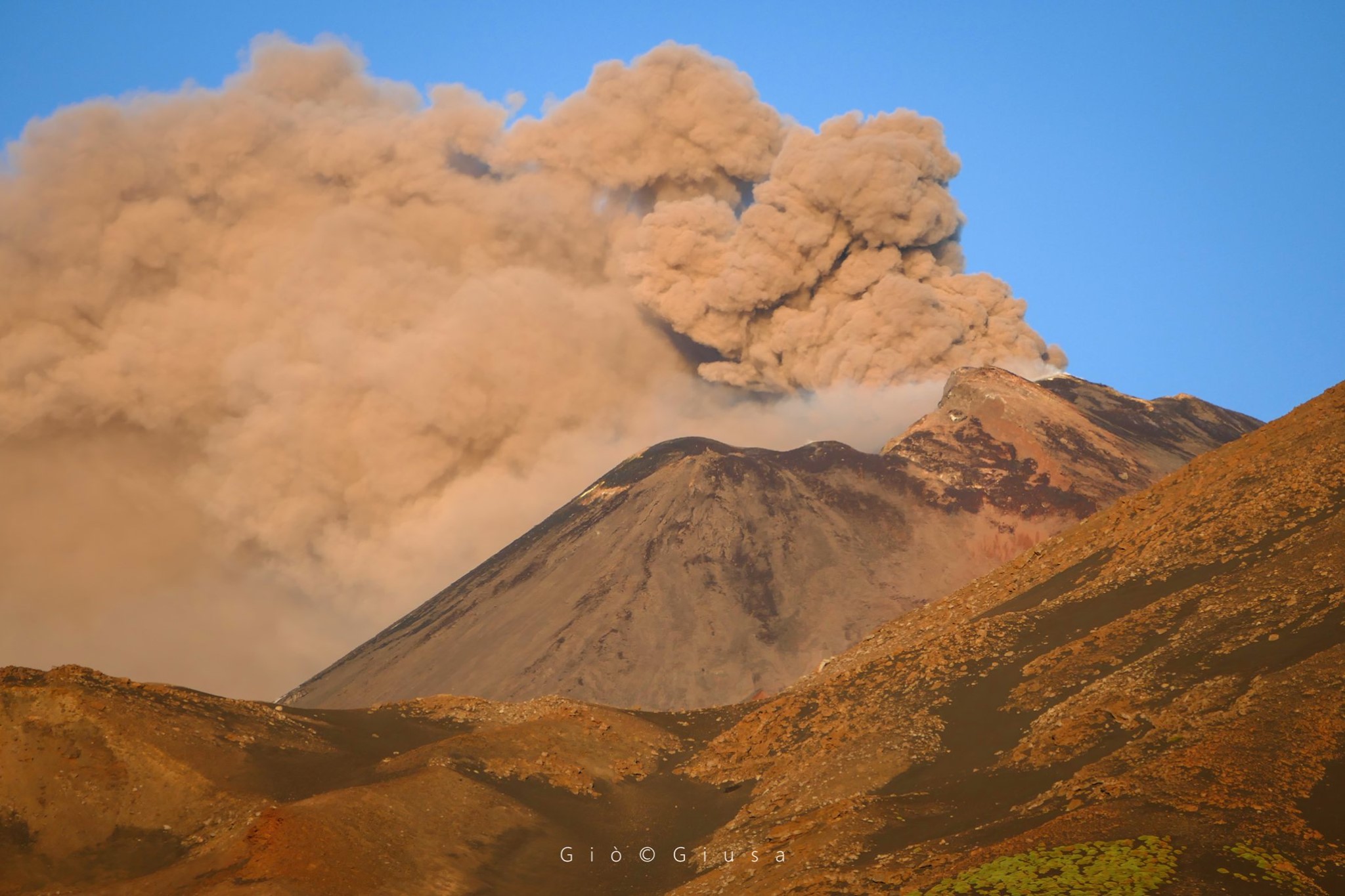
The amplitude of volcanic tremor has decreased, returning to the values that preceded the increase phase, reported in press release No. 51 of May 19 (average values). The source is located about 2.8 km above sea level and in the area of the New Southeast Crater. Infrasonic activity is moderately declining and the sources remain active in the Northeast Crater area and in the New Southeast Crater. The deformations of the soil do not show significant variations.
Other updates will be communicated shortly.
Source : INGV.
Photo : Gio Giusa.
Chile , Copahue :
Special report on volcanic activity (REAV) Région del Bio Bio, Copahue volcano, May 20, 2020, 03:40 local time (continental Chile).
The National Geological and Mining Service of Chile (Sernageomin) publishes the following PRELIMINARY information, obtained thanks to the surveillance teams of the National Volcanic Surveillance Network (RNVV), processed and analyzed at the South Andean Volcanological Observatory (Ovdas):
On Wednesday May 20 at 02:58 local time (06:58 UTC), the monitoring stations installed near the Copahue Volcano recorded a VT (volcano-tectonic) earthquake associated with the fracturing of rocks in the volcanic system.

The characteristics of the earthquake after its analysis are as follows:
TIME OF ORIGIN: 02:58 local time (06:58 UTC).
LATITUDE: 37.890 ° S
LONGITUDE: 71.184 ° W
DEPTH: 1.5 km
LOCAL MAGNITUDE: 3.0Ml
Observations:
At the time of this report, no additional volcanic or seismological activity has been detected
The volcanic technical alert remains at the GREEN level.
Source : Sernageomin.
Photo : Dario G. Lazo.
Alaska , Great Sitkin :
52°4’35 » N 176°6’39 » W,
Summit Elevation 5709 ft (1740 m)
Current Volcano Alert Level: ADVISORY
Current Aviation Color Code: YELLOW
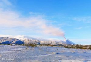
Small earthquakes were detected at Great Sitkin volcano throughout the past week. Earthquake activity remains above background levels and the degree of seismic unrest has not changed appreciably for a number of weeks. Satellite and web camera views of the volcano were obscured by clouds throughout the week, except for May 15 when minor steaming at the summit was observed in satellite data. There were no additional observations of outward unrest this week.
Great Sitkin volcano is monitored by local seismic and infrasound sensors, satellite data, web cameras, and remote infrasound and lightning networks. Should conditions at the volcano change, this should be apparent in these data streams and AVO will respond accordingly.
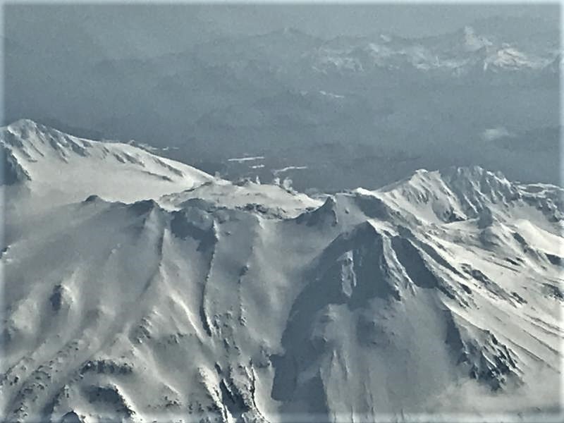
Views of Great Sitkin volcano taken on an Alaska Airlines flight from Anchorage to Adak, Alaska on March 21, 2020. Snow free ground due and light steaming observed.
Great Sitkin Volcano is a basaltic andesite volcano that occupies most of the northern half of Great Sitkin Island, a member of the Andreanof Islands group in the central Aleutian Islands. It is located 43 km (26 miles) east of the community of Adak. The volcano is a composite structure consisting of an older decapitated volcano and a younger parasitic cone with a 2-3 km diameter summit crater. A steep-sided lava dome, emplaced during an eruption in 1974, occupies the center of the crater. Great Sitkin erupted at least three times in the 20th century, most recently in 1974. That eruption produced a lava dome and at least one ash cloud that likely exceeded an altitude of 25,000 ft above sea level. A poorly documented eruption occurred in 1945, also producing a lava dome that was partially destroyed in the 1974 eruption. Within the past 280 years a large explosive eruption produced pyroclastic flows that partially filled the Glacier Creek valley on the southwest flank.
Source : AVO.
Photo : McConnell, Angela