January 11 , 2024.
Iceland , Grímsvötn :
A brief seismic swarm at Grímsvötn was recorded by the seismic network beginning at 1600 on 4 January, prompting Icelandic Meteorological Office (IMO) to raise the Aviation Color Code to Yellow (the second level on a four-color scale). The swarm consisted of seven earthquakes with magnitudes above 1, which was considered unusual. Since the beginning of December there had been evidence of water drainage from the lake; the earthquakes may have been related to the drainage, but it was not confirmed. Activity did not escalate on 5 January and only one M 0.6 earthquake was detected. The Aviation Color Code was lowered to Green. The report noted that seismic activity at the volcano had been above background levels during the previous four months.
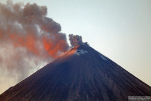
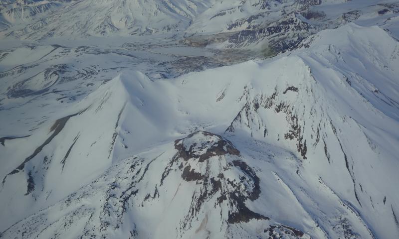
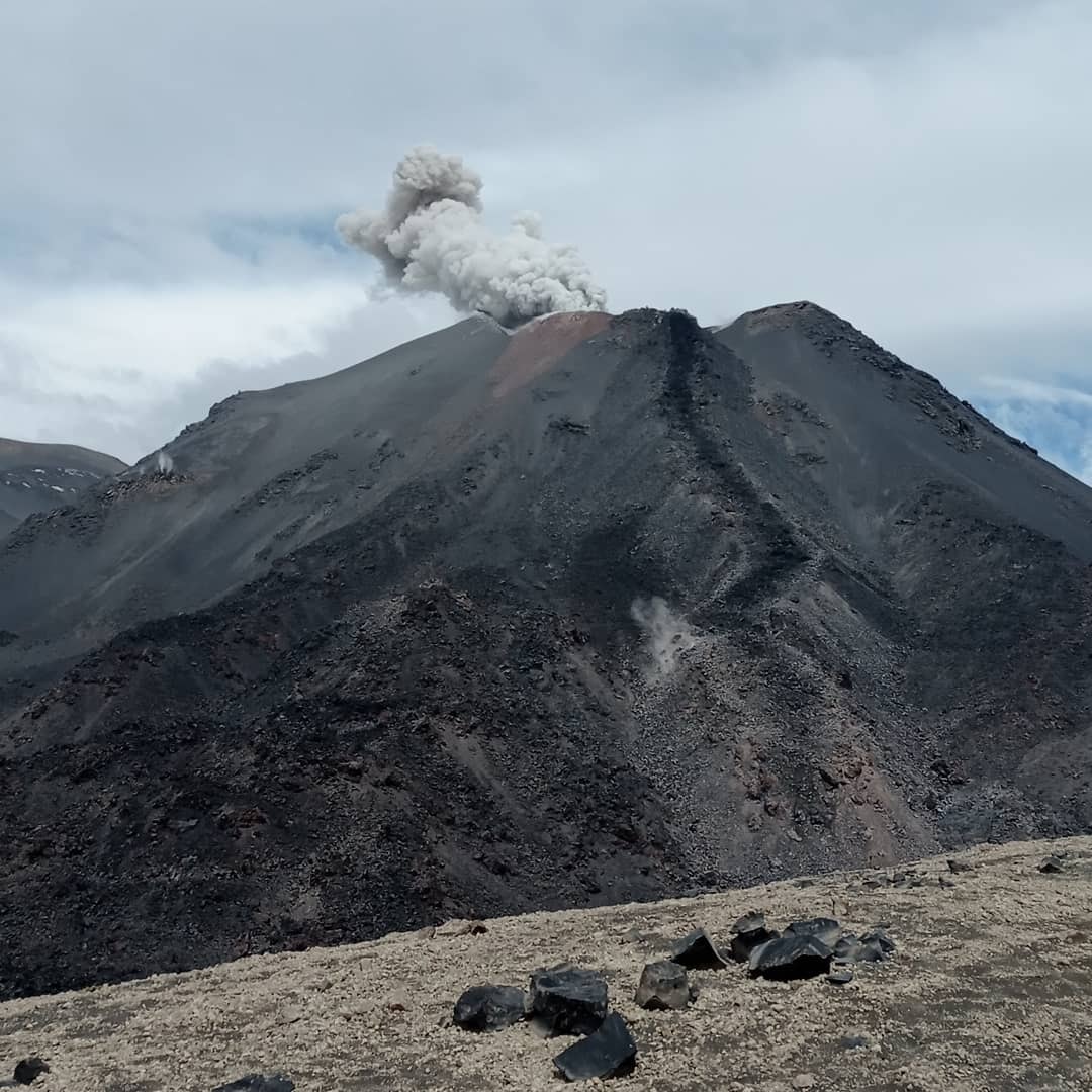
Grímsvötn, Iceland’s most frequently active volcano in recent history, lies largely beneath the vast Vatnajökull icecap. The caldera lake is covered by a 200-m-thick ice shelf, and only the southern rim of the 6 x 8 km caldera is exposed. The geothermal area in the caldera causes frequent jökulhlaups (glacier outburst floods) when melting raises the water level high enough to lift its ice dam. Long NE-SW-trending fissure systems extend from the central volcano. The most prominent of these is the noted Laki (Skaftar) fissure, which extends to the SW and produced the world’s largest known historical lava flow in 1783. The 15 km3 basaltic Laki lavas were erupted over 7 months from a 27-km-long fissure system. Extensive crop damage and livestock losses caused a severe famine that resulted in the loss of one-fifth of the population of Iceland.
Source: Icelandic Meteorological Office (IMO) , GVP.
Photo : Laki/ Chmee2/Valtameri.
Alaska , Trident :
AVO/USGS Volcanic Activity Notice
Current Volcano Alert Level: NORMAL
Previous Volcano Alert Level: ADVISORY
Current Aviation Color Code: GREEN
Previous Aviation Color Code: YELLOW
Issued: Wednesday, January 10, 2024, 11:04 AM AKST
Source: Alaska Volcano Observatory
Notice Number: 2024/A38
Location: N 58 deg 14 min W 155 deg 6 min
Elevation: 3599 ft (1097 m)
Area: Alaska Peninsula
Volcanic Activity Summary:
Volcanic activity beneath Trident Volcano has decreased over the past month. Occasional small earthquakes continue to be observed; however, the current activity is at background levels. No evidence of ground deformation has been observed since the end of November 2023. Due to this decrease in activity, the Alaska Volcano Observatory is lowering the Aviation Color Code and Volcano Alert Level to GREEN/NORMAL.
AVO monitors Trident with a local network of seismometers, a webcam, remote sensing data, and regional infrasound and lightning networks.
Hazard Analysis:
[General hazards] none
[Ash cloud] none
Remarks:
Trident Volcano is one of the Katmai group of volcanoes located within Katmai National Park and Preserve on the Alaska Peninsula. Trident consists of a complex of four cones and numerous lava domes, all andesite and dacite in composition, that reach as high as 6,115 ft above sea level. An eruption beginning in 1953 constructed the newest cone, Southwest Trident, and four lava flows on the flank of the older complex. This eruption continued through 1974 and produced ash (an initial plume rose to 30,000 ft asl), bombs, and lava at various times. Fumaroles remain active on the summit of Southwest Trident and on the southeast flank of the oldest, central cone. Trident is located 148 km (92 miles) southeast of King Salmon and 440 km (273 miles) southwest of Anchorage.
Source : AVO.
Photo : Lopez, Taryn
Philippines , Bulusan :
BULUSAN VOLCANO ADVISORY , 11 January 2024 , 10:00AM
This is a notice of increased seismic activity at Bulusan Volcano.
A total of seventy-one (71) volcanic-tectonic (VT) earthquakes associated with rock fracturing were recorded by Bulusan Volcano Network (BVN) since 5AM today, 11 January 2024. The strongest of these ranged from 0.3 ML to 2.2 ML and occurred between 1 to 6 kilometers beneath the southern flank of the volcano edifice. Degassing activity from the summit crater and active vents generated weak to moderate volume plumes that drifted west to southeast. The seismic parameters indicate shallow hydrothermal activity is underway and may lead to steam-driven or phreatic eruption.
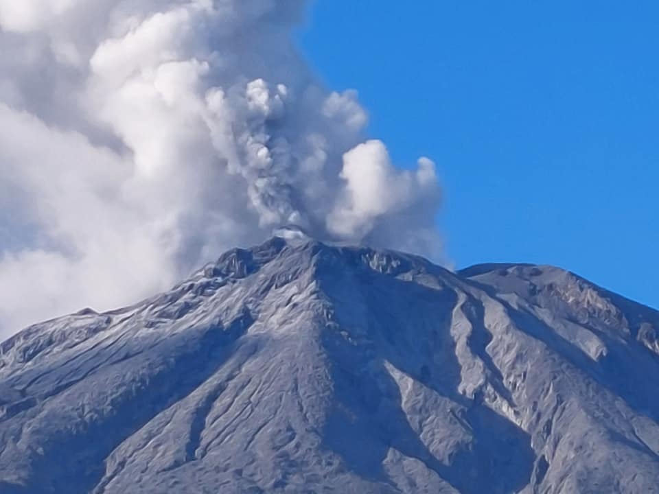
The public is reminded that Alert Level 1 prevails over Bulusan Volcano, which means it is currently at low-level of unrest with increased chances of steam-driven or phreatic eruptions. Local government units and the public are reminded that entry into the 4-kilometer radius Permanent Danger Zone (PDZ) should be prohibited and that vigilance in the 2-kilometer Extended Danger Zone (EDZ) on the southeast sector must be exercised due to the possibilities of sudden and hazardous phreatic eruptions. Civil aviation authorities must also advise pilots to avoid flying close to the volcano’s summit as ash from any sudden phreatic eruption can be hazardous to aircraft. Furthermore, people living within valleys and along river/stream channels should be vigilant against sediment-laden stream flows and lahars in the event of heavy and prolonged rainfall should phreatic eruption occur.
DOST-PHIVOLCS is closely monitoring Bulusan Volcano’s condition, and any new development will be communicated to all concerned stakeholders.
Source : Phivolcs
Photo : Sorsogon news.
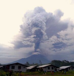
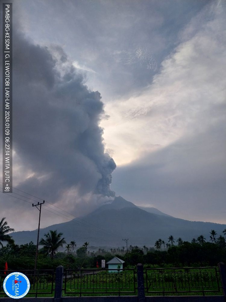
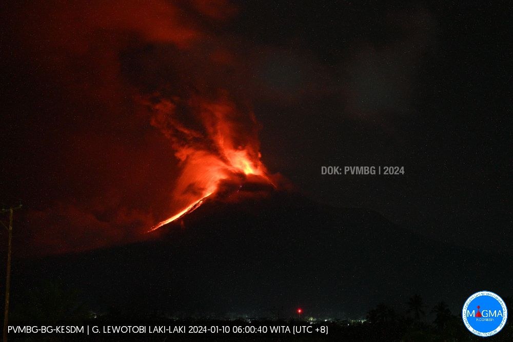
Indonesia , Lewotobi Laki Laki :
VOLCANO OBSERVATORY NOTICE FOR AVIATION – VONA
Issued : January 11 , 2024
Volcano : Lewotobi Laki-laki (264180)
Current Aviation Colour Code : ORANGE
Previous Aviation Colour Code : orange
Source : Lewotobi Laki-laki Volcano Observatory
Notice Number : 2024LWK015
Volcano Location : S 08 deg 32 min 20 sec E 122 deg 46 min 06 sec
Area : East Nusa Tenggara, Indonesia
Summit Elevation : 5069 FT (1584 M)
Volcanic Activity Summary :
Eruption at 05h22 UTC (13h22 local).
Volcanic Cloud Height :
Ash-cloud is not observed.
Other Volcanic Cloud Information :
Ash-cloud is not observed.
Remarks :
Eruption and ash emission is continuing. Tremor recorded on seismogram with maximum amplitude 14 mm. Continuous eruptive tremor recorded.
PVMBG reported that the eruption at Lewotobi’s Laki-laki volcano from a fissure on the upper NNW flank and from a vent on the upper SSE flank was ongoing during 3-9 January. White plumes rose 300-1,000 m above the summit and drifted SW and W during 3-5 December. During the rest of the week white-and-gray or gray-to-brown ash plumes rose 1-1.5 km above the summit and drifted NW, N, and NE. The ash plumes were sometimes dense.
Masks had been distributed in Hokeng Jaya, Pululera, Klatanlo, and Nawakote in the district of Wulanggitan and the village of Dulempari in the district of Bura after the eruption began in late December and residents were encouraged to wear them when outside to minimize ash inhalation. On 1 January as many as 1,185 residents of Boru Village and 328 residents in the Konga Village area self-evacuated to several other locations including relatives’ homes and evacuation posts. Ash fell in several areas in the Wulanggitan and Bura districts. Badan Penanggulangan Bencana Daerah (BPBD) East Flores Regency mobilized and provided residents with essentials including mobile kitchens, food, tents, and cleaned ash off roadways. By 4 January a total of 3,898 people had evacuated. The Frans Xavier Seda Airport in Sikka District closed on 1 January due to thick ash deposits on the runways; it remained closed as of 9 January.
Activity intensified during the evening of 9 January. Incandescent material was ejected from the summit and lava flows from the NNW-flank fissure descended the NW flank. At 2300 the Alert Level was raised to 4 (on a scale of 1-4) and the public was warned to stay 4 km away from the Perempuan and Laki-laki craters and an additional 5 km from the NNW flanks of Laki-laki.
Source : Magma Indonésie , GVP.
Photos : PVMBG.
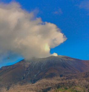
Chile , Nevados de Chillan :
Special Report on Volcanic Activity (REAV), Nuble region, Nevados de Chillan volcanic complex, January 10, 2024, 6:05 p.m. local time (mainland Chile)
The National Geology and Mining Service of Chile (Sernageomin) announces the following PRELIMINARY information, obtained through the monitoring equipment of the National Volcanic Monitoring Network (RNVV), processed and analyzed at the Andes del Sud Volcanological Observatory ( Ovdas):
On Wednesday January 10, 2024 at 5:53 p.m. local time (8:53 p.m. UTC), monitoring stations installed near the Nevados de Chillan volcanic complex recorded an earthquake, associated with the fracturing of rocks (volcano-tectonic type, VT).
The characteristics of the largest magnitude earthquake recorded so far after its analysis are as follows:
ORIGINAL TIME: 5:53 p.m. local time (8:53 p.m. UTC)
LATITUDE: 36.888°S
LONGITUDE: 71.364°E
DEPTH: 4.8 km
LOCAL MAGNITUDE: 3.0 (ML)
Comments:
Following the main event, other lower energy volcano-tectonic earthquakes were recorded.
The technical volcanic alert remains at green level.
Source : Sernageomin.
Photo : Sernageomin