May 19 , 2020.
Peru , Sabancaya / Ubinas :
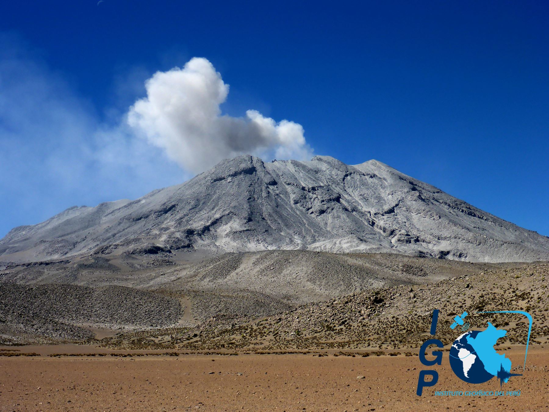
Sabancaya Volcano :
Analysis period: from May 11 to 17, 2020, Arequipa, May 18, 2020
Alert level: ORANGE
The Peruvian Geophysical Institute (IGP) reports that the eruptive activity of the Sabancaya volcano remains at moderate levels; that is to say with the continuous recording of explosions with columns up to 2.5 km high on the summit of the volcano and consequent emissions of ash and gas. Consequently, for the following days, no significant change is expected regarding its activity.
The IGP recorded and analyzed the occurrence of approximately 413 earthquakes of volcanic origin, associated with the circulation of fluids (magma, gas, etc.) inside the volcano. In addition, there is an average of 12 daily explosions of low to medium intensity.
The monitoring of the deformation of the volcanic structure, using GNSS data (processed with fast orbits), does not present any significant anomalies. Visual surveillance identified columns of gas and ash up to 2.5 km high above the summit of the volcano, scattered east and southeast of the Sabancaya. Satellite surveillance has identified the presence of 7 thermal anomalies with values from 1 MW to 10 MW, associated with the presence of a body of lava on the surface of the volcano crater.
RECOMMENDATIONS
• Maintenance of the orange volcanic alert level.
• Do not approach within a radius of less than 12 km from the crater. In case of ash fall, cover your nose and mouth with rags or wet masks. Keep doors and windows of houses closed.
Ubinas volcano :
Analysis period: May 11 to 17, 2020 Arequipa, May 18, 2020 Alert level: ORANGE
Suggested alert level: GREEN
The Geophysical Institute of Peru (IGP) reports that the dynamic behavior of the Ubinas volcano remains at low levels. Consequently, in the short term, no eruptive activity is planned for the said volcano, so that the population can exercise its activities normally according to the directives of the government and the state of health emergency.
Between 11 and 18 May, the IGP recorded and analyzed a total of 54 seismic events associated with the dynamic behavior of the Ubinas volcano, with the predominance of seismic signals of the Volcano-Tectonic (VT) type, related to the fracturing of rocks inside the volcano. On average, there were 7 earthquakes per day with magnitudes below M1.7. Surveillance cameras recorded light and sporadic emissions of volcanic gases and water vapor with heights less than 300 m above the summit of the volcano. The monitoring of the deformation of the volcanic structure does not record any significant anomalies. MIROVA satellite monitoring did not record any thermal anomalies.
RECOMMENDATIONS
• It is recommended to decrease the level of volcanic alert from orange to green.
• Do not approach within a radius of less than 3 km from the volcano crater.
• Do not neglect preventive actions in the event of an increase in volcanic activity
Source : IGP.
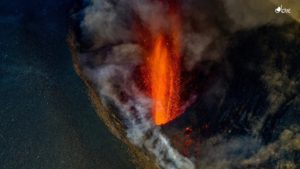
Photo : Photovolcanica , IGP.
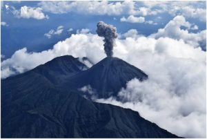
Alaska , Shishaldin :
54°45’19 » N 163°58’16 » W,
Summit Elevation 9373 ft (2857 m)
Current Volcano Alert Level: ADVISORY
Current Aviation Color Code: YELLOW
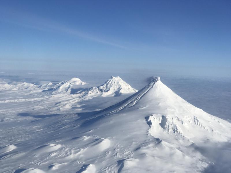
Unrest continues at Shishaldin. Seismicity remains above background with continuous low-level tremor occurring over the past day. No explosive activity was detected on regional infrasound sensors. Nothing noteworthy was observed in satellite data over the past day and web camera images of the volcano were obscured by clouds. Although unrest is currently at low levels, activity could escalate with little warning, and additional eruptive activity within the summit crater, lava flows, lahars, and ash-producing eruptive events could occur.
Shishaldin is monitored by local seismic and infrasound sensors, satellite data, web cameras, a telemetered geodetic network, and distant infrasound and lightning networks.
Source : AVO.
Photo : Jacob, Ben David .
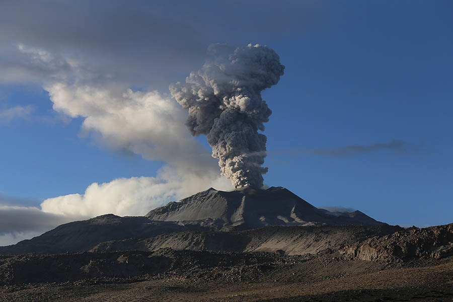
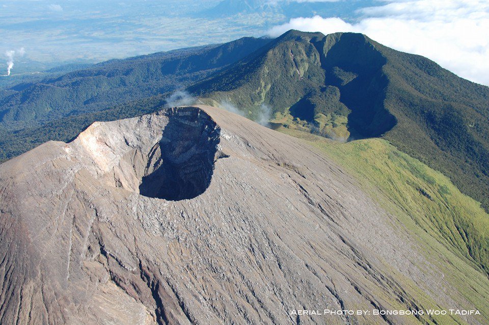
Philippines , Mayon / Taal / Kanlaon :
MAYON VOLCANO BULLETIN: 19 May 2020 08:00 A.M.
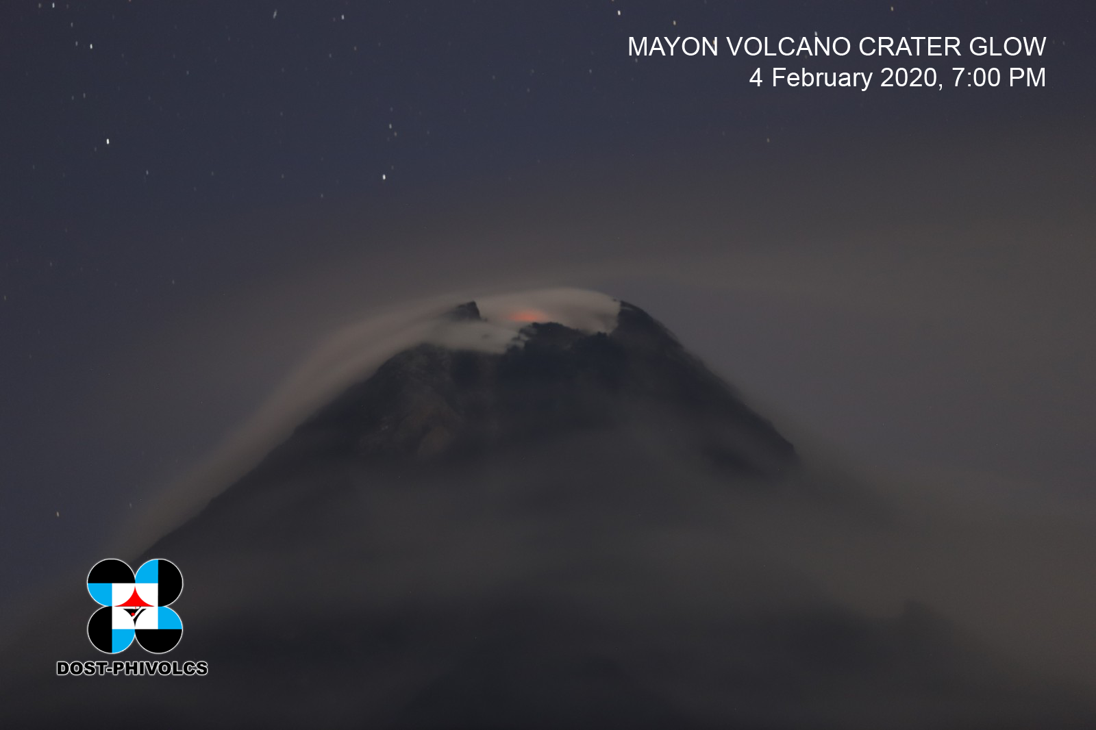
Mayon Volcano’s seismic monitoring network did not detect any volcanic earthquake during the 24-hour observation period. Moderate emission of white steam-laden plumes that crept downslope before drifting northwest and north-northwest was observed. Faint crater glow from the summit could be observed at night. Sulfur dioxide (SO2) emission was measured at an average of 324 tonnes/day on 18 May 2020. Recent electronic tilt data showed inflation of the middle to upper portions of the volcanic edifice that began in the last quarter of 2019. This follows an inflationary trend that began in February 2019 as recorded by continuous GPS monitoring.
TAAL VOLCANO BULLETIN: 19 May 2020 08:00 A.M.
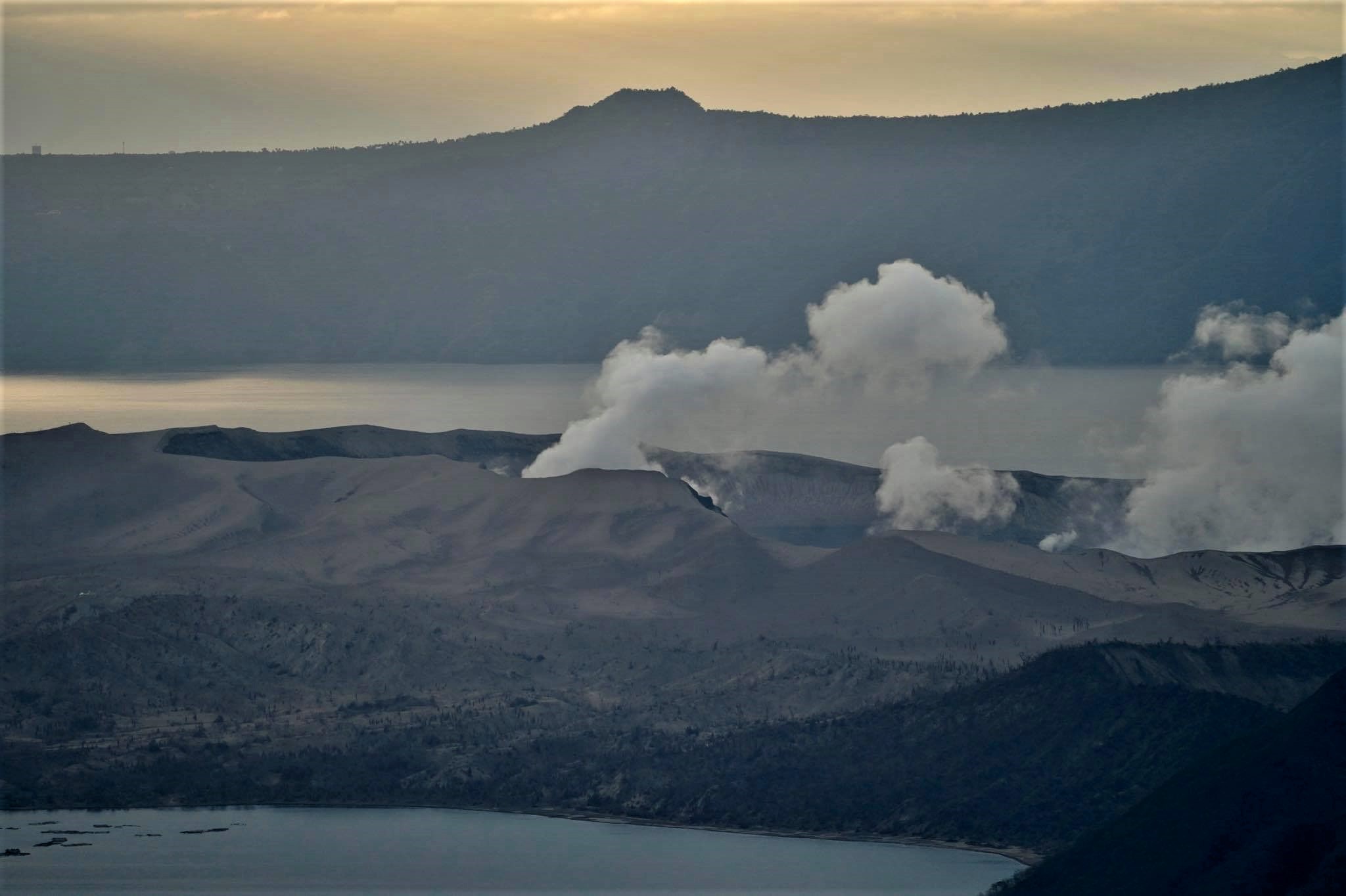
In the past 24-hour period, the Taal Volcano Network recorded fifteen (15) volcanic earthquakes that are associated mainly with rock-fracturing processes beneath and around the edifice. Weak steaming or fumarolic activity was observed from vents on the Main Crater and fissure vents along the Daang Kastila Trail.
KANLAON VOLCANO BULLETIN: 19 May 2020 08:00 A.M.
Kanlaon Volcano’s seismic monitoring network recorded one (1) volcanic earthquake during the 24-hour observation period. Moderate emission of white steam-laden plumes rising 300 meters high before drifting northeast was observed. Ground deformation data from continuous GPS measurements indicate a slight deflation of the lower and mid slopes since January 2020. Short-term electronic tilt monitoring on the southeastern flanks recorded pronounced inflation of the upper slopes at the end of January 2020. These parameters indicate that hydrothermal or magmatic activity is occurring deep beneath the edifice.
Source : Phivolcs.
Photos : Phivolcs , Raffy Tima , Bong Bong Woo Tadifa.
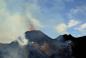
Vanuatu Archipelago , Yasur :
19°32’0”S 169°26’30”E
Summit 1184ft (361m)
Current Vanuatu Volcano Alert Level: Level 2
Yasur volcano activity has decreased in the Level of major unrest state. The volcanic Alert Level remains at Level 2.
New observations on the ground suggest that the Yasur volcanic activity emits plumes of volcanic gases and/or ash. With this current activity with presence of volcanic gases and/or volcanic ash around the summit crater, the danger zone remains at 600 meter around the volcanic cone.
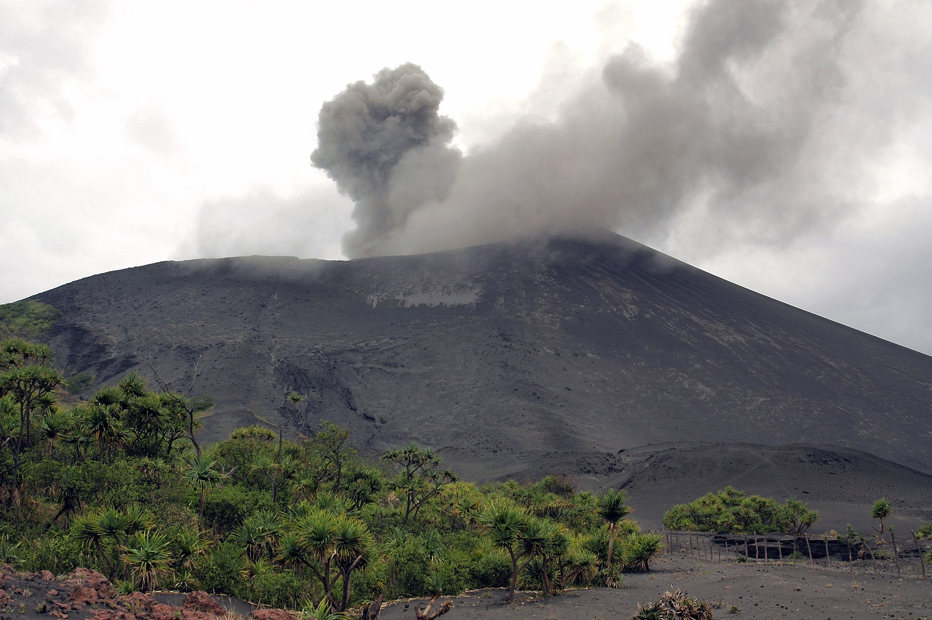
Analysis of the latest Yasur seismic data from the volcano monitoring system confirms that the increased in activity of Yasur in March 2020 has now decreased in the level of major unrest state. The activity consists of ongoing explosions with gas plumes and/or volcanic ash. Some explosions remains intensified and volcanic projectiles or bombs may fall in and/or around the summit crater.
The Yasur Volcanic Alert Level (VAL) has been at the Level 2 since 18th October 2016. The current observations are consistent with the activity of the Volcanic Alert Level 2.
Source : Geohazard.
Photo : Auteur inconnu.