February 18 , 2020 .
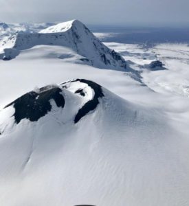
Peru , Sabancaya :
Analysis period: February 10-16, 2020
Alert level: Orange
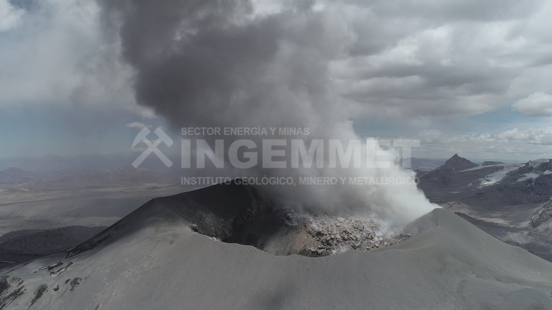
During the period from February 10 to 16, 2020, the IGP recorded and analyzed the occurrence of approximately 619 volcanic earthquakes, associated with the circulation of fluids (magma, gas, etc.) which occur at the interior of the volcano. During this period, on average, 10 daily explosions of medium to low intensity were recorded.
The monitoring of the deformation of the volcanic structure, using GNSS data (processed with fast orbits), does not record any significant anomalies. Visual surveillance, using surveillance cameras, has made it possible to identify the presence of columns of gas and ash up to 3.8 km high above the summit of the volcano, scattered in the Southwest, South sectors and Southeast of Sabancaya. Satellite surveillance has identified the presence of 2 thermal anomalies with values between 1 MW and 11 MW, associated with the presence of a lava dome of approximately 280 m in diameter in the crater of the volcano. It should be noted that the number of anomalies has been reduced due to the high cloudiness in the region.
Conclusion:
The Peruvian Geophysical Institute (IGP) reports that the eruptive activity of the Sabancaya volcano is maintained at moderate levels; that is to say with the continuous recording of moderate explosions and consequent emissions of ash and gas. Consequently, for the following days, no significant change in activity is expected.
Prospect:
• The presence of a lava dome inside the crater of the volcano leads the Sabancaya to present two possible scenarios:
Scenario 1: corresponds to a light to moderate explosive activity such as that recorded by the Sabancaya in recent months, associated, of course, with slow growth or the rise of the lava dome. This activity will result in the partial destruction of said dome.
Scenario 2: growth and collapse of the lava dome with subsequent generation of small volume pyroclastic flows.
• Between February 17 and 20, in the event of explosions, the ashes will disperse towards the south-east and south-west sectors of the volcano at speeds of up to 55 km / h. Between February 18 and 24, winds would disperse gas and ash emissions in the south-southwest sectors of the volcano at speeds of up to 55 km / h.
• Rainfall is expected between February 17 and 19 and February 21 and 23, 2020 which could generate lahars near the Sabancaya.
Source : IGP.
Photos : Auteur inconnu , Ingemmet .
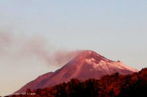
Russia / Kuriles Islands , Ebeko :
50.69 N, 156.01 E;
Elevation 3792 ft (1156 m)
Aviation Colour Code is ORANGE
A moderate explosive eruption of the volcano continues. Ash explosions up to 19,700 ft (6 km) a.s.l. could occur at any time. Ongoing activity could affect low-flying aircraft and airport of Severo-Kurilsk.
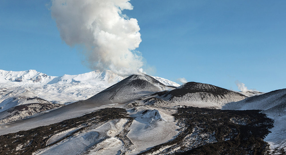
A moderate explosive eruption of the volcano continues. According to visual data by volcanologists from Severo-Kurilsk, explosions sent ash up to 1.5 km a.s.l. on 12-13 February; ash clouds drifted to the east of the volcano; ashfalls were noting at Severo-Kurilsk. Satellite data showed the volcano was quiet or obscured by clouds last week.
Source : Kvert.
Photo : Sputnik . Alexandre Peraguis.
Costa Rica , Irazú :
Lat: 9.979 ° N; Long: 83.852 ° W;
Altitude: 3432 meters
Current activity level: 1 (active)
Potentially associated hazards: landslides.
Seismicity remains low. The main landslide in the tower sector continues with steady acceleration. The level of the lake is rapidly decreasing.
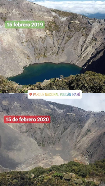
Laguna del Irazú continues to dry up, park wardens say
In recent days, the amount of water has decreased significantly due to the few rains that occur in the region.
Source : Ovsicori .
Photo : Parque Nacional.
Indonesia , Anak Krakatau :
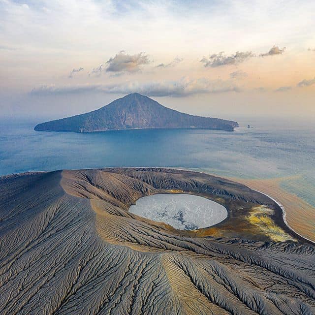
Level of activity at level II (Waspada), since March 25, 2019. The Anak Krakatau (157 m above sea level) has experienced an increase in volcanic activity since June 18, 2018 which was followed by a series of eruptions between September 2018 and February 2019. The last eruption occurred on February 11, 2020. with a height of eruption column not observed.
The volcano is clearly visible until it is covered with fog. The smoke from the crater is observed to be white in color with a weak, thick intensity about 50-100 meters above the summit. The weather is sunny / rainy, the winds are weak to moderate oriented towards the East and the Southwest. The temperature is around 25-28.5 ° C.
According to the seismographs of February 17, 2020, it was recorded:
5 low frequency earthquakes
1 distant tectonic earthquake
Continuous tremor, amplitude 0.5 to 3 mm (dominant value 1 mm)
Recommendation: People / tourists are not allowed to approach the crater within a radius of 2 km.
VONA: The last VONA ORANGE color code sent, was published on February 11, 2020 at 10 h 06 min WIB. No rash was observed.
Source : PVMBG.
Photo : picuki.com via Vulcanologia Esia .
La Guadeloupe , La Soufrière :
Seismic sequence in the La Soufrière area of Guadeloupe – Basse Terre . End of sequence
The sequence of volcanic earthquakes that started in the La Soufrière volcano area on Monday February 10, 2020 at 1:23 p.m. local time (February 10, 2020 5:23 p.m. UT) ended on Saturday February 15 at 12:50 p.m. local time (February 15 2020 at 4:50 p.m. universal time, UT). During this sequence 164 earthquakes were recorded.
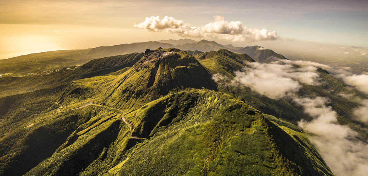
Earthquakes are of very small magnitude (M <1). No earthquake has been reported. The events are located at a depth of less than 2.5 km below the summit of the dome of La Soufrière.
The alert level remains: yellow, vigilance.
Source : Direction de l’OVSG-IPGP
Photo : A.-Brusini-hemis-fr