October 05 , 2019.
Hawaii , Mauna Loa :
19°28’30 » N 155°36’29 » W,
Summit Elevation 13681 ft (4170 m)
Current Volcano Alert Level: ADVISORY
Current Aviation Color Code: YELLOW
Activity Summary:
Mauna Loa Volcano is not erupting. Rates of deformation and seismicity have not changed significantly in the past week and persist above long-term background levels.
Observations:
During the past week, approximately 40 small-magnitude earthquakes (all smaller than M2.5) were detected beneath the upper elevations of Mauna Loa. Most of the earthquakes occurred at shallow to intermediate depths of less than 10 km (~6 miles) below ground level.
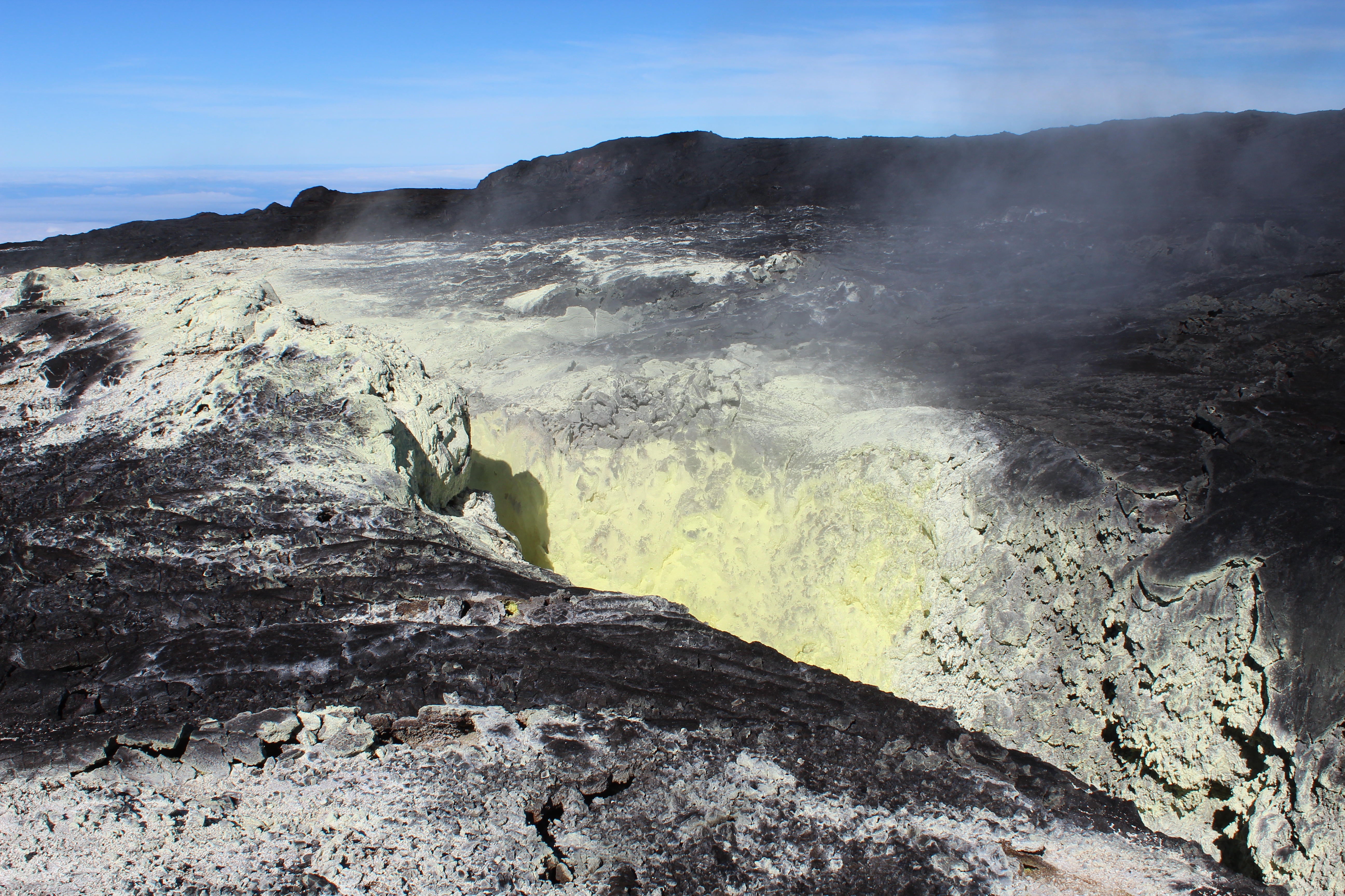
Native sulfur crystals often form through the reaction of sulfur dioxide and hydrogen sulfide gases, both of which are degassing from this old fissure on Mauna Loa, making it an ideal site for volcanic gas monitoring. As a result of the degassing, the fissure is lined with yellow sulfur crystals. USGS photo by P. Nadeau, 09-17-2019.
Global Positioning System (GPS) and Interferometric Synthetic Aperture Radar (InSAR) measurements show continued summit inflation, consistent with magma supply to the volcano’s shallow storage system.
Readings of fumarole temperature and gas concentrations at the Sulphur Cone monitoring site on the Southwest Rift Zone remain stable, but are slightly elevated from measurements from several weeks ago due to repositioning and servicing of instrument sensors during maintenance in mid-September by HVO field crews.
Source : HVO.
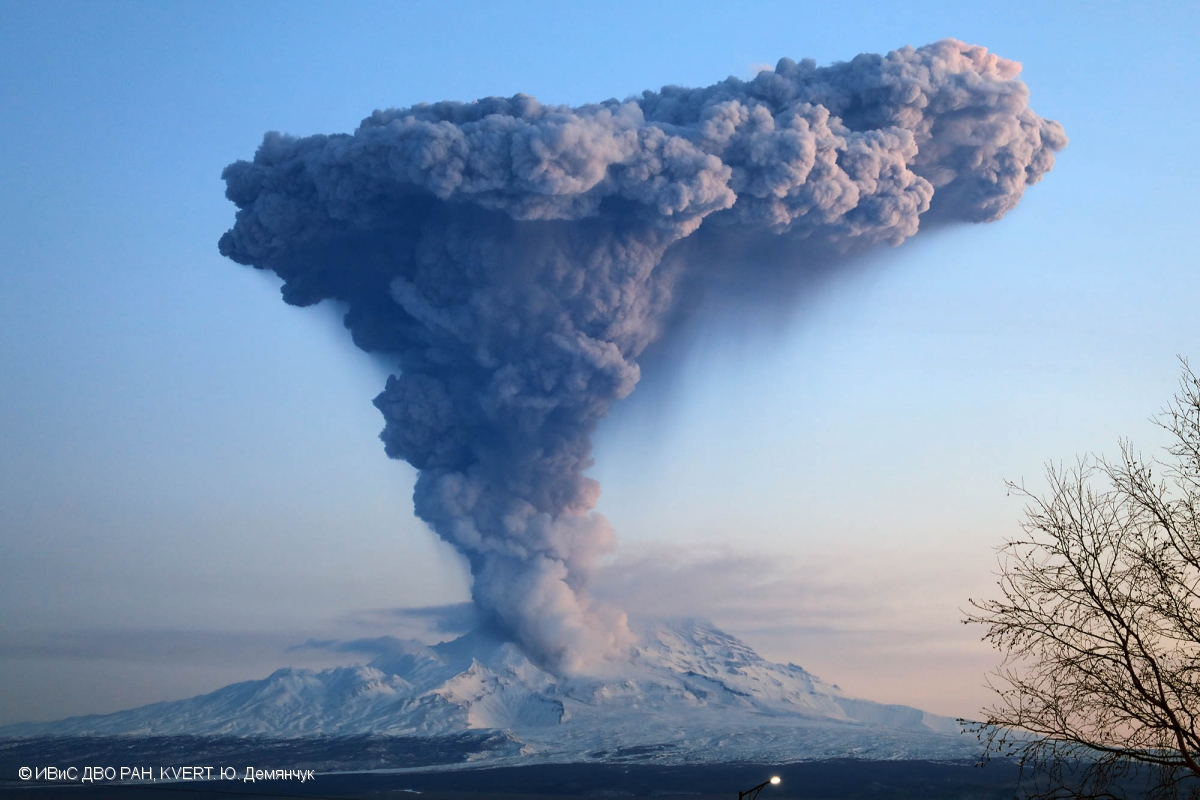
Kamchatka , Sheveluch :
VOLCANO OBSERVATORY NOTICE FOR AVIATION (VONA).
Issued: October 04 , 2019.
Volcano: Sheveluch (CAVW #300270)
Current aviation colour code: ORANGE
Previous aviation colour code: orange
Source: KVERT
Notice Number: 2019-151
Volcano Location: N 56 deg 38 min E 161 deg 18 min
Area: Kamchatka, Russia
Summit Elevation: 10768.24 ft (3283 m), the dome elevation ~8200 ft (2500 m)
Volcanic Activity Summary:
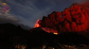
A growth of the lava dome continues, a strong fumarolic activity sometimes with some amount of ash, and an incandescence of the dome blocks and hot avalanches accompanies this process. Video and satellite data by KVERT showed a resuspended ash plume 25-42 km width continues to move to the east-southeast of the volcano.
Explosive-extrusive eruption of the volcano continues. Ash explosions up to 32,800-49,200 ft (10-15 km) a.s.l. could occur at any time. Ongoing activity could affect international and low-flying aircraft.
Volcanic cloud height:
11480-13120 ft (3500-4000 m) AMSL Time and method of ash plume/cloud height determination: 20191004/2225Z – Video data
Other volcanic cloud information:
Distance of ash plume/cloud of the volcano: 96 mi (155 km)
Direction of drift of ash plume/cloud of the volcano: ESE / azimuth 102 deg
Time and method of ash plume/cloud determination: 20191004/2150Z – Himawari-8
Source : Kvert.
Photo : Yu. Demyanchuk, IVS FEB RAS, KVERT (12/2017).
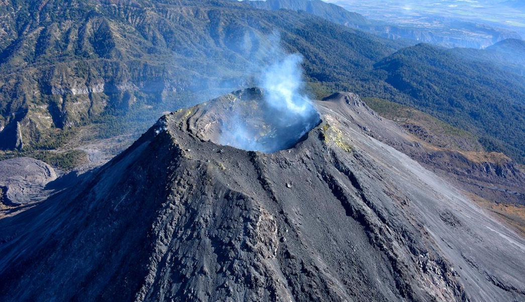
Mexico , Colima:
Weekly technical bulletin of the activity of the volcano Colima, Date: 04-October-2019 Newsletter n ° 141
Seismic activity:
During the past week, 6 high frequency events (HF), 4 collapses and 3.2 min of low amplitude tremors were automatically counted. This week, there were only two small lahars in the Montegrande ravine.
Visual observations:
Intermittent steam and gas emissions on the northeast side of the crater continue to be recorded during the reporting period, although fumaroles were also observed in the western part. When clouds allowed, the fixed thermal camera located to the south of the volcano recorded thermal anomalies related to the activity of fumaroles .
Geochemistry:
The flow of SO2 was not measured during the week.
Remote perception:
No thermal anomalies detected by the MIROVA satellite system were observed during the last week.
Diagnostic:
The volcano maintains an explosive activity of low intensity. The occurrence of these events indicates that the gas probably associated with the moving magma has reached surface levels. This activity can continue and increase in intensity over the following days, weeks or months. The staff in charge of monitoring the volcano monitors any changes and developments in the activity.
Possible scenarios from days to weeks:
1. Low to moderate explosions continue.
2. There is a new growth of lava dome in the crater with collapses of glowing material and lava flows.
Source : UCOL Mexique.
Photo : Protección Civil Jalisco.
Indonesia , Merapi :
ACTIVITY REPORT OF MONT MERAPI, 27 September – 3 October 2019.
I. RESULTS OF THE OBSERVATION.
visual:
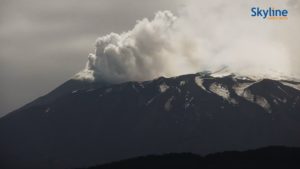
The weather around Mount Merapi is usually sunny during the day, while the evening and the night are foggy. There is a white smoke, thin to thick with low pressure. A maximum smoke height of 100 m was observed from the observation post on Mount Merapi Babadan on 29 September 2019 at 0630 WIB.
Morphological analysis of the crater area based on Pic photographs revealed no significant changes. The volume of the lava dome based on an aerial photo analysis with the drone of 19 September 2019 was 468 000 m3. Since January 2019, the volume of the lava dome has remained relatively stable, as the magma extrusion has largely fallen directly upstream of Kali Gendol in the form of avalanches and hot clouds.
This week, no hot cloud has been reported.

Seismicity:
During this week, the seismicity of Mount Merapi noted:
2 deep volcanic earthquakes (VTA),
14 shallow volcanic earthquakes (VTB),
56 multiple phase earthquakes (MPs),
47 avalanche earthquakes (RF),
4 low frequency earthquakes (LF)
15 tectonic earthquakes (TT).
The seismicity type MP is higher than last week.
Deformation:
The deformation of G. Merapi, monitored by EDM and GPS this week, showed no significant change.
Rain and lahars:
This week, October 2, 2019, the Mount Merapi observation post was covered with rain with a rainfall intensity of 4.5 mm for 10 minutes. There were no reported lahars or increased flow in the rivers flowing from Mount Merapi.
Conclusion:
Based on the results of the visual and instrumental observations, it was concluded that:
The lava dome is currently in a stable state with a relatively low growth rate.
The volcanic activity of Mount Merapi is still quite high and is determined by the level of activity « WASPADA ».
Source : BPPTKG
Photo : Yohannes Tyas Galih Jati / volcanodiscovery.
El Salvador , San Miguel (Chaparrastique) :
Location: San Miguel Department
Altitude: 2130 meters above sea level
Type of volcano: Stratovolcano
Attraction type: Strombolian – Vulcanian
Last major eruption: December 29, 2013.
The behavior of the seismic activity continued to show fluctuations. However, throughout the month, they remained below 50 units, ranging from 31 to 49 RSAM units per average day. The presence of microseisms associated with the movement of fluids (gas / magma) decreased by 3% compared to the previous month, an average of 512 events per day. Due to the low energy released, no earthquakes were perceived by the population living in the volcano area.
For sulfur dioxide (SO2) emissions, they fluctuated between 188 and 493 tonnes per day, averaging 346 t / d, with a threshold of 620 t / d.
Source : Marn.
Photo : Unknown author.