February 20 , 2019.
La Réunion , Piton de la Fournaise :
Activity Bulletin from Tuesday, February 19, 2019 to 18:15 (local time).
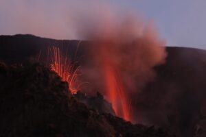
Following the resumption of sustained seismic activity under the eastern flank of the volcano at 15h local time, a volcanic tremor corresponding to the arrival of magma near the surface is recorded since 17:00 local time approximately. At first very weak, the intensity gradually increased until 17:50, time of the first observations by a team of the OVPF of a degassing against the eruption of the 18/02/2019, and against the bottom of the signal of the Enclos.
Further information will follow regarding the precise location of the vent (s).
Soil CO2 concentrations in the volcano deposit area and in the Plaine des Cafres region are in sharp decline, consistent with ongoing magma transfer to the surface.
Note that no deformation was recorded during this phase of magmatic injection to the surface meaning that the dyke that fed this or these new cracks is the same as the one that fed the eruption of 18/02/2019.
Alert level: Alert 2-2.
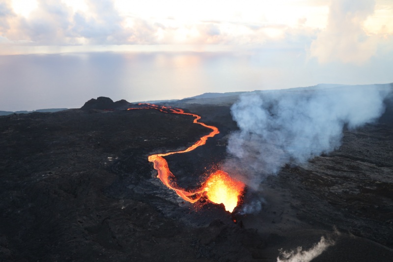
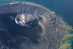
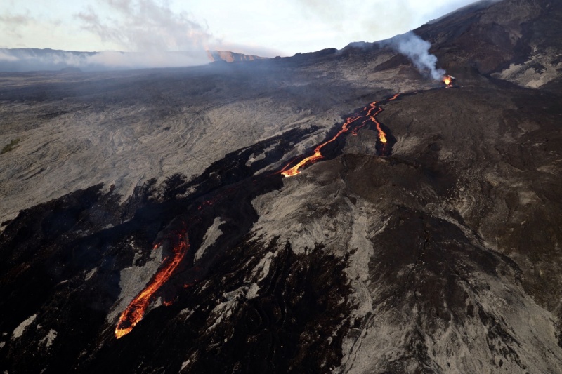
A single crack opened at an altitude of about 1800 meters on the eastern flank of Dolomieu. It lets out at least two lava flows. One of them cuts the crater Madoré and stops in a small lake of liquid fire upstream of the Guyana crater. The second arm of lava descends the slopes and has already reached the site of the fire that devastated part of the Grand-Brûlé Sainte-Rose side last January.
Wide of about 1300 meters, the casting front spreads over 1600 meters and moves relatively fast.
Source : OVPF. ipreunion.com
Photos : rb/www.ipreunion.com
Indonesia , Bromo :
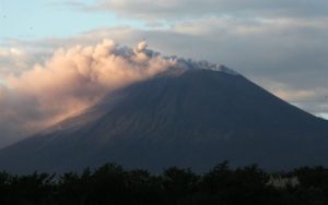
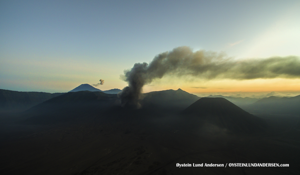
An eruption occurred on Mount Bromo on Tuesday (2/19) in the morning. But the eruption did not hinder the flights that crossed the region of the volcano in the province of East Java.
The head of the Volcanological and Geological Disaster Mitigation Center (PVMBG), said the eruption of Mount Bromo occurred around 6 am with a height of the ash column above the crater observed around 600 meters.
« Currently, Mount Bromo is at Level II [Waspada] with recommendations that the community around Mount Bromo and visitors or mountaineers are not allowed to enter the area within a radius of 1 km around the active crater. « , Kasbani said via the courier service CNNIndonesia.com, Tuesday (2/19).
Kasbani describes the eruption ash column that occurred this morning as white to brown, of medium to thick intensity, inclined to the Northeast, East, Southeast.
He added that continuous emissions with a continuous seismic tremor amplitude of 0.5 to 1 millimeter and a dominant value of mostly 1 millimeter.
Source : CNN Indonésie .
Photo : Oystein Lund Andersen .
Colombia , Chiles / Cerro Negro :
Weekly activity bulletin of Chiles and Cerro Negro volcanoes
The activity level of volcanoes continues at the level: LEVEL YELLOW ■ (III): CHANGES IN THE BEHAVIOR OF THE VOLCANIC ACTIVITY.
Following the activity of the CHILE and CERRO NEGRO volcanoes, the COLOMBIAN GEOLOGICAL SERVICE (SGC) reports that:
Between 12 and 18 February 2019, seismicity in the Chiles – Cerro Negro volcanoes region showed a significant increase in frequency and energy, from a total of 2864 events recorded the previous week to 8865 events recorded this week; the seismic energy went from 3.97×10¹⁵ ergs to 6.32×10¹⁷ ergs.
As usual, the vast majority of events were associated with fracturing of the cortical material, which, compared to the top of the Chiles volcano (4700 m) was preferentially located in three springs, the first located south of Chiles volcanic edifice, at distances between zero and 3 km, with a depth of less than 7 km; the second intermediate source to the south-east, with distances between 4 and 6 km and a depth of between 6 and 11 km; and the third farthest source, also to the southeast, with distances between 11 and 14 km and a depth of less than 9 km.
The results of two energy events with ML values (local magnitude) of 4.9 and 4.0 on February 14 at 1:24 and 1:49 local time are highlighted. as being felt in the area of influence of the Chiles volcano, in the republics of Colombia and Ecuador. The swarm produced during this activity recorded 3198 VT type earthquakes for 14, 2170 VT for 15 and 1391 VT for 16 February.
In total, earthquake reports were received for 10 events.
Although activity has decreased, it is not excluded that similar episodes of energetic earthquakes felt by communities will reappear in the future.
The COLOMBIAN GEOLOGICAL SERVICE is attentive to the evolution of the volcanic phenomenon and will continue to inform in a timely manner of the observed changes.
Source : SGC.
Mexico , Popocatepetl :
The National Coordination of Civil Protection (CNPC), through the National Center for Disaster Reduction (CENAPRED), reported the formation of a dome in the crater of the Popocatepetl volcano.
He said that, after two overflights, which aimed to evaluate the recent activity of the volcano and measure gas emissions, it was possible to verify the formation of the number 82 dome in the crater Don Goyo, which measures approximately 200 meters in diameter.
It was reported that the warning level of the volcano remained in phase 2 Amarillo and that in the coming days, another episode of dome growth could occur, involving an activity similar to that of last Thursday, February 14, in which Strombolian type explosions trains have been recorded, ie relatively small explosions projecting incandescent fragments at relatively short distances.
The other scenario is considered for this activity is that the dome is destroyed by a Vulcanian type explosion, that is to say that are ejected fragments at a greater distance and produces a column of ash several kilometers high as has been observed before.
Source : La Prensa
Video : Cenapred.
Philippines , Mayon :
MAYON VOLCANO BULLETIN 20 February 2019 08:00 A.M.
Mayon Volcano’s seismic monitoring network did not detect any volcanic earthquake during the 24-hour observation period. Moderate emission of white steam-laden plumes that drifted west-northwest and north-northwest was observed. Fair crater glow from the summit could be observed at night. Sulfur dioxide (SO2) emission was measured at an average of 2236 tonnes/day on 16 February 2019. Precise leveling data obtained on 25 January-03 February 2019 indicate a slight deflation of the edifice relative to 08-13 December 2018. However, continuous GPS and electronic tilt data show inflation of the mid-slopes since June 2018.
Alert Level 2 currently prevails over Mayon Volcano. This means that Mayon is at a moderate level of unrest. DOST-PHIVOLCS reminds the public that sudden explosions, lava collapses, pyroclastic density currents or PDCs and ashfall can still occur and threaten areas in the upper to middle slopes of Mayon. DOST-PHIVOLCS recommends that entry into the six kilometer-radius Permanent Danger Zone or PDZ and a precautionary seven kilometer-radius Extended Danger Zone or EDZ in the south-southwest to east-northeast sector, stretching from Anoling, Camalig to Sta. Misericordia, Sto. Domingo must be strictly prohibited. People residing close to these danger areas are also advised to observe precautions associated with rockfalls, PDCs and ashfall. Active stream/river channels and those identified as perennially lahar-prone areas on all sectors of the volcano should also be avoided especially during extreme weather conditions when there is heavy and prolonged rainfall. Civil aviation authorities must advise pilots to avoid flying close to the volcano’s summit as airborne ash and ballistic fragments from sudden explosions and PDCs may pose hazards to aircrafts.
Source : Phivolcs.