December 14 , 2018.
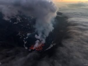
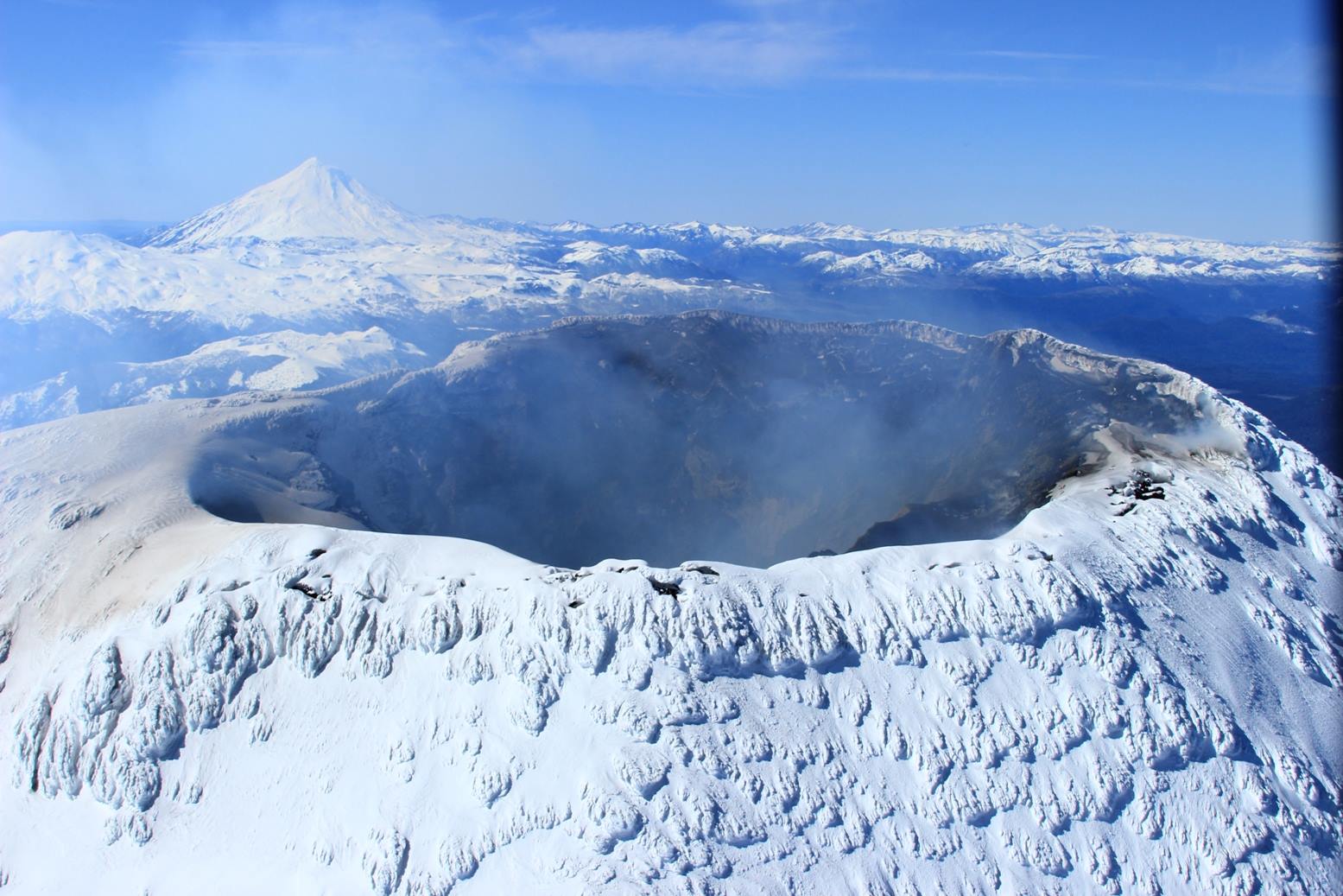
Chile , Villarica :
A total of 4022 seismic events have been recorded, 3984 of which have been classified as long-period type (LP) earthquakes, in relation to fluid dynamics within the volcano, with reduced displacement values of up to 22.7 cm2. In addition, 38 volcano-tectonic (VT) seismic events were recorded associated with rock fracturing. The event with the greatest energy had a local magnitude of M 1.6, and was located 5.0 km east of the active crater and 5.4 km deep.
The volcanic tremor signal, a seismic signal also associated with the dynamics of the fluids within the volcano during the period considered, has been maintained with reduced displacement values of up to 4 cm2. On the other hand, the dominant frequencies are maintained between 1.0 and 2.1 Hz, sometimes with the presence of frequencies around 5 Hz.
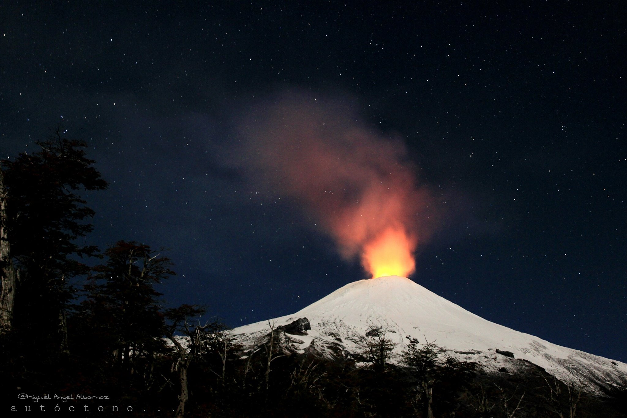
The images recorded with the IP cameras installed near the volcano, when the weather conditions permitted, showed degassing of predominantly whitish color; this one did not exceed 140 m of height. In addition, a night glow is recorded, when the weather conditions allowed to observe it.
The infrasound sensor recorded explosions associated with the surface activity of the lava lake hosted in the main crater, with pressures less than 2 Pascals reduced (value considered low).
According to the data provided by 4 GNSS stations and two (2) electronic inclinometers, it is observed that certain variations exist both in the displacement of the stations and in the lengths of the control lines which cross the active crater, which in principle does not suggest a association with volcanic activity. The inclinometers showed no significant changes attributable to changes in the internal activity of the volcano during the period.
According to the data provided by the differential absorption optical spectrometry equipment (DOAS), Los Nevados and Tralco stations, located 10 km east-north-east and 6 km east-southeast of the crater On the active side, sulfur dioxide emission values of 639 +/- 142 t / d were recorded, with a maximum value of 2414 t / d reported on 19 November. These values are considered low for this volcano.
During the period 11 thermal alerts were reported on the volcano, with a maximum observed Volcanic Radiative Power (VRP) of 4 MW as of 06 November, which is considered moderate, according to data processed by volcanic activity (Mirova) (http://www.mirovaweb.it/).
The seismic activity, in relation with the movements of the fluids, is influenced by the fluctuating dynamics of the lava lake located in the main crater of the volcano which is reflected in the increase of the seismic parameters in relation with the dynamics of the fluids and the thermal anomalies of low intensity. It is noted that the dynamics of the lava lake are fluctuating and that it continues to be located near the surface, so the occurrence of minor explosions affecting the crater environment is not excluded.
As a result, the alert level is maintained at:
GREEN LEVEL: Active volcano with stable behavior – No immediate risk – Time for possible eruption: MONTH / YEARS.
Observation: It is recommended to apply precautionary access restrictions to an area close to the crater with a radius of 500 m.
Source : Sernageomin.
Photos : Miguel Angel Albornoz , Insivumeh.
Colombia , Nevado del Ruiz :
Subject: Level of activity of bulletins of the Nevado del Ruiz volcano.
The level of activity continues at the level: Yellow activity level or (III): changes in the behavior of volcanic activity.
With regard to monitoring the activity of the Nevado del Ruiz volcano, the COLOMBIAN GEOLOGICAL SERVICE announces that:
Over the past week, the seismicity caused by rock fracturing has shown similar levels in earthquake numbers and released seismic energy compared to the previous week. The earthquakes were mainly located in the Arenas crater and in the south-east, north-east and south of the volcano at depths between 0.6 and 6.8 km. The maximum magnitude recorded during the week was 1.3 ML (local magnitude), corresponding to the earthquake on December 10 at 00:34 (local time) located southeast of the volcano, 7 km from the crater Arenas, 3 , 1 km deep.
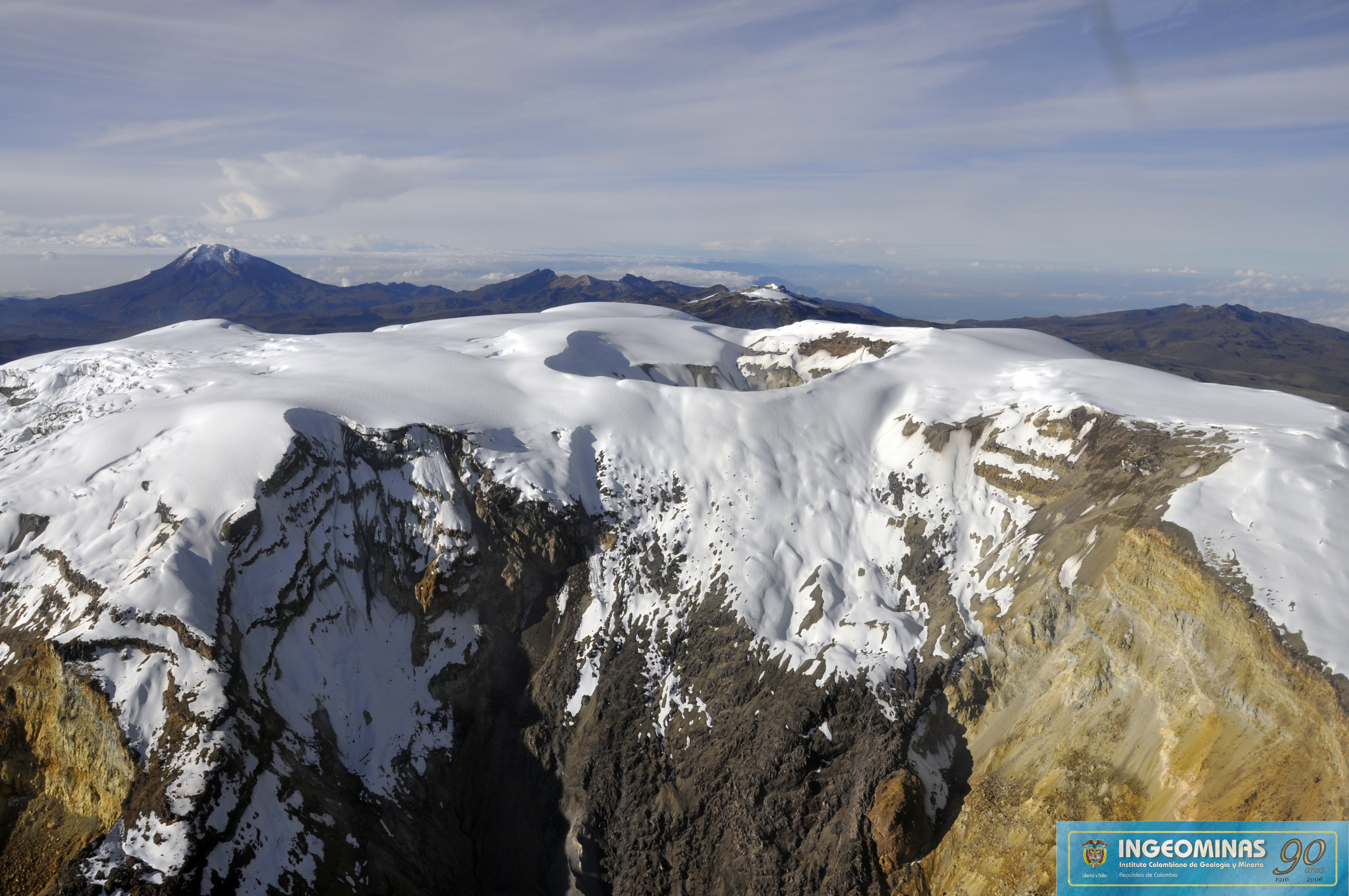
Seismicity related to fluid dynamics within the channels of the volcanic structure showed a slight increase in the number of earthquakes and released seismic energy compared to the previous week. This activity was characterized by the presence of earthquakes with variable energy levels, long period, very long period and tremor pulses. The earthquakes occurred mainly in the crater Arenas and its surroundings.
Volcanic deformations measured from electronic inclinometers, GNSS (Global Navigation Satellite System) stations and radar images have so far shown stability behavior without recording significant deformation processes of the volcanic structure.
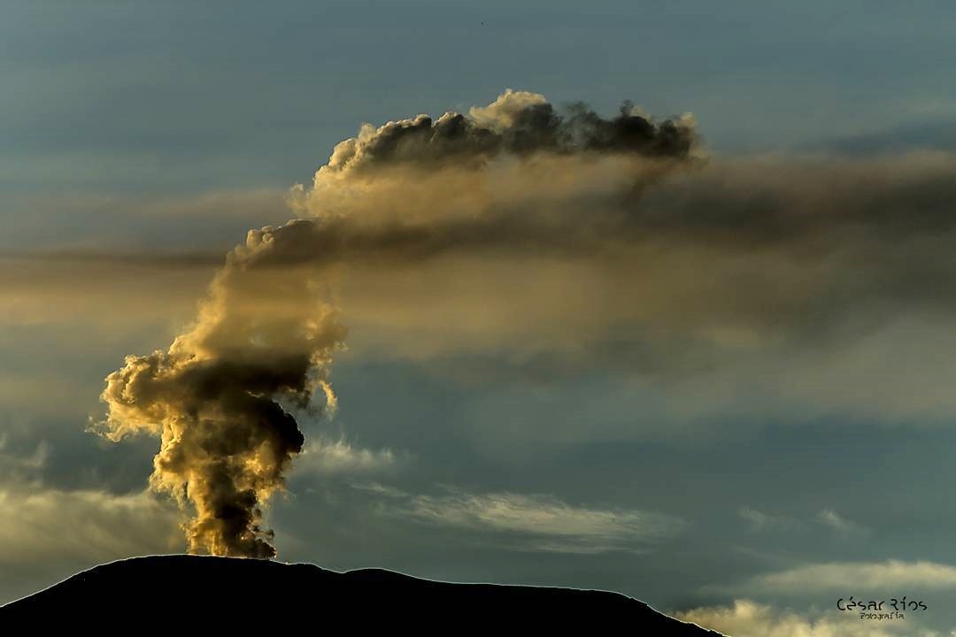
The volcano continues to emit water vapor and gases into the atmosphere, among which is the sulfur dioxide (SO2), as evidenced by the values obtained by the SCANDOAS stations installed in the region of the volcano. satellite image analysis. During the week, the NASA FIRMS and MIROVA portals reported several low-energy thermal anomalies.
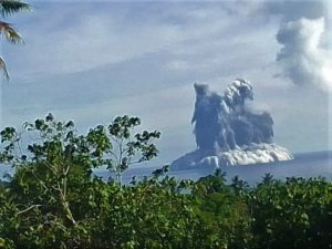
The column of gas and steam reached a maximum height of 1600 m, measured at the top of the volcano on December 6. The direction of dispersal of the column was governed by the direction of the wind in the area, which predominated to the north-west and north-east of the volcano.
The Nevado del Ruiz volcano continues its activity at the level yellow.
Source : SGC.
Photos : Ingeominas ( archives) , Cesar Rios .
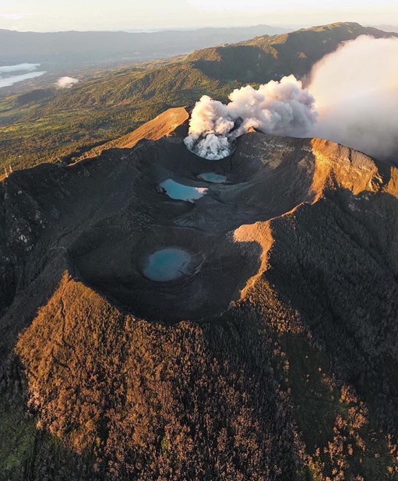
Guatemala , Pacaya :
SPECIAL VOLCANOLOGICAL BULLETIN, Guatemala 13 December, 22:00 (local time). INCREASE IN THE ACTIVITY of VOLCÁN PACAYA (1402-11)
Type of activity: Strombolian
Morphology: Composite Stratovolcano
Geographical location: 14 ° 22’50˝ Latitude N; 90 ° 36’00˝ Longitude O.
Altitude: 2,552msnm
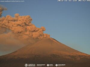
At this time, OVPAC reports significant changes in the volcanic structure of Pacaya volcano, with weak to moderate rumblings within a radius of about 8 kilometers. Small strombolian explosions are generated, projecting materials at a height of approximately 25 to 50 meters.
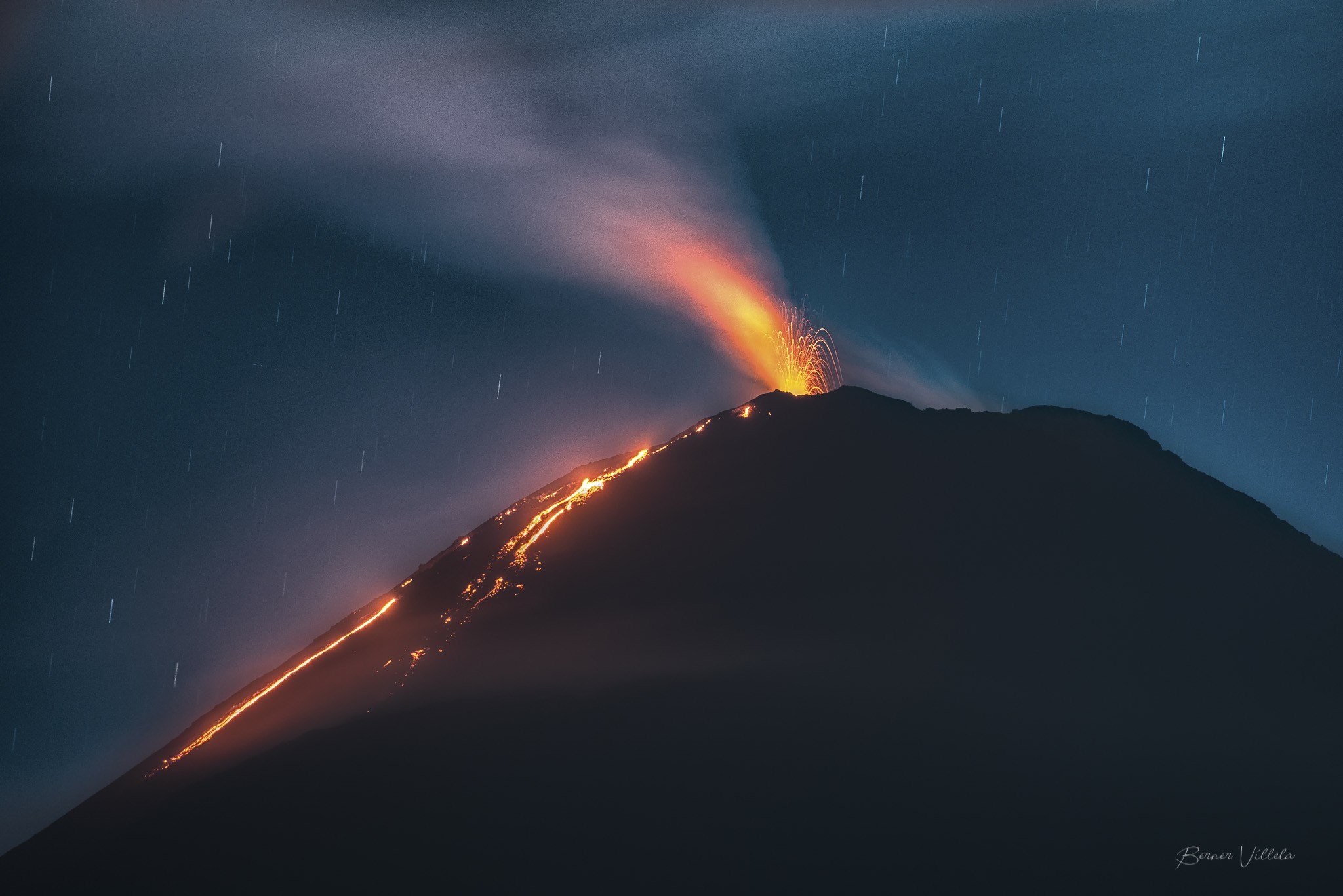
It is important to remember that in recent months, the Pacaya volcano has maintained changes in seismic activity due to the presence of lava flows of different length and orientation, producing a constant tremor recorded by the PCG seismic station. These lava flows today are observed on the northwest flank, descending towards Cerro Chino, over an approximate length between 200 and 300 meters. Due to the slope of the Mackenney cone in this area, constant avalanches are generated, allowing to observe incandescent materials up to 1 meter in diameter. As observed during this eruptive phase, the construction of the intra-crater cone continues and, to this day, it has filled the crater of the Mackenney cone and it is possible that today it exceeds 75 meters in height .
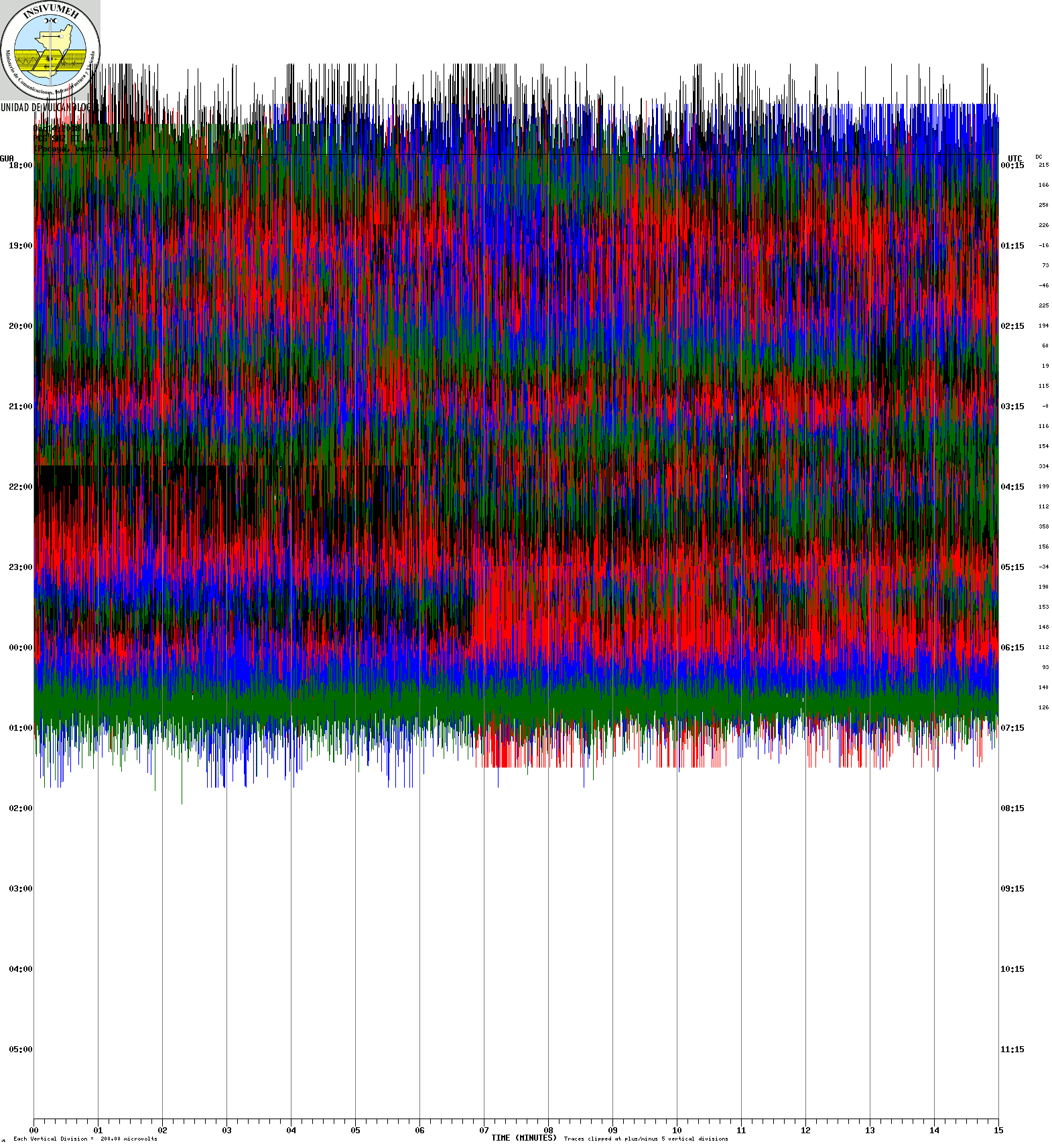
Due to the presence of this activity, the possibility of generating lava flows in greater quantity and recurrence is not excluded. Even a new eruptive phase could be initiated in the next days or months.
Source : Insivumeh
Photo : B Villela .
Costa Rica , Turrialba :
10.025°N, 83.767°W
Elevation 3340 m
OVSICORI-UNA reported continuing activity at Turrialba during 5-11 December. A minor emission from the vent was visible on 5 December, and an ash emission drifted S the next day. An event at 0749 on 8 December produced an ash plume that rose 500 m and drifted NW. Emissions of ash, steam, and gas rose as high as 1 km on 9 December and caused ashfall in areas of Valle Central. On 10 December diffuse emissions were periodically observed during periods of clear viewing. That same day ash fell in Moravia (31 km WSW) and Santa Ana, and residents of Heredia (38 km W) noted a sulfur odor.
Daily report on the state of volcanoes. OVSICORI-UNA
Date: December 13, 2018., Updated at: 11:17:00.
Since 22 November 2018, the Turrialba volcano has been erupting continuously. Its column rises 500 meters above the height of the crater and at 3,840 meters above sea level. (meters above sea level, 12595.2 ft).
The seismic activity is similar to that of yesterday.
At the time of writing, winds are blowing from the southwest.
The emission of ashes has decreased compared to yesterday. The plume still contains particles and pulses were observed in the morning.
Ash falls are reported in the central valley.
Source: GVP , Observatoire scientifique et social du Costa Rica – Université nationale (OVSICORI-UNA).
Photo : jcarvaja17