November 05 , 2018.
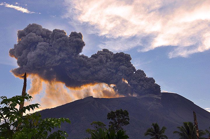
Guatemala , Fuego :
SPECIAL BEFGO VULCANOLOGICAL BULLETIN # 195-2018: INCREASE IN ACTIVITY. Guatemala 4 November 2018, 07:00 hours (Local time).
Type of activity: Vulcanian
Morphology: Composite Stratovolcano.
Geographical location: 14 ° 28’54˝ N Latitude; 90 ° 52’54˝ Longitude W.
Altitude: 3,763msnm.
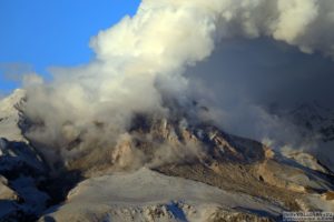
The Fuego volcano has shown a slight increase in activity in recent days. Currently, there is a slight outgassing at an altitude of approximately 4,600 m (15,092 feet) dispersed in a west and southwest direction.
There are 10 to 15 explosions per hour, with light to moderate features, ash columns at a height of approximately 4,500 to 4,700 meters (14,764 to 15,420 feet) moving 12 to 15 km to the west and the Southwest. This causes falls of ashes to Panimaché, El, Porvenir, Morelia, Santa Sofia, Sangre de Cristo, Finca Palo Verde, San Pedro Yepocapa, among others.
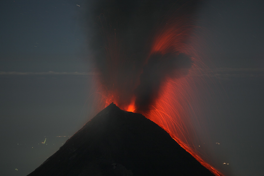
At night and early in the morning, incandescence was observed at an approximate height of 200 to 300 meters above the crater, causing weak to moderate avalanches on the crater contour, some reaching long distances to vegetation. Similarly, 600-meter lava flows were observed towards the Taniluyá and Ceniza ravines. The explosions are accompanied by low to moderate rumbling, weak and sensitive shockwaves in the volcanic perimeter, causing vibrations in the roofs and windows of dwellings near the volcano, and noises that resemble a locomotive.
The seismic recording of the FG3 station shows slight increases associated with outgassing, explosions, avalanches and lava flows. Because of these parameters, it is possible that this increase in activity may be the beginning of a new eruptive phase in the next hours or days, so that INSIVUMEH maintains constant surveillance.
Source : Insivumeh.
Photo : Auteur inconnu.
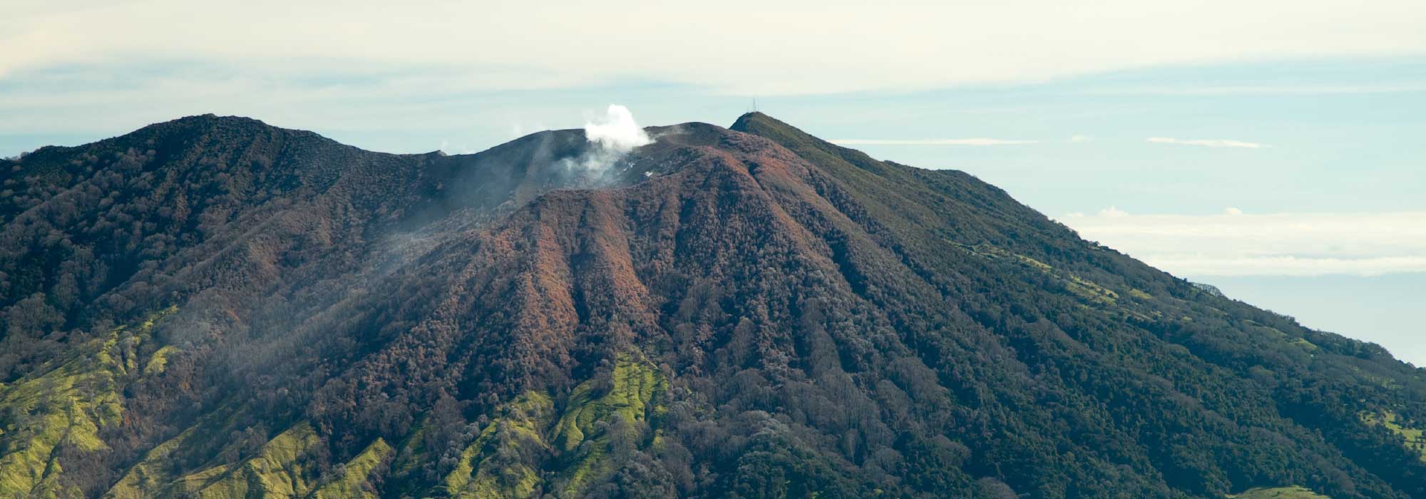
Costa Rica , Turrialba / Rincon de la Vieja :
Turrialba and Rincon de la Vieja volcanoes in Costa Rica are very active.
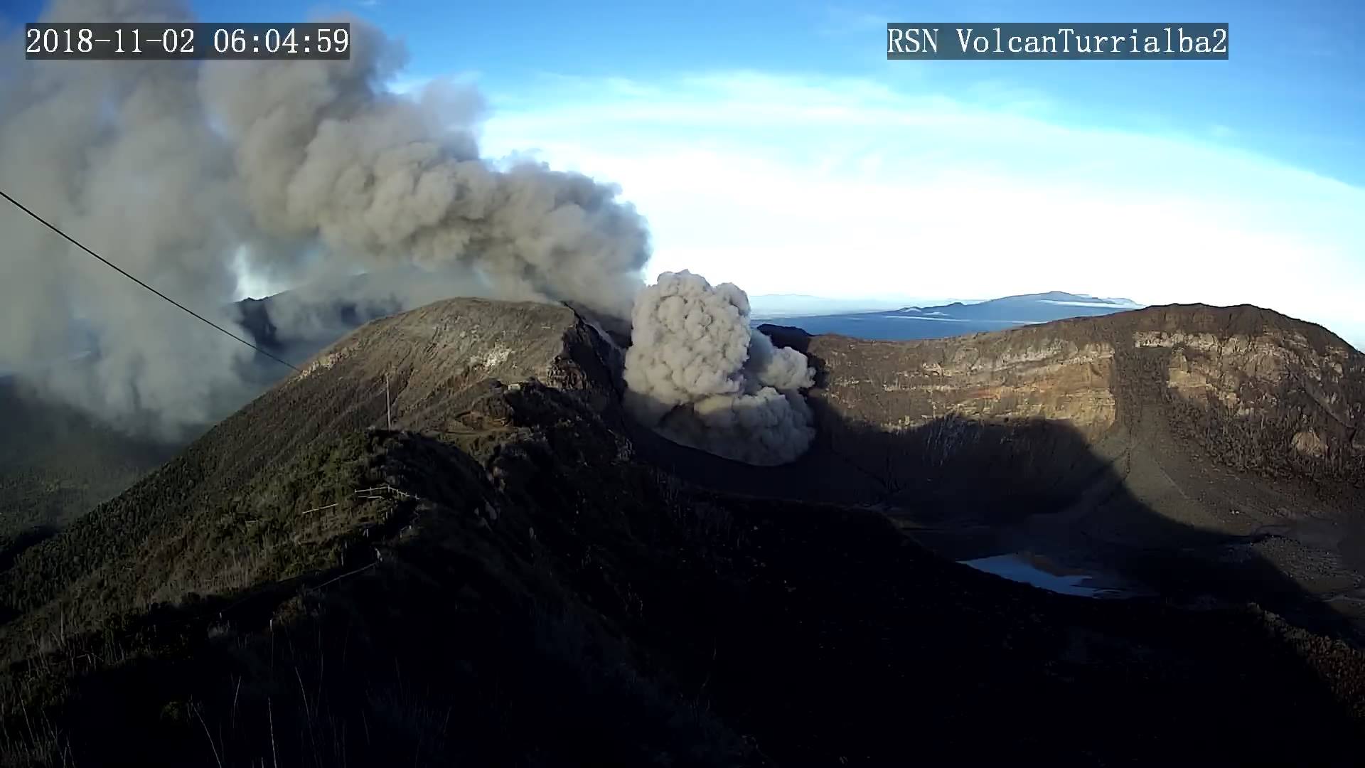
This Sunday, November 4, two of the volcanoes of Costa Rica recorded a significant activity. Turrialba volcano in Cartago had an eruption with a column of ash up to 500 meters above the crater or 3,484 meters above sea level (1,255 ft.).
In Guanacaste, the Rincon de la Vieja volcano began its activity at 19:45, the weather conditions at the time of the eruption did not confirm the height reached by the column. The activity lasted nearly 12 minutes with an eruptive sequence of at least three episodes of two minutes each, the neighboring community reported a smell of sulfur.
The Turrialba volcano has recorded several eruptions since the beginning of October. Before this Sunday’s activity, he had also had a significant activity on November 2nd; while Rincon de la Vieja recorded its last eruption on 17 October.
Turrialba Volcano Activity Report, 4 November 2018.
November 4, 2018 in ?? local time, there is an eruption on the volcano Turrialba, with a column that rose 500 meters above the height of the crater and 3840 m.s.n.m. (meters above sea level) (12595.2 ft).
Duration of the activity: in progress.
The winds blow in the West.
Fall of ash reported in: No ash drop
Sulfur odor reported in: No sulfur odor reported
Comments: Now that the volcano is clear, the continuous emission of diluted ash can be confirmed.
Activity report of the Rincón de la Vieja volcano, November 4, 2018.
On November 4, 2018 at 19:45 local time, there is an eruption on the volcano Rincon de la Vieja; the height reached by the column is unknown because of the visibility conditions of the site.
Duration of the activity: 12 minutes.
Fall of ash reported in: No ash drop
Sulfur odor reported in: No sulfur odor reported
Comments: Eruptive sequence of at least 3 episodes of 2 min each.
Source : news.co.cr , Ovsicori .
Photo : RSN , Ovsicori.
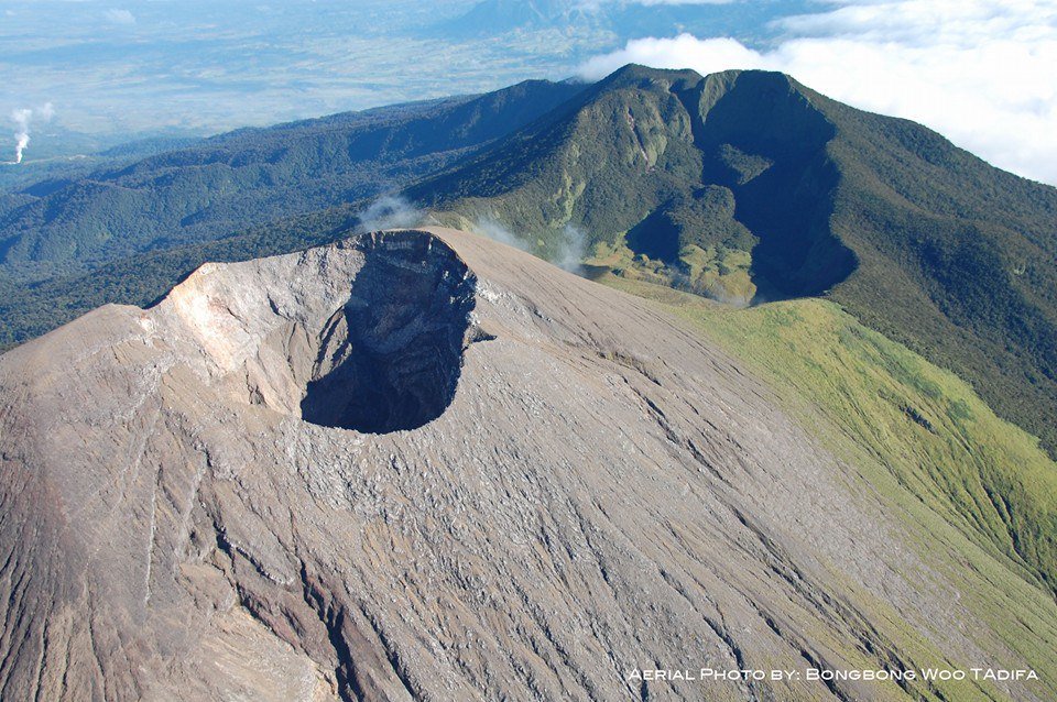
Philippines , Kanlaon :
KANLAON VOLCANO BULLETIN 05 November 2018 08:00 A.M.
Kanlaon Volcano’s seismic monitoring network recorded fifteen (15) volcanic earthquakes during the past 24 hours. Moderate emission of white steam-laden plumes that rose 200 meters before drifting northwest was observed. Ground deformation data from continuous GPS measurements indicate pronounced inflation of the edifice since December 2017, signifying pressurization beneath the edifice. Sulfur dioxide (SO2) emission was measured at an average of 146 tonnes/day on 31 October 2018.
Alert Level 2 status prevails over Kanlaon Volcano, which means that the volcano is undergoing a moderate level of unrest due to probable intrusion of magma at depth that may or may not lead to a magmatic eruption. The local government units and the public are strictly reminded that entry into the 4-kilometer radius Permanent Danger Zone (PDZ) is strictly prohibited due to the further possibilities of sudden and hazardous steam-driven or phreatic eruptions. Civil aviation authorities must also advise pilots to avoid flying close to the volcano’s summit as ejecta from any sudden phreatic eruption can be hazardous to aircraft.
DOST-PHIVOLCS is closely monitoring Kanlaon Volcano’s activity and any new development will be relayed to all concerned.
Source : Phivolcs
Photo : Bongbong Woo Tadifa.
Indonesia : Gamalama :
Level of activity at Level II (WASPADA). The Gamalama (1715 m altitude) presented a minor eruption on October 4, 2018 at 11:52 (Paris time). There is a column of ash up to 250 meters above the summit or 1965 m above sea level.
Since yesterday and until this morning, the vision of the volcano was clear until it was covered with fog, the smoke of the crater was not observed above the summit. The wind is blowing weakly to the North-North-East.
Thanks to the seismographs, on November 3, 2018, it was recorded:
1 volcanic earthquake
3 emission earthquake.
18 distant tectonic earthquakes
2 local tectonic earthquakes
Recommendation: Communities around G. Gamalama and visitors / tourists should not move within 1.5 km of the summit crater. During the rainy season, residents of the river descending from G. Gamalama are aware of the potential threat of secondary dangers in the form of lahar flow.
VONA: Last message VONA received the YELLOW color code, published on October 10, 2018 at 7:26 pm WIB, for smoke puffs from the crater at about 1725 m above sea level or about 10 m above the summit.
Source : PVMBG
Photo : Auteur inconnu