August 25 , 2018.
Italy / Sicily , Etna :
Etna: eruptive activity at the new crater South-East, 23-24 August 2018.
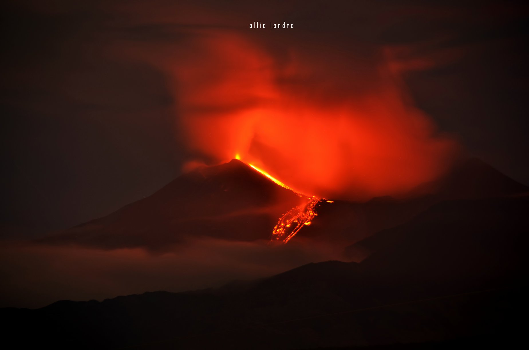
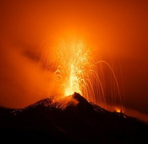
After waking up in July (https://ingvvulcani.wordpress.com/2018/07/24/letna-da-segni-di-risveglio-attivita-stromboliana-in-area-sommitale/) and progressive intensification from eruptive activity to the craters of the summit (https://ingvvulcani.wordpress.com/2018/08/23/aumenta-di-intensita-lattivita-eruttiva-sommitale-delletna/), Etna has launched a new episode of strombolian activity and emission of lava flows during the night of August 23-24, 2018 (Fig. 1).
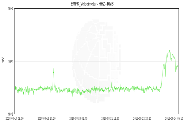
At the end of the afternoon of August 23, a sudden increase in the amplitude of the volcanic tremors (Fig 2) announced the beginning of a low explosive activity from the so-called saddle mouth, at mid -walk between the old crater South-East and the new crater South-East.
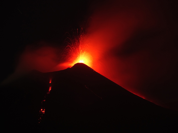
This activity quickly became almost continuous with launches of incandescent lava bombs up to about 100-150 m above the crater. Around 8:30 pm (local time), a small lava flow emitted by another mouth of the new Southeast crater, located on the east flank of its cone, was observed; lava emission was accompanied by sporadic and weak explosions from the same mouth. This flow slowly lengthened towards Valle del Bove (east side), slowing down after having traveled a few hundred meters. Shortly afterwards, a lava outflow from the « mouth of the saddle » spilled onto the northern flank of the cone of the new Southeast Crater and began to reach its base in the late evening (Figure 3).
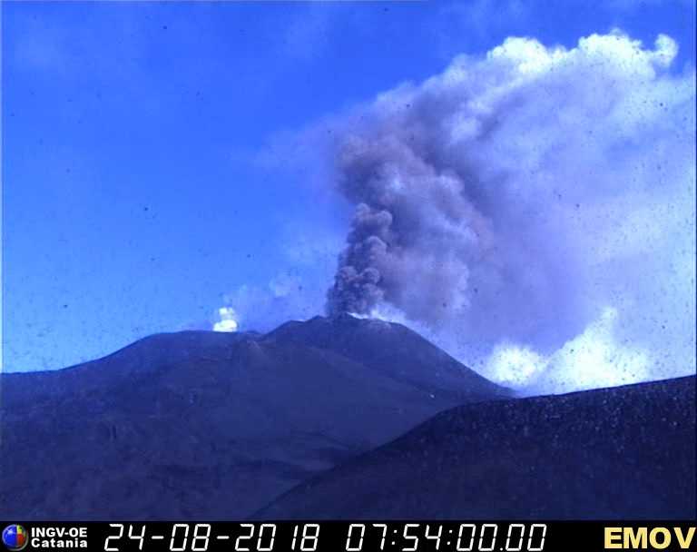
In the following hours, activity continued without significant changes. At dawn on August 24, the amplitude of volcanic tremor began to decrease slightly and Strombolian activity was less intense. However, in the morning, a new small lava flow was observed towards the south side of the cone of the new south-east crater, which reached a length of a few tens of meters. After 9:20, a continuous ash emission also began (Fig. 4) and fed a high plume several hundred meters above the crater.
Today, August 24, at 11 am, the eruptive phenomenon is in full swing.
The phenomenon is constantly monitored by the Etneo Observatory of the National Institute of Geophysics and Volcanology (INGV).
https://www.facebook.com/myetnamap/videos/2094371620607418/
Source : INGV Comunicazione.
Photos : Alfio Leazndro , INGV
Video : Eruzione Etna – 23/24 agosto 2018 [Timelapse]
© Marco Restivo • Giuseppe Distefano
www.myetnamap.it
Alaska , Great Sitkin :
52°4’35 » N 176°6’39 » W,
Summit Elevation 5709 ft (1740 m)
Current Volcano Alert Level: ADVISORY
Current Aviation Color Code: YELLOW
Low-level unrest continues at Great Sitkin Volcano. Over the past week the rate of small earthquakes located beneath the summit has increased slightly, although the rate of these quakes is not unusual since unrest began in July of 2016. A seismic event that may represent a small steam explosion was observed on Tuesday August 21 at 12:37 AM Alaska Time. This event was considerably smaller than those observed in June and August 2018 and in 2017 and explosive activity was not confirmed by satellite imagery or infrasonic measurements. Satellite observations have been mostly obscured by clouds over the past week.
Great Sitkin Volcano is monitored with a local real-time seismic network, which will typically allow AVO to detect changes in unrest that may lead to an explosive eruption. Rapid detection of an ash-producing eruption would be accomplished using a combination of seismic, infrasound, lightning, and satellite data.
Great Sitkin Volcano is a basaltic andesite volcano that occupies most of the northern half of Great Sitkin Island, a member of the Andreanof Islands group in the central Aleutian Islands. It is located 43 km (26 miles) east of the community of Adak. The volcano is a composite structure consisting of an older decapitated volcano and a younger parasitic cone with a 2-3 km diameter summit crater. A steep-sided lava dome, emplaced during an eruption in 1974, occupies the center of the crater. Great Sitkin erupted at least three times in the 20th century, most recently in 1974. That eruption produced a lava dome and at least one ash cloud that likely exceeded an altitude of 25,000 ft above sea level. A poorly documented eruption occurred in 1945, also producing a lava dome that was partially destroyed in the 1974 eruption. Within the past 280 years a large explosive eruption produced pyroclastic flows that partially filled the Glacier Creek valley on the southwest flank.
Source : AVO
Mexico , Popocatepetl :
August 24, 11:00 am (August 24 at 4:00 pm GMT)
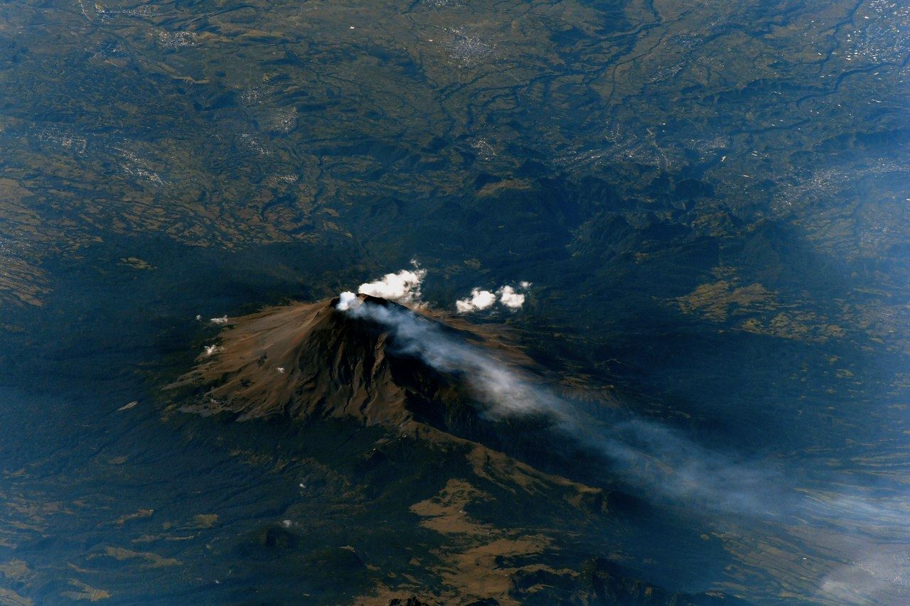
In the last 24 hours, thanks to the surveillance systems of the Popocatepetl volcano, 45 low intensity exhalations have been identified, accompanied by water vapor and other gases. Yesterday also, a volcano-tectonic earthquake was detected at 14:30 with a magnitude of 1.9 Mc and two explosions at 12:57 and 20:30.
During the night, an incandescence was observed which increased at the time of the exhalations.
At the time of writing this report, there is an intermittent release of water vapor and gas that winds are scattering to the southwest.
CENAPRED urges not to approach the volcano and especially the crater, because of the danger of falling ballistic fragments, and in case of heavy rains to move away from the bottom of the ravines because of the risk of landslides and floods. mud.
The warning light of the Popocatepetl volcano is located at Amarillo Phase 2.
Source : Cenapred
Hawaï : Kilauea :
19°25’16 » N 155°17’13 » W,
Summit Elevation 4091 ft (1247 m)
Current Volcano Alert Level: WATCH
Current Aviation Color Code: ORANGE
Kīlauea summit and lower East Rift Zone
Seismicity and ground deformation are negligible at the summit of Kīlauea Volcano. On the volcano’s lower East Rift Zone (LERZ), only a few ocean entries were oozing lava and laze plumes were minimal from overflights early this week. Sulfur dioxide emission rates at both the summit and LERZ are drastically reduced; the combined rate is lower than at any time since late 2007. On Tuesday, the SO2 emissions from the LERZ were too low to measure although SO2 smells were noticed. Our overflight, originally scheduled for this morning, was cancelled due to weather. The next overflight is scheduled for Monday morning.
https://www.facebook.com/cara.kaeola/videos/735434050128340/
Major Hurricane Lane continues to move slowly northward and is forecast to pass to the west of the island of Hawaiʻi during the day and evening. The hurricane should not have a significant effect on the eruption aside from minor rockfalls at the summit and increased steaming from Puʻu ʻŌʻō and LERZ vents. Whiteout conditions could occur on the new lava field due due to steam produced by heavy rainfall on still-hot lava flows.
The Hawaiian Volcano Observatory (HVO) will continue to closely monitor Kīlauea’s seismicity, deformation, and gas emissions for any sign of reactivation, and maintain visual surveillance of the summit and LERZ as best we can during the next few days while Hurricane Lane passes. Ground crews are not working in the field today and, possibly, tomorrow but remain on call should any changes in the volcano develop.
HVO will continue to issue daily updates and additional messages as needed. The next update will be issued tomorrow morning unless significant changes occur.
Source : HVO
Video : Cara Keola.

