July 02 , 2022.
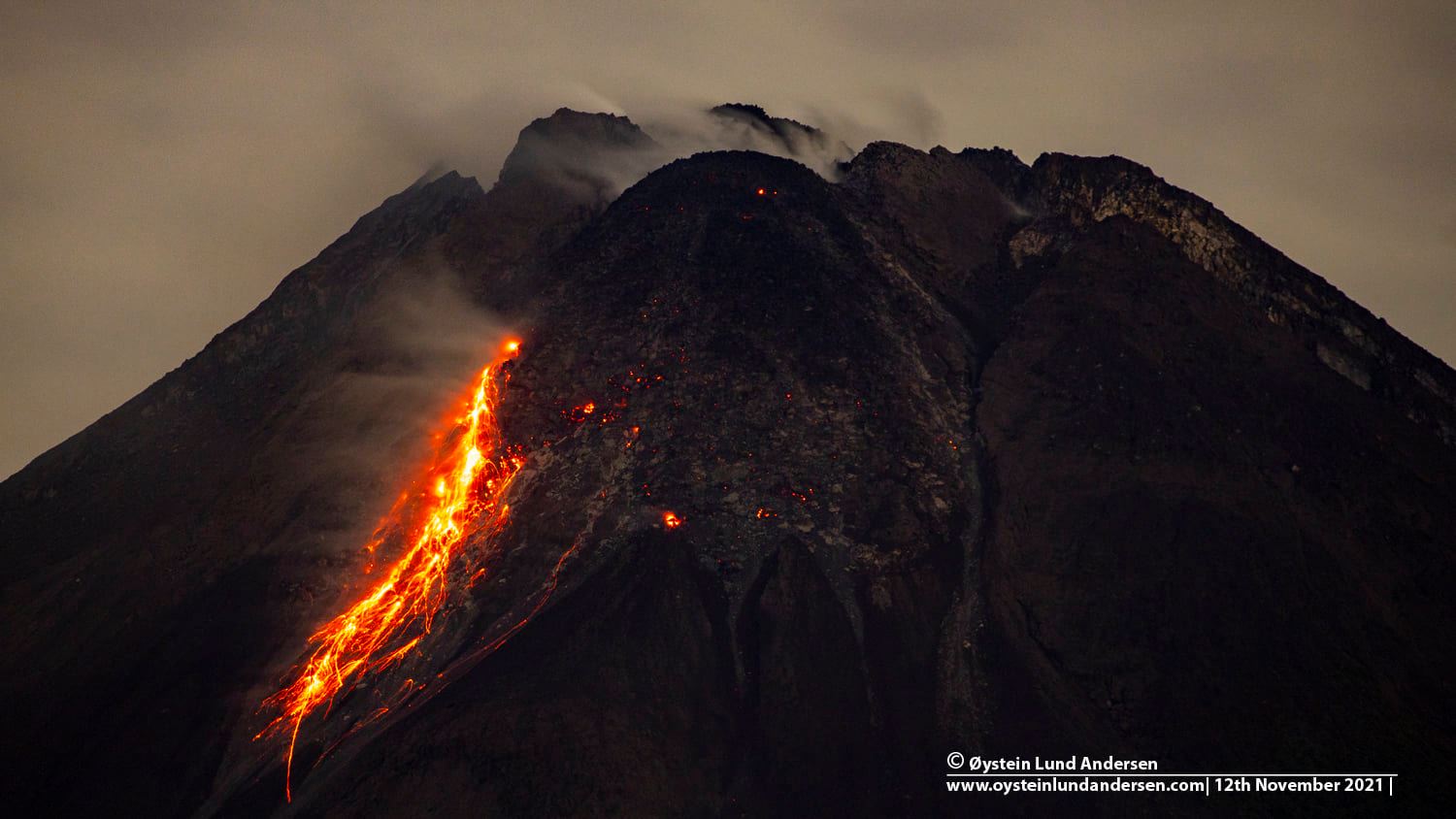
Indonesia , Merapi :
Mount Merapi activity report from June 24 to 30, 2022
– This week, 69 lava avalanches were observed in a southwesterly direction, descending the Bebeng River with a maximum sliding distance of 1800 m.
– For the southwest dome, there is no change in the height of the dome. For the central dome, no significant morphological change was observed. According to photo analysis, the volume of the Southwest lava dome is 1,551,000 m3 and that of the central dome is 2,582,000 m3.
Seismicity:
This week, the seismicity of Mount Merapi recorded:
13 shallow volcanic earthquake (VTB),
22 multi-phase earthquakes (MP),
604 avalanche earthquakes (RF),
10 emission earthquakes (DG),
6 tectonic earthquakes (TT).
– The intensity of seismicity this week is still quite high.
Mount Merapi’s deformation, which was monitored using EDM this week, showed a distance shortening rate of 0.2 cm/day.
Rainfall intensity of 40 mm/hour for 30 minutes is recorded at Kaliurang Post on June 24, 2022. No reports of lahars or additional flow in rivers that originate at Mount Merapi.
Conclusion:
1. Merapi volcanic activity is still quite high in the form of effusive eruption activity. The state of the activity is defined at the « SIAGA » level.
2. The current potential danger is lava avalanches and hot clouds in the South-South-West sector covering the Boyong River for a maximum of 5 km, the Bedog River, Krasak, Bebeng for a maximum of 7 km. The Southeast sector covers the Woro River for a maximum of 3 km and the Gendol River for a maximum of 5 km. Meanwhile, the ejection of volcanic material in the event of an explosive eruption can reach a radius of 3 km around the summit.
The public should not carry out any activity in potentially dangerous areas, anticipate disturbances due to volcanic ash from the Merapi eruption and be aware of the dangers of lahars, especially when it rains around Merapi.
Source : BPPTKG.
Photo : Oystein Lund Andersen
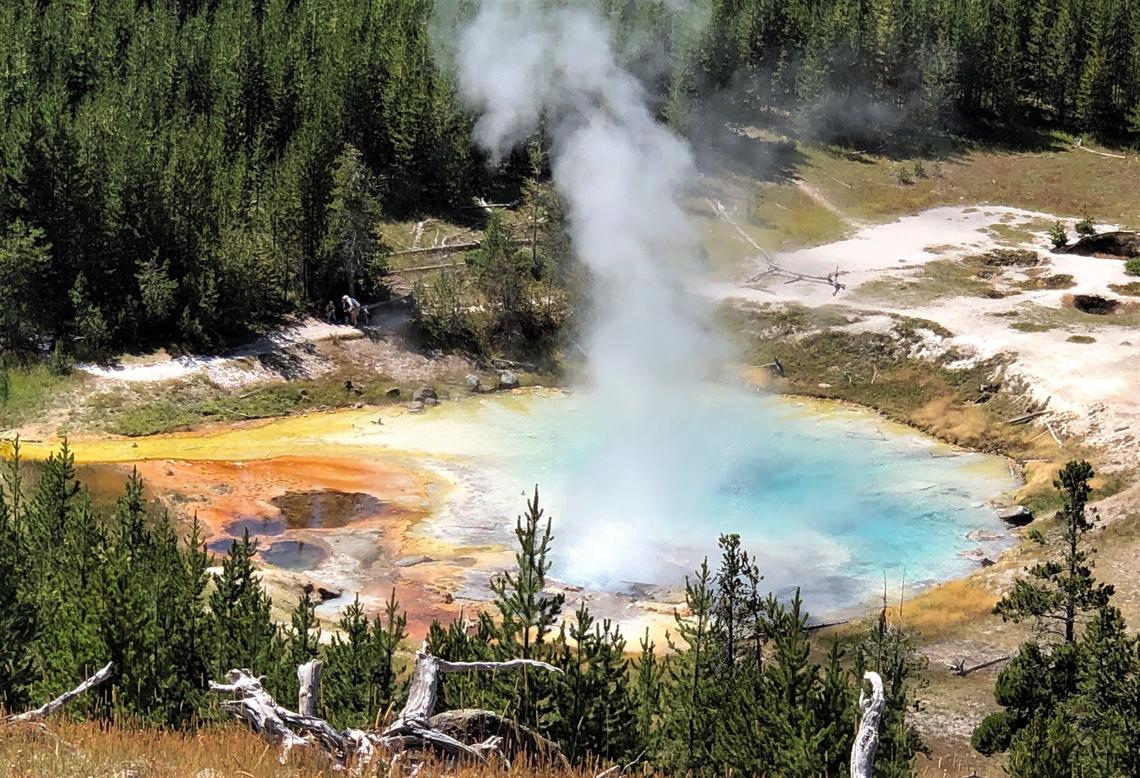
United – States , Yellowstone :
44°25’48 » N 110°40’12 » W,
Summit Elevation 9203 ft (2805 m)
Current Volcano Alert Level: NORMAL
Current Aviation Color Code: GREEN
Recent Work and News
The Yellowstone region saw record flooding owing to heavy rainfall and snowmelt during June 10–13. Several roads and bridges were washed out, and many small landslides and rockfalls occurred, especially in the northern part of Yellowstone National Park. Although severe, the flooding is not expected to have any significant impact on seismic or hydrothermal activity in the Yellowstone region. The only potential impact would be on geyser activity, because some geysers tend to erupt slightly more frequently during high-precipitaiton years compared to drier years. The timing shift is subtle but statistically significant.
Steamboat Geyser erupted twice during the past month, on June 10 and June 20; there have now been a total of 8 major water eruptions of the geyser in 2022.
Seismicity
During June 2022, the University of Utah Seismograph Stations, responsible for the operation and analysis of the Yellowstone Seismic Network, located 149 earthquakes in the Yellowstone National Park region. The largest event of the month was a small earthquake of magnitude 2.4 located ~13 miles south-southwest of Mammoth Hot Springs in Yellowstone National Park on June 12 at 9:49 PM MDT.
June seismicity in Yellowstone was marked by three swarms:
1) A swarm of 67 earthquakes, ~13 miles south-southwest of Mammoth Hot Springs in Yellowstone National Park occurred during June 9–14, with the largest event (magnitude 2.4) on June 12 at 9:49 PM MDT.
2) A swarm of 29 earthquakes, continuing in the same area ~13 miles south-southwest of Mammoth Hot Springs occurred during June 20–30. The largest event of the swarm (magnitude 1.4) occurred June 24 at 2:34 PM MDT.
3) A small swarm of 11 earthquakes, ~15 miles south of West Thumb in Yellowstone National Park occurred on June 7. The largest event of the swarm (magnitude 1.5) was recorded on June 7 at 11:39 AM MDT.
Earthquake sequences like these are common and account for roughly 50% of the total seismicity in the Yellowstone region.
Yellowstone earthquake activity remains at background levels.
Ground deformation
Conitinuous GPS stations in Yellowstone Caldera continue to record gradual subsidence of 2–3 centimeters (1 inch) per year, which has been ongoing since 2015. In the area of Norris Geyser Basin, a continuous GPS station suggests slight subsidence of about 2 centimeters (less than 1 inch) over the past 2–3 months.
Source : YVO.
Photo : Pat Shanks.
La Réunion , Piton de la Fournaise :
Piton de la Fournaise activity
Seismicity
In June 2022, the OVPF-IPGP recorded at the level of the Piton de la Fournaise massif in total:
• 47 superficial volcano-tectonic earthquakes (0 to 2.5 km above sea level) under the summit craters;
• 0 deep earthquake (below sea level);
• 342 landslides (in the Cratère Dolomieu, the ramparts of the Enclos Fouqué and the Piton de Crac, and the Rivière de l’Est).
The month of June 2022 will have been marked by low seismicity at the level of Piton de la Fournaise with an average of 1.5 superficial volcano-tectonic earthquakes per day.
Most of these events were located below the northern rim of the Dolomieu crater.
The month of June was also marked by numerous (342) landslides (in the Cratère Dolomieu, the ramparts of the Enclos Fouqué and mostly at the Casse de la Rivière de l’Est; but their number is down compared to the April (1222) and May (619).

Deformation
After the end of the last eruption, on January 17, 2022, a slight recovery in peak inflation was recorded. This, after accelerating in mid-April, stopped in mid-May before resuming in early June at a relatively low rate.
This inflation is linked to a weak pressurization of the superficial magmatic reservoir located at about 1.5-2 km depth.
CO2 concentration in the soil
Following the eruption of December 2020, a continuous increase in CO2 emissions from the ground is recorded at the level of the distal sites (Plaine des Cafres sectors) but also proximal (Gîte du volcan).
Source : OVPF
Read the full article :https://www.ipgp.fr/sites/default/files/ovpf_20220701_bullmensu.pdf
Photo : Imaz Press
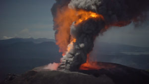
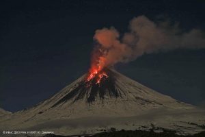
Kamchatka , Chikurachki :
50.32 N, 155.46 E;
Elevation 1816 m (5956 ft)
Aviation Colour Code is ORANGE
The explosive eruption of the volcano continues. Ash explosions up to 6 km (19,700 ft) a.s.l. could occur at any time. Ongoing activity could affect low-flying aircraft.
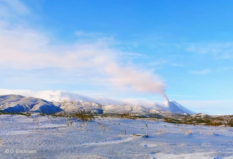
Satellite data by KVERT showed the explosive activity of the volcano began around 00:30 UTC on June 30. Explosions sent ash up to 4.5 km a.s.l., and the ash plume extended for 300 km to the west and for 50 km to the southsoutheast of the volcano; a thermal anomaly was noted in the volcano area on 30 June.
Source : Kvert.
Photo : O. Vasiliev
Indonesia , Ili Lewotolok :
VOLCANO OBSERVATORY NOTICE FOR AVIATION – VONA
Issued : July 01 , 2022.
Volcano : Ili Lewotolok (264230)
Current Aviation Colour Code : ORANGE
Previous Aviation Colour Code : orange
Source : Ili Lewotolok Volcano Observatory
Notice Number : 2022LEW23
Volcano Location : S 08 deg 16 min 19 sec E 123 deg 30 min 18 sec
Area : East Nusa Tenggara, Indonesia
Summit Elevation : 4554 FT (1423 M)

Volcanic Activity Summary :
Eruption with volcanic ash cloud at 21h46 UTC (05h46 local). Eruption and ash emission is not continuing.
Volcanic Cloud Height :
Best estimate of ash-cloud top is around 6794 FT (2123 M) above sea level, may be higher than what can be observed clearly. Source of height data: ground observer.
Other Volcanic Cloud Information :
Ash-cloud moving to west
Remarks :
Seismic activity is Dominated by Volcanic tremor earthquake.
SEISMICITY OBSERVATION
6 eruption/explosion earthquakes with an amplitude of 14.6 to 31.3 mm and a duration of 30 to 65 seconds.
43 emissions earthquake with an amplitude of 2.1 to 13.2 mm and a duration of 27 to 92 seconds.
1 harmonic tremor with an amplitude of 4.6 mm and a duration of 83 seconds.
7 inharmonic tremor with an amplitude of 2 to 12.5 mm and a duration of 85 to 159 seconds.
1 distant tectonic earthquake with an amplitude of 11.1 mm, S-P was not observed and the duration of the earthquake was 70 seconds.
1 continuous tremor with an amplitude of 0.5 mm, dominant value 0.5 mm.
Source : Magma Indonésie.
Photos : PVMBG , Centinella.