February 10 , 2021 .
Italy / Sicily , Etna :
Weekly bulletin from February 01, 2021 to February 07, 2021 (issue date February 09, 2021)
SUMMARY OF THE STATE OF ACTIVITY
In the light of surveillance data, it is highlighted:
1) VOLCANOLOGICAL OBSERVATIONS: Strombolian activity of variable frequency and intensity accompanied by discontinuous ash emissions at the Southeast Crater. Strombolian activity with sporadic ash emissions and intracrater effusive activity of the Voragine Crater. Strombolian activity of the Bocca Nuova crater and intracrater Strombolian activity of the Northeast Crater with occasional ash emissions.
2) SEISMOLOGY: Modest fracturing seismic activity; The average amplitude of the volcanic tremor remained at average levels until February 2, then at high levels.
3) INFRASONO: moderate infrasound activity.
4) DEFORMATIONS: During the last week, the trend of the time series of Etna soil deformation monitoring networks has not shown any significant changes.
5) GEOCHEMISTRY: SO2 flux: medium level
HCl flow occurs at an average level
The flux of CO2 from the soil is increasing and is at average levels.
The partial pressure of dissolved CO2 does not show significant changes.
There are no updates for the C / S report.
The isotopic ratio of helium is at medium-high values (last update 27/01/2021).
6) SATELLITE OBSERVATIONS: The thermal activity in the summit area is at a moderate-low level.
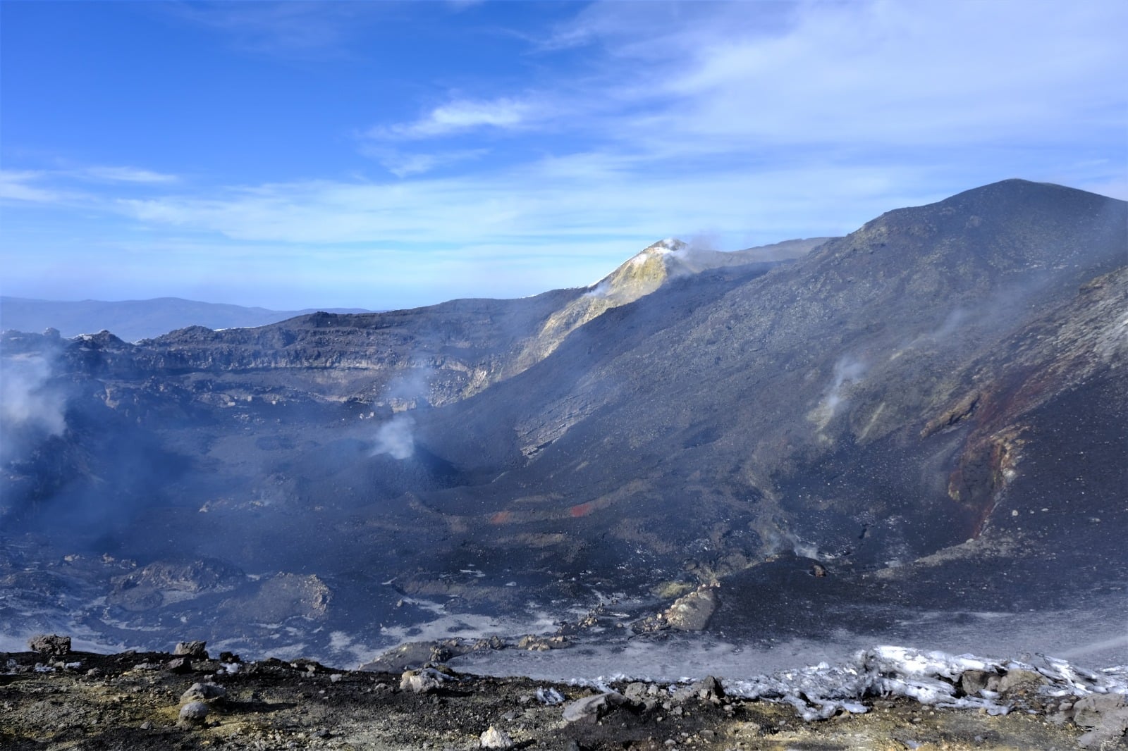
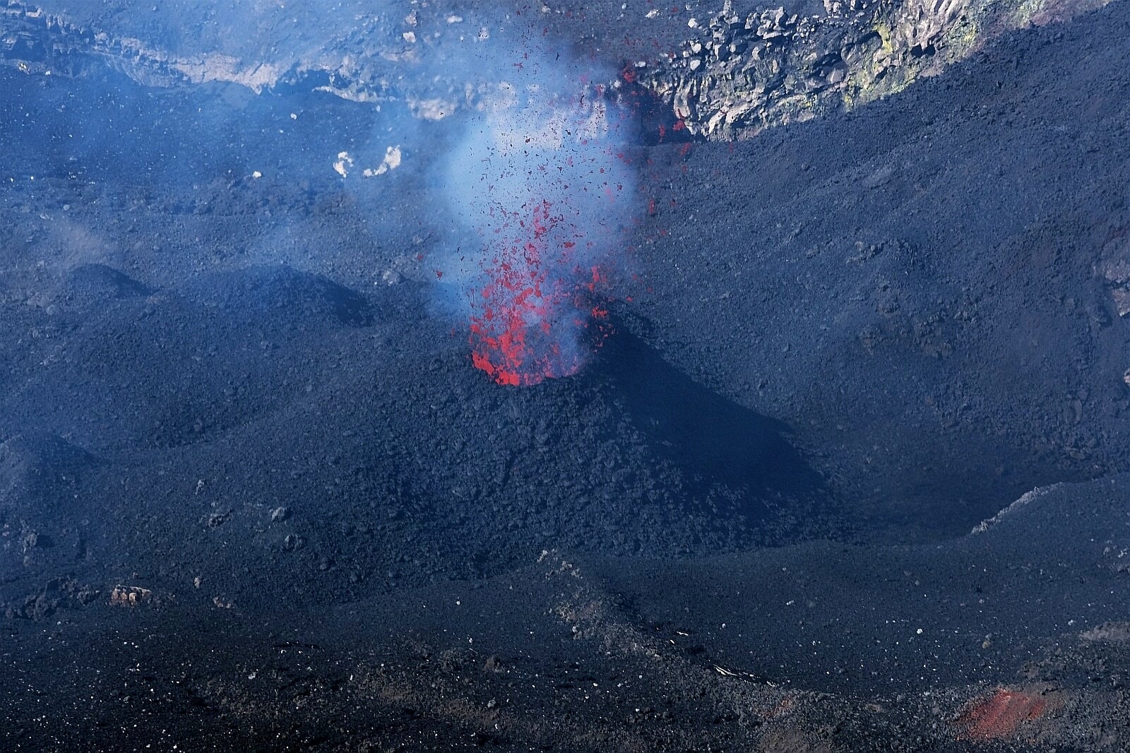
Overview of the Bocca Nuova, taken from the south-eastern edge of the crater, where the cones of scoriae that produce Strombolian explosions are visible. We note the position of the active flow (near the clear top at the top of the image) fed by the crater of Voragine.
VOLCANOLOGICAL OBSERVATIONS
During the week, the monitoring of the volcanic activity at the level of the summit craters of Etna was carried out by analyzing the images of the network of surveillance cameras of the INGV Catania Section, Osservatorio Etneo (INGV-OE) and by means of an inspection carried out by INGV-OE staff on February 5.
During the period under review, the activity of Etna followed the behavior of the previous weeks with an eruptive activity of varying intensity in the four summit craters.
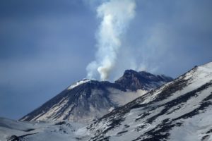
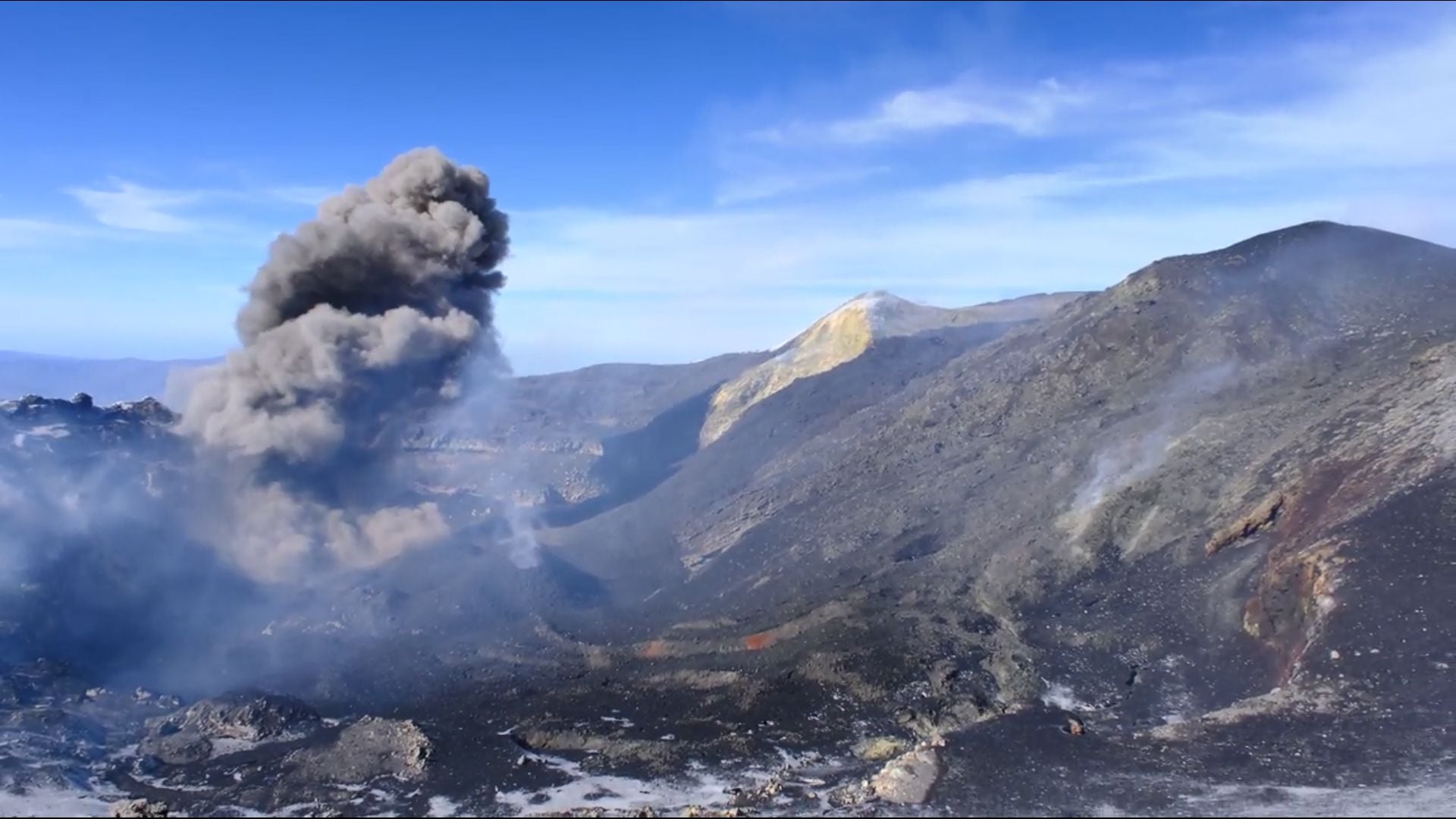
In particular, Strombolian activity continued at the Southeast Crater (SEC) with explosions of varying frequency and intensity over time. The strongest and almost continuous explosive activity was produced by two vents in the eastern sector of the top of the cone. The coarse materials that were emitted during the explosions accumulated in the apical parts of the cone, rolling due to the steep slope and sometimes descending along the flanks for several tens of meters. The explosions produced by these vents are generally accompanied by low emissions of ash which rapidly disperse into the atmosphere. On February 6, starting at around 04:30 UTC, the intensification of Strombolian activity formed, for about an hour and a half, a cloud of dilute ash which dispersed towards the east.
Detail of the three vents with Strombolian activity and the vent that emits ash.
During the period under review, the crater of Bocca Nuova (BN) produced Strombolian activity characterized by the launching of coarse materials beyond the edge of the crater and rare emissions of very dilute ash. During the inspection on February 5, lively and continuous explosive activity was observed from three vents at the bottom of the crater, around which cinder cones formed. At a short distance, another vent was observed which, during the period of the observations, produced occasional and dense emissions of cineritic material which rapidly dispersed into the atmosphere.
During the week, Strombolian activity from the Voragine Crater (VOR) continued, with launches of coarse material at heights exceeding even the crater rim and rare emissions of dilute ash. During the inspection on February 5, it was observed that intra-crater effusive activity was continuing: modest lava flows continued to flow into the Bocca Nuova, significantly overlapping those formed last week.
Finally, the Northeast Crater (NEC) fed an intracrater strombolian activity of varying intensity which, at night, produced a discontinuous glow visible by the cameras of the video surveillance system.
Dense cloud of ash produced by a Bocca Nuova vent.
Volcanic tremor:
The temporal trend of the average amplitude of the volcanic tremor, throughout the week, remained mainly at an average level until February 2. From about 3.30 p.m. UTC that day, a marked increase in the amplitude of the volcanic tremor was observed which, although showing continuous fluctuations, always remained at a high level. The source of the tremor was constantly located in the area of the Southeast Crater, at a depth of about 2800-3000 meters above mean sea level
Source : INGV .
Photos : Personnel d’INGV lors de l’inspection du 5 février.
Italy , Stromboli :
Weekly bulletin from February 01, 2021 to February 07, 2021 (issue date February 09, 2021)
SUMMARY OF THE STATE OF ACTIVITY.
In the light of surveillance data, it is highlighted:
1) VOLCANOLOGICAL OBSERVATIONS: Normal explosive volcanic activity of Strombolian type with intense projection activity which has reached the stage of lava fountains in the North zone. The total frequency of events showed values ranging from medium-high levels (16 events / h) to very high levels (28 events / h). The intensity of the explosions was mainly medium-high in the areas of the North and Center-South crater.
2) SEISMOLOGY: The monitored seismological parameters do not show significant variations.
3) DEFORMATIONS: The island’s soil deformation monitoring networks did not show any significant changes to report for the period under review.
4) GEOCHEMISTRY: SO2 flux: medium-high level
C / S Ratio: Values are at high levels (C / S = 17.96).
The isotopic ratio of Helium is at high values (R / Ra = 4.41 reported to the sampling of January 21, 2021).
5) SATELLITE OBSERVATIONS: The thermal activity in the summit area is at a moderate-low level.
VOLCANOLOGICAL OBSERVATIONS
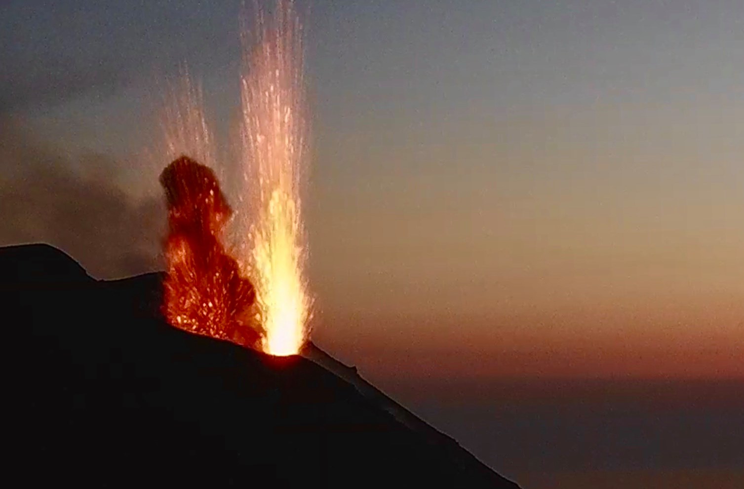
In the period under observation, the eruptive activity of Stromboli was characterized by the analysis of the images recorded by the surveillance cameras INGV-OE located at an altitude of 190 m, Punta Corvi and 400 m.
In the area of the North crater, the N1 crater, with two emission points, produced explosions of low intensity (less than 80 m high) to medium-high intensity (sometimes the projectiles reached 250 m high) emitting fine materials (ash) mixed with coarse materials (lapilli and bombs). The N2 vent, at four emission points, mainly showed low and medium-high intensity explosive activity (sometimes the products reached 250 m in height) emitting coarse materials. In addition, continuous throwing activity was observed at vent N2 which for long intervals was very intense both in terms of frequency and height reached by the lava shreds, reaching its peak with fountains during a few minutes. These fountains exceeded a hundred meters in height on the evening of February 4.
The average frequency of explosions ranged from 14 to 25 events / h.
In the Center-South zone, the explosions emitted fine and coarse ash emissions with an average and sometimes high intensity (the products exceeded 250 m in height). The explosive activity showed hourly frequency values between 2 and 6 events / h.
During the week, the amplitude of the tremor generally had medium to low values.
Source : INGV.
Photo : Webcam
Indonesia , Raung :
VOLCANO OBSERVATORY NOTICE FOR AVIATION – VONA.
Issued : February 09 , 2021
Volcano : Raung (263340)
Current Aviation Colour Code : ORANGE
Previous Aviation Colour Code : orange
Source : Raung Volcano Observatory
Notice Number : 2021RAU22
Volcano Location : S 08 deg 07 min 30 sec E 114 deg 02 min 31 sec
Area : East java, Indonesia
Summit Elevation : 10662 FT (3332 M)
Volcanic Activity Summary :
Eruption with volcanic ash cloud 23h50 UTC (06h50 Local Time ). Eruption and ash emission is continuing.
Volcanic Cloud Height :
Best estimate of ash-cloud top is around 17062 FT (5332 M) above sea level, may be higher than what can be observed clearly. Source of height data: ground observer.
Other Volcanic Cloud Information :
Ash-cloud moving to east.
Remarks :
Seismic activity is characterized by continuous volcanic tremor.
Since January 20, 2021, non-harmonic tremors have been recorded, followed by deep volcanic earthquakes, accompanied by changes in the color and height of the emission gas / ash column. Thus, since January 21, 2021, the activity level of G. Raung has been raised to level II (Waspada).
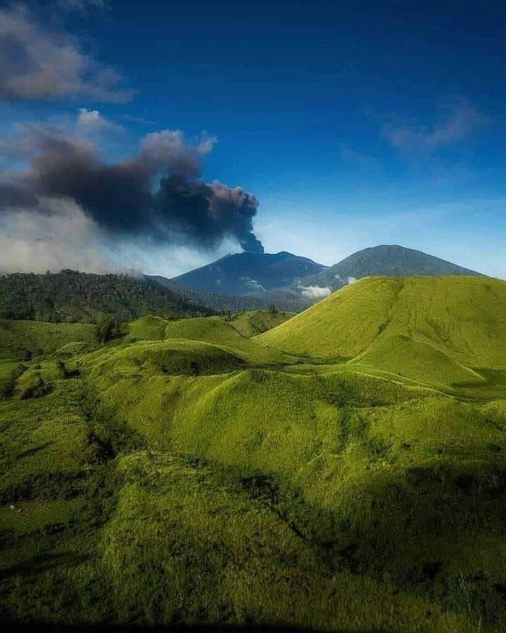
The volcano was clearly visible until it was covered in fog. The smoke emitted from the crater was observed to be gray and black with moderate to thick intensity, about 2,500 meters above the peak. The weather is sunny to rainy, the winds weak to the east and south. There was a roar and an eruption of smoke / ash directed east – southeast.
According to the seismographs of February 9, 2021, it was recorded:
Continuous tremor with an amplitude of 3 to 32 mm, dominant value of 7 mm.
A number of commercial flights operated by Lion Air Group that were initially scheduled to arrive and depart from Banyuwangi airport in East Java, has officially been canceled. The airport has been temporarily closed due to safety concerns caused by the eruption of Mount Raung.
Source : Magma Indonésie , PVMBG , Tempo .
Photo : Igan S Sutawidjaja.
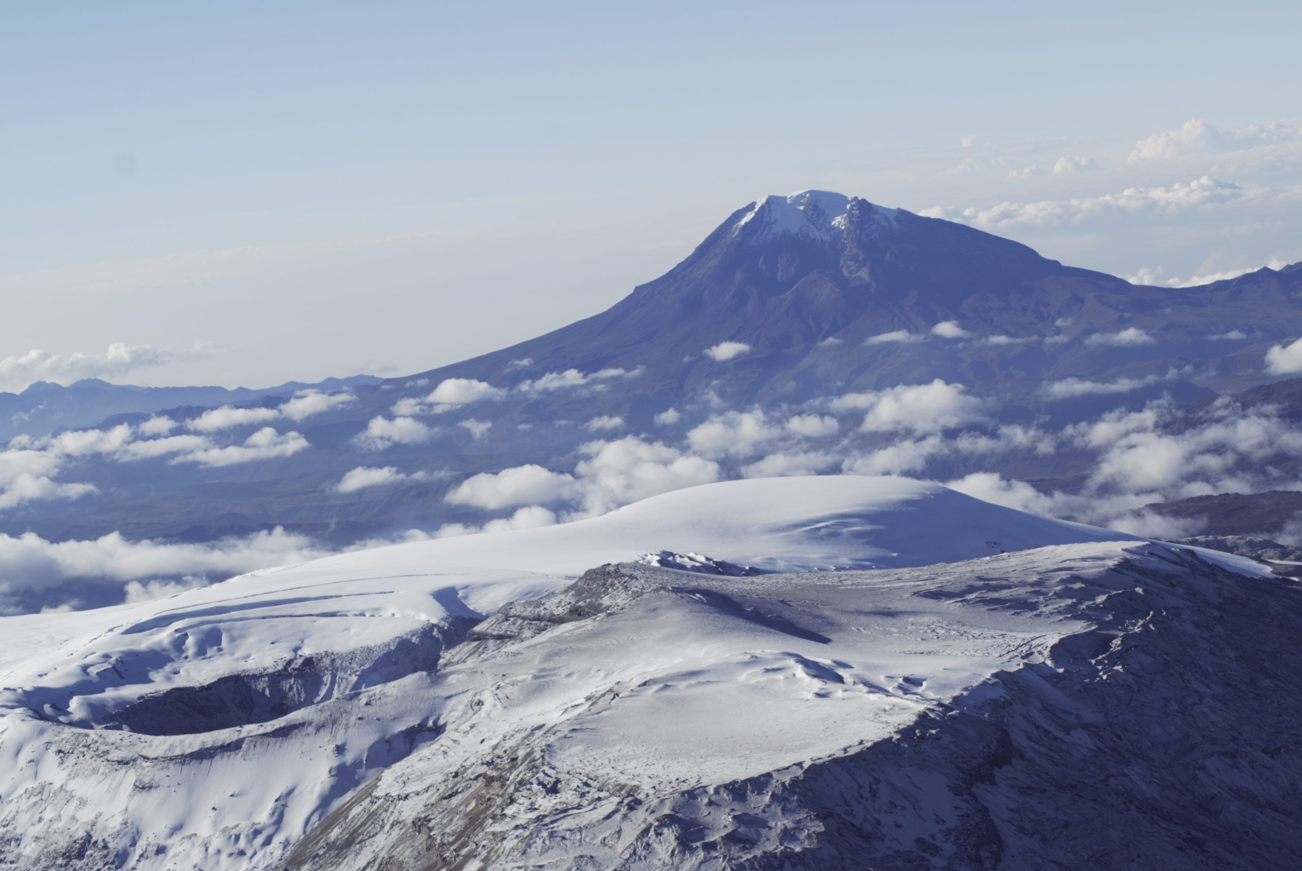
Colombia , Nevado del Ruiz :
Weekly activity bulletin of the Nevado del Ruiz volcano
The activity level continues at Yellow Activity Level or (III): changes in the behavior of volcanic activity.
Regarding the monitoring of the activity of the Nevado del Ruiz volcano, the COLOMBIAN GEOLOGICAL SERVICE reports that:
The seismicity generated by the fracturing of the rock decreased in the number of earthquakes and increased in the seismic energy released, compared to the previous week. This seismic activity was located mainly in the South-South-West, North-North-East sectors, the Arenas crater and to the north of the volcano.
The depths of the earthquakes ranged from 0.4 to 7.7 km. The highest magnitude recorded during the week was 1.1 ML (local magnitude), corresponding to the earthquake that occurred on February 7 at 8:14 p.m. (local time), located 4.1 km north-north – East of the crater, 3.4 km deep.
Seismicity linked to fluid dynamics, inside volcanic conduits, increased in the number of events and in the seismic energy released compared to the previous week. This seismic activity was characterized by the occurrence of continuous volcanic tremor, harmonic tremor, tremor pulses, long and very long period type earthquakes, which presented variable energy levels and spectral content. The earthquakes were located in the Arenas crater.
The deformation of the volcanic surface, measured from GNSS (Global Navigation Satellite System) stations and electronic inclinometers continued to show some minor changes in the volcano.
Source et photo : SGC.
Guatemala , Pacaya :
SPECIAL VOLCANOLOGICAL BULLETIN, February 9, 2021, 10:02 a.m. local time
Type of activity: Strombolian.
Morphology: composite stratovolcano
Geographical location: 14 ° 22’50˝ Latitude N; 90 ° 36’00˝ Longitude W
Height: 2,552 meters above sea level.

ASH CLOUD DISPERSION
As has been reported in special bulletins, the Pacaya volcano continues with a sharp increase in Strombolian activity, observing constant moderate explosions and some strong explosions, expelling ballistic and volcanic materials to an approximate height of 3000 to 3200 meters at the above sea level (9,842 to 10,498 feet). These are accompanied by columns of ash which move in a West, North-West direction, up to a distance of 66 kilometers. Effusive activity remains active, where several branches of flows are observed, the most important flow being 1200 meters long, with the probability of generating others on other slopes.
The activity of Pacaya is in a high period, so it can generate larger increases and even an eruption, so it is recommended to follow the instructions of the CONRED authorities and the Pacaya National Park.
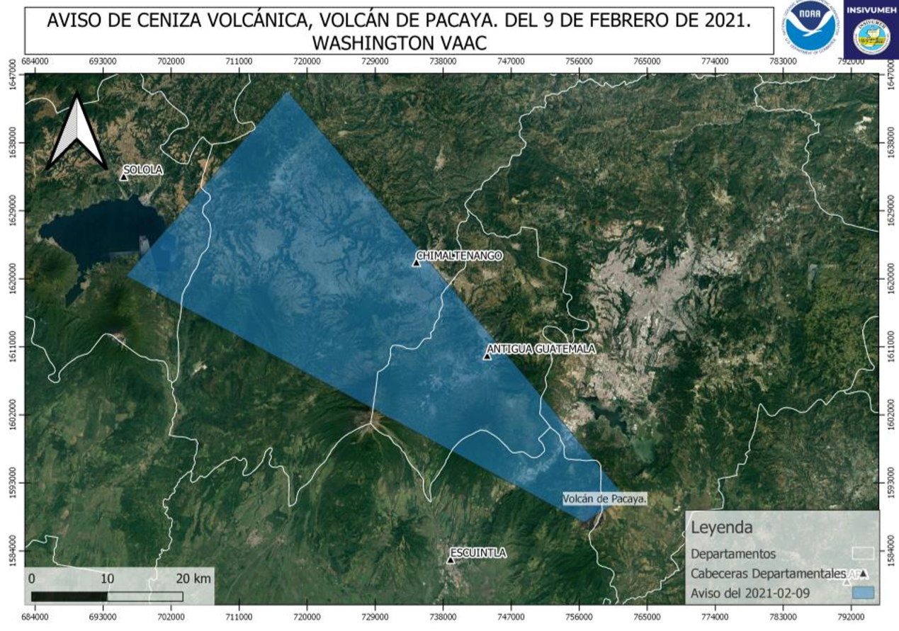
An ash cloud is observed moving in a northwesterly direction with an approximate length of 66 km and a height of 3811 msnm (12.504 feet)
INSIVUMEH provides visual and instrumental monitoring, through seismic stations (PCG and PCG5) and OVPAC observers.
Source : Insivumeh .
Photo : @diegorizzophoto