January 21 , 2021 .
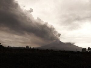
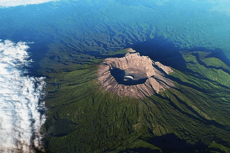
Italy / Sicily , Etna :
COMMUNICATION ON THE ACTIVITY OF ETNA [UPDATE n. 122]
The National Institute of Geophysics and Volcanology, Osservatorio Etneo, reports that overnight a lava flow formed on the north side of the Southeast Crater heading northeast overlapping the described lava overflow in update 118 of 01/18/2021. At 02:00 GMT, the lava front reached an altitude of approximately 2700 m.
From 7:00 GMT, there was also a marked decrease in the explosive and effusive activity of the Southeast Crater. However, from 9:30 a.m. GMT, the analysis of the INGV-OE surveillance cameras shows an increase in both activity, strombolian and the feed of the casting.
From 8:00 GMT, the amplitude of the tremor increases, still reaching values similar to those observed at 01:00 GMT. The infrasound activity also shows a moderate increase. The locations of the sources of the tremor are located under the Southeast Crater, while the infrasound events are mainly located in the Northeast area of the summit craters.
The deformation data does not show significant changes.
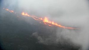
COMMUNICATION ON THE ACTIVITY OF ETNA [UPDATE n. 123]
The National Institute of Geophysics and Volcanology, Osservatorio Etneo, announces that the analysis of the images of the CCTV cameras INGV-OE shows that from 17:30 GMT the flow produced by the lava overflow on the north side of the Southeast Crater was no longer powered and cools down. In addition, weak Strombolian activity continues at the Southeast Crater.
As for the volcanic tremor, there are no substantial changes compared to the trend observed during the day. The amplitude of the tremor remains high, although it does not reach the alarm levels. The sources of the tremor are located in the area of the Southeast Crater, at an altitude of 2900-3000 m. Regarding infrasound activity, in the last few hours there has been a decrease in activity. The locations of infrasound events are located in the Southeast Crater region.
The deformation data does not show significant changes.
Further updates will be communicated shortly.
Source : INGV.
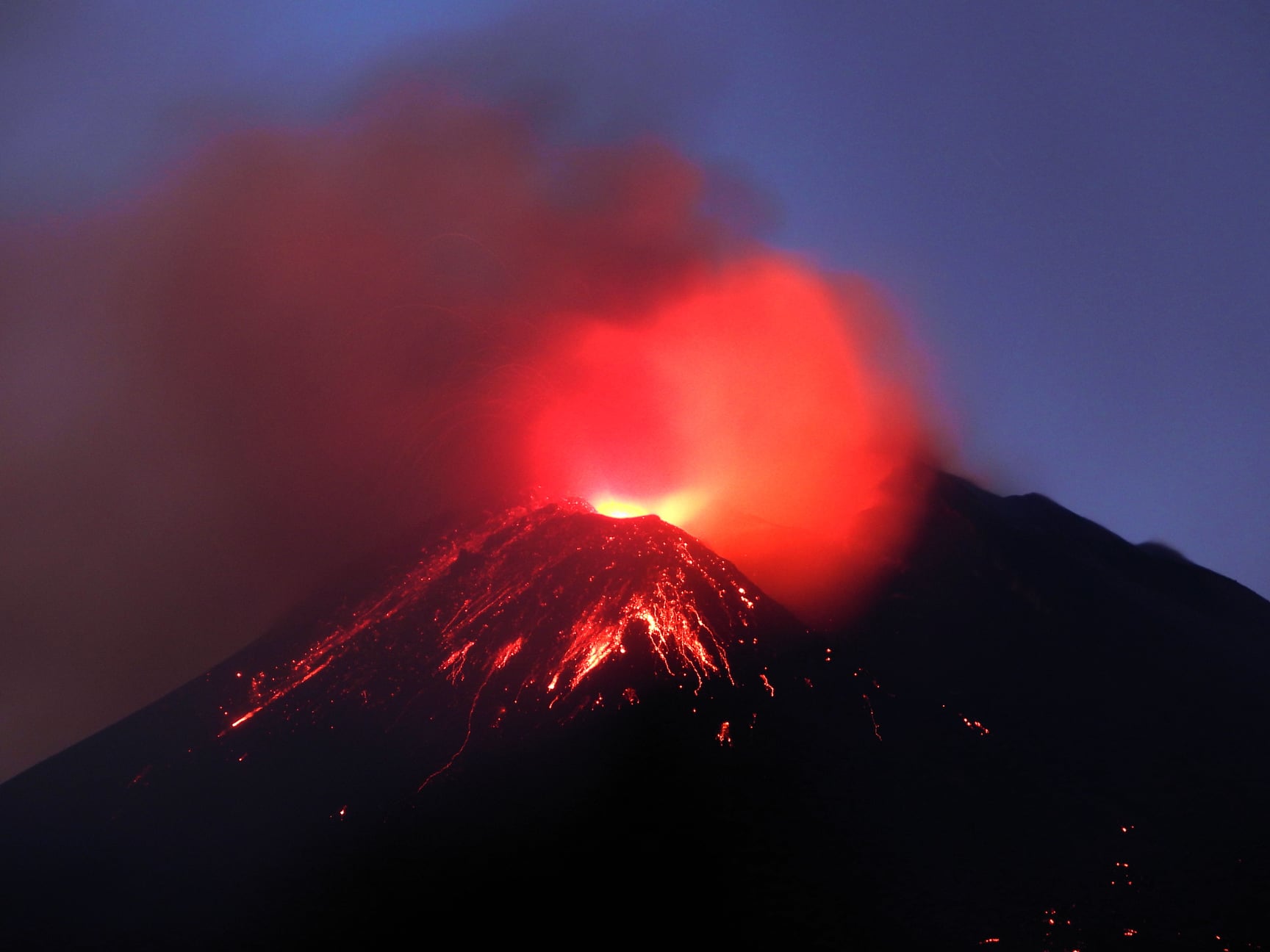
Photo : Boris Behncke .
Saint Vincent , Soufrière Saint Vincent :
University of the West Indies Seismic Research Centre (UWI-SRC) and National Emergency Management Organisation (NEMO) reported that the lava dome in Soufrière St. Vincent’s main crater continued to grow during 13-19 January.
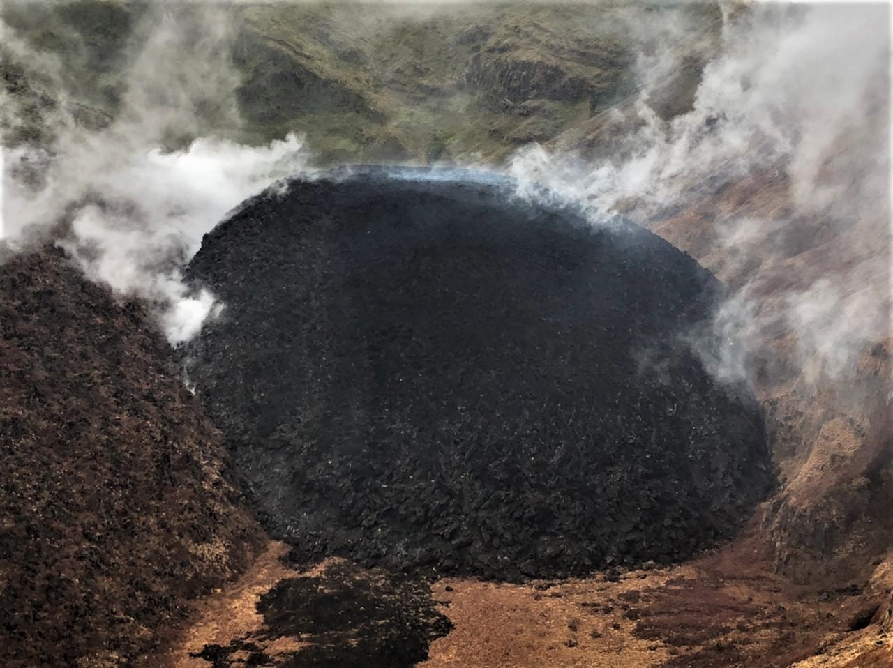
Observations on 14 January revealed that the dome was growing taller as well as expanding to the E and W. During an overflight on 15 January scientists saw extensive vegetation damage on the E, S, and W inner crater walls; damage previously noted along the upper part of the SW crater rim had expanded downslope. The dome dimensions were estimated to be 340 m long, 160 m wide, and 90 m high.
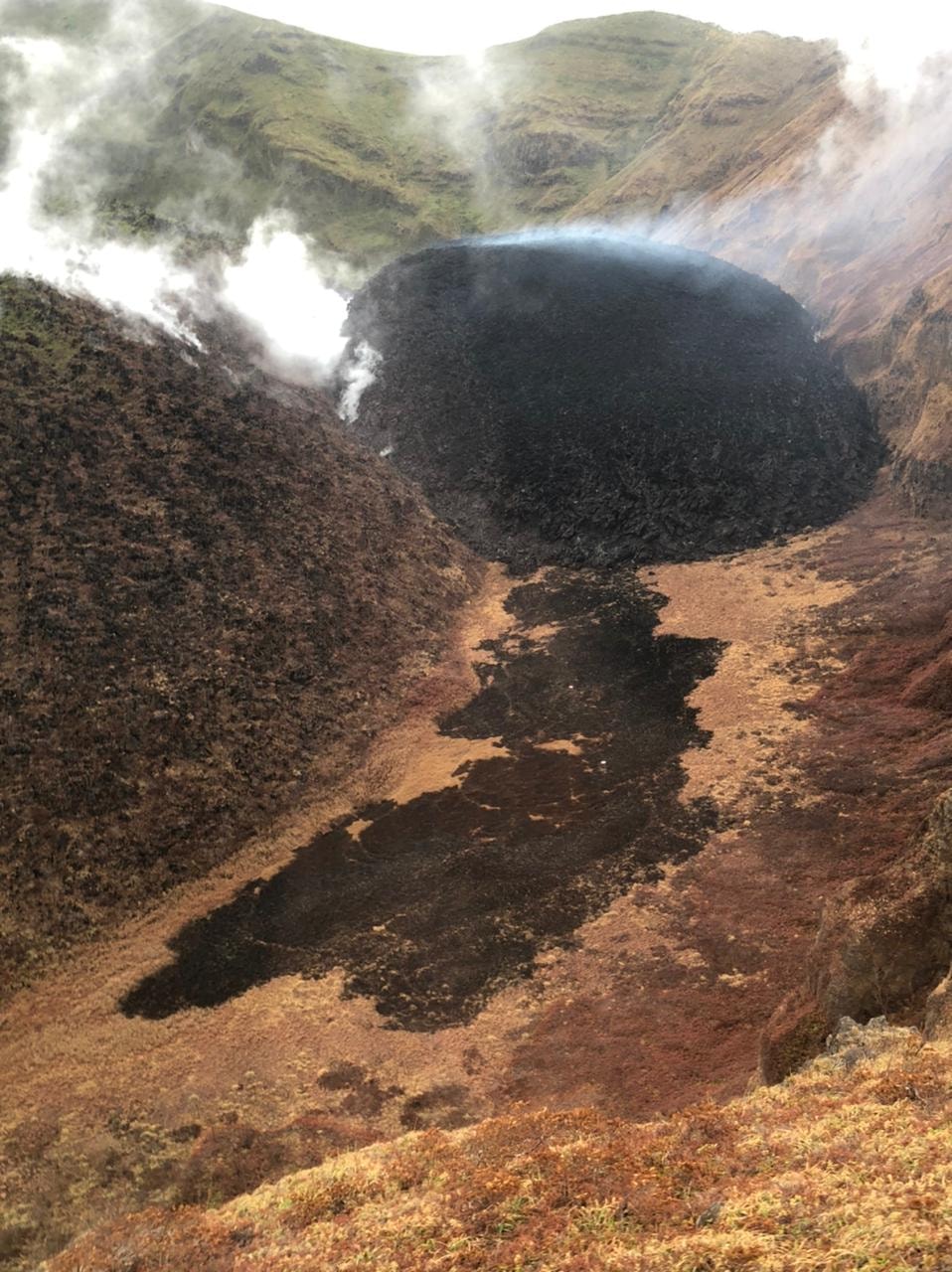
The black areas in the photo are likely burnt vegetation caused by contact of growing dome of hot material (lava) and abundant low lying shrubs in the crater
Scientists visited the dome on 16 January and collected rock samples from the W part of the dome. They recorded temperatures around 590 degrees Celsius from the expanding dome front. Gas emissions were most notable from a small circular depression at the top of the dome. At night during 15-17 January residents to the W saw incandescence emanating from the crater, a phenomenon likely to be more frequent as the dome grows higher. Gas emissions were visible in the afternoon of 17 January rising from the top of the dome as well as from areas of contact between the new and old domes. An area of burnt vegetation extended from the dome along the W part of the crater floor.
By the end of the week both new seismic and continuous GPS monitoring stations had been installed and were transmitting data, bring the total number of dedicated seismic stations to five. The Alert Level remained at Orange (the second highest level on a four-color scale).
LA SOUFRIÈRE BULLETIN , JANUARY 20, 2021 8:00 PM
No clear views were obtained of the dome today.
Weather conditions again hampered fieldwork on the volcano. Conditions eased sufficiently to allow Instrumentation Engineer Lloyd Lynch and Engineering Technician Ian Juman to be dropped off at the monitoring station on the upper flank of the volcano where they undertook some modification of the station configuration to improve communication.
Equipment to install a camera at the crater rim to monitor dome growth was also completed.
The helicopter support ended today and the crew from Calvin Air Helicopters returned to Antigua during the early afternoon.
Dr Adam Stinton who had been sent from the Montserrat Volcano Observatory to assist with dome growth measurements returned to Montserrat today. During his visit Dr. Stinton completed an aerial survey of the new dome, assisted with daily visual observations and photographic documentation of dome growth and was part of the two-man team who sampled the growing lava dome.
Alert level remains at Orange. The volcano continues to exude magma on the surface and steam can still be observed from the Belmont Observatory. Persons living in areas close to the volcano should expect strong sulphur smells for several days to weeks, depending on changes in wind direction.
Source : GVP , NEMO .
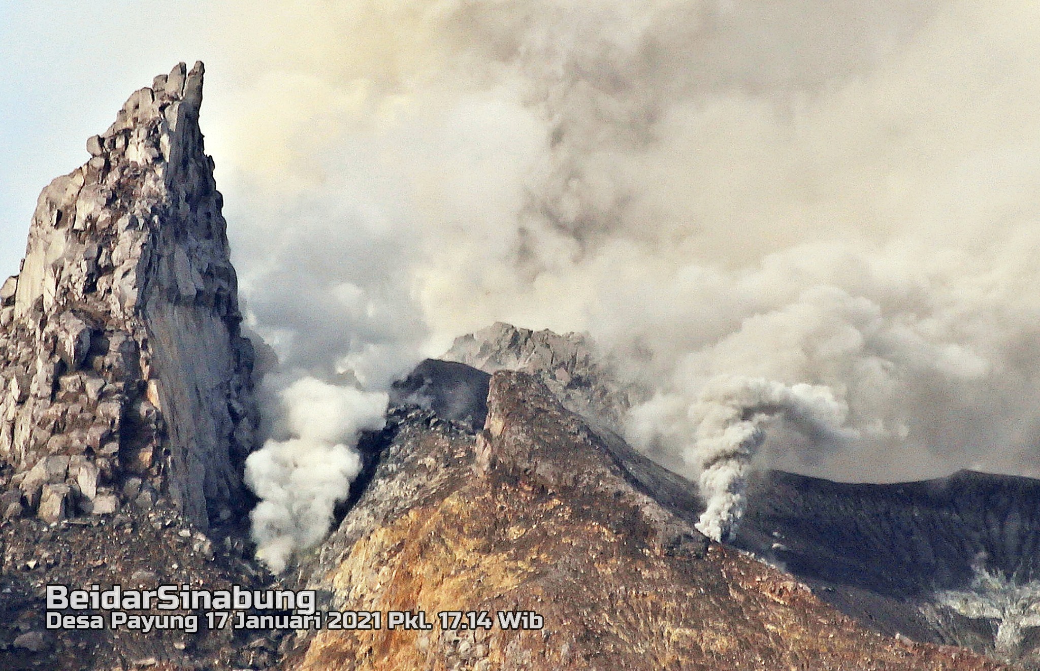
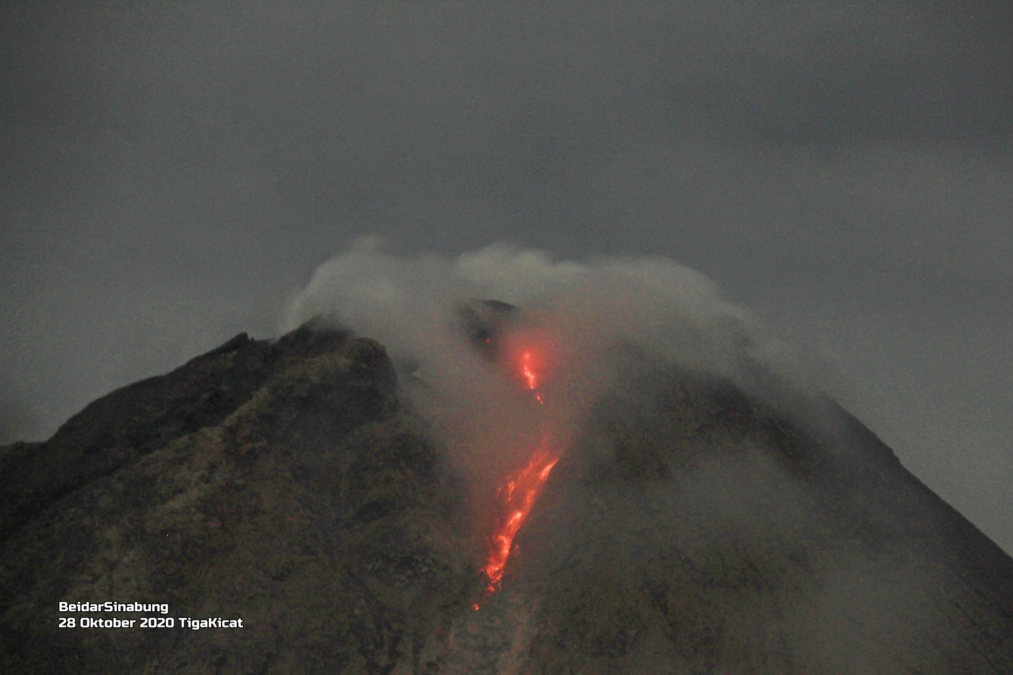
Indonesia , Sinabung :
VOLCANO OBSERVATORY NOTICE FOR AVIATION – VONA
Issued : January 20 , 2021
Volcano : Sinabung (261080)
Current Aviation Colour Code : ORANGE
Previous Aviation Colour Code : orange
Source : Sinabung Volcano Observatory
Notice Number : 2021SIN07
Volcano Location : N 03 deg 10 min 12 sec E 98 deg 23 min 31 sec
Area : North Sumatra, Indonesia
Summit Elevation : 7872 FT (2460 M)
Volcanic Activity Summary :
Eruption with ash clouds at 23h35 UTC (06h35 local time). The eruption lasted for 94 seconds
Volcanic Cloud Height :
Best estimate of ash-cloud top is around 9472 FT (2960 M) above sea level, may be higher than what can be observed clearly. Source of height data: ground observer.
Other Volcanic Cloud Information :
Ash cloud is moving to east-southeast
Remarks :
Seismic activity is characterized by Gas Emission. Rock avalanche (Incandescent lava) is not identified
The activity level has been at level III (SIAGA) since May 20, 2019 at 10:00 a.m. WIB. Mount Sinabung (2460 m above sea level) has been erupting since 2013.
The volcano was clearly visible until it was covered in fog. The crater emits white smoke with a strong thickness, about 100 to 500 meters above the summit. The weather is sunny to cloudy, with weak to moderate winds to the east and southeast.
According to the seismographs of January 20, 2021, it was recorded:
• 1 eruption / explosion earthquake
• 52 avalanche earthquakes
• 12 earthquakes of emissions.
• 10 low frequency earthquakes
• 3 hybrid / multi-phase earthquakes
• 3 local tectonic earthquakes
• 2 distant tectonic earthquakes
Source : Magma Indonésie . PVMBG.
Photos : Beidar Sinabung .
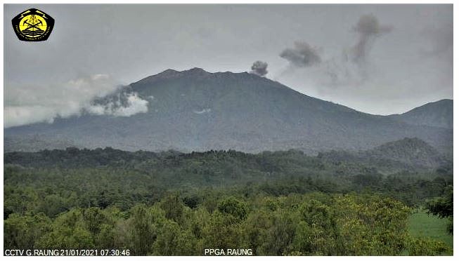
Indonesia , Raung :
Press Release: G. Raung, East Java Activity Level Increase from Level I (Normal) to Level II (WASPADA), January 21, 2021
Visual monitoring:
The volcano is clearly visible until it is covered in fog. Gas emissions from the summit crater were observed on two occasions, namely January 1 and 20, 2021, white in color with moderate intensity, rising to about 100-200 meters above the summit.
On January 21, 2021, 05.20 WIB, gas emissions were observed from the crater, white / gray in color, rising 100 to 400 m above the crater. Gas emissions do not occur continuously until 9:00 a.m.
Instrumental observation
The seismicity recorded during the period January 1 to 19, 2021 was dominated by tectonic emissions and earthquakes. January 20, 2021, recorded non-harmonic tremors and deep volcanic earthquakes. On January 21, 2021, he recorded 8 emission earthquakes and 32 non-harmonic tremors.
Evaluation
The height and color of the emission column began to change on January 21, 2021. The color of the column indicates that there was ash carried to the surface.
On January 20, 2021, a deep volcanic earthquake was recorded followed by a non-harmonic tremor, indicating a magma supply deep below the summit crater of Mount Raung.
Potential threat risks
The distribution of materials from the ashes released on January 21, 2021 is still around the crater / summit of Mount Raung, which is a III disaster prone area. However, the spread of ash can go to another area depending on the direction and speed of the wind.
Conclusions and Recommendations
The results of visual and instrumental monitoring show signs of increased activity, so that the level of volcanic activity of G. Raung is increased from level I (normal) to level II (WASPADA), from the 21 January 2021, at 1:00 p.m. WIB. Intensive monitoring will continue to be carried out by the Center for Volcanology and Geological Disaster Mitigation in order to anticipate a greater increase in activity.
At Activity Level II (WASPADA), people / visitors / tourists are recommended not to perform activities within a radius of 2 km around the crater / peak.
VOLCANO OBSERVATORY NOTICE FOR AVIATION – VONA.
Issued : January 21 , 2021
Volcano : Raung (263340)
Current Aviation Colour Code : ORANGE
Previous Aviation Colour Code : orange
Source : Raung Volcano Observatory
Notice Number : 2021RAU02
Volcano Location : S 08 deg 07 min 30 sec E 114 deg 02 min 31 sec
Area : East java, Indonesia
Summit Elevation : 10662 FT (3332 M)
Volcanic Activity Summary :
Eruption with volcanic ash cloud at 00h38 UTC (07h38 local)
Volcanic Cloud Height :
Best estimate of ash-cloud top is around 11942 FT (3732 M) above sea level, may be higher than what can be observed clearly. Source of height data: ground observer.
Other Volcanic Cloud Information :
ash-cloud moving to east.
Remarks :
Seismic activity is characterized by volcanic tremor
Source : PVMBG , Magma Indonésie .
Photos : Archipel360 , PVMBG.
Japan , Suwanosejima :
JMA reported that incandescence at Suwanosejima’s Ontake Crater was visible nightly during 11-15 January. Intermittent explosions produced ash plumes that rose as high as 1.4 km above the crater rim and ejected bombs 400 m away from the crater. The Alert Level was lowered to 2 (on a 5-level scale) on 14 January; JMA noted that no large bombs were ejected more than 1 km from the crater beginning on 29 December 2020.
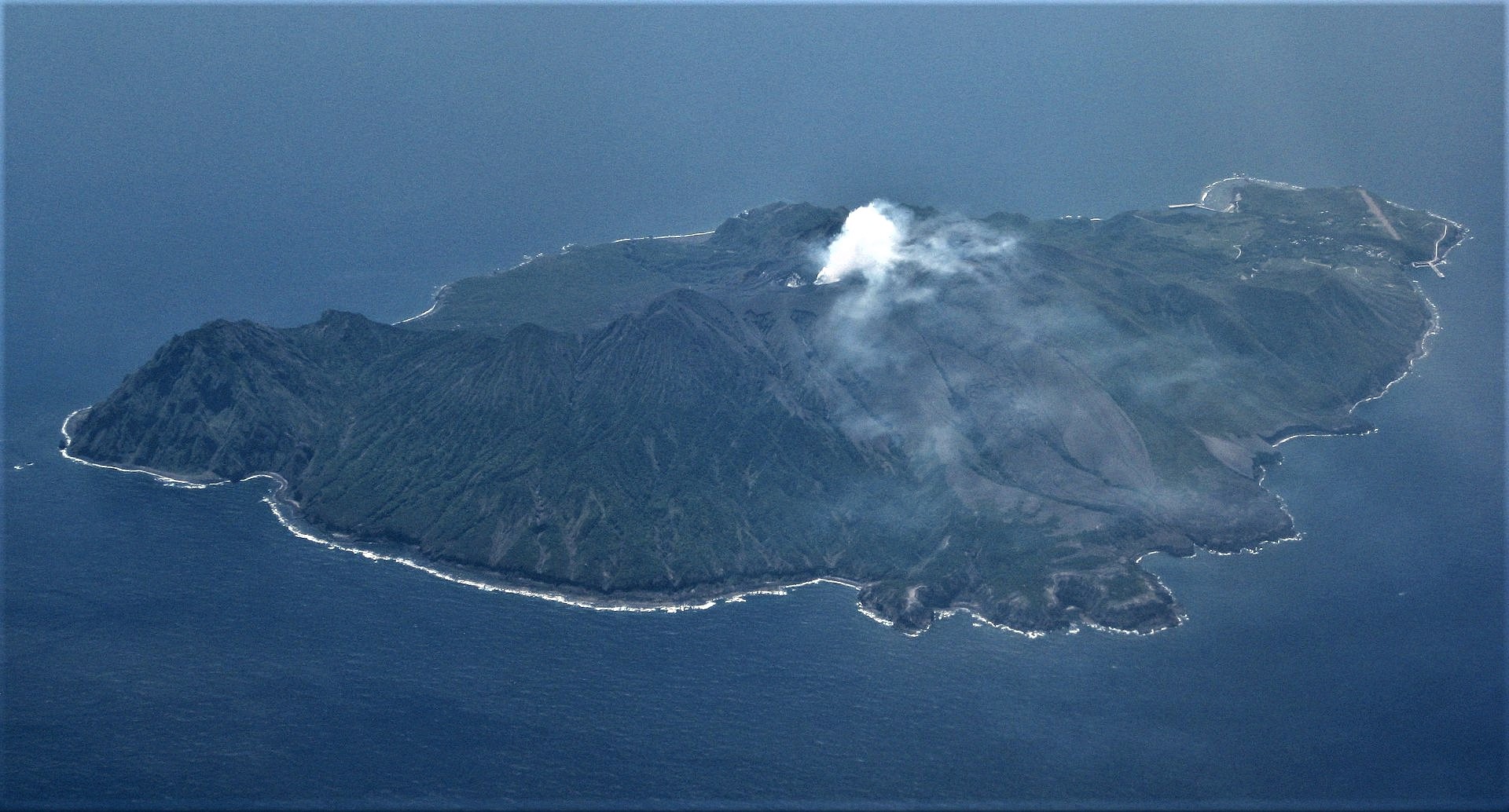
The 8-km-long, spindle-shaped island of Suwanosejima in the northern Ryukyu Islands consists of an andesitic stratovolcano with two historically active summit craters. The summit is truncated by a large breached crater extending to the sea on the east flank that was formed by edifice collapse. Suwanosejima, one of Japan’s most frequently active volcanoes, was in a state of intermittent strombolian activity from Otake, the NE summit crater, that began in 1949 and lasted until 1996, after which periods of inactivity lengthened. The largest historical eruption took place in 1813-14, when thick scoria deposits blanketed residential areas, and the SW crater produced two lava flows that reached the western coast. At the end of the eruption the summit of Otake collapsed forming a large debris avalanche and creating the horseshoe-shaped Sakuchi caldera, which extends to the eastern coast. The island remained uninhabited for about 70 years after the 1813-1814 eruption. Lava flows reached the eastern coast of the island in 1884. Only about 50 people live on the island.
Source: Japan Meteorological Agency (JMA) , GVP.
Photo : Ray Go.