July 30 , 2020.
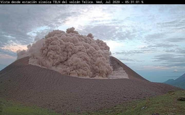
Nicaragua , Télica :
The Telica volcano records explosions with emissions of gas and ash.
This Wednesday, new explosions were reported on the Telica volcano with an approximate elevation of 30 meters, dispersing northward, releasing gases and ash that fell on the edge of the crater, without affecting the population.
According to the Nicaraguan Institute for Territorial Studies, the explosions started at 5:28 a.m.
Last week, the telica volcano recorded two small explosions of gas and ash, as a result of the increase in volcanic tremor, so that the real-time seismic amplitude (RSAM) had increased from 57 to 153 units.
The volcanic tremor remains at 144 units, which implies the possibility that other small explosions occur in the following hours or days, which do not represent a danger for the population.
Source : Ineter .
Mexico , Popocatepetl :
19.023 ° N, 98.622 ° W
Altitude: 5393 m
July 29, 11:00 a.m. (July 29, 4:00 p.m. GMT)
Over the past 24 hours, the Popocatépetl volcano monitoring system has identified 16 exhalations accompanied by volcanic gases and sometimes small amounts of ash. In addition, 1,097 minutes of tremors associated with the emission of water vapor, gas and ash were recorded, with heights of up to 1,000 m dispersing in a north-north-west direction. There were also three minor explosions, the first yesterday at 5:57 p.m., the others today at 1:20 p.m. and 8:31 p.m.
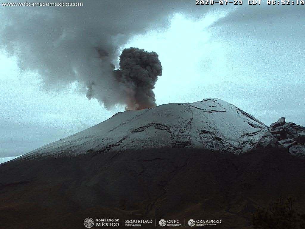
During the night, there was partial visibility of the volcano, however, an incandescence could be observed above the crater.
From the morning and at this moment, a constant emission of water vapor, gas and small amounts of ash is observed in a north direction.
CENAPRED urges NOT TO APPROACH the volcano and in particular the crater, because of the danger involved by the fall of ballistic fragments and, in the event of heavy rains, to move away from the bottom of the ravines because of the danger of lava flows. mud and debris.
The Popocatépetl volcanic alert signal light is in YELLOW PHASE 2.
CENAPRED reported that each day during 22-27 July there were 2-107 steam-and-gas emissions from Popocatépetl, some of which contained minor amounts of ash. Crater incandescence was visible most nights. Gas, steam, and ash plumes rose as high as 2 km above the crater rim and drifted NW, WSW, and SW. Minor ashfall was reported on 23 and 27 July in areas downwind, including in Tetela del Volcán (20 km SW), Ocuituco (24 km SW), Atlatlahucán (30 km WSW), Yecapixtla (20 km W), Yautepec (50 km WSW), and Jiutepec (60 km WSW), in the state of Morelos, as well as in Tlalmanalco (30 km NW), Juchitepec, Tepetlixpa (20 km W), Atlautla (17 km W), Ozumba (18 km W), and Ecatzingo (15 km SW), in the state of Mexico.
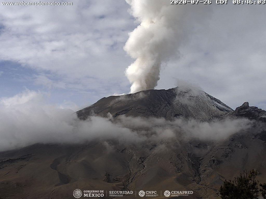
Incandescent material was ejected a short distance from the crater on 25 July and was followed by minor ashfall in Ecatzingo, Atlautla, Tepetlixpa, and Juchitepec. Incandescent material was again ejected a short distance from the crater during 26-27 July. Explosions were recorded at 1135 on 27 July and 0511 on 28 July. Minor ashfall was reported in the municipalities of Tlalmanalco (30 km NW), Ayapango (22 km NW), Temamatla (32 km NW), Ecatepec, Valle de Chalco (44 km NW), Texcoco (60 km NNW), Tezoyuca (68 km NNW), Tepetlaoxtoc, Naucalpan (80 km NW), Atizapán (90 km NW), Huixquilucan (85 km NW), Nicolás Romero (95 km NW), and Tlalnepantla (80 km NW) in the state of México.
The Alert Level remained at Yellow, Phase Two (middle level on a three-color scale).
Source : Cenapred , GVP.
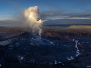
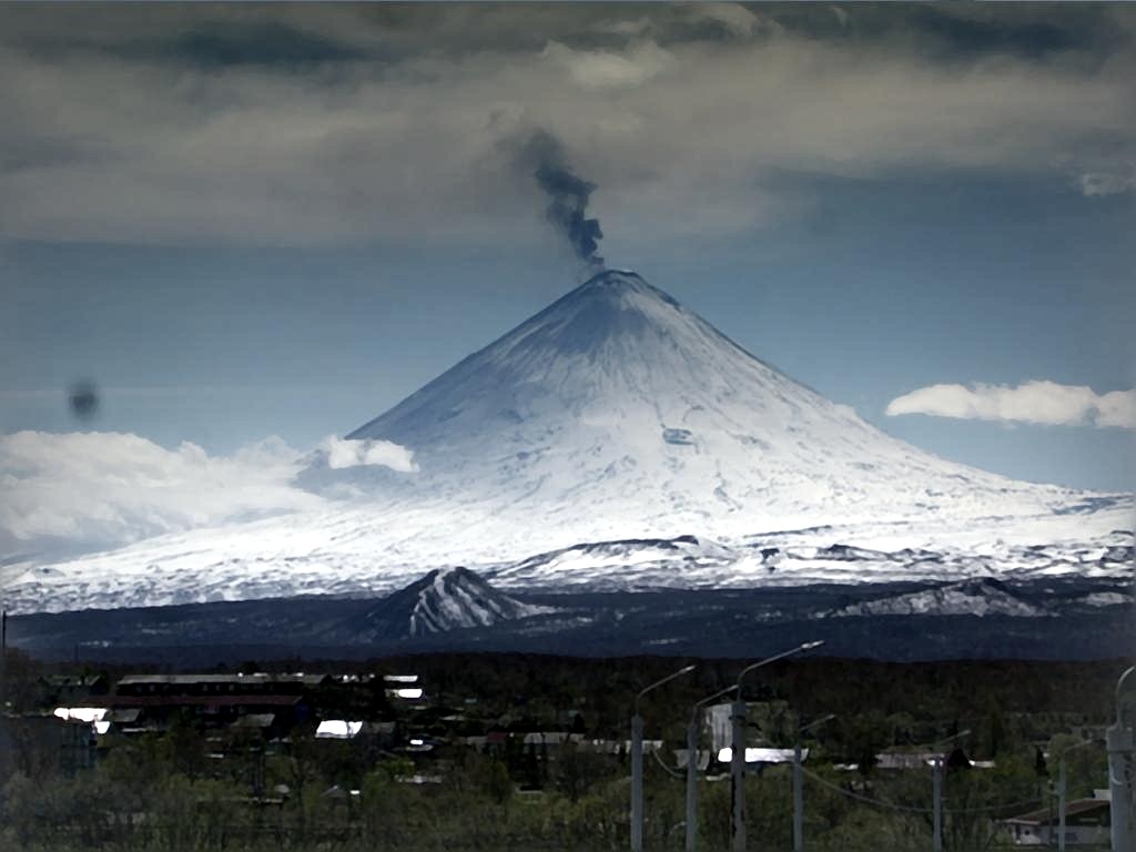
Kamchatka , Klyuchevskoy :
VOLCANO OBSERVATORY NOTICE FOR AVIATION (VONA).
Issued: July 30 , 2020
Volcano: Klyuchevskoy (CAVW #300260)
Current aviation colour code: GREEN
Previous aviation colour code: yellow
Source: KVERT
Notice Number: 2020-167
Volcano Location: N 56 deg 3 min E 160 deg 38 min
Area: Kamchatka, Russia
Summit Elevation: 15580 ft (4750 m)
Volcanic Activity Summary:
According to visual and video data, only a moderate gas-steam activity of the volcano was noted from 03 till 30 July. Satellite data by KVERT showed sometimes a weak thermal anomaly over the volcano, but the temperature of the anomaly steady decreased. KVERT continues to monitor Klyuchevskoy volcano.
A moderate gas-steam activity of the volcano continues. Ongoing activity could affect low-flying aircraft.
Volcanic cloud height: NO ASH CLOUD PRODUSED
Other volcanic cloud information: NO ASH CLOUD PRODUSED
Source : Kvert.
Photo : Andrew Matseevsky à Kamchatka – Land of Colors / VolcanoDiscovery.
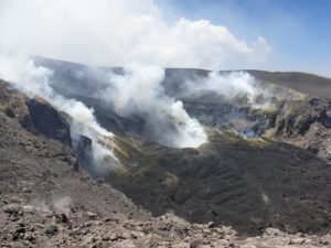
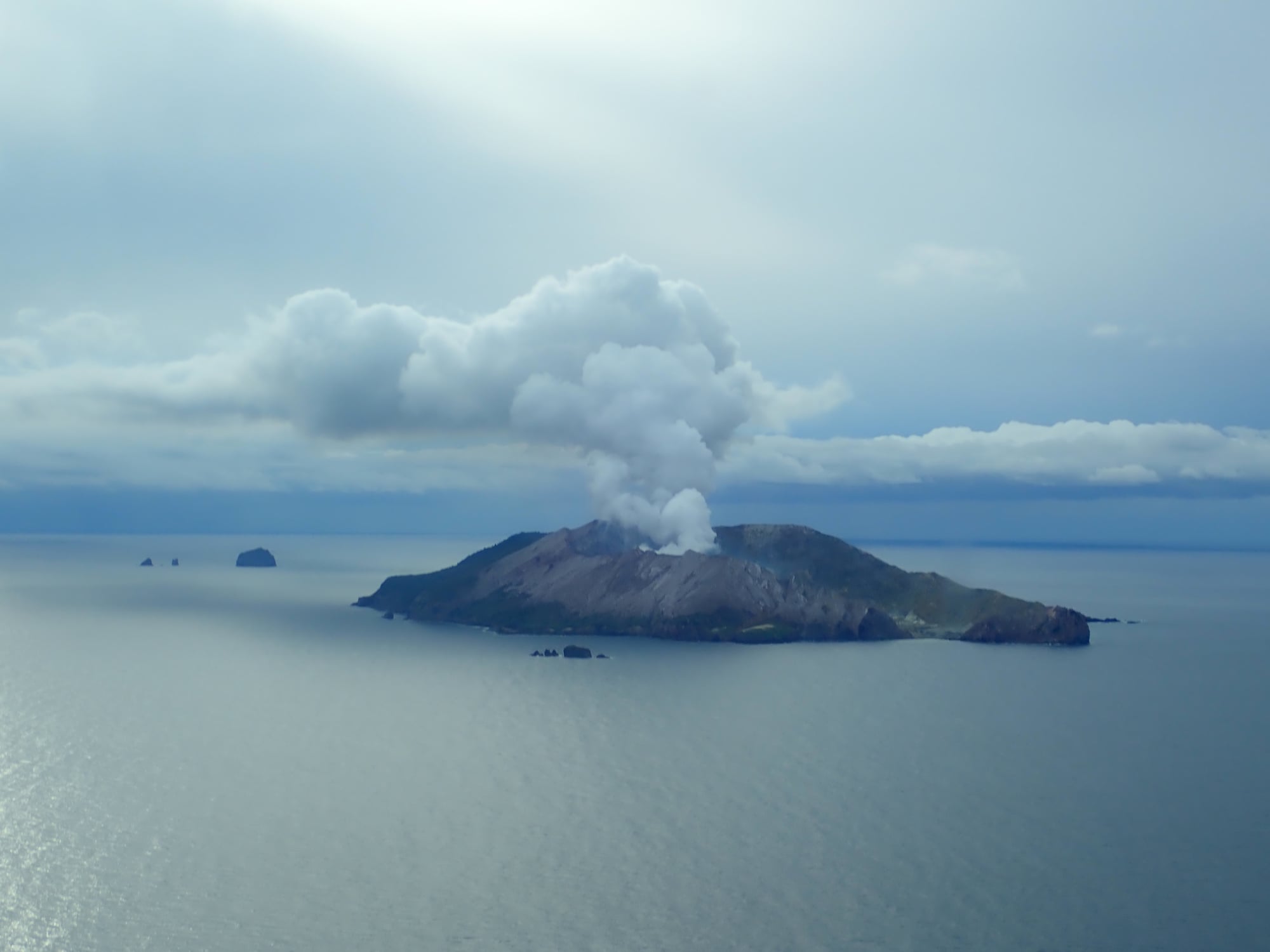
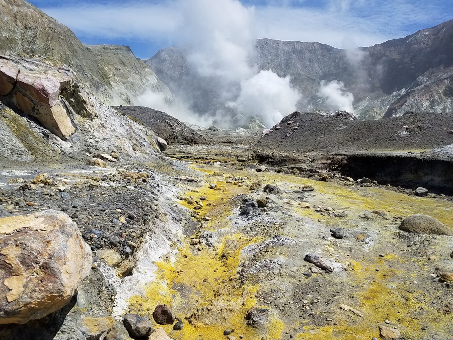
New Zealand , White Island :
Whakaari/White Island: Minor volcanic unrest continues. Volcanic Alert Level remains at Level 1.
Published: Thu Jul 30 2020 9:30 AM
VOLCANIC ALERT BULLETINWI – 2020/12
Aviation Colour Code remains at Green
New observations in July continue to indicate low levels of volcanic activity at Whakaari/White Island. The Volcanic Alert Level remains at 1.
Minor volcanic unrest continues at Whakaari/White Island. Temperatures in the active vents are high and volcanic gases continue to be emitted at moderate rates similar to those measured since May 2020. During fine weather conditions this will generate moderate to large steam plumes above the island.
An observation flight this week shows temperatures remain high at around 540°C in the active vent area. These have reduced from over 740°C measured in February and indicate a slowly cooling active vent area.
The latest gas flight was made in mid-July and regular measurements since May confirm moderate amounts of gas (200 to 300 tonnes per day SO2, 20 to 40 tonnes per day H2S and 1500 to 2000 tonnes per day CO2) continue to be emitted from the active vents. These are at similar rates to those measured between eruptive episodes over the last decade. Measurements of SO2 gas from instruments on the island have also recorded levels of SO2 like those previously seen between eruptive periods.
Deformation data obtained from satellite-based technology in the past month indicate continued subsidence around the active vent area as well as ongoing subsidence of the main crater wall, south and west of the active vents.
In July, the level of volcanic seismic tremor has remained generally low, aside from two short duration bursts of moderate volcanic tremor earlier in the month.
Recent rainfall has created small ponds of water on the crater floor. However, these do not appear to be encroaching into hot vent areas.
All observations over the past month indicate that the volcano remains in minor volcanic unrest and at Volcanic Alert Level 1.
The Volcanic Alert Level reflects the current level of volcanic unrest or activity and is not a forecast of future activity.
Although current indications are that activity is decreasing, an eruption could still occur with little or no warning. The main plausible triggers for a sudden eruption remain the collapse of unstable material from the crater walls onto the vents, increased release of gas from the shallow magma, and the ingress of water underground onto the shallow magma body.
Should any explosive activity produce an ash cloud, the likelihood of ash affecting the mainland remains very low. Under suitable weather conditions, the gas and steam plume may be noticed on the mainland as weak acid rain. Volcanic Alert Level 1 indicates the primary hazards are those expected during volcanic unrest; steam discharge, volcanic gas, earthquakes, landslides and hydrothermal activity. While Volcano Alert Level 1 is mostly associated with environmental hazards, eruptions can still occur with little or no warning.
GNS Science and our National Geohazards Monitoring Centre continue to continuously closely monitor Whakaari/White Island for changes in activity. Further updates will be provided as needed.
The Volcanic Alert Level remains at Level 1. The Aviation Colour Code remains at Green.
Source : Geonet / Craig Miller , Duty Volcanologist.
Photos : Geonet , Weatherboy.
Guatemala , Fuego :
SPECIAL VOLCANOLOGICAL BULLETIN
July 29, 2020 at 6:45 p.m. local time
BEPAC # 48-2020
Activity type: Vulcanian
Morphology: composite stratovolcano
Location: 14 ° 28’54˝Latitude N; 90 ° 52′54˝Longitude W.
Height: 3763 m above sea level.
The descent of weak to moderate lahars is reported at 8:50 p.m. (local time) in the Las Lajas canyon tributary of the Guacalate river and in the El Jute canyon tributary of the Achiguate river, located southeast of the volcano.
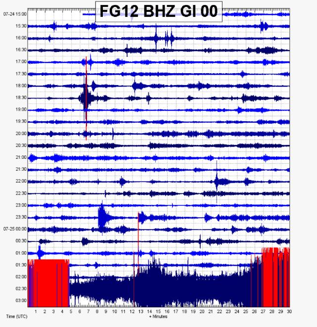
The INSIVUMEH seismic network located on the Volcán Fuego, records high-frequency seismic tremors as shown by the seismogram of the FG12 station. Heavy rains in the upper part of the ravines of the volcanic complex generate the descent of weak to moderate lahars, these can carry tree branches and volcanic material such as ash and boulders 1 to 2 meters in diameter which make the ground vibrate. . If the rain persists, the generation of more lahars in this ravine or in others of the volcanic complex is not excluded.
Source : Insivumeh /Fredy Arnoldo Esquit Chiquitá