June 28 , 2020.
Russia / Kuril Islands , Ebeko :
VOLCANO OBSERVATORY NOTICE FOR AVIATION (VONA)
Issued: June 27 , 2020.
Volcano: Ebeko (CAVW #290380)
Current aviation colour code: ORANGE
Previous aviation colour code: orange
Source: KVERT
Notice Number: 2020-141
Volcano Location: N 50 deg 41 min E 156 deg 0 min
Area: Northern Kuriles, Russia
Summit Elevation: 3791.68 ft (1156 m)
Volcanic Activity Summary:
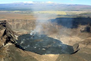
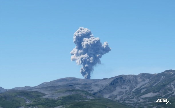
A moderate eruptive activity of the volcano continues. According to visual data by volcanologists from Severo-Kurilsk, explosion sent ash up to 1.9 km a.s.l., an ash cloud is drifting to the south-east of the volcano.
This eruptive activity continues. Ash explosions up to 19,700 ft (6 km) a.s.l. could occur at any time. Ongoing activity could affect low-flying aircraft and airport of Severo-Kurilsk.
Volcanic cloud height:
6232 ft (1900 m) AMSL Time and method of ash plume/cloud height determination: 20200627/0324Z – Visual data
Other volcanic cloud information:
Distance of ash plume/cloud of the volcano: 3 mi (5 km)
Direction of drift of ash plume/cloud of the volcano: ESE / azimuth 110 deg
Time and method of ash plume/cloud determination: 20200627/0324Z – Visual data
Source : Kvert.
Vanuatu Archipelago , Lopevi :
16°30’23”S 169°20’18”E
Summit 4635ft (1413m)
Current Alert Level: Level 2
Lopevi volcano is continuing in the major unrest state. The Volcanic Alert Level remains at Level 2 .
Lopevi volcano activity is continuing to be unstable in the level of major unrest. With the current state, the volcanic activity is likely to increase at any time but it could also remain at the same level for a longtime. Volcanic hazards remain on the island of Lopevi due to the current ongoing volcanic activity. The danger zone for life safety is limited to on the island of Lopevi.

Latest observations and daily analysis of the Lopevi seismic data from the volcano monitoring system confirm that Lopevi volcanic activity conditions remains unstable and its activity is currently continuing in the high level of unrest. The activity continues to occur in the active craters near the summit crater. The volcano activity consists of continuous emission of steam plume.
In the past, small or short-lived eruptions have followed volcanic unrest at Lopevi. The chance for an eruptive phase to follow the current volcanic unrest, like in January 2017, is likely.
With this current volcanic activity, it is a useful reminder that eruptions can occur with little or no warning.
Source :Geohazard.
Photo : Auteur inconnu.
Philippines , Taal / Mayon / Kanlaon :
TAAL VOLCANO BULLETIN: 28 June 2020 08:00 A.M.

In the past 24-hour period, the Taal Volcano Network recorded one (1) volcanic earthquake that is associated mainly with rock-fracturing processes beneath and around the edifice. Weak steaming or fumarolic activity that drifted south-southwest was observed from fissure vents along the Daang Kastila Trail.
MAYON VOLCANO BULLETIN: 28 June 2020 08:00 A.M.
Mayon Volcano’s seismic monitoring network recorded one (1) volcanic earthquake during the 24-hour observation period. Moderate emission of white steam-laden plumes that crept downslope before drifting to the general west was observed. Sulfur dioxide (SO2) emission was last measured at an average of 591 tonnes/day on 23 June 2020. Ground deformation data from Precise Leveling surveys on 12–19 June 2020 indicate a slight inflation of the edifice relative to February 2020 survey. Electronic tilt data also indicated non-steady inflation of the middle to upper edifice that began in late 2019. This follows an inflationary trend that has been recorded by continuous GPS monitoring since the middle of 2019.
KANLAON VOLCANO BULLETIN: 28 June 2020 08:00 A.M.

Kanlaon Volcano’s seismic monitoring network recorded thirty (30) volcano-tectonic earthquakes on the western flanks and one (1) volcanic earthquake in the summit area during the 24-hour observation period. Moderate emission of white steam-laden plumes that rose 300 meters before drifting northwest was observed. Sulfur dioxide (SO2) emission was measured at an average of 116 tonnes/day on 27 June 2020. Ground deformation data from continuous GPS measurements indicate a slight deflation of the lower and mid slopes since January 2020. Short-term electronic tilt monitoring on the southeastern flanks recorded continuing deflation on the lower slopes but inflation on the mid slopes since April 2020. These parameters indicate that hydrothermal or magmatic activity is occurring beneath the edifice.
Source : Phivolcs.
Photos : Tomasz Lepich , Julien Monteillet , dost .
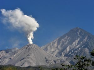
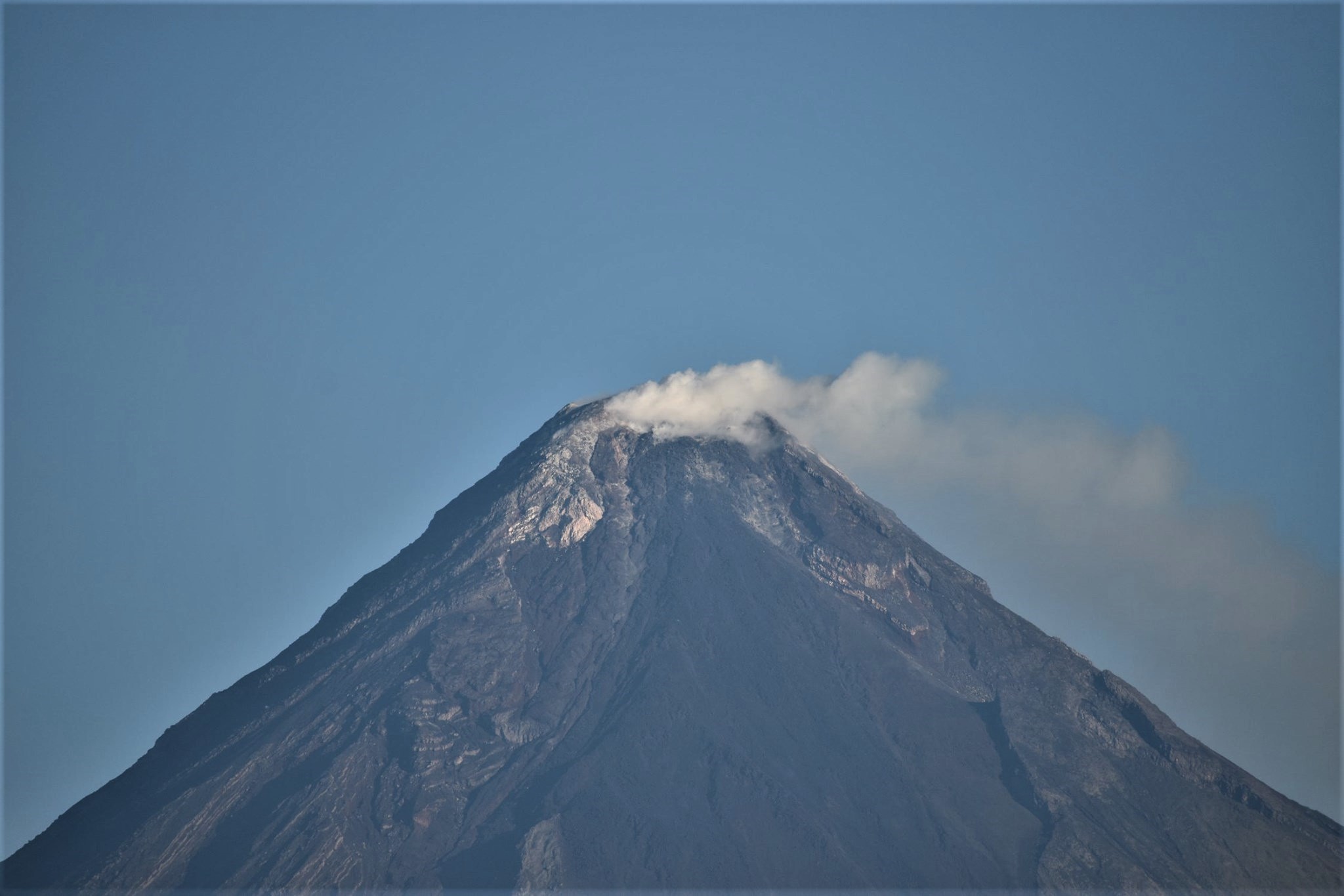
Guatemala , Fuego :
Atmospheric conditions: Clear
Wind: East Precipitation: 0.00 mm.
Activity:
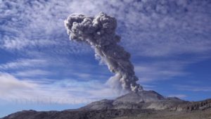
The Fuego volcano observatory reports low to moderate explosions, ranging from 8 to 13 per hour, which are accompanied by columns of gray ash, reaching a height between 4500 and 4800 m (14 764 to 15 748 feet) which disperse in the west and southwest direction for a maximum distance of 15 kilometers. Incandescent pulses rose on the crater from 100 to 300 meters (328 to 984 feet).

The avalanches are moderate to strong in the direction of the Seca, Taniluyá, Ceniza, Lajas and Honda ravines with boulders reaching the vegetation. The explosions generated low to moderate rumblings, 4 loud ones were counted; with moderate to strong shock waves that vibrate the roofs and windows of neighboring cities. Weak sounds similar to those of a train locomotive were heard for 8 to 25 minutes. Ash falls are reported in the villages of: Panimaché I, Morelia, Santa Sofía, Finca Palo Verde, Sangre de Cristo, Yepocapa and others.
Source : Insivumeh.
Photo : Conred