June 01 , 2020.
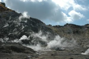
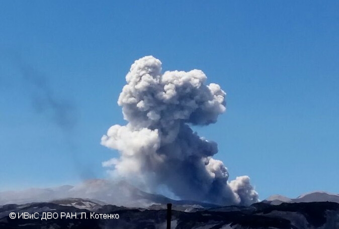
Kamchatka , Ebeko :
VOLCANO OBSERVATORY NOTICE FOR AVIATION (VONA).
Issued: June 01 , 2020.
Volcano: Ebeko (CAVW #290380)
Current aviation colour code: ORANGE
Previous aviation colour code: orange
Source: KVERT
Notice Number: 2020-114
Volcano Location: N 50 deg 41 min E 156 deg 0 min
Area: Northern Kuriles, Russia
Summit Elevation: 3791.68 ft (1156 m)
Volcanic Activity Summary:
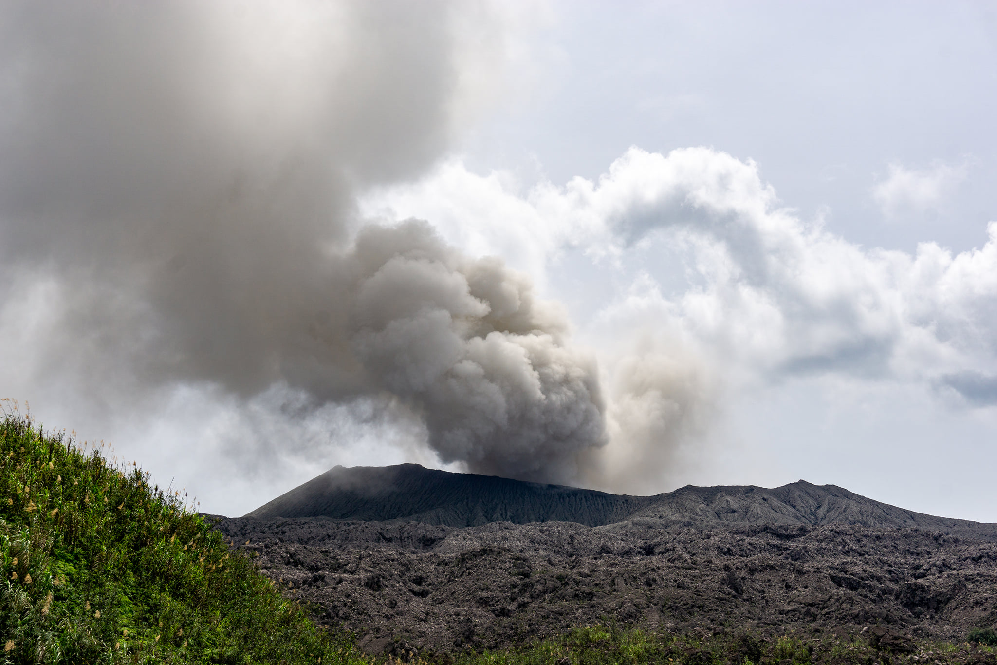
A moderate eruptive activity of the volcano continues. According to visual data by volcanologists from Severo-Kurilsk, explosion sent ash up to 2.5 km a.s.l., an ash cloud is drifting to the north-еast of the volcano.
This activity continues. Ash explosions up to 19,700 ft (6 km) a.s.l. could occur at any time. Ongoing activity could affect low-flying aircraft and airport of Severo-Kurilsk.
Volcanic cloud height:
8200 ft (2500 m) AMSL Time and method of ash plume/cloud height determination: 20200601/0454Z – Visual data
Other volcanic cloud information:
Distance of ash plume/cloud of the volcano: 3 mi (5 km)
Direction of drift of ash plume/cloud of the volcano: NE.
Source : Kvert.
Photo : L. Kotenko, IVS FEB RAS , 2017.
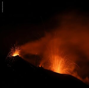
Indonesia , Dukono :
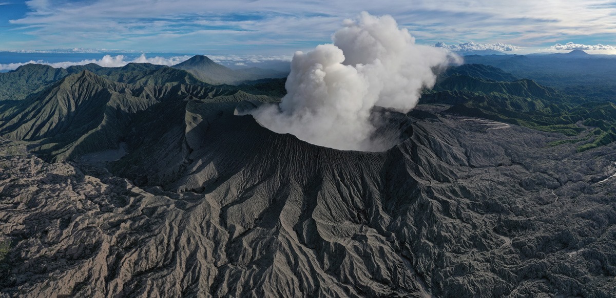
Level of activity at level II (WASPADA). The Dukono (1229 m above sea level) is experiencing a continuous eruption.
The volcano is clearly visible until it is covered with fog. The smoke from the crater is low pressure, white / gray with thick intensity, from a height of 100 to 200m above the Cuacererawan crater. The weather is cloudy and rainy, light to moderate winds going west.
According to the seismographs of May 31, 2020, it was recorded:
1 volcanic earthquake
Continuous tremor (amplitude 0.5 to 4 mm, dominant value 2 mm).
Recommendation:
The communities around G. Dukono and visitors / tourists must not move, climb and approach the crater of Malupang Warirang within a radius of 2 km.
Since volcanic ash eruptions occur periodically and the ash dispersion follows the wind direction and speed, when the ash is not fixed, it is recommended that the community around G. Dukono always wear masks / nose and mouth cover to be used when necessary to avoid threats of the danger of volcanic ash in the respiratory system.
VOLCANO OBSERVATORY NOTICE FOR AVIATION – VONA .
Issued : May 31 , 2020.
Volcano: Dukono (268010)
Current Aviation Colour Code: ORANGE
Previous Aviation Colour Code: orange
Source: Dukono Volcano Observatory
Notice Number: 2020DUK41
Volcano Location: N 01 deg 41 min 35 sec E 127 deg 53 min 38 sec
Area: North Maluku, Indonesia
Summit Elevation: 3933 FT (1229 M)
Volcanic Activity Summary:
Eruption with volcanic ash cloud at 22h25 UTC (07h25 local).
Volcanic Cloud Height:
Best estimate of ash-cloud top is around 5213 FT (1629 M) above sea level, may be higher than what can be observed clearly. Source of height data: ground observer.
Other Volcanic Cloud Information:
Ash-cloud moving to west
Remarks:
Eruption and ash emission is continuing.
Source : PVMBG , Magma Indonésie .
Photos : Claudio Jung. Martin Rietze .
Vanuatu Archipelago , Ambrym :
16°15’00”S 168°07’00”E
Summit Elevation 4377ft (1334m)
Current Vanuatu Volcano Alert Level: Level 1
Ambrym volcano is continuing in the minor unrest state. The Volcanic Alert Level remains at Level 1 .
Some volcanic hazards do remain on Ambrym specifically at the summit and eastern part of the Island. These are related to the presence of cracked areas. In addition to the summit hazards, the presence of active rifts and faults (major ground cracking) at the South-East area of Ambrym are also hazardous, they will continue to be eroded and affected by earthquake activity. The danger zone for life safety at the summit area remains limited inside the Permanent Exclusion Zone at Benbow and Danger Zone A at Marum (See Ambrym caldera safety map below). These danger zones are about 1 km around Benbow and 2 km around Marum craters including Maben-Mbwelesu, Niri-Mbwelesu and Mbwelesu. An additional danger zone at the South-East of Ambrym remains within 500 meters from major cracks
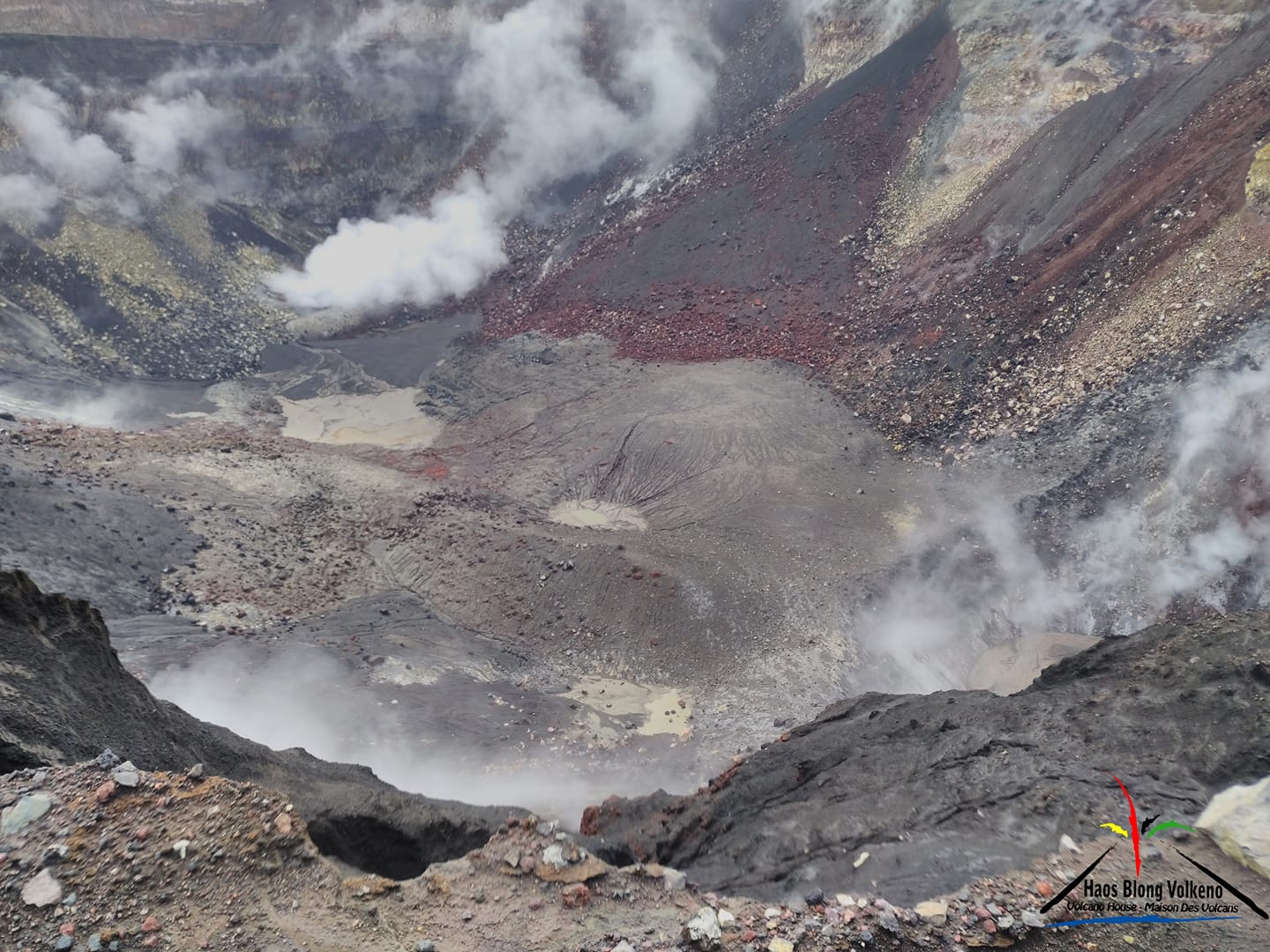
The new face of Benbow volcano! No more visible lava!
Latest observations and daily analysis of the Ambrym seismic data from the volcano monitoring system confirm that the Ambrym volcano activity conditions remains stable and its activity is continuing at the low level of unrest. The lava lakes that used to appear in Benbow and Marum craters have disappeared since the December 2018 eruption. The remaining activity inside both craters consists of ongoing steam emissions. People from Ambrym and neighbouring islands will not see the volcanic glow at nights.
Open cracks in the South-East Ambrym that formed during the December 2018 eruption may continue to open due to erosion. Major earthquake activity could continue to affect these cracks and weak layers or areas around the actives craters.
Source : Geohazard.
Photo : Haos Blong Volkeno , 27 Mai 2019 .
Ecuador , Sangay :
DAILY REPORT OF THE STATE OF SANGAY VOLCANO, Sunday, May 31, 2020.
Surface activity level: High, Surface trend: No change.
Internal activity level: High, Internal trend: No change.
Seismicity: From May 30, 2020, 11:00 a.m. to May 31, 2020, 11:00 a.m .:
Long Period Type (LP): 17 events.
Explosions: 13.
Rains / lahars: According to satellite data, rains have been recorded in the area. ** In the event of heavy rain, secondary lahars can be generated in the Volcán, Upano and other tributaries. **
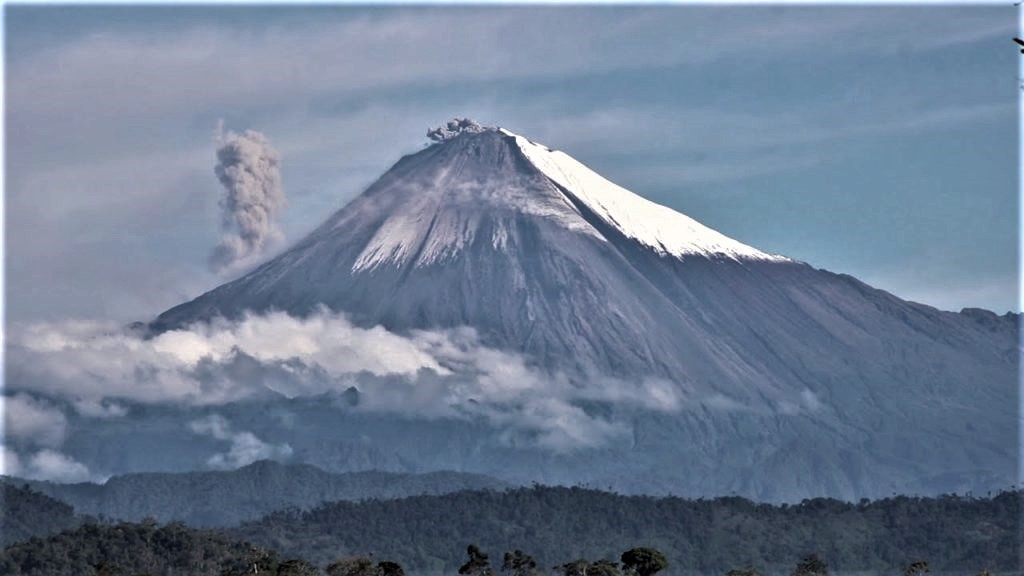
Emission / ash column: No emission was observed, however, the Washington VAAC reported two ash emission alerts, with a maximum height of 570 meters above the level of the crater, in a southwest direction. .
Other monitoring parameters: No changes.
Observations: Climatic conditions in the area prevented direct observations of surface activity.
Alert level: yellow.
Source et photo : IGEPN.