May 20 , 2020.
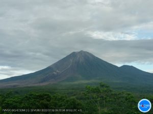
Italy / Sicily , Etna :
PRESS RELEASE ON THE VOLCANIC ACTIVITY of May 19, 2020, 10:12:52 UTC (12:12:52 LOCAL HOURS) – ETNA.
The National Institute of Geophysics and Volcanology, Etneo Observatory, reports that the monitoring networks have recorded Strombolian activity at 12:12 hours (10:12 UTC).
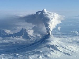
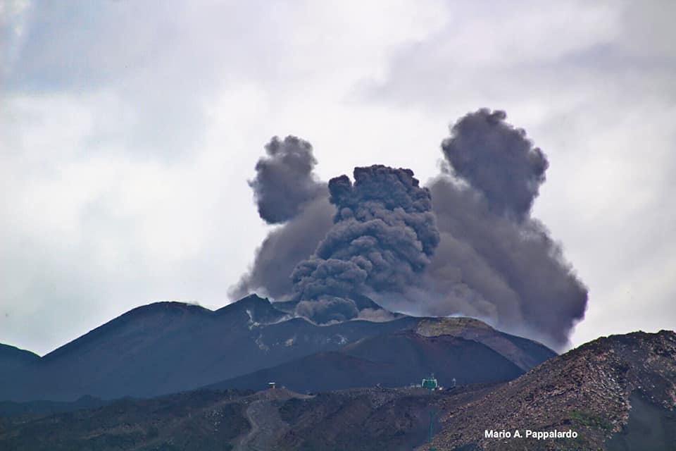
From 08:45 h UTC, strombolian activity in the New Southeast Crater, reported in the previous press release, increased in intensity. This activity is also associated with a low ash emission dispersed towards the North-East.
From the seismic point of view, the average amplitude of the volcanic tremor is, from 09:20 hours UTC, in phase of increase and currently shows high values. The source of the tremor is located in the area of the New Southeast Crater at a depth of about 2.9 km above sea level. The infrasonic activity during the morning showed a moderate increase and is localized in the area of the New Southeast Crater.
The deformations of the soil do not show significant impulsive variations associated with the current phenomenology. However, a trend of movement towards the North at the Pizzi Deneri and Crater of North East stations, which started in early May, continues.
In the photo above, ash emissions at the New Southeast Crater, May 18-19, 2020.
ETNA PRESS RELEASE [UPDATE n. 52]
The National Institute of Geophysics and Volcanology, Etneo Observatory, announces that according to the analysis of the images of the surveillance cameras, from 13:10 UTC, there is a decrease in strombolian activity in the New South Crater -East. The previously reported modest emission of ash has ceased. A low ash fall in the summit area was also observed by INGV-OE personnel present in the field during the increase in Strombolian activity. From a seismic point of view, the average amplitude of the volcanic tremor, after the sudden increase which started at 09:20 UTC, reached its maximum value at 10:00 UTC.
Subsequently, the amplitude began to decrease, settling on average values, which are still not comparable to those observed previously (press release 51). The source of the tremor, as well as the infrasound activity (also in moderate decrease) are in the zone of the New Crater of the Southeast, as indicated previously. The deformations of the soil do not present significant variations linked to current phenomenology. From the first days of May, there is a slight increase in the northern component of the speed of the summit stations of Pizzi Deneri (EPDN) and the northeast crater (ECNE), for which a displacement of about 1 cm has was measured in the north direction.
Weekly bulletin from May 11, 2020 to May 17, 2020 (issue date May 19, 2020)
SUMMARY OF THE STATUS OF THE ACTIVITY
In light of the monitoring data, it is underlined:
1) VOLCANOLOGICAL OBSERVATIONS: Low explosive activity in the Voragine crater with sporadic emission of ash. Strombolian activity with ash emissions from the New Southeast Crater.
2) SEISMOLOGY: Modest fracturing seismicity. Amplitude of the tremor oscillating between medium and high values.
3) INFRASOUND: weak infrasound activity
4) DEFORMATIONS: The Etna soil deformation monitoring networks have not shown any significant variation to report during the last week.
5) GEOCHEMISTRY: The flow of SO2 is at a medium-low level. The values of the soil CO2 flux are medium-high values with a decreasing trend which started in the first days of May. The partial pressure of dissolved CO2 does not show significant variations. The C \ S ratio recorded in discrete mode (sampling carried out on May 15) at the Voragine crater is at average values. The isotopic ratio of helium is fixed at average values (last update 28/04)
6) SATELLITE OBSERVATIONS: The thermal activity in the upper zone is weak.
VOLCANOLOGICAL OBSERVATIONS
The monitoring of volcanic activity in the upper craters of Etna, during the week, was carried out by analyzing the images of the network of surveillance cameras from the INGV Catania section, Etneo Observatory (INGV- OE) and by an inspection carried out by INGV-OE staff on May 15. The figure shows the summit area of Etna through a shaded terrain model, obtained from the photogrammetric processing of the images taken with the drones during an inspection carried out on May 9 by M. Cantarero and E. De Beni, integrated to the comments made by Mr. Coltelli during the May 15 inspection. On the map, the two zooms A and B are respectively the details of the volcanic complex formed by the Southeast crater and the New Southeast crater on the one hand, and the Bocca Nuova and Voragine on the other. Indented black lines = edge of the upper craters: BN = Bocca Nuova, with the northwest (BN-1) and southeast (BN-2) depressions; VOR = Voragine; NEC = Northeast Crater updated in July 2017; SEC = Southeast Crater; NSEC = New southeast crater. The indented blue line indicates the depression inside the Bocca Nuova. Yellow circles = degassing vents, red circles = active vents. The green polygon defines the cooling flow. The dotted lines indicate that the limit is uncertain because the presence of gas slightly obliterated certain areas during the surveys. The topographic reference base on which the morphological updates have been superimposed is the DEM 2014 (Laboratory of Aerogeophysics-Rome Section 2).
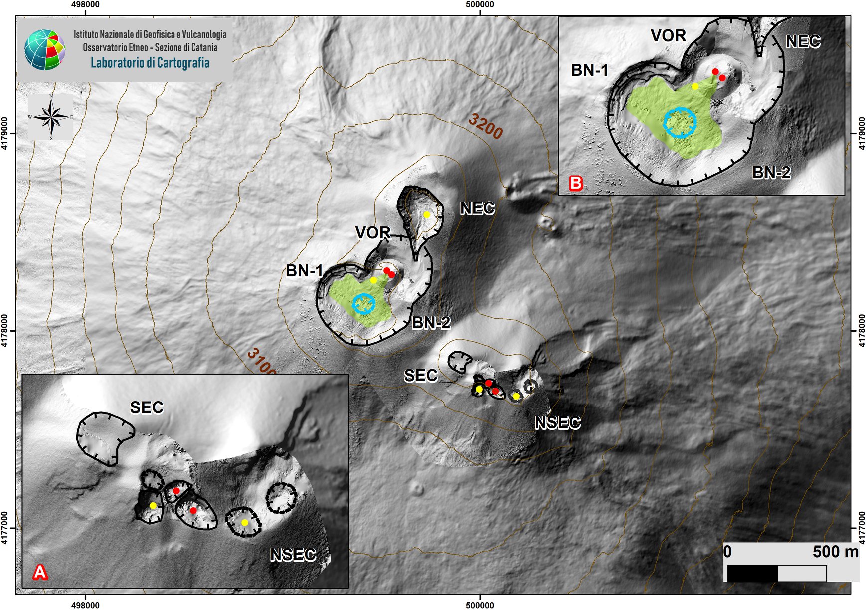
Fig. 3.1 – Map of the summit crater area updated on May 15, 2020 by the group of drones INGV-OE, the topographic base on which the updates have been superimposed is DEM 2014 (Laboratory of Aerogeophysics-Section Rome 2, (for detailed description, see text).
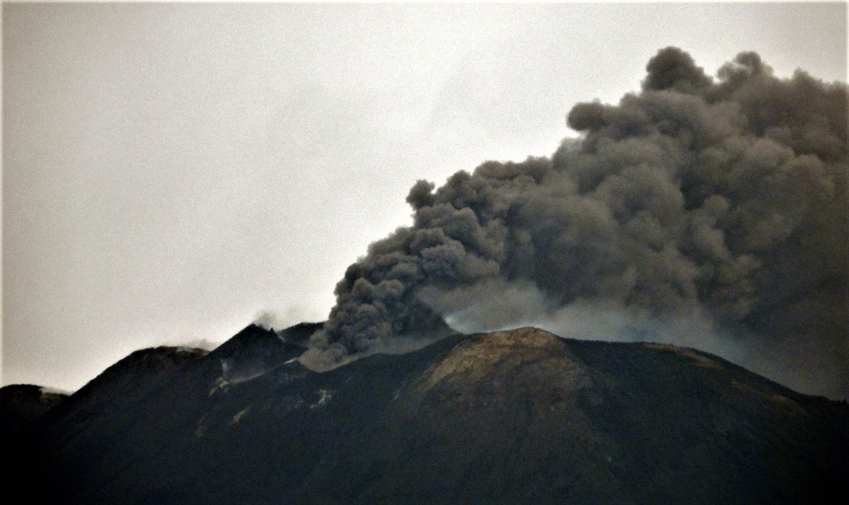
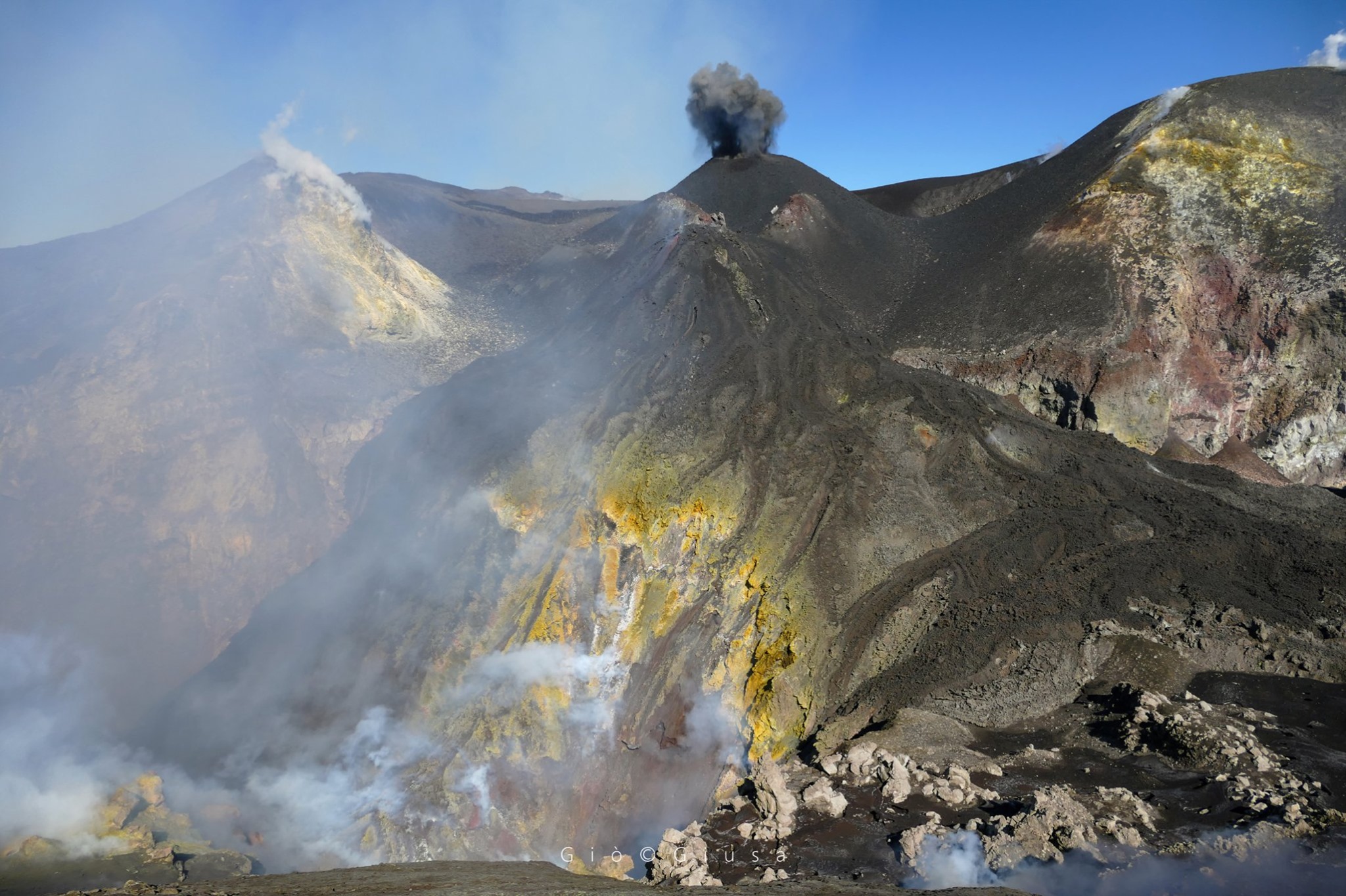
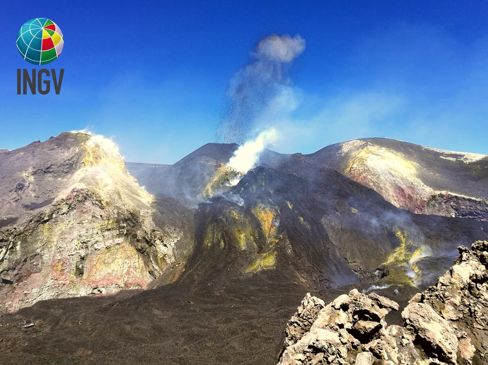
During the period considered, the upper craters were characterized mainly by an explosive activity in the crater of Voragine, relatively soft and very discontinuous, and by a strombolian activity in the New Southeast Crater, with ash emissions which are are rapidly dispersed in the atmosphere.
In particular, during the May 15 inspection, the eruptive activity in Voragine was among the lowest observed from the beginning of March to today. Indeed, during the stay in the summit area, of about two hours, 4 to 5 ash emissions were recorded from the main cone of Voragine, active since September. These emissions were characterized by a series of very weak and weak pulses and were not accompanied by bombs and falling materials. The Southeast crater did not show any activity.
As for the Bocca Nuova, the dimensions of the collapsed area did not show any significant changes compared to the May 9 investigation, while inside the degassing fractures appeared wider and the degassing less intense. Finally, also during the inspection on May 15, the crater of the New South-East Crater saddle seems to have widened further to the North, following collapses which exposed the new internal wall without signs of fumaroles.
During the week, the explosive activity continued at the New Southeast Crater, in the crater area of the saddle, ranging from simple explosions to Strombolian activity lasting a few hours. This activity was accompanied by ash emissions which quickly dispersed into the atmosphere. …/…
Source : INGV .
Photos : INGV , Mario Alfio Pappalardo , Gio Giusa.
Read the whole article : file:///C:/Users/Utilisateur/AppData/Local/Packages/Microsoft.MicrosoftEdge_8wekyb3d8bbwe/TempState/Downloads/BollettinoEtna20200519%20(1).pdf
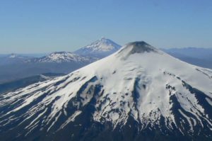
Colombia , Chiles / Cerro Negro :
Weekly activity bulletin of Chiles and Cerro Negro volcanoes
Volcanic activity continues at the YELLOW LEVEL ■ (III): CHANGES IN THE BEHAVIOR OF VOLCANIC ACTIVITY.
According to the monitoring of the activity of VOLCANS CHILE and CERRO NEGRO, the COLOMBIAN GEOLOGICAL SERVICE (SGC) reports that:
For the period evaluated between May 12 and May 18, 2020, compared to the previous week, there was a slight decrease in both the number and the energy released by the recorded seismicity, which maintains the predominance of associated events at the rock break inside the volcano.
This seismicity was located mainly south of the volcanic building of Chiles, at epicentral distances up to 16 km and depths less than 11 km, compared to its summit (4700 m altitude) and with local magnitudes up to ‘at 1.8 on the Richter scale. The sporadic occurrence of earthquakes associated with fluid dynamics in the volcanic system continues, accounting for 12% of the total seismicity.
The changes recorded by one of the volcanic deformation sensors have continued since September 2019. No manifestation of surface activity has been observed. The other volcanic monitoring parameters did not show significant variations.
Source : Ingeominas .
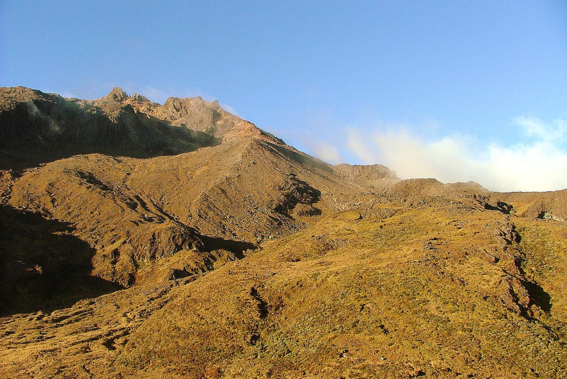
Photo : Boriss Andean / summit post.
Mexico , Popocatepetl :
May 19, 11:00 a.m. (May 19, 4:00 p.m. GMT)
In the past 24 hours, using the Popocatépetl volcano monitoring system, 198 exhalations have been identified, accompanied by water vapor, volcanic gases and slight amounts of ash. The ash emissions were dispersed in the East-South-East sector. In addition, 328 minutes of tremors and a volcano-tectonic earthquake were recorded, recorded yesterday at 21:19 with a calculated magnitude of M2.9.
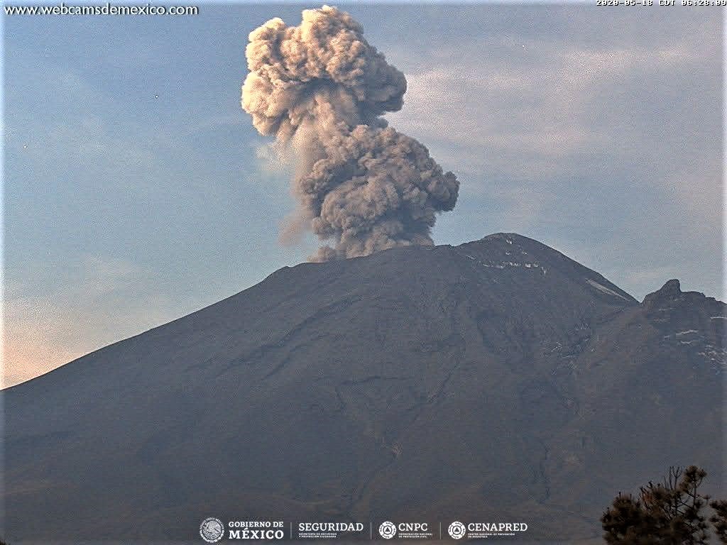
At the time of this report, there was visibility towards the volcano, and during the early hours of the morning, one could see the emission of volcanic gases and small amounts of ash that were dispersed mainly to the east.
CENAPRED urges not to get near the volcano and especially the crater, because of the danger involved in the fall of ballistic fragments and, in the event of heavy rain, to move away from the bottom of the ravines because of the danger of mud and debris.
The Popocatépetl volcanic alert signaling light is in YELLOW PHASE 2.
Source : Cenapred .
Iceland , Reykjanes Peninsula :
About 490 earthquakes were located by the IMO¿s SIL seismic network this week, fewer than last week when over 670 earthquakes were located. Less activity was in Reykjanes peninsula and in the Highlands than last week, but activity continues in Reykjanes with over 200 earthquakes located there this week, most by Reykjanestá like last week.

More activity was in the North and in Mýrdalsjökull glacier than last week. The largest earthquake of the week was M2.7 in Öxarfjörður on 12. May at 7:09. IMO received no reports that the earthquake was felt. Six earthquakes were located in Grímsvötn and one small earthquake was located in Hekla.
Source : Vedur Is.