August 16 , 2022.
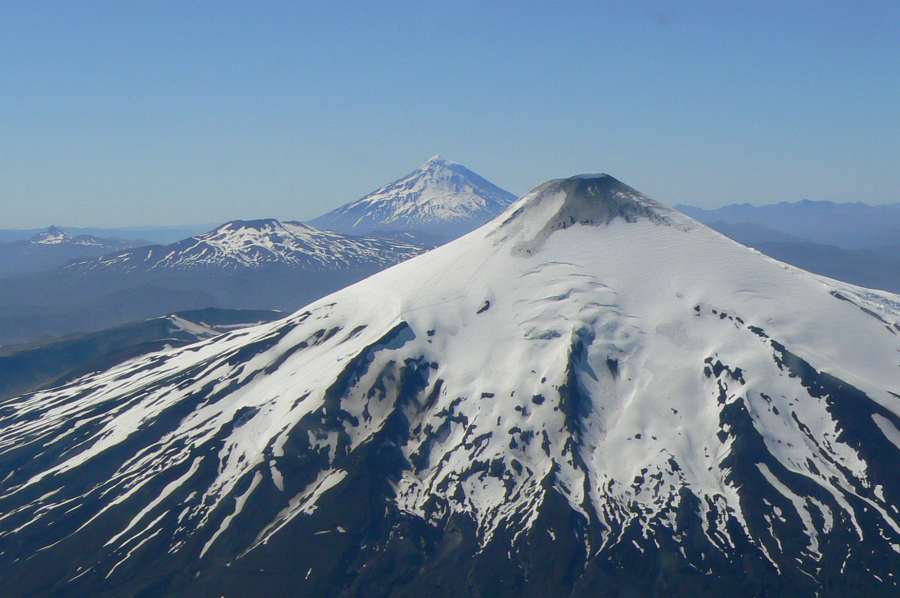
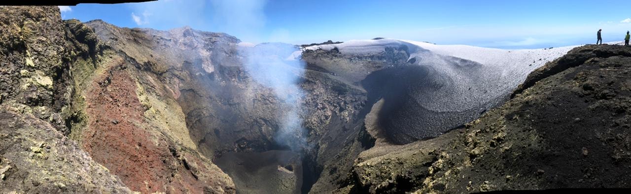
Chile , Villarica :
Special Report on Volcanic Activity (REAV), Auracania Region, Los Rios Region – Villarica Volcano, August 12, 2022, 1:50 p.m. local time (mainland Chile)
The National Geology and Mining Service of Chile (Sernageomin) publishes the following PRELIMINARY information, obtained through the monitoring equipment of the National Volcanic Monitoring Network (RNVV), processed and analyzed in the Volcanological Observatory of the Southern Andes (Ovdas) :
Seismology
The seismological activity of the period was characterized by a low occurrence of seismicity of the long period type (LP) associated with the dynamics of the fluids inside the volcanic system, accounting for between 20 and 60 earthquakes per day. In general, this seismicity has reduced displacement values (RD) of less than 11 cm2, with a maximum of Dr equal to 20, values considered low. The continuous tremor signal with energy values evaluated from the RSAM between 0.25 and 0.4 um/s, values considered low. This tremor signal had dominant frequencies between 1.0 and 1.2 Hz and a second group of dominant frequencies between 1.6 and 1.9 Hz
When the VT type seismicity, associated with rock fracturing (Volcano-Tectonic), 2 earthquakes were recorded with a local magnitude value (ML) equal to 1.2 and 0.2, These earthquakes were located at a distance of 5 km in an east-southeast direction from the volcanic edifice, at a depth of 3.0 and 4.8 km respectively.
Fluid Geochemistry
From the first days of the month, a sustained increase in the value of sulfur dioxide (SO2) emissions was observed, obtained through the optical spectroscopy equipment of the Tralco station installed 6 km to the east. east-southeast (ESE) of the active crater. For the current month, 5 days of measurements were recorded showing a value of 3195 +/- 825 t/d, and a maximum of 5303 t/d (August 11), a value considered to be above normal limits (>1800 t/d) established for this volcano.
Satellite thermal anomalies
During the month, a slight increase in satellite thermal anomalies was observed according to data processed by the Middle Infrared Observation of Volcanic Activity (MIROVA). ) (http://www.mirovaweb.it/) with a maximum volcanic radiative power (VRP) of 2 MW on August 9. Thanks to the analysis of Sentinel 2L2A satellite images, 3 radiance anomalies were detected in the area associated with the crater, on August 1, 3 and 8, with a maximum anomalous radiance surface of 1800 m2 on August 3.
Geodesy
According to data provided by 4 GNSS stations installed around the volcanic edifice, displacements of low magnitude have been observed, the directions of which are not consistent with a source of deformation of the surface of the volcano. In addition, variations associated with the heavy presence of snow were recorded, showing no significant signs of deformation indicating changes in the dynamics inside the volcano.
Surveillance cameras
Through the surveillance cameras, it was observed a predominance of gas emissions in the atmosphere, with a gradual increase from August. Notwithstanding, the column heights showed a level considered low, with a maximum height on August 2 of 300 m (9:34 p.m.). No events with pyroclast emissions were noted. From July 29, a nocturnal incandescence was recorded recurrently and with greater intensity compared to previous months.
In accordance with the analysis of the parameters described, these suggest a process of greater superficialization of the lava lake compared to previous months.
The Volcanic Technical Alert Level maintains at the GREEN level.
Source : Sernageomin.
Photos : ameriquedusud.org , Nicolás Luengo .
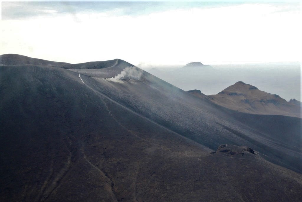
Indonesia , Semeru :
VOLCANO OBSERVATORY NOTICE FOR AVIATION – VONA
Issued : August 15 , 2022
Volcano : Semeru (263300)
Current Aviation Colour Code : ORANGE
Previous Aviation Colour Code : orange
Source : Semeru Volcano Observatory
Notice Number : 2022SMR191
Volcano Location : S 08 deg 06 min 29 sec E 112 deg 55 min 12 sec
Area : East java, Indonesia
Summit Elevation : 11763 FT (3676 M)

Volcanic Activity Summary :
Eruption with volcanic ash cloud at 23h35 UTC (06h35 local)
Volcanic Cloud Height :
Best estimate of ash-cloud top is around 13683 FT (4276 M) above sea level, may be higher than what can be observed clearly. Source of height data: ground observer.
Other Volcanic Cloud Information :
Ash-cloud moving to west
SEISMICITY OBSERVATION:
20 earthquakes of eruptions/explosions with an amplitude of 20-23 mm and a duration of 66-134 seconds.
Source : PVMBG.
Photo : Oystein Lund Andersen .
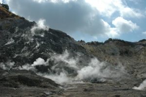
Colombia , Puracé – Chaîne volcanique Los Coconucos :
Weekly bulletin of the activity of the Puracé volcano – Los Coconucos volcanic chain
The activity level of the volcano continues at the Yellow activity level or (III): changes in the behavior of volcanic activity.
From the analysis and evaluation of the information obtained through the monitoring network of the Puracé volcano – Los Coconucos volcanic chain, during the week of August 2 to 8, 2022, the COLOMBIAN GEOLOGICAL SERVICE – Volcanological and Seismological Observatory of Popayan informs that:
During the period evaluated, 334 seismic events were recorded, of which 27 were associated with rock fracturing processes (type VT) and 307 with fluid dynamics in volcanic conduits; of these, 264 were classified as long-period type events (LP type), two (2) events were associated with both failure mechanisms and fluid dynamics, so they were classified as hybrid (type HB), two (2) were classified as low frequency events (type BF), six (6) as « tornillos » type earthquakes (type TO) and 33 as pulses of low energy tremor (type TR).
The geodetic network of GNSS (Global Navigation Satellite System) stations monitoring ground deformation continues to record a process associated with inflation.
When monitoring surface activity, images obtained during the week using the Anambío, Mina, Lavas Rojas and Cerro Sombrero web cameras showed degassing of the volcanic system, with a white column oriented preferentially to the northwest. .
Magnetic field and infrasonic wave monitoring sensors did not record variations associated with changes in volcanic activity.
It is concluded from the above that significant variations in volcanic activity continue to be recorded, consistent with the behavior expected at activity level III (yellow level), which could evolve towards states of greater activity.
Source : SGC.
Photo : Mapio
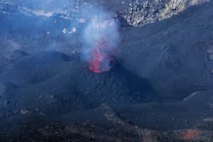
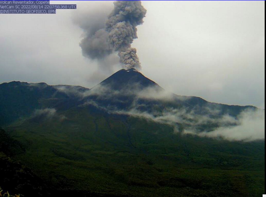
Ecuador , Reventador / Chiles :
DAILY REPORT OF THE STATE OF THE REVENTADOR VOLCANO, Monday August 15, 2022.
Information Geophysical Institute – EPN.
Surface Activity Level: Moderate, Surface Trend: No change.
Internal activity level: Moderate, Internal trend: No change.
Seismicity: From August 14, 2022, 11:00 a.m. to August 15, 2022, 11:00 a.m.:
Explosion (EXP) 43
Long Periods (LP) 61
Emission Tremors (TREMI ) 7.
Rains / Lahars:
No rain was recorded.
Emission / ash column:
Yesterday afternoon, the volcano cleared and several emissions of gas, steam and ash could be observed towards the West and the North-West with heights between 500 and 600 meters above the level of the crater. Washington’s VAAC over the past 24 hours has released 3 reports of ash emission 988 meters above the summit looking northwest.
Other Monitoring Parameters:
In the past 24 hours, there have been no thermal alerts reported by the FIRMS and MIROVA systems.
Observation:
During yesterday night an incandescence was observed at the level of the crater. Today in the morning the area of the volcano remained cloudy.
Alert level: Orange.
———————————————————————————————————————————————-
DAILY REPORT OF THE STATE OF THE CHILES VOLCANO, Monday August 15, 2022.
Information Geophysical Institute – EPN.
Surface activity level: Very low, Surface trend: No change.
Internal activity level: Moderate, Internal trend: Ascending.
Seismicity: From August 14, 2022, 11:00 a.m. to August 15, 2022, 11:00 a.m.:
Since the earthquake of 07/25/2022, 1753 events have been located on the Chiles-Cerro Negro volcanic complex. The following table shows the total number of earthquakes at the CHL2 reference station, in the last 24 hours.
Tectonic Volcano (VT) 1200
Long Periods (LP) 18

Locations of seismic events recorded on Chiles-Cerro Negro (orange dots) and Potrerillos-Chalpatán (red dots) since the 07/25/2022 earthquake (yellow star) to date.
Seismicity at Potrerillos-Chalpatán:
After the earthquake of magnitude 5.2 MLv (5.6 Mw) which occurred on 07/25/2022, in the Potrerillos-Chalpatán region, about 15 km southeast of the Chiles-Cerro Negro volcanic complex, 888 earthquakes of magnitudes between 0.5 to 4.2 Mlv have been located at less than 10 km depth in the epicentral zone.
Rains / Lahars:
No rain was recorded.
Observation:
Yesterday afternoon the volcano was partially cleared with no observed surface level activity, today morning it cleared without much change.
Source : IGEPN
Photos : IGEPN.
Costa Rica , Turrialba / Poas / Rincon de la Vieja :
Daily report of the state of volcanoes. Date: August 14, 2022, updated at: 10:50:00.
Turrialba Volcano (photo July 17)
Latitude: 10.025 Longitude: -83.767
Altitude: 3,325 meters
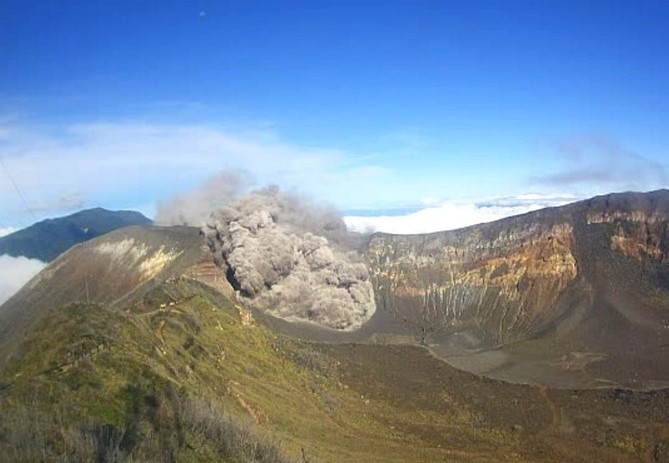
Observed activity:
Park rangers reported a large crater collapse at around 8:50 a.m., which was not enough to be recorded by the seismic network. The air quality monitoring station located in Coronado has recorded an increase in the concentration of SO2 and fine particles (PM10, PM2.5 and PM1.0) since August 11.
Environmental conditions:
The wind is blowing northwest.
Activity Level: Warning (2)
Poas Volcano
Latitude: 10.2 Longitude: -84.233
Altitude: 2687 meters.

Observed activity:
The seismic activity remains of low amplitude. Gas ratios remain stable. The temperature of the lake was measured remotely at 32°C yesterday. Convection cells continue to be observed.
Environmental conditions:
The wind is blowing southwest. Visibility conditions are good this morning.
Activity Level: Warning (2)
Rincon de la Vieja Volcano
Latitude: 10.83 Longitude: -85.324
Altitude: 1,916 meters
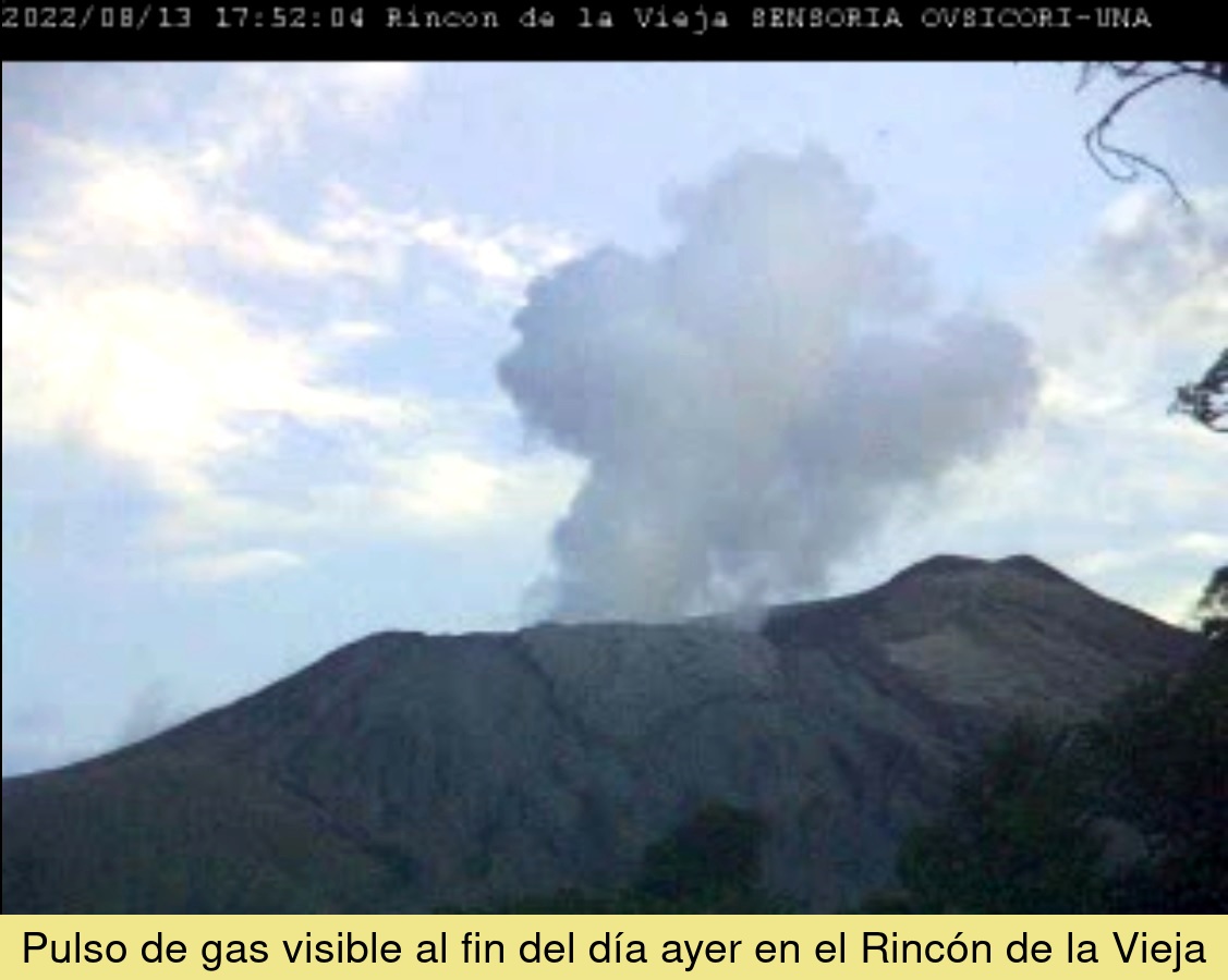
Observed activity:
Exhalations were recorded and a gas pulse could be observed at 5:42 p.m. yesterday associated with the seismic signal. A fragmented tremor is recorded.
Environmental conditions:
The wind is blowing southwest. Visibility conditions are variable, generally limited.
Activity Level: Warning (2)
Source et photos : Ovsicori.