February 08 , 2020 .
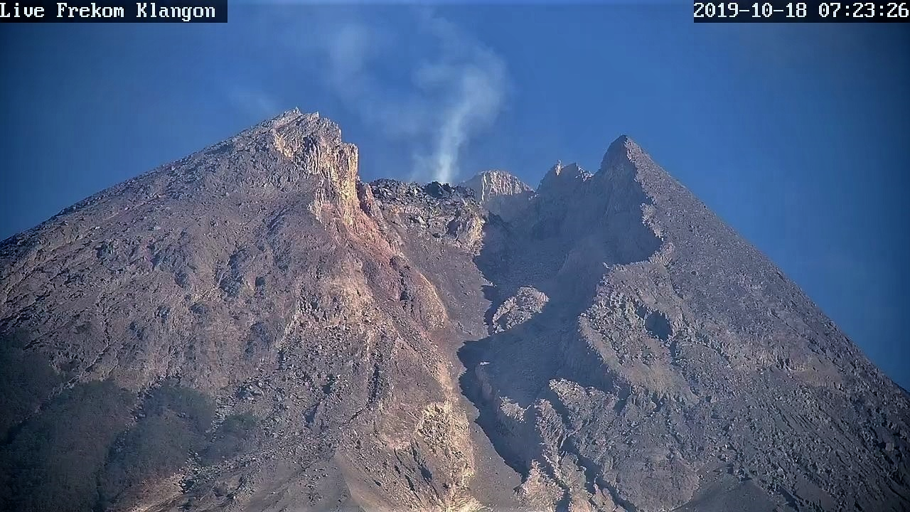
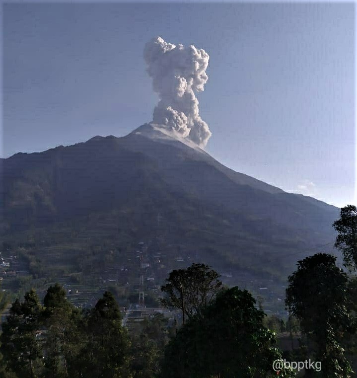
Indonesia , Merapi :
Activity report of the Merapi volcano, January 31-February 6, 2020
OBSERVATION RESULTS
visual
The weather around Mount Merapi is generally sunny in the morning, while in the evening and at night it is mainly foggy. There is white smoke, from thin to thick with a low pressure. A maximum smoke height of 500 m was observed from the Mount Merapi observation post in Selo on February 2, 2020 at 5:50 a.m.WIB.
Morphological analysis of the crater area based on photographs of the Southeast sector did not show any significant morphological change. The volume of the lava dome based on aerial photo analysis with drones on November 19, 2019 was 396,000 m3.
Seismicity:
During this week, the seismic sensors of Mount Merapi recorded:
14 emission earthquakes (DG),
2 deep earthquakes (VTA),
3 shallow volcanic earthquakes (VTB),
23 multiple phase earthquakes (MP),
42 avalanche earthquakes (RF),
25 low frequency (LF) earthquakes
21 tectonic earthquakes (TT).
The LF type seismicity this week is higher than last week.
Deformation:
The deformation of G. Merapi which was monitored by EDM and GPS this week did not show any significant change.
Rain and lahars:
This week there was rain at the Mount Merapi observation post with the highest precipitation of 40 mm / hour for 30 minutes at Pos Kaliurang on February 1, 2020. It was reported that there was a increased flow in the Gendol River on February 3 and 6, 2020.
Conclusion:
Based on the results of the visual and instrumental observations, it was concluded that:
1. The lava dome is currently in a stable state
2. The volcanic activity of Mount Merapi is still quite high and is determined by the level of activity « WASPADA ».
3. The current potential danger is in the form of hot clouds from the collapse of the lava dome and bursts of volcanic material due to explosive eruptions.
Source : BPPTKG.
Photos : Live Frekom Klangon 18.10.2019 / 7h23 , BPPTKG.
Italy , Campi Flegrei :
Weekly bulletin from 01/28/2020 to 04/02/2020, (Update from 04 February 2020 at 12:00 local time)
SUMMARY OF THE ACTIVITY:
In light of the monitoring data:
1) Seismicity: This last week in the Campi Flegrei, three earthquakes of small amplitude were recorded (Mdmax = 0.1).
2) Deformation: The average uplift value has been around 0.7 cm / month since July 2017. The zone of maximum deformation showed an increase in the weeks between the end of November and the beginning of December, then returned to the usual average values after the swarm of December 6. The lift recorded at the RITE GPS station has been approximately 59.5 cm since January 2011.
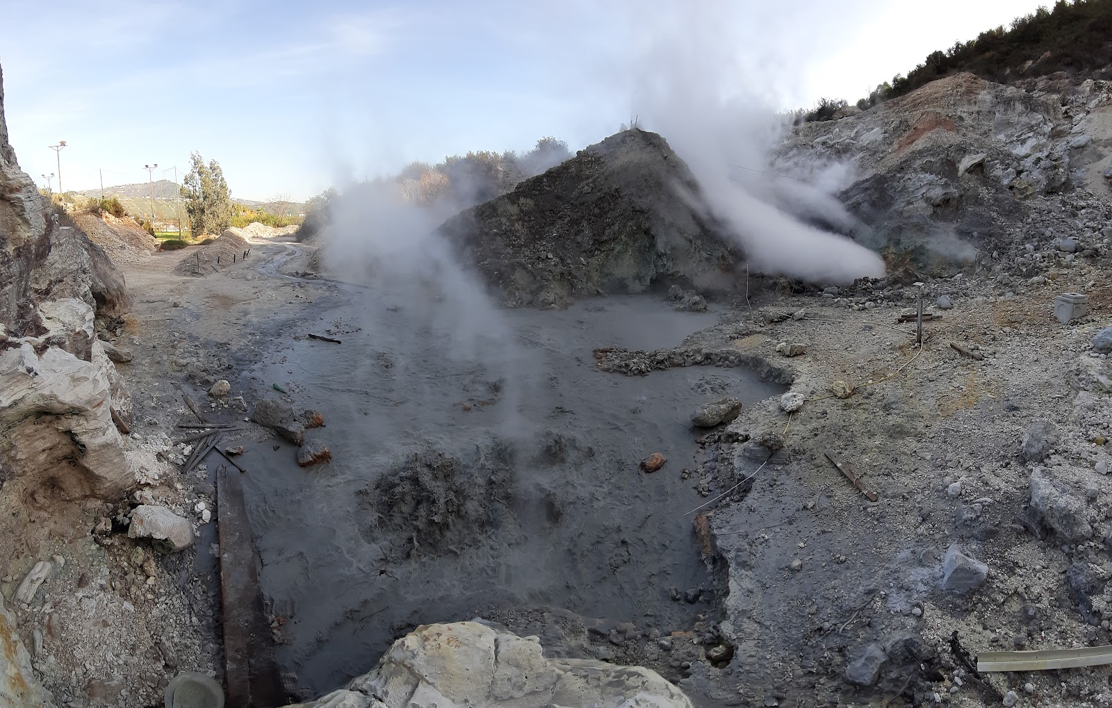
3) Geochemistry: The flow of CO2 from the ground measured last week showed no significant change compared to the previous period, which confirms the persistence of the long-term trend. Last week, the average temperature of the main fumarole of Pisciarelli was around 114 ° C.
Source : INGV Vulcani.
Read the whole article : http://www.ov.ingv.it/ov/bollettini-campi-flegrei/Bollettino_Flegrei_2020_02_04.pdf
Photo : Pisciarelli , Tullio Ricci, dicembre 2019
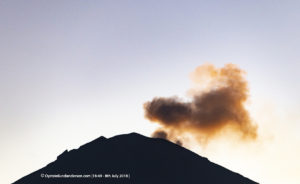
Philippines , Taal :
TAAL VOLCANO BULLETIN 08 February 2020 8:00 A.M.
Activity in the Main Crater in the past 24 hours has been characterized by moderate emission of white to dirty white steam-laden plumes rising 200 to 300m high before drifting southwest.
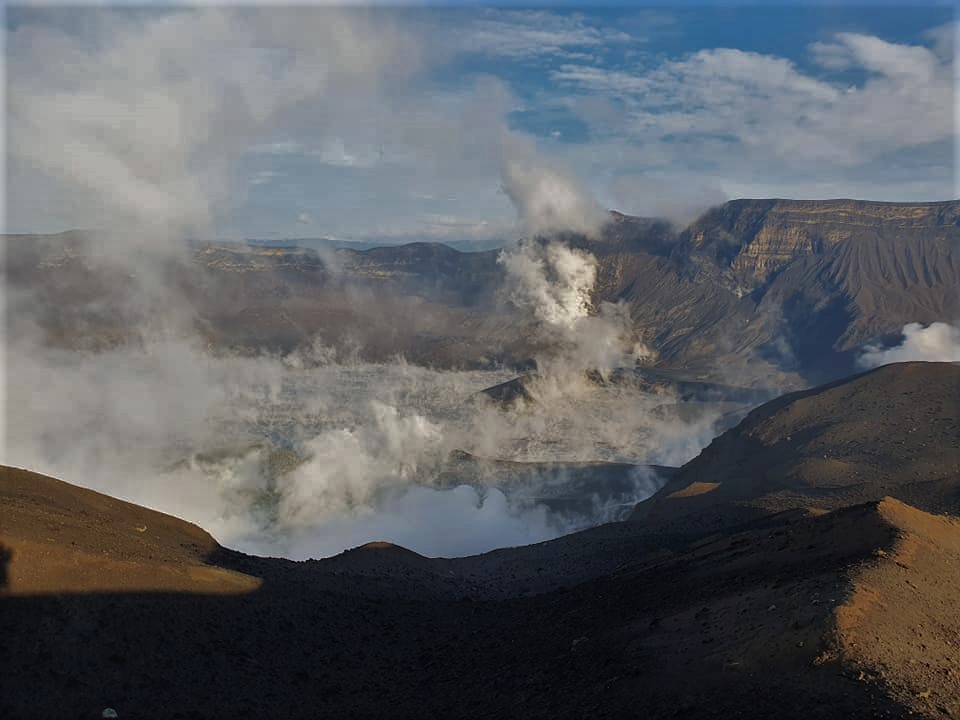
Weak steaming from fissure vents along the Daang Kastila trail is currently ongoing. Sulfur dioxide (SO2) emission was measured at an average of 54 tonnes/day on February 7, 2020. The Taal Volcano Network recorded one hundred fifteen (115) volcanic earthquakes including three (3) low-frequency events. These earthquakes signify magmatic activity beneath the Taal edifice that could lead to eruptive activity at the Main Crater.
Source : Phivolcs .
Photo : William Enriquez.
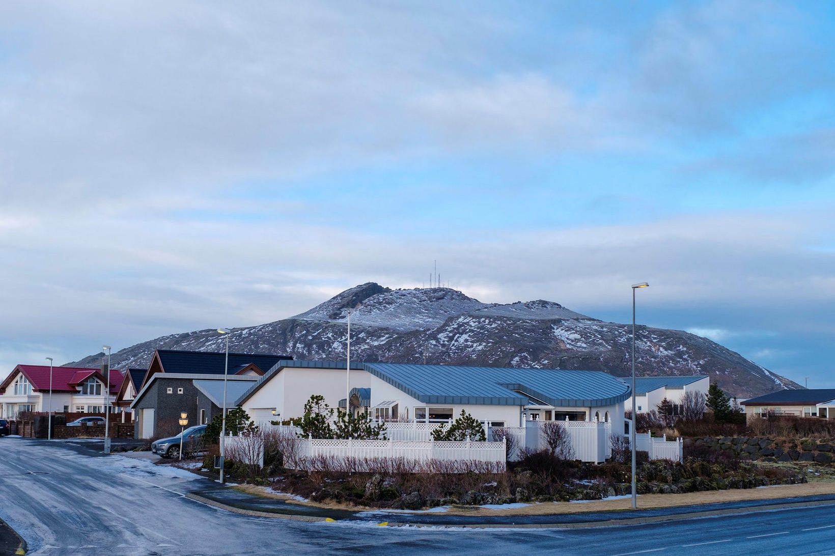
Iceland , Mt Thorbjörn :
The Scientific Advisory Board meets to discuss the unrest at Mt. Thorbjörn in the Reykjanes peninsula
On the 6th of February geoscientists joined a Scientific Advisory Board meeting and reviewed the current status of the unrest at Mt. Thorbjörn in the Reykjanes peninsula.
The data collected over the past week (including those measured by the recently installed stations) were reviewed. The new results suggest that the magma body is located at a depth of 3-5km, whereas it was previously estimated to be at 3-9km. There are indications of changing patterns in the crustal movements. The earthquake activity has decreased over the past two days, but there are still signs of a continuing inflation. Until now, the maximum deformation observed from the GPS stations is about 5 centimeters.
Similar volcanic crises in the country suggest that this might be a long-term event, for which changes can occur week after week without the possibility to anticipate with certainty if the activity is resolved.
During the meeting, possible scenarios that could be triggered in the event of an eruption have been also considered.
In the coming days, it will be assessed whether it is necessary to increase the number of monitoring stations in order to improve the capability to follow the evolution of the events.
The next meeting of the Scientific Advisory Board will be held after a week, if no changes occur.
The meeting was attended by scientists from the Icelandic Meteorological Office, the Institute of Earth Sciences at the University and ÍSOR, together with representatives from the Civil Protection Department of the National Commissioner of Police, HS-Orka, the Environment Agency, Isavia and the Police of the Suðurnes.
Source : Vedur . is .
Photo : mbl.is/Kristinn Magnússon.
Mexico , Popocatepetl :
According to the monitoring systems of the Popocatepetl volcano, 134 exhalations and 258 minutes of tremors have been identified. Some of these events were accompanied by the emission of volcanic gases with a low ash content. From today in the morning and until the moment of this report, there is visibility on the crater, it is possible to see a slight emission of volcanic gases which disperse towards the East-North-East .
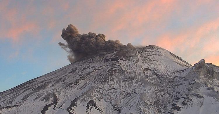
CENAPRED urges NOT to approach the volcano and especially the crater, because of the danger of falling ballistic fragments and in heavy rain, stay away from the bottom of the ravines because of the danger of mudslides and debris.
The Popocatépetl volcanic signaling light is in YELLOW PHASE 2.
Source : Cenapred .