July 18 , 2018.
Colombia , Nevado del Huilà :
Subject: Weekly activity bulletin of the Nevado del Huila volcano
The level of activity of the volcano continues at the level:
Level of activity yellow or (III): changes in the behavior of volcanic activity.
Based on the analysis and evaluation of the information obtained from the surveillance network of the Nevado del Huila volcano, during the week of July 10 to July 16, 2018, the COLOMBIAN GEOLOGICAL SERVICE – Volcanological and Seismological Observatory of Popayán reports that:
• During the evaluated period, 376 seismic events were recorded, of which 345 were related to rock fracturing processes (type VT) and 31 to fluid dynamics in volcanic conduits. The latter have been classified in their entirety as being of long period type (type LP).
• Regarding the seismic activity presented last week, there has been a decrease in the number of recorded events and the extent of these events. Most of the time, VT events continue to be located at an average distance of 15 km northeast of Pico Central, in a range of depths ranging from 7 to 12 km.
• The most significant events of the evaluated period had the following characteristics:
Date Local time local magnitude
July 10 14h48 M 3.5
July 11 14h01 M3,1
July 12 6h24 M3,3
July 13 7h27 M3,1
• The seismicity that has been recorded is in an active zone where tectonically the geological faults of Moras and Simbola coexist with the Nevado del Huila volcano. In this sense, it is stated that up to now, this activity has not been linked to changes that compromise the stability of the volcanic system.
• Images obtained during the week through the web cameras of Caloto, Tafxnú, Maravillas and La Palma showed low levels of degassing of the volcanic system, with a white column emitted from the top of the volcano.
• Sensors for monitoring magnetic fields and infrasonic waves have not recorded any variations to highlight.
Therefore, it is concluded that during the evaluated period, the volcano continued to exhibit stable behavior.
The Colombian Geological Survey is attentive to the evolution of the volcanic phenomenon and will inform in a timely manner of any changes that may occur.
Source : SGC.
Hawai : Kilauea :
Tuesday, July 17, 2018, 1:43 PM HST (Tuesday, July 17, 2018, 23:43 UTC)
19°25’16 » N 155°17’13 » W,
Summit Elevation 4091 ft (1247 m)
Current Volcano Alert Level: WARNING
Current Aviation Color Code: ORANGE
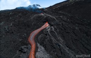
Kīlauea Volcano Lower East Rift Zone:
Fissure 8 continues to erupt lava into the perched channel leading northeastward from the vent. Surging was noted at the Fissure 8 cone during the overflight but had stopped by the time ground crews arrived to verify it .
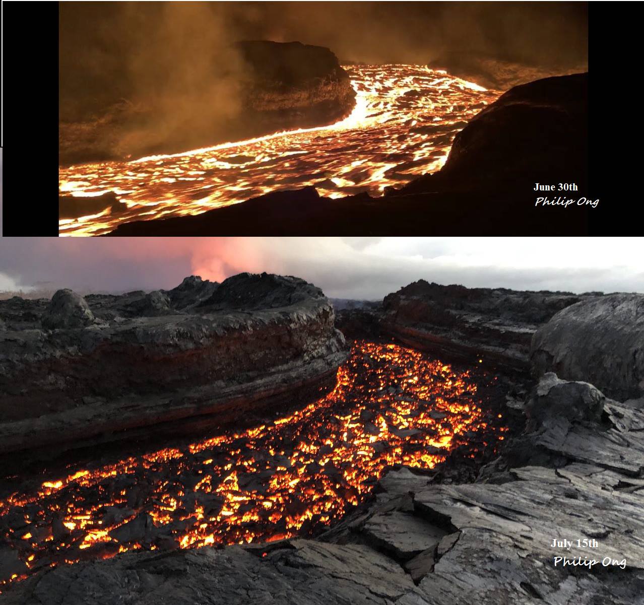
Lava in the channel is a bit lower this morning and there were no significant overflows. The southern margin of the flow was located about 750 m (0.5 mi) from the boat ramp at Isaac Hale Park this morning. Despite no visible surface connection to the fissure 8 channel, lava continues to ooze out at several points on the 6 km (3.7 mi) wide flow front into the ocean.
No other fissures are active this morning.
Kīlauea Volcano Summit
https://www.facebook.com/USGSVolcanoes/videos/2119683881393495/
Seismicity has increased as has been the pattern leading up to collapse/explosion events beneath the summit. The last event occurred at 11:42 a.m. HST July 16 with energy equivalent to a magnitude-5.3 earthquake. We expect a high rate of earthquakes (25-35 per hour) to continue until the next collapse/explosion event occurs later today. Inward slumping of the rim and walls of Halemaʻumaʻu continues in response to the ongoing subsidence at the summit.
Source : HVO.
Photo : Philip Ong
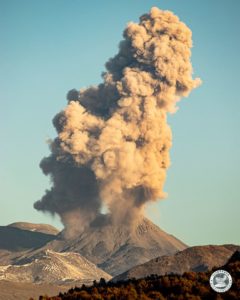
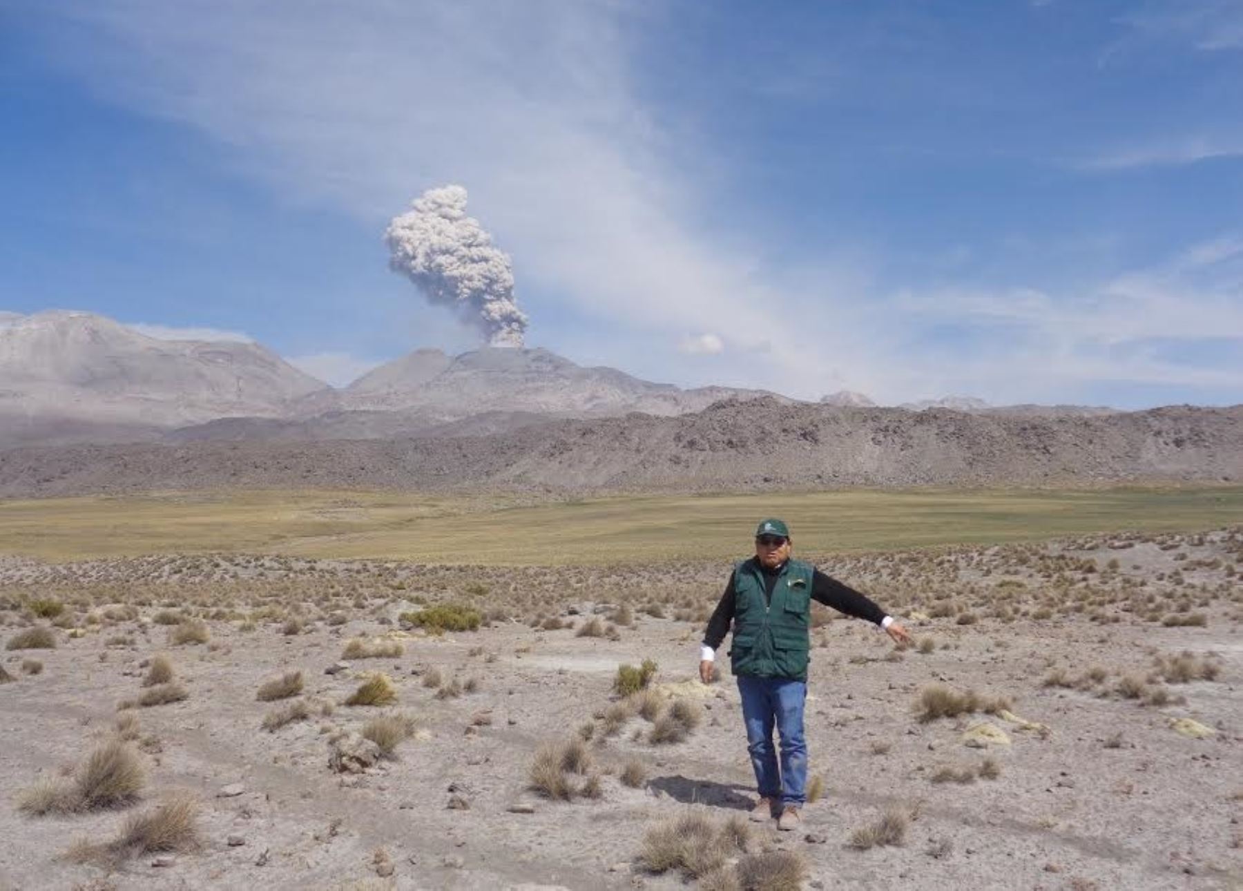
Peru , Sabancaya :
A continuous emission of ashes appears since this morning on the Sabancaya volcano, located in Arequipa. The emission reached a radius of dispersion of more than 30 kilometers, reports the Volcological Observatory of the Institute of Geology, Mines and Metallurgy (Ingemmet).
The villages affected by the ashes are Taya and Huanca, jurisdictions located in the South and Southeast of Sabancaya, whose authorities have been alerted to the fact so that they take the corresponding preventive actions.
Institute of Geophysics of Peru
[NOW] Sabancaya Volcano ashfall warning (Arequipa). Columns from 1000 to 1500 meters above the crater are scattered more than 30 km to the south and south-east, towards the cities of Taya and Huanca.
Ashes can cause environmental problems and affect people’s health. Specialists therefore recommend protecting the eyes and the respiratory tract by using lenses and masks, respectively.
Source : Andina
Mexico : Popocatépetl :
July 17, 11:00 am (July 17, 16:00 GMT)
During the last 24 hours, through monitoring systems of the Popocatepetl volcano, 14 low intensity exhalations accompanied by water vapor and gas have been identified. In addition, four volcano-tectonic earthquakes were recorded yesterday at 16:22, 16:23 and 16:24, and today at 14:55, with magnitudes of M1,7, M1,1, M1,2 and M1,3 respectively.
During the night, low incandescence was observed and sometimes the emission of steam and gas.
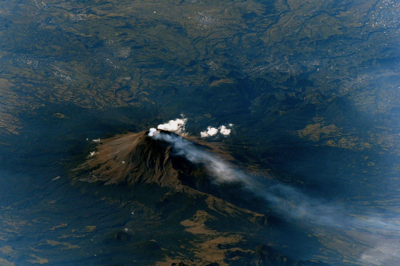
At the time of this report, the activity of the volcano is stable. In the case of an emission, it will extend towards the South-West.
CENAPRED urges not to approach the volcano and especially the crater, because of the risk of falling ballistic fragments, and in case of heavy rains to move away from the bottom of the ravines because of the risks of landslides and flows mud.
The volcanic warning light of the Popocatepetl volcano is located at Amarillo Phase 2
Source : Cenapred