August 04 , 2025.
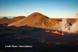
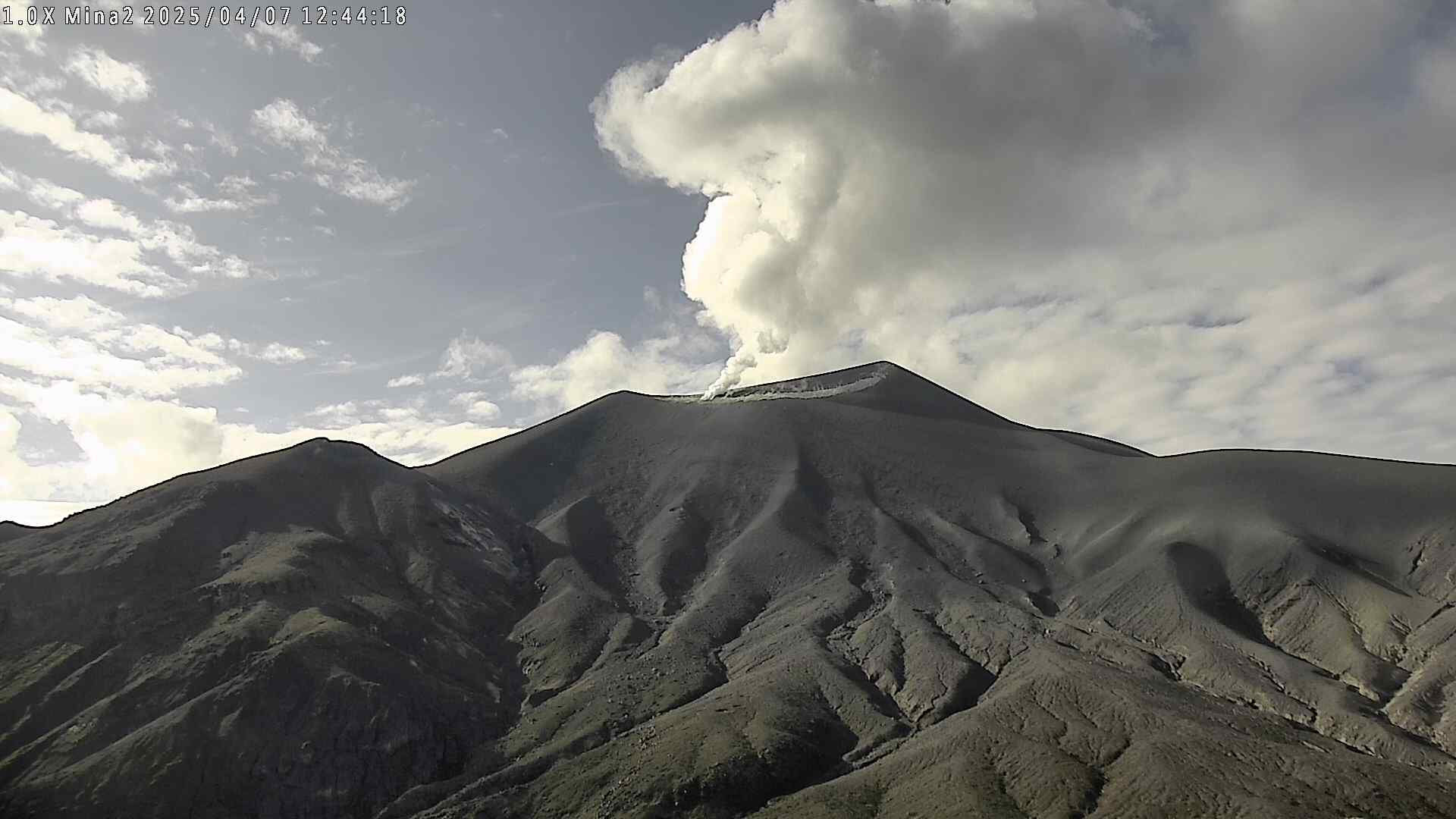
Iceland : Reykjanes Peninsula :
Eruption ongoing on the Sundhnúkur crater row
Updated 1 August
Risk of Lava Breakout and Gas Pollution – New Hazard Assessment Map
Dangers in the Area
Walking on newly solidified lava is life-threatening, as the surface crust can break without warning and glowing lava may lie just beneath.
There is a danger near the lava edge, where thin, fast-moving lava tongues can suddenly surge forward. The edge itself can also collapse unexpectedly.
Gas pollution levels can at any time exceed danger thresholds in the vicinity of the eruption site.
Eruption Status
Magma accumulation has resumed beneath Svartsengi.
The lava field continues to thicken, and lava is flowing partially beneath the surface.
A new hazard assessment map is valid until August 5 unless changes in volcanic activity call for a revision.
Volcanic activity continues, with reduced fountaining – Danger Near Lava Edges
The eruption on the Reykjanes Peninsula, which began on July 16, continues with relatively steady intensity. However, the fountaining activity has decreased.
Satellite images from ICEYE, along with measurements from Verkís and Efla, show that the lava field continues to thicken, though no significant changes in its spread have occurred in recent days. This thickening leads to a buildup of pressure that can trigger sudden breakouts at the lava edge. In such cases, the edge can rupture without warning and glowing lava tongues may advance. These breakouts are life-threatening, and it is essential to stay well away from the lava margins.
The latest flow path analyses, based on topography, suggest that lava may move toward Innri Sandhóll, an area where tourists have been gathering.
Measurements Confirm Ongoing Magma Accumulation
Recent deformation measurements confirm continued uplift at Svartsengi. This uplift is observed both on GNSS instruments and InSAR satellite data, which measure ground movement between July 21 and 28.
Source : IMO.
Photo : Capture d’écran Ragnar Visage / FB.
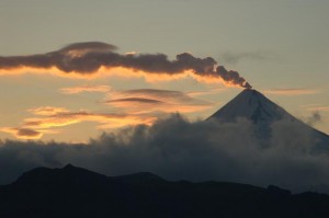
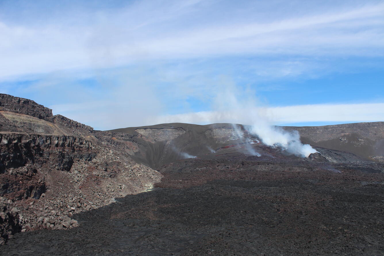
Colombia , Puracé – Los Coconucos volcanic chain :
Popayán, July 29, 2025, 3:30 a.m.
Regarding the monitoring of the activity of the Puracé volcano and the Los Coconucos volcanic chain, the Colombian Geological Survey (SGC), an entity affiliated with the Ministry of Mines and Energy, reports that:
During the week of July 22-28, 2025, an increase in the number of seismic events, both fracture and fluid-related, was recorded compared to those detected the previous week. Earthquakes associated with rock fracturing were concentrated mainly in the area between the Puracé and Piocollo volcanoes, at depths between 1 and 3 km and with magnitudes less than 1.0. The remaining seismic activity was located in a scattered manner near the crater of the Puracé volcano, where the most significant event of the evaluated period was recorded, with a magnitude of 1.3 and a depth of 1 km. At the same time, the earthquakes related to the movement of fluids were located under this same crater, at a depth of less than one kilometer, and were characterized by low energy.
Satellite and ground-based instruments recorded moderate levels of sulfur dioxide (SO2) emissions. Furthermore, the slow deformation process identified after the eruption of Curiquinga Volcano on January 20, 2025, persists.
Visible and infrared webcam images continued to show degassing processes and thermal anomalies inside the Puracé Volcano crater and in the fumarole field on the outer rim of the crater, respectively.
In conclusion, the variations observed in the Puracé Volcano and Los Coconucos volcanic chain indicate that the system remains active and that monitoring parameters remain above their baseline. Based on the above, the SGC recommends closely monitoring the evolution of volcanic activity through weekly and special bulletins, in addition to information published through official channels, and following the instructions of local and departmental authorities and the National Disaster Risk Management Unit (UNGRD).
The alert status for volcanic activity remains yellow: an active volcano exhibiting changes in the baseline behavior of monitored parameters and other manifestations.
Source et photo : SGC.
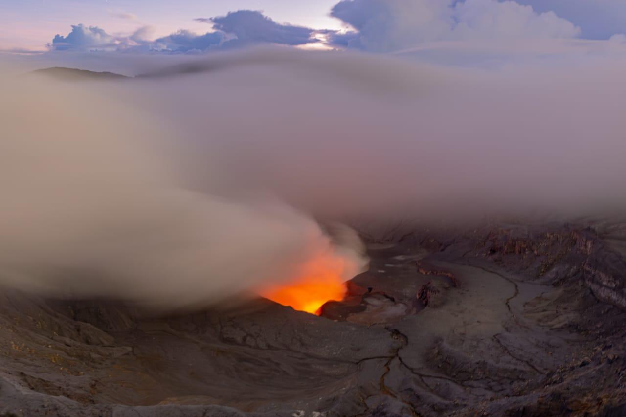
Hawaii , Kilauea :
HAWAIIAN VOLCANO OBSERVATORY DAILY UPDATE , U.S. Geological Survey
Sunday, August 3, 2025, 9:12 AM HST (Sunday, August 3, 2025, 19:12 UTC)
19°25’16 » N 155°17’13 » W,
Summit Elevation 4091 ft (1247 m)
Current Volcano Alert Level: WATCH
Current Aviation Color Code: ORANGE
Activity Summary:
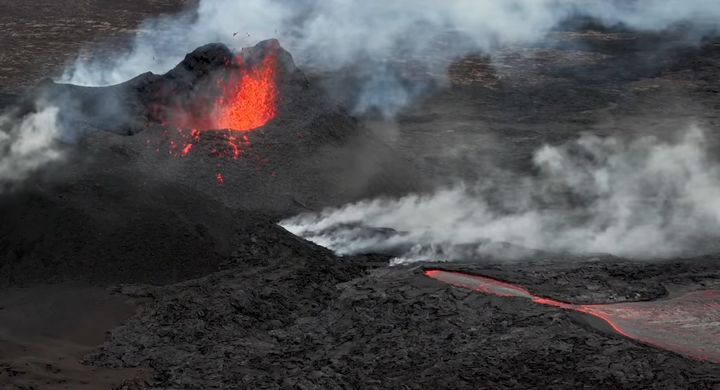
Episode 29 of the Halemaʻumaʻu eruption ended on July 20, 2025 and is currently paused. Low-level seismic tremor and degassing at the summit continues. Summit tiltmeters recorded 1.5 microradians of deflation since Friday night, which may delay the start of the next episode. Current models suggest that episode 30 may start between now and Tuesday.
No significant activity has been noted along Kīlauea’s East Rift Zone or Southwest Rift Zone.
This low-angle view of the crater complex that has built up since December 23, 2024, in western Halema‘uma‘u, was captured during a USGS Hawaiian Volcano Observatory monitoring helicopter overflight of Kīlauea volcano on July 24, 2025. The north vent is degassing on the right side of photo. The south vent is to the left of north vent but is not distinctive in this photo.
Summit Observations:
Glow was visible from the north vent overnight after re-appearing Thursday evening. The return of glow from the north vent indicates that the shallow blockage has been partially or completely removed. Incandescence in other parts of the crater remains very low, with weak, intermittent glow from two areas higher up on the eruptive cone. There has been no movement or incandescent breakouts from lava flows on the floor of Halemaʻumaʻu. Slow slumping of the eruptive cone is possible as it cools.
Elevated degassing continues from the vent. Average sulfur dioxide (SO2) emission rates during inter-episode pauses are typically 1,200 to 1,500 t/d, though emission rates vary on short time scales in association with gas pistoning.
Background seismic tremor remains low during the eruption pause.
Summit tiltmeters have recorded 1.5 microradians of deflation since Friday night. Fountaining associated with episode 29 resulted in approximately 19 microradians of deflation. The UWD tiltmeter had re-inflated almost 18 microradians by Friday night, however, deflationary tilt since then has dropped the total down to 16.5 microradians since the end of episode 29, which may delay the start of the next episode.
Source : HVO
Photo : USGS / A. Ellis.
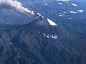
Costa Rica , Poas :
OVSICORI-UNA Weekly Volcano Monitoring Bulletin, August 1, 2025
Latitude: 10.20°N;
Longitude: 84.23°W;
Altitude: 2,687 m
Current Activity Level: Alert
This week, two small eruptions were recorded at Boca A. The first occurred on July 27 at 2:44 a.m., when incandescent fragments were ejected and fell back into the crater, less than 50 meters from the entrance. The second, on July 30, consisted of a weak ash emission that lasted less than a minute.
After the increase in the amplitude of the continuous seismic tremor observed last week, the seismic amplitude has returned to normal levels compared to recent months. Acoustic tremor gradually increased two days before the eruption, reaching a maximum before returning to previous levels.
The number of long-period events remains similar to the previous week. This week, one proximal and two distal volcano-tectonic events were recorded. In recent weeks, the volcano has been subsiding. MultiGAS stations measured an average SO2/CO2 ratio of 1.7 ± 0.6 this week, similar to last week. The H2S/SO2 ratio has remained very low (< 0.1) in recent weeks. Based on the observed ratios, it is interpreted that the gases originate from a surface magmatic source. This week, a decrease in the SO2 flux (369 ± 61 t/d) measured by DOAS stations was observed compared to the previous week (559 ± 36 t/d).
Source : Ovsicori .
Photo : RSN-UCR.
Vanuatu , Yasur :
The Ambrym volcanic activity is continuing in the major unrest state. The Ambrym Volcanic Alert Level remains at Level 2.
Major volcanic unrest continues at Ambrym volcano and remains confined inside Benbow and Marum craters. Latest observations and data analysis have confirmed that Ambrym volcanic activity exhibits ongoing unrest and suggest that its activity continues at this similar level, consistent with Volcanic Alert Level 2. The volcanic hazards danger zone remains limited at 1 km radius from Benbow crater and 2 km radius from Marum crater and the major cracks at the south-east part of Ambrym.
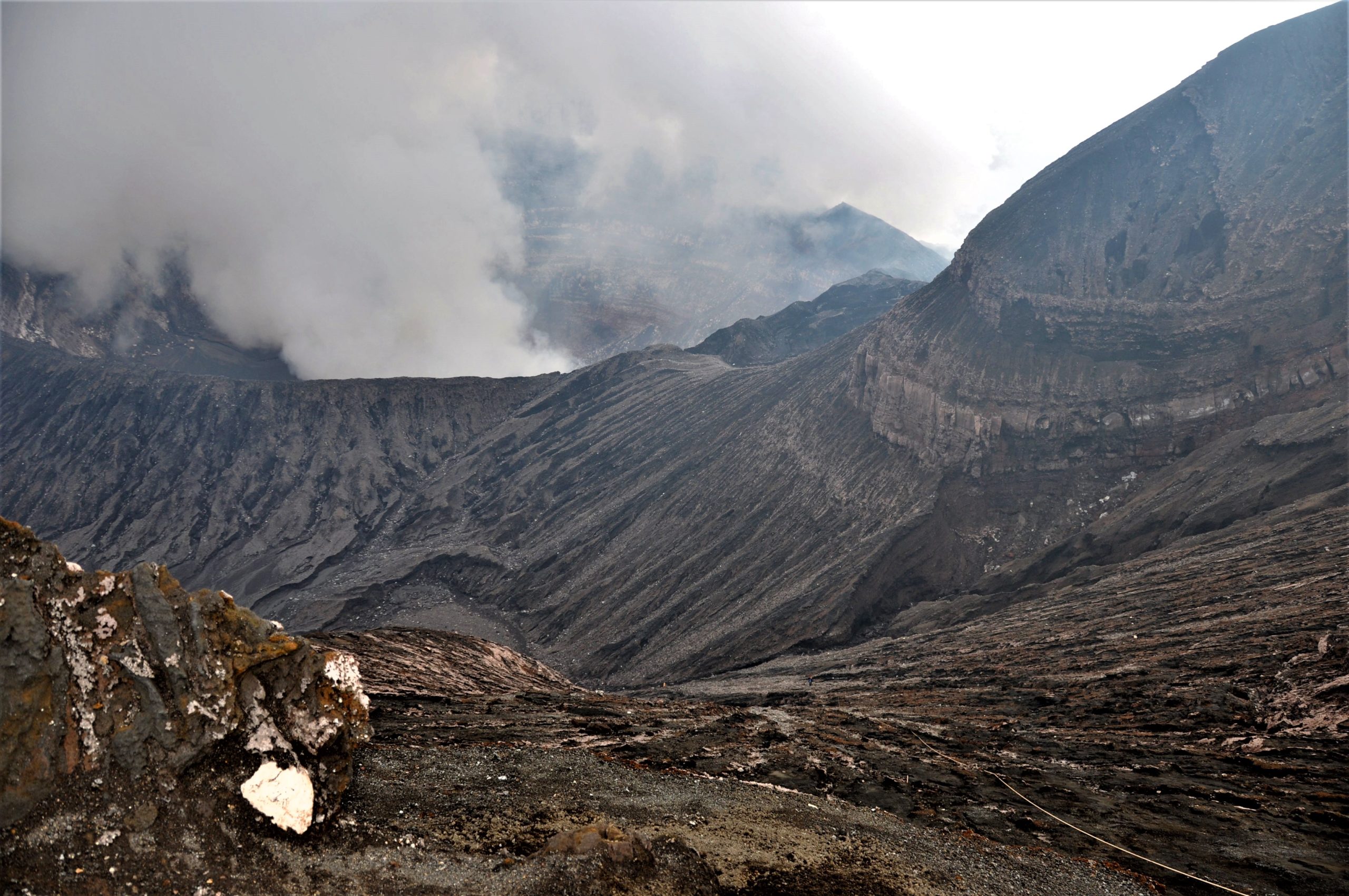
Observation photos taken on the ground and via webcam on July 11st and 14th 2025 showed continuous emissions of volcanic fumeroles from Marum crater. The satellite imageries from July 14th and 27th, 2025, also showed evidence of a low thermal anomaly detection at Ambrym volcano, indicating an increase in surface temperature around the volcano due to the presence of magma near the Earth’s surface. Seismic data analysis has confirmed the ongoing major volcanic unrest activity on Ambrym.
The Ambrym volcanic Alert Level has been at Level 2 since 17th January 2024. Observations of the current activity are consistent with the Volcanic Alert Level 2. Level 2 indicates “Major unrest. The danger zone is at the Exclusion Zone which is about 1 km radius from Benbow crater and the Danger Zone A which is about 2 km radius from Marum crater with major cracked areas at the south eastern part of Ambrym”. With this current volcanic activity, it is a useful reminder that eruptions can occur with little or no warnings.
Source : Geohazard .
Photo : G Vitton