September 11 , 2022.
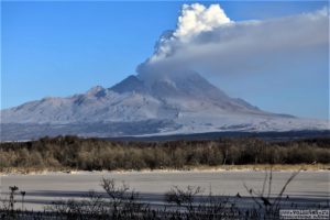
Alaska , Pavlof :
55 25’2″ N 161 53’37 » W,
Summit Elevation 8261 ft (2518 m)
Current Volcano Alert Level: WATCH
Current Aviation Color Code: ORANGE
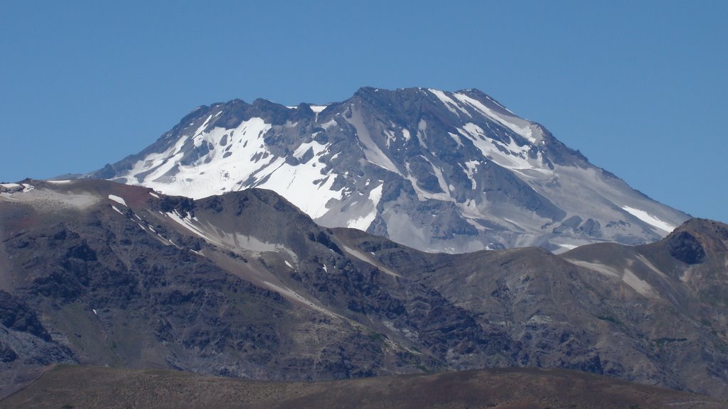
Pavlof Volcano continues to erupt from the active vent just below the summit on its east flank.? Webcam images showed minor emissions of ash or steam on September 5, 6 and 8, and incandescence at the vent was observed in overnight views early September 4. Elevated surface temperatures were observed in satellite data on most days, and near-continuous seismic tremor was recorded throughout the week. No explosive activity was recorded.
Periods of lava spatter and fountaining from the vent on the volcano’s upper east flank have been occurring since mid-November 2021. This activity has built a small cone and sent lava flows down the flank that melt the snow and ice and produce variable amounts of meltwater. The meltwater typically incorporates loose debris on the flank of the volcano and forms thin (less than 2 m thick) lahars. The lahar deposits extend down the east-southeast flank for several kilometers, not quite to the base of the volcano. Previous eruptions of Pavlof indicate that the level of unrest can change quickly and the progression to more significant eruptive activity can occur with little or no warning.
Pavlof is monitored by local seismic and infrasound sensors, satellite data, web cameras, and regional infrasound and lightning networks.
Source : AVO
Photo : Waythomas, Chris , Alaska Volcano Observatory / U.S. Geological Survey .
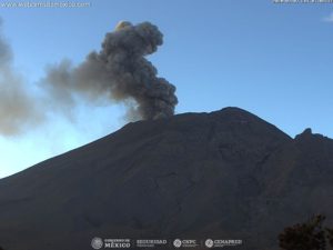
Russia / Kuril Islands , Ebeko :
VOLCANO OBSERVATORY NOTICE FOR AVIATION (VONA)
Issued: September 10 , 2022
Volcano: Ebeko (CAVW #290380)
Current aviation colour code: ORANGE
Previous aviation colour code: orange
Source: KVERT
Notice Number: 2022-113
Volcano Location: N 50 deg 41 min E 156 deg 0 min
Area: Northern Kuriles, Russia
Summit Elevation: 1156 m (3791.68 ft)

Volcanic Activity Summary:
A moderate eruptive activity of the volcano continues. According to visual data by volcanologists from Severo-Kurilsk, explosions sent ash up to 1.9 km a.s.l., an ash cloud is drifting to the east of the volcano; an ashfall is observing at Severo-Kurilsk.
A moderate eruptive activity of the volcano continues. Ash explosions up to 6 km (19,700 ft) a.s.l. could occur at any time. Ongoing activity could affect low-flying aircraft and airport of Severo-Kurilsk.
Volcanic cloud height:
1800-1900 m (5904-6232 ft) AMSL Time and method of ash plume/cloud height determination: 20220910/2315Z – Visual data
Other volcanic cloud information:
Distance of ash plume/cloud of the volcano: 5 km (3 mi)
Direction of drift of ash plume/cloud of the volcano: E
Time and method of ash plume/cloud determination: 20220910/2315Z – Visual data
Source : Kvert.
Photo : Кирилл Баканов
Chile , Descabezado Grande :
Special Report on Volcanic Activity (REAV)
Del Maule region, Descabezado Grande volcano, September 10, 2022, 04:00 a.m. local time (mainland Chile).
The National Geology and Mining Service of Chile (Sernageomin) announces the following PRELIMINARY information, obtained through the monitoring equipment of the National Volcanoes Monitoring Network (RNVV), processed and analyzed at the Volcanological Observatory of the Southern Andes (OVDAS):
Today, Saturday September 10, 2022 at 03:03 local time (07:03 GMT), the monitoring stations installed near the Descabezado volcano recorded an earthquake associated with rock fracturing (Volcano-Tectonics).
The characteristics of the earthquake after its analysis are as follows:
Original time: 03:03 local time (07:03 GMT)
Latitude: 35.578°S
Longitude: 70,760°W
Depth: 3.0 km
Magnitude: 4.3 (ML)
OBSERVATIONS
At the time of this report, at least 20 events of similar characteristics but of lower energy have been recorded. No superficial activity was recorded by the cameras installed in the sector.
The volcano’s alert level remains at the GREEN level.
Source and photo : Sernageomin.
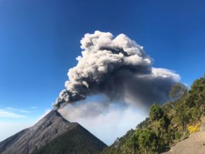
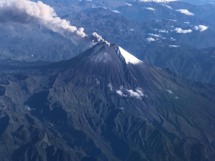
Ecuador , Sangay / Reventador :
DAILY REPORT OF THE STATE OF SANGAY VOLCANO, Saturday September 10, 2022.
Information Geophysical Institute – EPN.
Surface Activity Level: High, Surface Trend: Decreasing.
Internal activity level: High, Internal trend: No change.
Seismicity: From September 09, 2022. , 11:00 a.m. to September 10, 2022, 11:00 a.m.:
There was no interruption in the transmission of data from the reference station for seismic statistics.
Explosion (EXP) 638
Long Periods (LP) 18
Emission Tremors (TREMI ) 60.
Rains / Lahars:
At night, there were rains in the area which generated a small signal associated with the descent of mudslides and debris. **In the event of heavy rains, these could remobilize the accumulated materials, generating mudslides and debris that would descend on the flanks of the volcano and flow into the adjacent rivers.**
Emission / ash column:
Yesterday afternoon, an emission of gas and ash about 1500 meters above the level of the crater in a southwest direction was observed between the clouds. Thanks to the GOES-16 satellite, an ash emission was observed in a southwest direction. The VAAC recorded 4 ash emission alerts observed on satellites that reached heights of 1,500 meters above the level of the crater in a southwest and west direction.
Other Monitoring Parameters:
Over the past 24 hours, satellite systems have recorded thermal anomalies in the area, FIRMS 6 and MIROVA 1 moderately weak.
Observation:
Yesterday afternoon, the volcano partially cleared on very short occasions, allowing the emission reported in the previous parameter to be observed. Today the volcano remained cloudy. As of the close of this bulletin, there are no reports of ashfall.
Alert level: Orange.
——————————————————————————————————————————————–
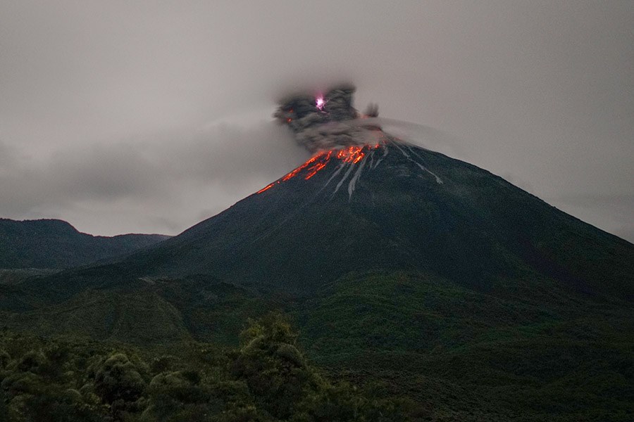
DAILY REPORT OF THE STATE OF THE REVENTADOR VOLCANO, Saturday September 10, 2022.
Information Geophysical Institute – EPN.
Surface Activity Level: Moderate, Surface Trend: No change.
Internal activity level: Moderate, Internal trend: No change.
Seismicity: From September 09, 2022, 11:00 a.m. to September 10, 2022, 11:00 a.m.:
There was no interruption in the transmission of data from the reference station for seismic statistics.
Explosion (EXP): 38
Long periods (LP): 28
Emission Tremors (TREMI): 11.
Harmonic Tremors (TRARM): 6.
Rains / Lahars:
No rain was recorded in the area.
Emission / ash column:
No emissions were observed by cameras, however, the VAAC recorded 3 ash emission alerts observed by satellites that reached heights of 1,638 meters above crater level in a westerly direction.
Other Monitoring Parameters:
The FIRMS and MIROVA satellite systems have not recorded any thermal anomalies on the volcano in the past 24 hours.
Observation:
For the past 24 hours, the volcano has remained partly cloudy at the summit, preventing direct observations of surface activity.
Alert level: Orange.
Source : IGEPN.
Photos : volcan sangay FDB / auteur inconnu , Martin Rietze ( archive).
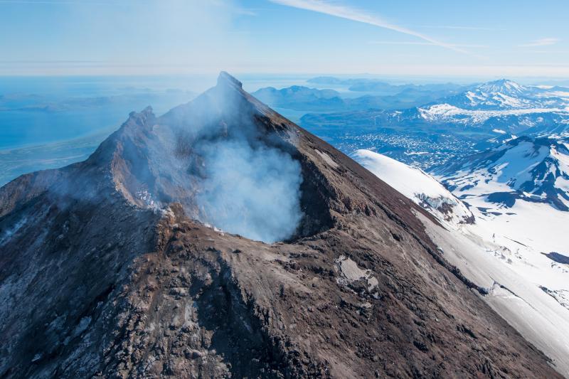
Samoa Island , Ta’u :
14°13’48 » S 169°27’14 » W,
Summit Elevation 3054 ft (931 m)
Current Volcano Alert Level: ADVISORY
Current Aviation Color Code: YELLOW
The earthquake swarm related to Taʻū Island continues. In the past 24 hours, no felt earthquakes were reported by people on the Manuʻa Islands. The frequency of earthquakes in the past 24 hours continues a general declining trend of seismicity over the past week. The current trend of decreasing numbers of earthquakes does not mean the earthquake swarm will end.
The FAGA broadband seismometer is transmitting data again as of this afternoon.
The satellite data from the previous 24 hours observed no volcanic activity.
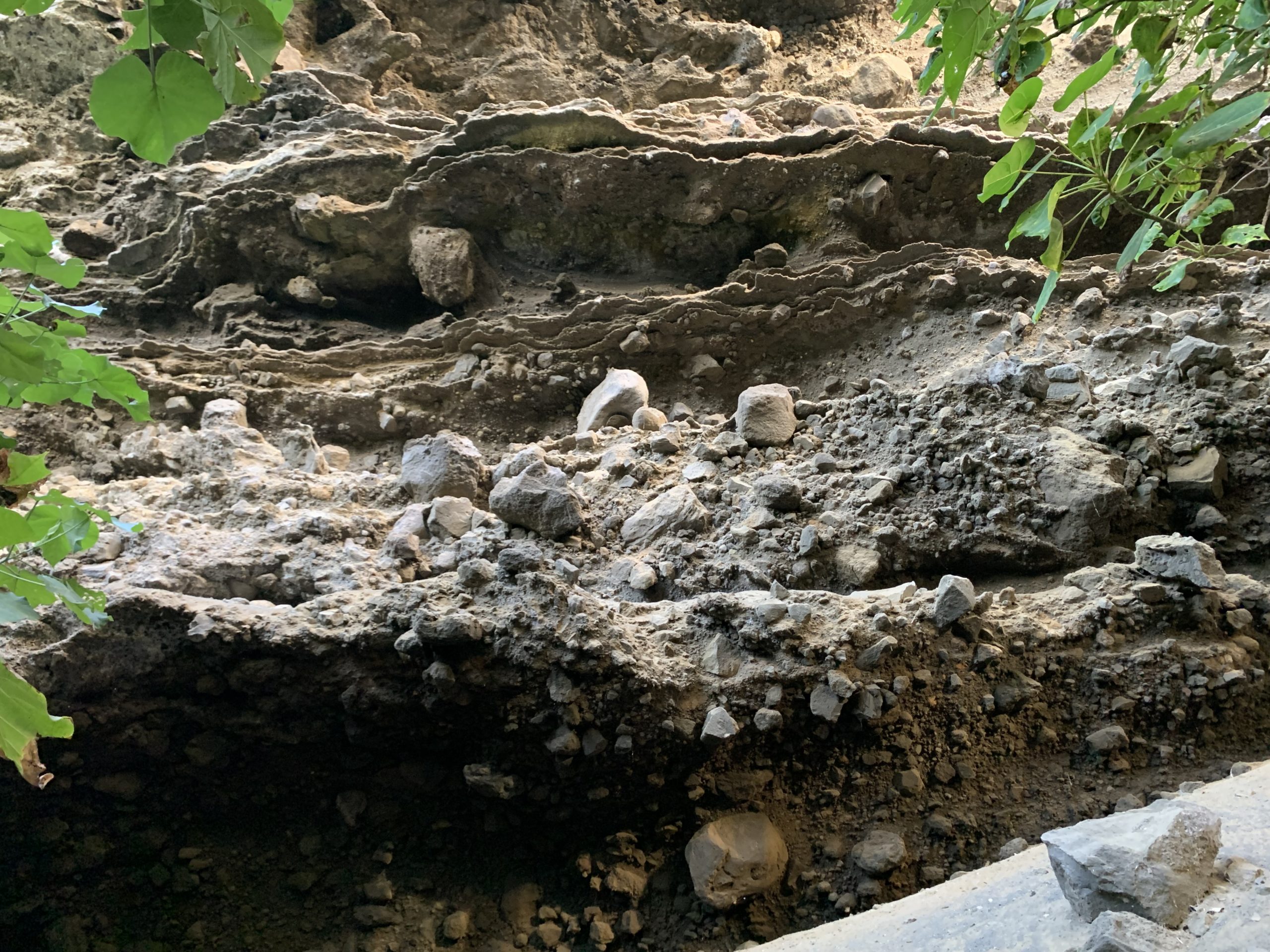
The base of a tuff cone near the coast of Ta‘ū Island in American Samoa. Tuff cones are created from phreatomagmatic processes through the interaction of lava with shallow seawater. This part of the tuff cone contains mostly sand size material that hosts larger blocks and bombs that are up to several feet (one meter) in diameter. There are several tuff cones that are present near the coastline of the island of Ta‘ū.
It is unclear if this earthquake unrest will escalate to a volcanic eruption and exactly where an eruption might occur. An eruption could pose significant hazards to residents of American Samoa; these hazards include volcanic gases, volcanic ash, low-level localized explosions of lava, lava flows, earthquake shaking, and tsunami.
Source : HVO.
Photo : USGS / D. Downs.