March 08 , 2025 .
Alaska , Spurr :
Volcanic unrest continues at Mount Spurr and is characterized by ongoing earthquake activity and surface deformation. Seismicity remains elevated, and has not changed significantly this week. Over the past week, 106 earthquakes were located, most in the summit region and fewer near Crater Peak . Satellite radar data obtained this week showed the continued collapse of the snowpack within the summit crater in response to slightly elevated heat flux there. No unusual activity was observed in other satellite data. Minor steam emissions were observed in web camera views of Mount Spurr yesterday and a gas measurement flight is being conducted today. The Spurr monitoring network is functioning well, although the web camera at station CKT remains obscured by snow and ice. AVO continues to closely monitor activity at Mount Spurr for signals indicating the volcano is moving closer to an eruption using local seismic, infrasound, web camera, GNSS stations, regional infrasound, lightning networks, and satellite data. Based on previous eruptions, additional changes in earthquakes, ground deformation, the summit lake, and fumaroles would be expected if magma moves closer to the surface. Therefore, if an eruption occurred, it would be preceded by additional signals that would allow advance warning.
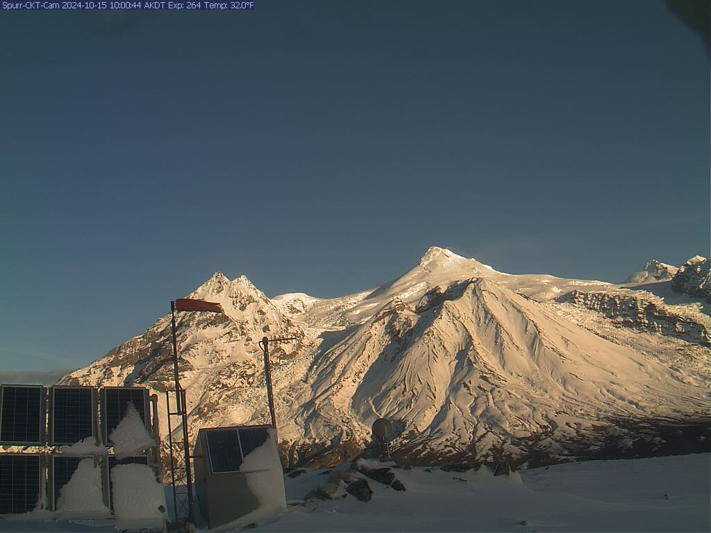
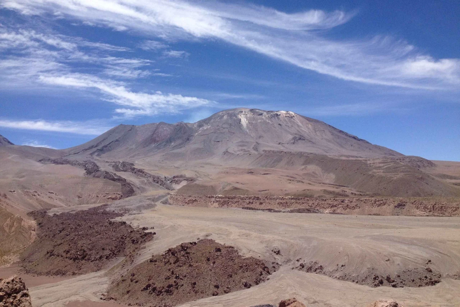
Mount Spurr volcano is an ice- and snow-covered stratovolcano located on the west side of Cook Inlet approximately 120 km (75 mi) west of Anchorage. The only known historical eruptions occurred in 1953 and 1992 from the Crater Peak flank vent located 3.5 km (2 mi) south of the summit of Mount Spurr. These eruptions were brief, explosive, and produced columns of ash that rose up to 20 km (65,000 ft) above sea level and deposited several mm of ash in south-central Alaska, including approximately 6 mm of ash in Anchorage in 1953. The last known eruption from the summit of Mount Spurr was possibly more than 5,000 years ago. Primary hazards during future eruptions include far-traveled ash clouds, ash fall, pyroclastic flows, and lahars or mudflows that could inundate drainages all sides of the volcano, but primarily on the south and east flanks.
Source : AVO
Photo : Boyce, Ellie / Alaska Volcano Observatory / University of Alaska Fairbanks, Geophysical Institute ,
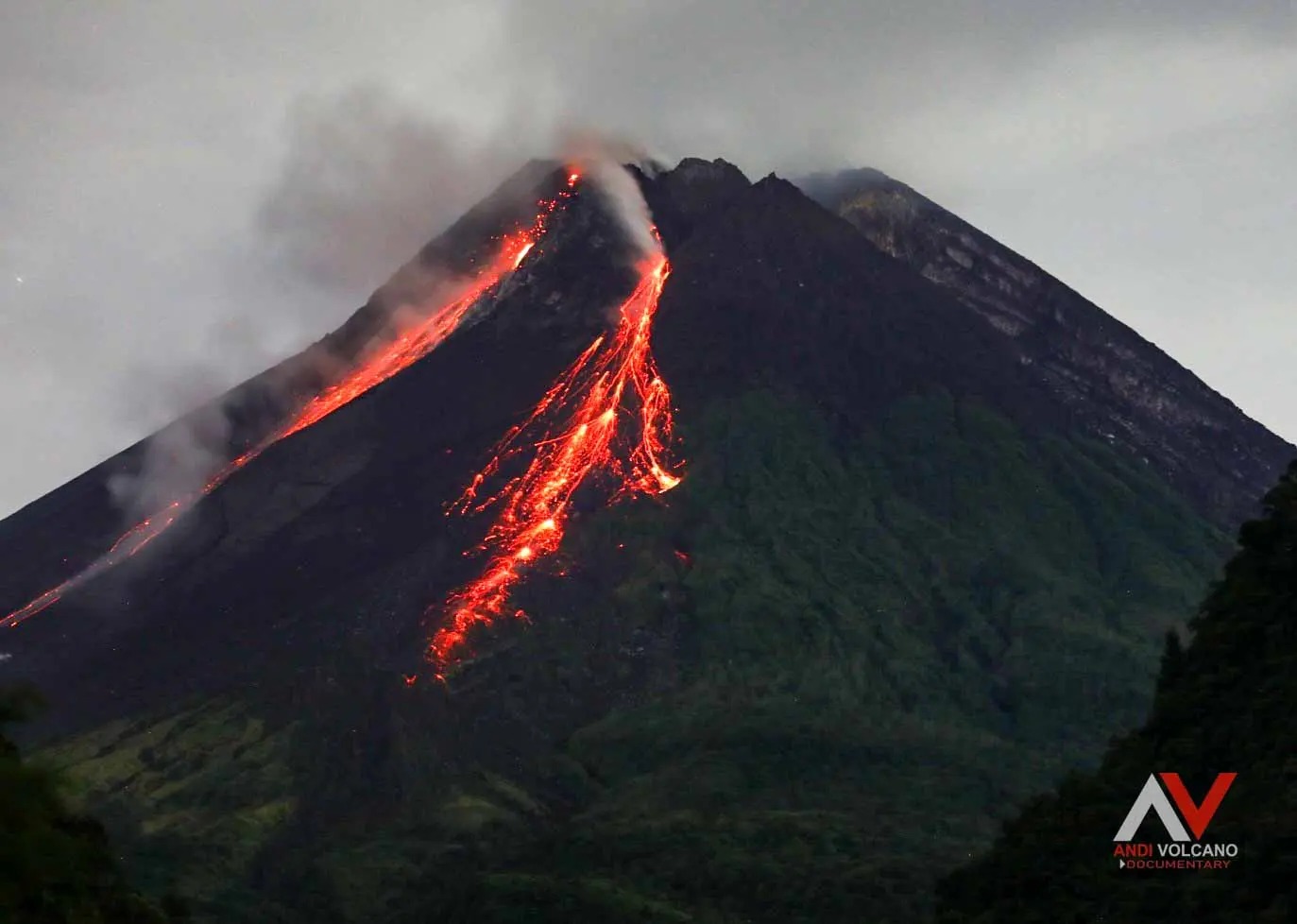
Indonesia , Merapi :
MERAPI ACTIVITY REPORT, February 28 – March 6, 2025
OBSERVATION RESULT
Visual
The weather around Mount Merapi is generally sunny in the morning and evening, while during the day and evening it is hazy. White smoke, thin to thick, low to moderate pressure, with a smoke height of 200 m observed from the Kaliurang Mount Merapi observation post on March 1, 2025 at 05:50 WIB. This week, lava avalanches were observed 57 times in the Southwest (upstream of Kali Bebeng) up to a maximum of 2,000 m, 43 times upstream of Kali Krasak up to a maximum of 2,000 m, and 34 times in the West (upstream of Kali Sat/Putih) up to a maximum of 2,000 m. The morphology of the Southwest dome was observed and shows slight changes due to the lava flow activity. For the central dome, no significant morphological changes were observed. According to the analysis of aerial photos dated February 20, 2025, the volume of the Southwest dome is 3,546,200 m3. Meanwhile, the volume of the central dome is measured at 2,360,700 m3.
Seismicity
This week, the seismicity of Mount Merapi recorded:
3 Shallow Volcanic Earthquakes (VTB),
582 Multiphase Earthquakes (MP),
3 Low Frequency Earthquakes (LF),
939 Avalanche Earthquakes (RF),
12 Tectonic Earthquakes (TT).
The intensity of earthquakes this week is higher than last week.
Deformation
The deformation of Mount Merapi monitored using EDM and GPS this week showed no significant changes.
Rainfall and Lahars
This week, it rained at Mount Merapi observation post with the highest rainfall intensity of 30 mm/hour for 54 minutes at Babadan post on 1 March 2025. There were no reports of additional discharge or lahar in the rivers that originate from Mount Merapi.
Conclusion
Based on the results of visual and instrumental observations, it is concluded that:
The volcanic activity of Mount Merapi is still quite high in the form of effusive eruptions. The activity status is defined at the « SIAGA » level.
Source : BPPTKG
Photo : Andi Volcanist.
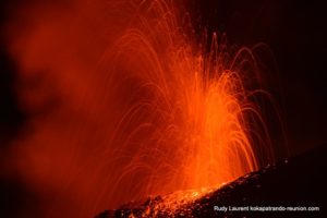
Chile , Lascar :
Seismology
The seismological activity of the period was characterized by the recording of:
15 VT-type seismic events, associated with rock fracturing (Volcano-Tectonic).
23 LP-type seismic events, associated with fluid dynamics within the volcanic system (Long Period). The size of the largest earthquake estimated from the reduced displacement parameter (DR) was equal to 9 cm2.
Fluid geochemistry
The data on sulfur dioxide (SO2) emissions obtained using the Differential Optical Absorption Spectroscopy (DOAS) equipment, corresponding to the Emú station, located 6 km in the East-Southeast (ESE) direction of the active crater, presented an average SO2 flux value of 421 t/d, with a maximum daily value of 1,010 t/d on February 22.
Fourteen anomalies were reported in satellite images obtained using the Tropospheric Monitoring Instrument (TROPOMI) in sulfur dioxide (SO2) emissions into the atmosphere in areas near the volcano. On February 25, the maximum emission value was recorded, reaching 1,442 tons of SO2 mass. It should be noted that subsequently, outside the reference period, the high values continued. These data were published by the Mounts Project and Global Sulfur Dioxide Monitoring.
Geodesy
The geodetic activity of the period was characterized by:
– Low horizontal deformation rates, with a maximum of 0.44 cm/month.
– Low vertical deformation rates, with a maximum of 0.55 cm/month.
– Low magnitude of the monitoring line displacement (distance between stations) that crosses the crater.
– No obvious traces of InSar deformation.
The above indicates that no relevant changes associated with deformation are observed on the volcano.
Thermal anomalies by satellites
During the period, 20 thermal alerts were recorded in the area associated with the volcano, on the MIROVA platform, the maximum value was 5 MW, on February 22 and 26. The Sentinel 2-L2A satellite images of 21 and 26 February, in combination of bands, allow us to observe a radiance pattern characterized by three zones inside the crater, which is consistent with the Landsat 8-9 image of 24 February.
Surveillance cameras
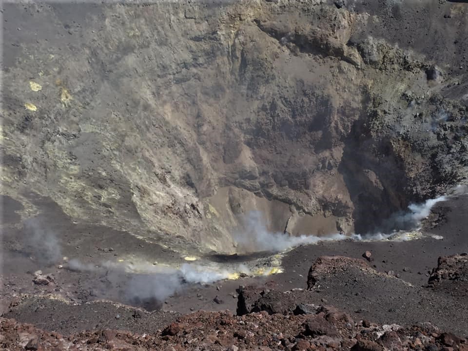
The images provided by the surveillance cameras installed around the volcano, when weather conditions permitted, recorded white columns of degassing in the north and northwest direction, the maximum value being 1,220 m above the crater, reached on 22 and 26 February. In addition, on 19 February, a weak incandescence is observed, while from the 22nd of the same month, the incandescence remains continuous during the nights.
Geomorphological analysis by satellite
According to the satellite images Planet Scope Scene (spatial resolution of 3 m) and Skysat (spatial resolution of 0.5 m), no morphological changes are identified in the volcanic system. It should be noted that degassing continues in the active crater.
During this period, the presence of abnormal indicators of volcanic activity continues. According to the recordings of the equipment belonging to the instrumental network, fixed cameras and DOAS, columns of incandescence and degassing less than 1 km above the level of the crater have been observed. In addition, the SO2 flux has a continuous character, although the values remain low, probably related to the direction of dispersion of the gases (in the opposite direction to the location of the DOAS equipment).
Similarly, satellite alerts related to SO2 emissions into the atmosphere, thermal anomalies and radiation in the active crater show the continuity of this abnormal process. The seismicity record remains low, but some characteristics of the waveforms and a lower occurrence of LP earthquakes show similarities with those that occurred at the beginning of the previous three-year cycles that evolved towards mainly low-energy phreatic emissions. Despite the periodicity of the process, it is likely that the current cycle may involve a greater contribution of the magmatic component evidenced by the anomalous SO2 and evolve towards states of greater instability.
The above indicates that the system is above its basic activity threshold, therefore, its technical alert remains at:
YELLOW TECHNICAL ALERT: Changes in the behavior of volcanic activity
Source : Sernageomin
Photos : MyguideChile . com , Eric Jo ( 2019) .
Costa Rica , Poas :
Latitude: 10.20°N;
Longitude: 84.23°W;
Altitude: 2687 m
Current activity level: Warning
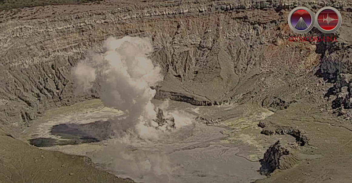
Between 1 and 3 March, an increase in the energy of phreatic eruptions was recorded. It began on 1 March at 17:47 with an eruption whose ash column was ejected between 300-400 m above the surface of the hyperacid lake (the part of the plume consisting of steam, gas and aerosols rose even higher to about 1000 m). Since then until 3 March, 7 eruptions of comparable magnitude have been recorded. Eruptive activity continues with frequent small eruptions at Boca C (north) and sporadic larger eruptions at Boca A.
Two larger than usual long-period (LP) events were recorded in the 18 hours prior to the eruption on 1 March. Since the increase in eruptive activity on 1 March, an increase in distal and proximal volcano-tectonic activity has been recorded.
A maximum of 7 distal earthquakes was reached on 5 March. Most of the events occur on the southwest flank. Tremor amplitude fluctuated during the weekend, when the largest eruptions occurred, and stabilized at a moderate amplitude from the fourth day onwards.
Geodetic monitoring has detected a new vertical uplift that, on this occasion, affects not only the immediate area of the crater, but also the rest of the GNSS stations located at the summit. This uplift is associated with a volcanic extension.
The MultiGAS station recorded this week SO2/CO2 gas ratios up to 5.3 (5 is considered a high value). The H2S/SO2 ratio started to increase (up to 0.1), which is expected when the lake is almost dry. The SO2 concentrations measured at the Visitors Observatory this week reached values up to 5 ppm this week. The SO2 flux increased this week (404 ± 132 t/d), compared to the previous week (333 ± 175 t/d). The OMI instruments on the SENTINEL satellite continue to detect SO2 in the atmosphere with variable but high values, higher than those of 2024.
A significant increase in the lake level was observed on 1 March, a day of low visibility due to cloud cover. Since then, the lake level has decreased again (approximately -0.5 m). Since March 5, it has separated into 2 distinct lagoons each centered on mouths A and C.
The eruptions of March 1 and 2 emitted a large amount of ash which, due to its humidity, fell mainly inside the crater, although it reached greater distances in reduced quantities.
Source et photo : Ovsicori . ( Capture d’écran 08 /03/ 2025 )
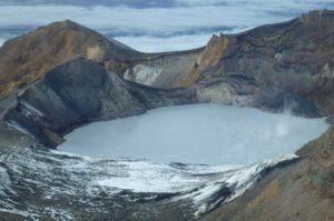
La Réunion Island , Piton de la Fournaise :
Press release from the Institut de physique du globe de Paris / Piton de la Fournaise Volcanological Observatory, 07/03/2025 – 8:00 a.m. local time – 4:00 a.m. UTC
Earthquake felt
On Friday, March 7, 2025, 01:08 (local time – or 21:08 UT on March 6), an earthquake was weakly felt by residents of the island, mainly in the Roche Ecrite sector.
This earthquake was recorded by the seismometers of the Piton de la Fournaise Volcanological Observatory. Initial analyses of this earthquake have made it possible to locate it, 6 km west-southwest of Sainte-Clotilde, at a depth of 11 km. Its magnitude was measured at 1.8 on the Richter scale. There is currently a high level of uncertainty about its location.
OVPF staff are working to refine the location calculations for this event. Also, information regarding location and intensity may change marginally.
This type of event, felt by the population, is recorded several times a year. This event is isolated and is of tectonic origin. At present, this earthquake has not been followed by aftershocks.
Call for testimonies on felt earthquakes: the real intensities (effects of an earthquake in a given place) can only be correctly determined by collecting testimonies. If you felt this earthquake, even weakly, you are invited to report it to the BCSF (French Central Seismological Bureau).
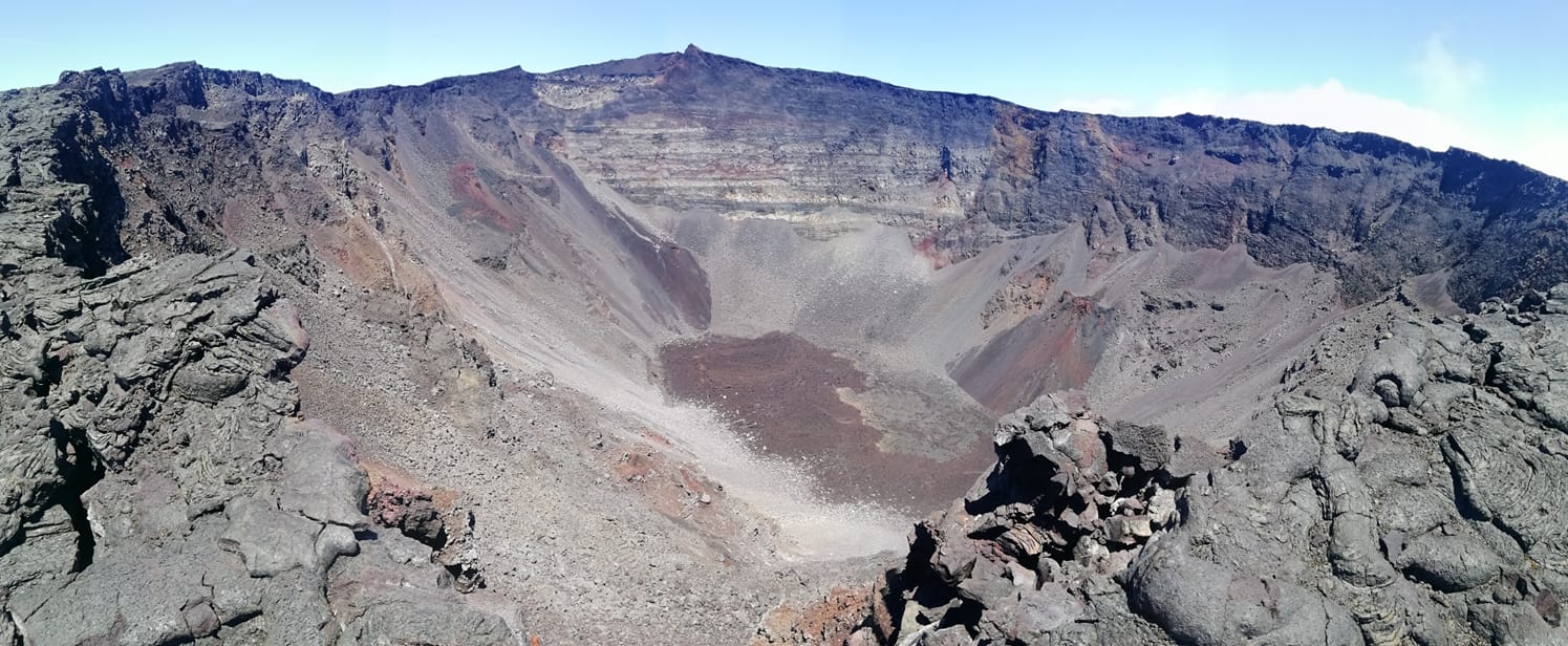
Source : direction de l’OVPF-IPGP
Photo : OVPF