August 25 , 2024.
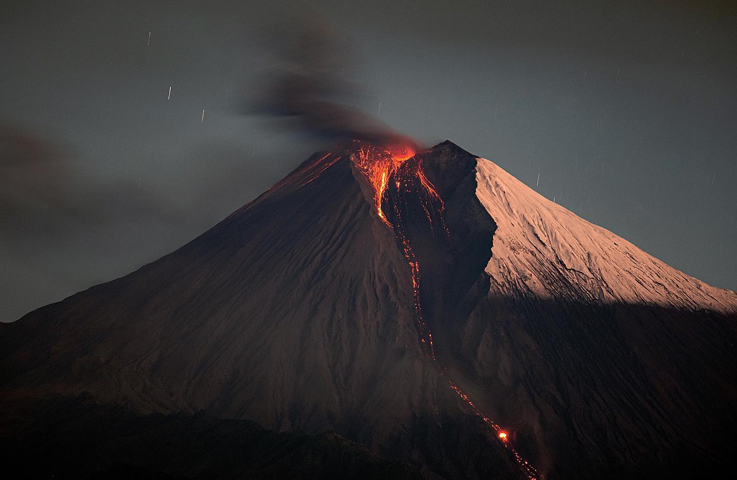
Iceland : Reykjanes Peninsula :
Eruption of the Sundhnúks crater series. Updated August 24, 9:30 AM
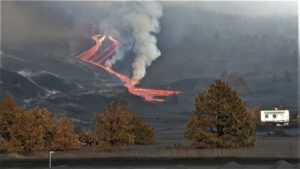
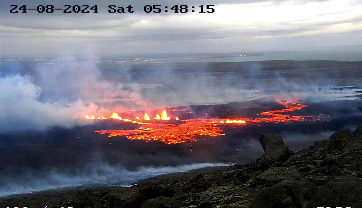
The eruption appears to have stabilized tonight
Activity is occurring to the very north of Stóra-Skógfell
No seismic activity is measured in the south, near Hagafell or Grindavík.
Gas pollution will reach the south
The eruption appears to have stabilized tonight and activity has been fairly steady throughout the night. All activity is north of Stóra Skógfell.
Activity is limited to two locations in the northern fissure that opened last night. Nice plumes of magma are still visible, but judging by visual assessment, the plumes appear to have diminished since last night.
Screenshot from the Public Safety surveillance camera on Fagradalsfjall, looking northwest.
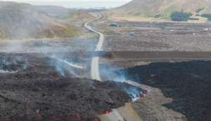
The lava is flowing mainly northwest and does not appear to be moving quickly. The lava flow towards Grindavíkurveg appears to have stopped.
Seismic activity is very low, with occasional earthquakes recorded north of Stóra-Skógfell and at Fagradalsfjall. No activity is measured in the south, near Hagafell or Grindavík.
The weather forecast continues to be north and the weather watch predicts that gas pollution will reach south above Grindavík.
Source : IMO
Photo : Sécurité publique Islande
Philippines , Kanlaon :
KANLAON VOLCANO ADVISORY , 24 August 2024 , 05:00 PM
Notice of elevated volcanic SO2 gas flux at Kanlaon Volcano.
Volcanic sulfur dioxide (SO2) gas emission from the summit crater of Kanlaon based on campaign Flyspec measurements today, 24 August 2024, reached 6,367 tonnes/day. This is the third highest emission from the volcano recorded this year and since instrumental gas monitoring began. SO2 fumes were also reported today in several barangays of Murcia, Negros Occidental. Kanlaon has been degassing increased concentrations of volcanic SO2 this year at an average rate of 1,273 tonnes/day prior to the 3 June 2024 eruption, but emission since then has been particularly elevated at a current average of 3,295 tonnes/day. In addition, strong degassing activity from the summit crater today generated voluminous steam-rich plumes that rose 700 meters before drifting north. Volcanic earthquake activity persists at an average of 9 events/day since the eruption. Real-time ground deformation data from continuous GPS and electronic tilt measurements have been recording slow but sustained inflation (swelling) and pressurization of the edifice since March 2022, with increased inflation of the eastern flank beginning in 2023 and of the southeastern flank detected by campaign EDM in July 2024. The current monitoring parameters warn of shallow magmatic processes beneath the volcano that are actively driving unrest, causing persistent and increasing concentrations of volcanic gas emission, persistent volcanic earthquake activity and swelling of the edifice.
The public is reminded that Alert Level 2 (increasing unrest) prevails over Kanlaon. This means that there is current unrest driven by shallow magmatic processes with increased chances of leading to explosive eruptions or even hazardous magmatic eruption from the summit crater. The public is strongly advised to be vigilant and avoid entry into the four (4) kilometer-radius Permanent Danger Zone (PDZ) to minimize risks from volcanic hazards such as pyroclastic density currents, ballistic projectiles, rockfall and others. In case of ash fall events that may affect communities downwind of Kanlaon’s crater, people should cover their nose and mouth with a damp, clean cloth or dust mask. Civil aviation authorities must also advise pilots to avoid flying close to the volcano’s summit as ash and ballistic fragments from sudden eruption can be hazardous to aircraft. Communities living beside river systems on the southern and western slopes, especially those that have already experienced lahars and muddy streamflows, are advised to take precautionary measures when heavy rainfall over the volcano has been forecast or has begun.
DOST-PHIVOLCS maintains close monitoring of Kanlaon Volcano and any new development will be immediately communicated to all concerned stakeholders.
Source : Phivolcs
Photo : Vajiramandravi.
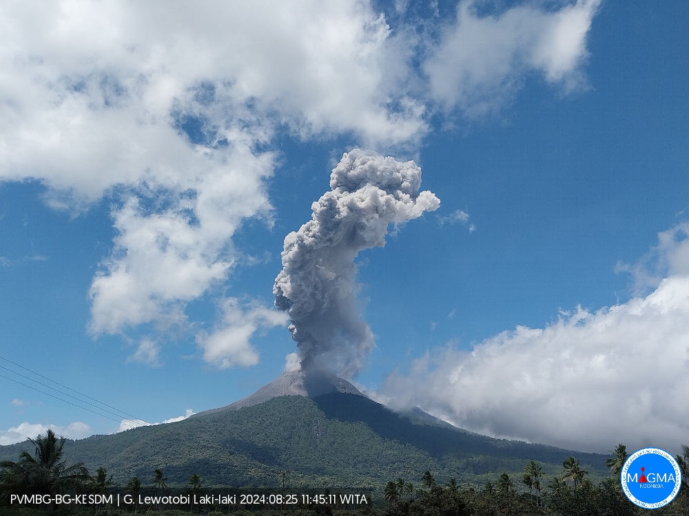
Indonesia , Lewotobi Laki-laki :
An eruption of Mount Lewotobi Laki-laki occurred on Sunday, 25 August 2024 at 11:42 WITA with the height of the ash column observed at ±800 m above the summit (±2384 m above sea level). The ash column was observed to be gray with thick intensity, oriented to the west and northwest. At the time of writing, the eruption was still ongoing.
VOLCANO OBSERVATORY NOTICE FOR AVIATION – VONA
Issued : August 25 , 2024
Volcano : Lewotobi Laki-laki (264180)
Current Aviation Colour Code : ORANGE
Previous Aviation Colour Code : orange
Source : Lewotobi Laki-laki Volcano Observatory
Notice Number : 2024LWK406
Volcano Location : S 08 deg 32 min 20 sec E 122 deg 46 min 06 sec
Area : East Nusa Tenggara, Indonesia
Summit Elevation : 5069 FT (1584 M)
Volcanic Activity Summary :
Eruption with volcanic ash cloud at 03h42 UTC (11h42 local).
Volcanic Cloud Height :
Best estimate of ash-cloud top is around 7629 FT (2384 M) above sea level or 2560 FT (800 M) above summit. May be higher than what can be observed clearly. Source of height data: ground observer.
Other Volcanic Cloud Information :
Ash cloud moving from west to northwest. Volcanic ash is observed to be gray. The intensity of volcanic ash is observed to be thick.
Remarks :
Eruption recorded on seismogram with maximum amplitude 22.2 mm and maximum duration 311 second.
Source et photo : Magma Indonésie.
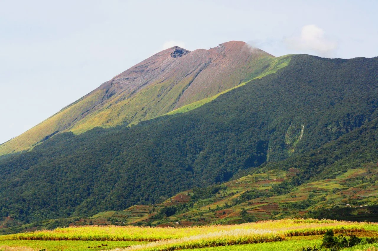
Ecuador , Sangay :
DAILY STATE REPORT OF SANGAY VOLCANO , Saturday, August 24, 2024 .
Information Geophysical Institute – EPN.
Surface Activity Level: High , Surface Trend: No change
Internal Activity Level: High , Internal Trend: No change
Seismicity: From August 23, 2024, 11:00 a.m. to August 24, 2024, 11:00 a.m. :
Seismicity:
Below is the count of seismic events recorded at the reference station
Explosion (EXP): 314
Rainfall / Lahars:
Rainfall was recorded in the volcano area without generating mudflows or debris. **Heavy rains could remobilize accumulated materials and generate mudflows and debris that would descend the sides of the volcano and flow into rivers downstream.**
Emissions/ash column:
Yesterday afternoon, thanks to the surveillance camera system, several emissions of gas and ash were observed with heights between 600 and 1,100 meters above the crater level in the West and West-Southwest directions. In connection with this activity, the VAAC agency in Washington published 1 emission report with a height of 1,200 meters above the crater level in a West direction.
Other monitoring parameters:
The FIRMS satellite system recorded 3 thermal anomalies in the last 24 hours.
Observation:
In the early morning of today, several episodes of incandescence and descent of incandescent material were observed in the South-East ravine, up to 500 meters below the level of the crater. At the end of this report, the volcano is completely cloudy.
Alert level: yellow
Source : IGEPN
Photo : Eqphos_fotografía ( 2022 ).
Costa Rica , Rincon de la Vieja / Poas :
Rincón de la Vieja Volcano
Latitude: 10.83°N;
Longitude: 85.34°W;
Altitude: 1916 m
Current Activity Level: Warning
This week, 10 exhalations and one eruption rich in water vapor, aerosols, and volcanic gases were recorded. None of these generated lahars or ash. The banded tremor sequence that began on July 25 remains intermittent to this day.
Starting on August 20, banded tremor episodes have been recorded with durations of 400 to 600 seconds and a time of approximately 8 minutes between them. When visibility permits, these banded tremor pulses are associated with larger flows of water vapor and volcanic gases from the crater, similar to exhalations. Many of these events are preceded by long-period, very low-amplitude signals.
The sporadic occurrence of long-period signals such as « tornillos » type signals persists. The dominant frequency of « tornillos » shows a decreasing trend since 15 August and with some higher energy events. In recent weeks, a contraction of the base of the volcanic edifice has been detected without significant vertical and horizontal movements of the summit. The SO2 plume in the atmosphere has not been detected by the Sentinel-5P satellite since 29 June. However, during the previous week, the NOVAC station recorded an increase in the SO2 flow (301 ± 136 t/d) compared to the previous week (233 ± 119 t/d). Gas ratios recorded by the MultiGAS station remain relatively stable with weekly averages of 0.80 ± 0.14 (CO2/SO2) and 0.17 ± 0.09 (H2S/SO2).
Poas Volcano
Latitude: 10.20°N;
Longitude: 84.23°W;
Altitude: 2687 m
Current activity level: Warning
The seismic tremor remains. However, the downward trend observed in recent weeks has reversed to an upward trend. Almost no acoustic tremor is recorded.
There are also frequent low-frequency, low-amplitude LP-type seismic events. This week, a peak of nearly 300 daily events was recorded. Short, broad-spectrum tremors continue to be recorded. Over the past week, the crustal contraction of the crater has disappeared as well as the subsidence to the north of the crater and there is no significant vertical movement to the south of it.
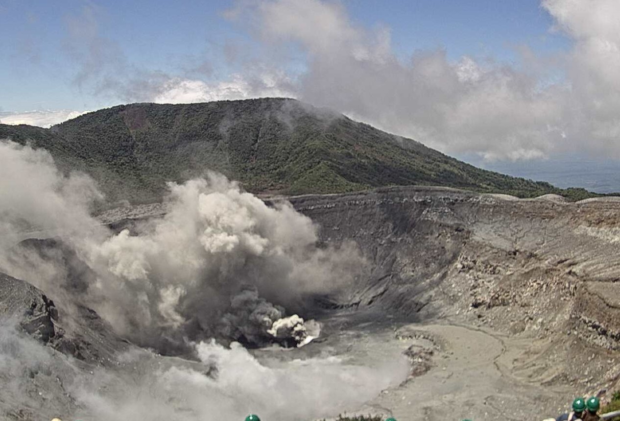
Gas compositions recorded by the MultiGAS station show little change with weekly averages of 2.0 ± 0.6 (SO2/CO2) and 0.19 ± 0.03 (H2S/SO2). The SO2 concentration recorded by the ExpoGAS station at the visitor observation point reached a maximum of 5.7 ppm this week. The SO2 plume in the atmosphere has not been detected by the Sentinel-5P satellite since June 20. However, the NOVAC station recorded a flow of 157 ± 16 t/d of SO2. The lake level fluctuated by about 60 cm in one week and then rose by about 40 cm.
Source : Ovsicori
Photos : Raul Mora / RSN / UCR ( archive 2020 ) , Ovsicori ( 04/2024)