August 22 , 2024 .
Japan , Sakurajima :
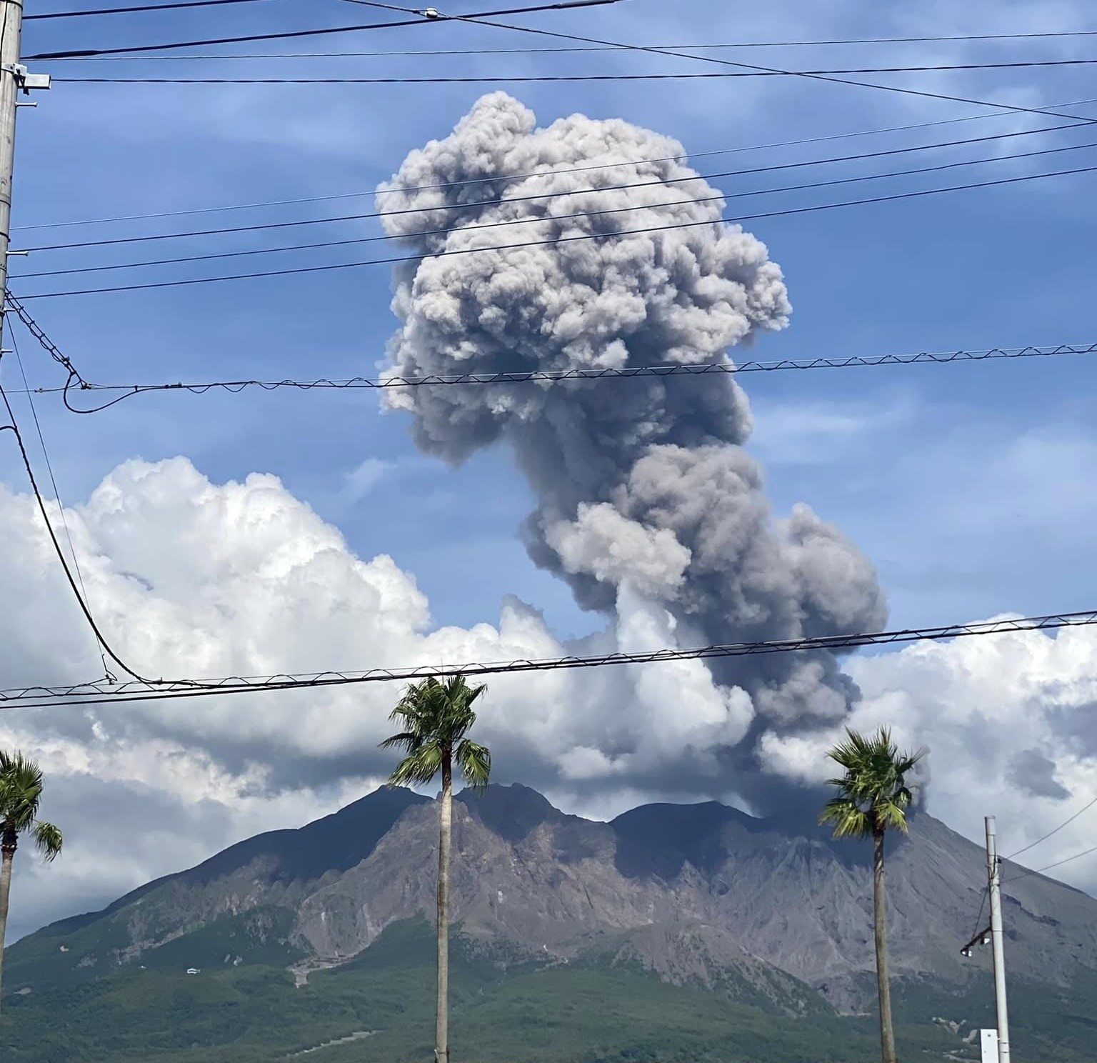
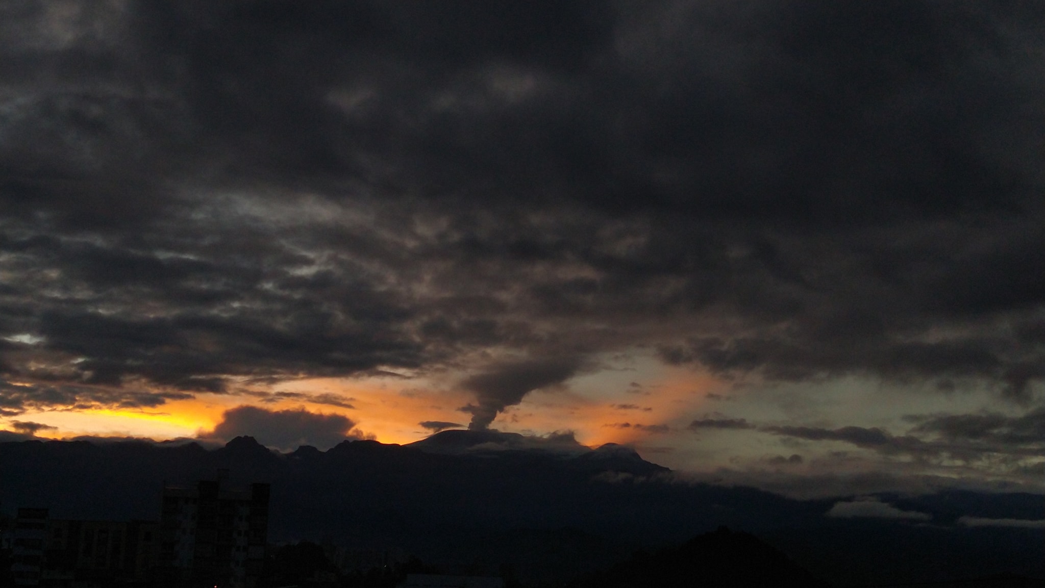
JMA reported ongoing eruptive activity at Minamidake Crater (Aira Caldera’s Sakurajima volcano) during 12-19 August. Nighttime crater incandescence was visible in webcam images. An eruptive event at 0541 on 12 August produced an ash plume that rose 1.5 km above the crater rim. Sulfur dioxide emissions were somewhat high, averaging 1,500 tons per day (t/d) on 14 August. An ash plume from an eruptive event at 1831 on 18 August rose 1.1 km above the crater rim and drifted NW. The Alert Level remained at 3 (on a 5-level scale), and the public was warned to stay 1 km away from both craters.
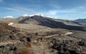
The Aira caldera in the northern half of Kagoshima Bay contains the post-caldera Sakurajima volcano, one of Japan’s most active. Eruption of the voluminous Ito pyroclastic flow accompanied formation of the 17 x 23 km caldera about 22,000 years ago. The smaller Wakamiko caldera was formed during the early Holocene in the NE corner of the caldera, along with several post-caldera cones. The construction of Sakurajima began about 13,000 years ago on the southern rim and built an island that was joined to the Osumi Peninsula during the major explosive and effusive eruption of 1914. Activity at the Kitadake summit cone ended about 4,850 years ago, after which eruptions took place at Minamidake. Frequent eruptions since the 8th century have deposited ash on the city of Kagoshima, located across Kagoshima Bay only 8 km from the summit. The largest recorded eruption took place during 1471-76.
Sources : Agence météorologique japonaise (JMA) , GVP.
Photo : Kumiko Nagai ( 20/08/2024)
Philippines , Kanlaon :
Notice of elevated volcanic SO2 gas flux at Kanlaon Volcano. 21 August 2024 , 05:00 PM
Volcanic sulfur dioxide (SO2) gas emission from the summit crater of Kanlaon based on campaign Flyspec measurements today, 21 August 2024, reached 6,720 tonnes/day. This is the second highest emission from the volcano recorded this year and since instrumental gas monitoring began. SO2 fumes were also reported today in several barangays of La Carlota City and La Castellana, Negros Occidental. Kanlaon has been degassing increased concentrations of volcanic SO2 this year at an average rate of 1,273 tonnes/day prior to the 3 June 2024 eruption, but emission since then has been particularly elevated at a current average of 3,247 tonnes/day. In addition, the Kanlaon Volcano Network recorded today a total of fifteen (15) volcano-tectonic earthquakes that were generated by rock fracturing 0 to 8 kilometers beneath the northeastern sector of the edifice. Real-time ground deformation data from continuous GPS and electronic tilt measurements have been recording slow but sustained inflation (swelling) and pressurization of the edifice since March 2022, with increased inflation of the eastern flank beginning in 2023 and of the southeastern flank detected by campaign EDM in July 2024. The current monitoring parameters warn of shallow magmatic processes beneath the volcano are actively driving unrest, causing persistent and increasing concentrations of volcanic gas emission, persistent volcanic earthquake activity and swelling of the edifice.
The public is reminded that Alert Level 2 (increasing unrest) prevails over Kanlaon. This means that there is current unrest driven by shallow magmatic processes with increased chances of leading to explosive eruptions or even hazardous magmatic eruption from the summit crater. The public is strongly advised to be vigilant and avoid entry into the four (4) kilometer-radius Permanent Danger Zone (PDZ) to minimize risks from volcanic hazards such as pyroclastic density currents, ballistic projectiles, rockfall and others. In case of ash fall events that may affect communities downwind of Kanlaon’s crater, people should cover their nose and mouth with a damp, clean cloth or dust mask. Civil aviation authorities must also advise pilots to avoid flying close to the volcano’s summit as ash and ballistic fragments from sudden eruption can be hazardous to aircraft. Communities living beside river systems on the southern and western slopes, especially those that have already experienced lahars and muddy streamflows, are advised to take precautionary measures when heavy rainfall over the volcano has been forecast or has begun.
DOST-PHIVOLCS maintains close monitoring of Kanlaon Volcano and any new development will be immediately communicated to all concerned stakeholders.
Source : Phivolcs
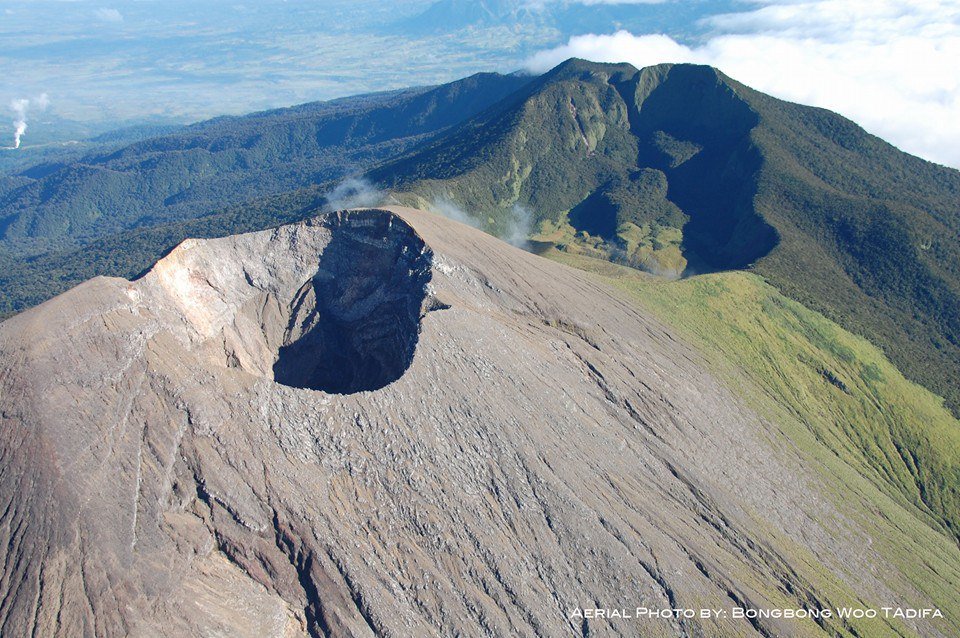
Photo : Bong Bong Woo Tadifa ( 2018)
Indonesia , Lewotobi Laki-laki :
An eruption of Mount Lewotobi Laki-laki occurred on Wednesday, August 21, 2024, at 17:49 WITA with the height of the ash column observed at ± 600 m above the summit (± 2184 m above sea level). The ash column was observed to be gray with a thick intensity, oriented towards the west. This eruption was recorded on a seismograph with a maximum amplitude of 4.4 mm and a duration of 261 seconds.
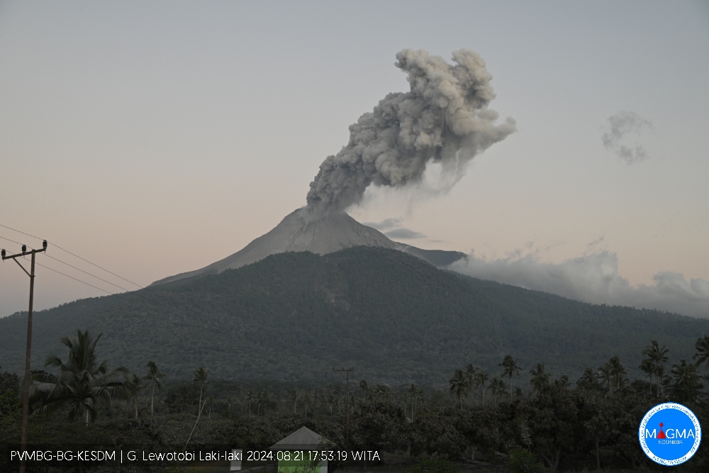
PVMBG reported that eruptive activity at Lewotobi’s Laki-laki volcano continued during 14-20 August. Daily gray or white-and-gray ash plumes that were sometimes dense rose as high as 1.5 km above the summit and drifted mainly SW, W, and NW. Incandescence near the summit crater was visible in a 14 August webcam image. The Alert Level remained at 3 (the second highest level on a scale of 1-4) and the public was warned to stay outside of the exclusion zone, defined as a 3-km radius around both Laki-laki and Perempuan craters, 4 km to the NNW and SSE of Laki-laki.
Source et photo : Magma Indonésie, GVP.
Colombia , Nevado del Ruiz :
Manizales, August 20, 2024, 7:00 p.m.
From the monitoring of the activity of the Nevado del Ruiz volcano, the Colombian Geological Survey (SGC), an entity attached to the Ministry of Mines and Energy, reports that:
During the week of August 13 to 19, 2024, the volcano continued with unstable behavior. The main variations in the monitored parameters, compared to the previous week, were:
– The seismic activity associated with the fracturing of rocks inside the volcanic edifice increased in the number of earthquakes recorded and decreased in seismic energy released. The earthquakes were located mainly in the Northwest, East-Southeast, South-Southeast and in the Arenas crater; also, to a lesser extent, in the North and Northeast sectors, at distances less than 8 km from the crater. The depths of the events ranged from less than 1 km to 8 km from the summit of the volcano. The highest magnitude of the week was 1.0, corresponding to the earthquake recorded on August 13 at 5:47 p.m., located 8 km east-southeast of the crater, at a depth of 5 km. – Seismicity related to the activity of fluids inside volcanic conduits increased in the number of earthquakes recorded and in the seismic energy released. Energy levels ranged from low to moderate values. The occasional recording of long-period signals stands out. Thanks to the cameras used to monitor the volcano, it was possible to confirm several ash emissions and changes in the temperature of the emitted materials. Both phenomena were associated with some of these seismic events.
– The emission of water vapor and gases into the atmosphere from the Arenas crater continues. The rates of degassing of sulfur dioxide (SO₂) were variable, with a slight increase compared to the previous week. The maximum vertical height of the gas column was 700 m and its dispersion 1,200 m. These values were measured at the summit of the volcano on August 19 and 14, respectively. The direction of dispersion of the gas column was variable and with a preferential tendency towards the west of the volcano (from northwest to southwest). This direction of dispersion and the strong winds, especially during the weekend, caused ash falls in the municipalities of Manizales and Villamaría (Caldas department). – When monitoring thermal anomalies at the bottom of the Arenas crater, from satellite monitoring platforms, their detection continues to be limited by the atmospheric conditions prevailing in the area. However, during the week, low to moderate energy level anomalies were detected.
The alert level remained yellow (the second level on a four-level scale) and the public was warned to stay away from restricted areas around the Arenas Crater, not to spend long periods of time on the Murillo-Cerro Gualí road and to avoid drainages in high-risk areas.
Source : SGC , GVP.
Photo : Julian Fernando Aranzazu Henao (01/2024).
Hawaii , Kilauea :
Wednesday, August 21, 2024, 8:41 AM HST (Wednesday, August 21, 2024, 18:41 UTC)
19°25’16 » N 155°17’13 » W,
Summit Elevation 4091 ft (1247 m)
Current Volcano Alert Level: ADVISORY
Current Aviation Color Code: YELLOW
Activity Summary:
Kīlauea is not erupting. Increased earthquake activity and rates of ground deformation at Kīlauea’s upper East Rift Zone (UERZ) began early Tuesday morning. Activity is still elevated but has decreased over the past 24 hours. Changes in the character and location of unrest can occur quickly, as can the potential for eruption, but there are no signs of imminent eruption at this time. There are no significant changes in activity in the lower East Rift Zone and Southwest Rift Zone.
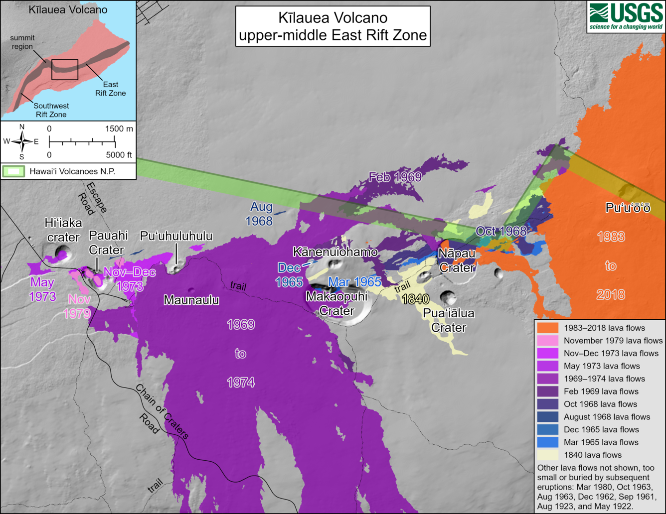
This reference map depicts the features on Kīlauea’s middle East Rift Zone, much of which is within Hawaiʻi Volcanoes National Park. Pit craters and lava flows are evidence of a long history of magma moving along this rift zone pathway. Numerous eruptions took place in this region during the 1960s–1970s. Most eruptions in this area during that timeframe lasted less than one day to about two weeks, though there were long-lived eruptions at Maunaulu (1969–1971 and 1972–1974) and Puʻuʻōʻō (1983–2018). The most recent eruption in this area took place over 35 years at and near the Puʻuʻōʻō vent (shown in orange on the map).
Summit Observations:
Approximately 43 earthquakes were detected beneath Kaluapele (Kīlauea’s summit caldera) over the past 24 hours. Most were located south of Halema‘uma‘u and near Keanakākoʻi Crater at depths of 1–3 km (0.6–1.9 mi) below the ground surface with magnitudes of less than M2.0. Rates of deformation at the summit remained relatively low with minor local deflation, likely in response to unrest in the upper East Rift Zone (UERZ). An overall gradual inflationary trend continues to be seen on GPS instruments around the summit region. The most recent measurement of the summit’s SO2 emission rate was approximately 75 tonnes per day on August 20, 2024.
Rift Zone Observations:
Over the past 24 hours, there have been approximately 181 earthquakes beneath Kīlauea’s UERZ region, extending from Puhimau Crater southeast to Maunaulu. Most earthquakes have been smaller than M2.0, though there were 2 events larger than M3.0. Events have remained at depths of 1–3 km (0.6–1.8 miles) beneath the surface. Most earthquakes have been too small to feel, but several were reported felt in Hawaiʻi Volcanoes National Park and surrounding communities.
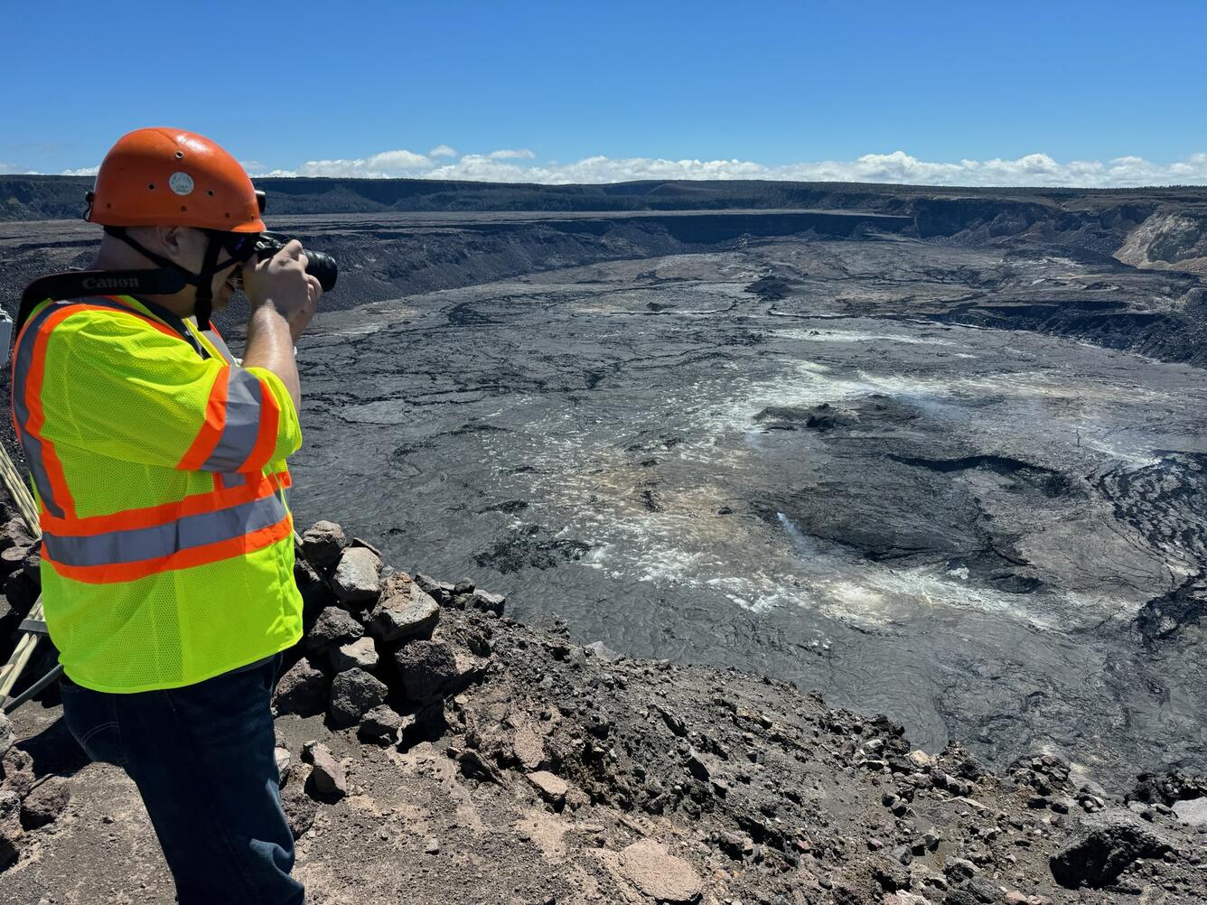
USGS scientists made a routine visit to the summit of Kīlauea for maintenance work on a webcam and general observations. The weather offered clear views of Kaluapele (the summit caldera), and only minor outgassing from several spots on the caldera floor.
Earthquake activity was accompanied by elevated rates and changing patterns of ground deformation recorded by the ESC tiltmeter northeast of Pauahi Crater in Kīlauea’s UERZ on Tuesday (8/19). Deformation as of Wednesday morning is relatively level (flat).
Activity in the middle East Rift Zone (MERZ) remains low. Earthquake locations are scattered around Makaopuhi crater within Hawaiʻi Volcanoes National Park. Depths range from 1–3 km (0.6–1.9 mi) below the ground surface with magnitudes less than M2.0. There has been no significant change in deformation at the POC tiltmeter overnight. GPS instruments continue to record inflation in the region.
At this time, there is no evidence of seismicity or ground deformation beneath the lower East Rift Zone, and Southwest Rift Zone activity remains low. Current activity is restricted to the summit and upper East Rift Zone region.
Source : HVO
Photos : HVO , USGS / M. Patrick (20/08/2024)