June 24 , 2024.
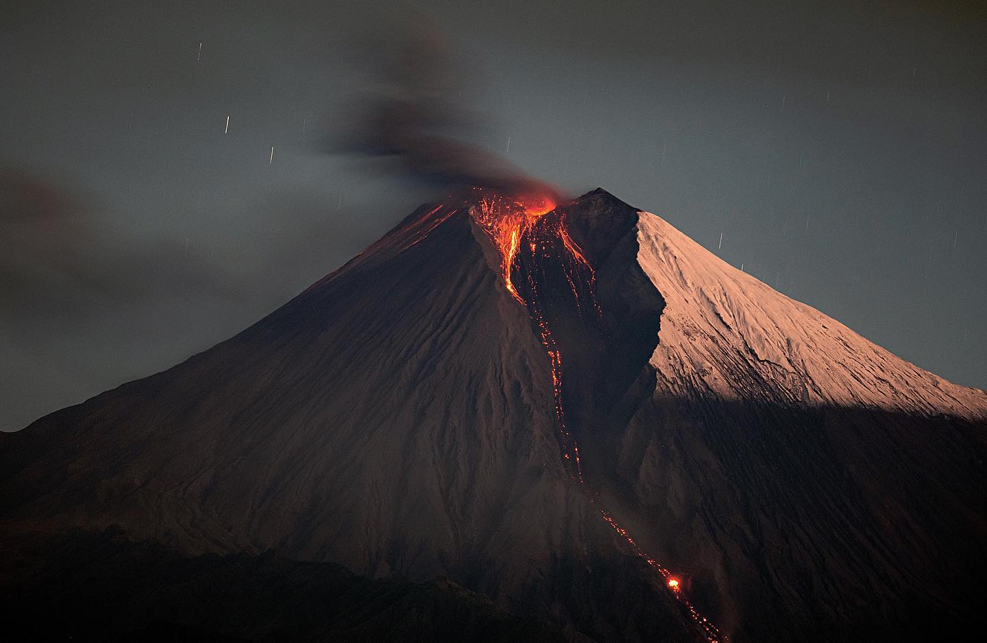
Italy , Stromboli :
Press release on Stromboli activity, June 23, 2024 2:17 p.m. (12:17 p.m. UTC)
The National Institute of Geophysics and Volcanology, Osservatorio Etneo communicates that a lava overflow is observed.
Further updates will be communicated shortly.
Press release on Stromboli activity, June 23, 2024 3:09 p.m. (1:09 p.m. UTC)
The National Institute of Geophysics and Volcanology, Osservatorio Etneo, communicates that since around 12:00 UTC, intense projection activity has been observed at the level of BN1 of Stromboli, which feeds modest lava overflows on the upper part of the Sciara del Fuoco , with a length of around a hundred meters. We can also observe the rolling of the blocks on the Sciara to the coast.
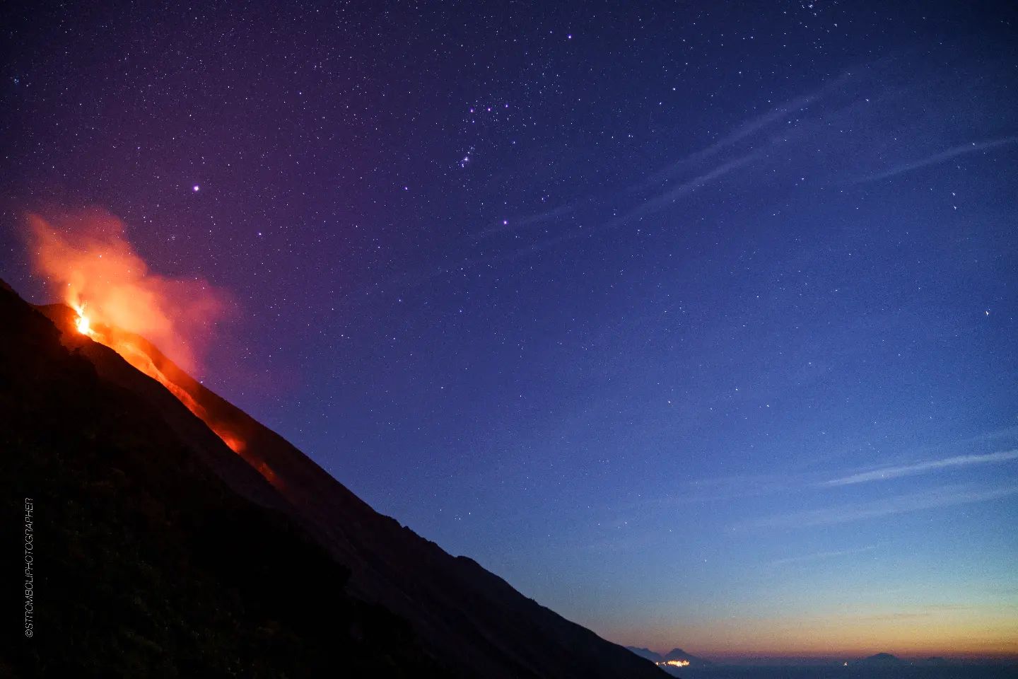
Around 03:20 UTC, an increase in the values of the mean amplitude of the volcanic tremor was observed which rose quickly from the high level to the very high level, remaining at the latter. The maximum value was reached at 10:30 UTC. The hourly frequency of VLP events is stable from tonight at around 10 events per hour.
The signals from the GNSS (HF) and inclinometer deformation monitoring networks do not show significant variations.
Further updates will be communicated promptly and in any case within 3 hours of this press release.
Source : INGV
Photo : Stromboli stati d’animo / Sebastiano Cannavo. ( archive)
Colombia , Puracé :
Today at 05:35 p.m. , under the crater of the Puracé volcano and its eastern flank, a fracture earthquake with a maximum magnitude of 1.9 was recorded.
Popayan, June 23, 2024, 1:15 p.m.
Regarding the monitoring of the activity of the PURACE VOLCANO – LOS COCONUCOS VOLCANIC RANGE, the COLOMBIAN GEOLOGICAL SERVICE (SGC), an entity attached to the MINISTRY OF MINES AND ENERGY, reports that:
Since yesterday until the publication of this bulletin, both the seismic activity associated with the fracturing of rocks inside the volcanic edifice and that linked to the movement of fluids have been characterized by behavior similar to that observed the previous days. The locations of fracture earthquakes continue to be located under the crater of the Puracé volcano at depths between 1 and 5 km. Fluid seismicity, for its part, continues to be located mainly below the crater of the Puracé volcano, in a depth range of less than 3 km, the maximum magnitude recorded was 1.2 ML, corresponding to an earthquake today at 5:26 a.m.

In the images obtained until the publication of this bulletin, the webcams captured images showing degassing processes in the lateral fumarole, with white emissions that dispersed according to the direction of the winds in the area. Due to strong winds in the upper part of the volcano, it was not possible to calculate the height of the gas column. On the other hand, the process of ground deformation and the concentrations of carbon dioxide (CO2) and sulfur dioxide (SO2) gases maintain the observed trend, with values that remain above the known baselines for this volcano.
The SGC confirms that the alert state of the PURACE VOLCANO continues at ORANGE: volcano with significant changes in the monitored parameters.
Source et photo : SGC
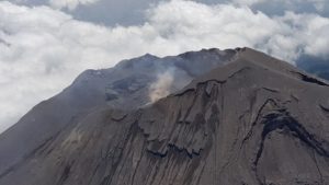
Ecuador , Sangay :
DAILY REPORT ON THE STATE OF THE SANGAY VOLCANO, Sunday June 23, 2024.
Information Geophysical Institute – EPN.
Surface activity level: High, Surface trend: No change
Internal activity level: High, Internal trend: No change
Seismicity: From June 15, 2024, 11:00 a.m. to June 16, 2024, 11:00 a.m.:
Due to data transmission problems, it was not possible to count volcanic events.
Precipitation/Lahars:
The presence of rain has not been reported in the volcano area or surrounding areas through surveillance cameras, satellite images or external reports. **In the event of heavy rains, these could remobilize the accumulated materials, generating mud and debris flows which would descend the sides of the volcano and flow into adjacent rivers.
Emissions/ash column:
Since yesterday, no gas or ash emissions have been observed thanks to surveillance cameras, satellite images, external reports or reports issued by the Washington-VAAC.
Observation:
Since yesterday, we have observed that the volcano remains cloudy to partially clear. On the other hand, during the night, a few episodes of incandescence were recorded at the crater.
Alert level: yellow
Source : IGEPN
Photo : Eqphos_fotografía
United – States , Cascade Range / St Helens :
CASCADES VOLCANO OBSERVATORY WEEKLY UPDATE
U.S. Geological Survey , Friday, June 21, 2024, 9:52 AM PDT (Friday, June 21, 2024, 16:52 UTC)
Current Volcano Alert Level: NORMAL
Current Aviation Color Code: GREEN
Activity Update:
All volcanoes in the Cascade Range of Oregon and Washington are at normal background activity levels. These include Mount Baker, Glacier Peak, Mount Rainier, and Mount Adams in Washington State, and Mount Hood, Mount Jefferson, Three Sisters, Newberry, and Crater Lake in Oregon.
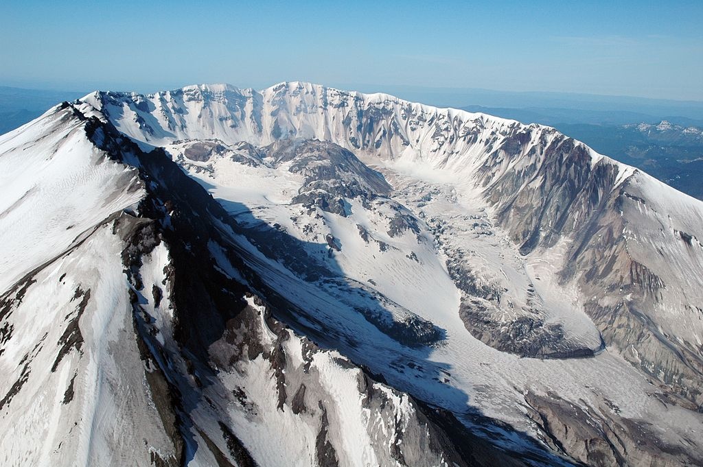
Past Week Observations:
Mount St. Helens continues to experience slightly heightened seismicity than typical of recent years, with 31 located earthquakes in the last week, and 368 since Feb 1 when the current increase in seismicity began. The largest earthquake over the past week was a magnitude 1.0, with the largest since Feb 1 a magnitude 2.0. The average depth of earthquakes at Mount St. Helens last week was 4.1 miles below the crater, compared to an average depth of 3.8 since Feb 1. Although this level of seismicity is elevated compared to the last several years at Mount St. Helens, it is still considered within the background range and does not suggest an imminent eruption. No changes have been detected in ground deformation, volcanic gas, or thermal emissions at the volcano. During the past week, monitoring data were consistent with background activity levels in the Cascades Range.
Source : CVO
Photo : USGS ( archive).
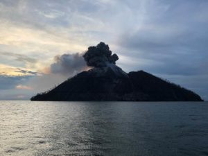
Guatemala , Fuego :
Weather conditions: Clear weather
Wind: South-East
Precipitation: 12.6 mm.
Activity:
The Fuego Volcano Observatory reports low degassing at an altitude of 4,400 meters. Small to moderate explosions also occur at a rate of 5 to 8 per hour. These explosions generate columns of gas and ash with heights of 4,600 to 4,700 meters above the sea (15,092 meters, 15,420 feet) which move over 12 km in the North, North-West and West. According to the WRF numerical model, the dispersion direction will remain north and northwest during the day. The explosions produce small to moderate avalanches around the crater and towards the Seca, Ceniza, Trinidad and Las Lajas ravines.
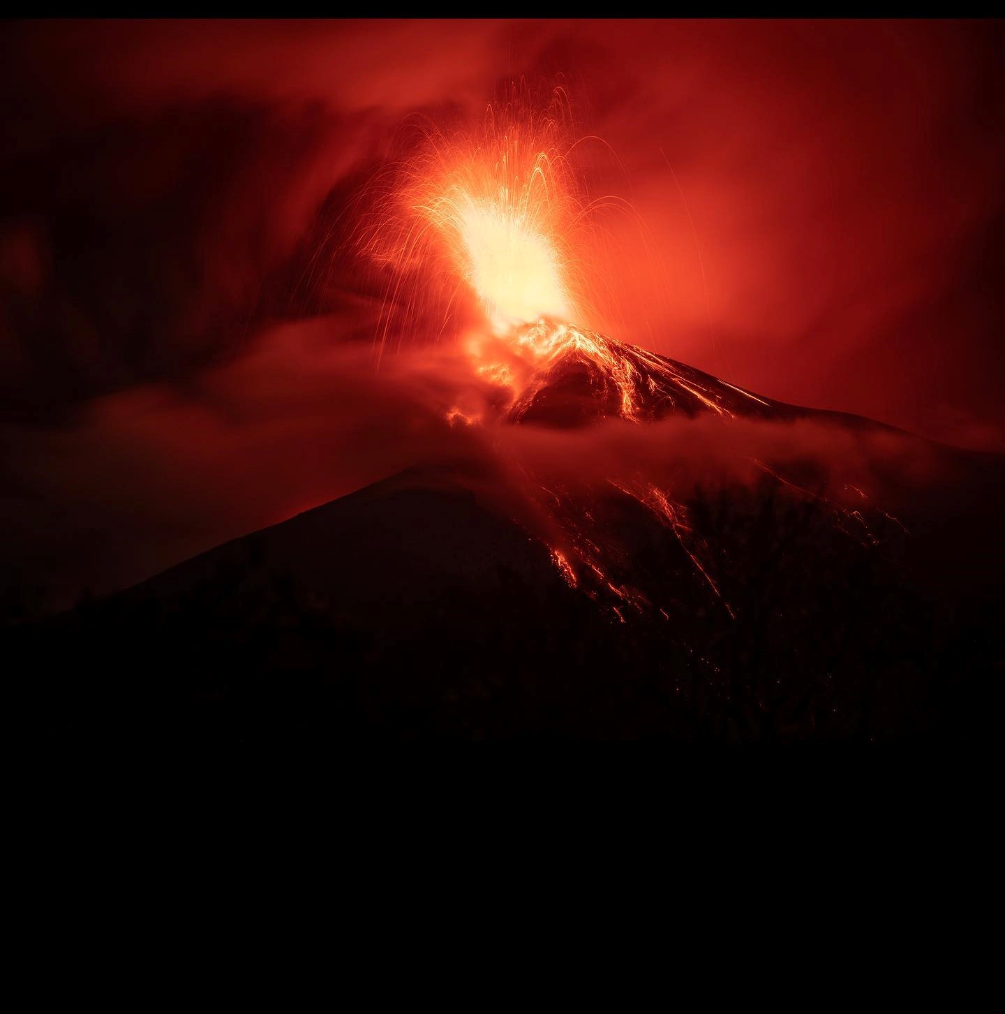
Low to moderate rumbling with weak shock waves that shake roofs and windows of houses near the volcano are also reported. At night and early in the morning, an incandescent pulse was observed 100 meters above the crater. Due to wind direction, fine ashfall is likely in towns located to the north and northwest of the volcano, such as Acatenango and Yepocapa. In the afternoon and evening, the heavy rains forecast could cause lahars in different ravines of the volcano.
Source : Insivumeh.
Photo : Diego Rizzo