June 14 , 2024.
Indonesia , Ibu :
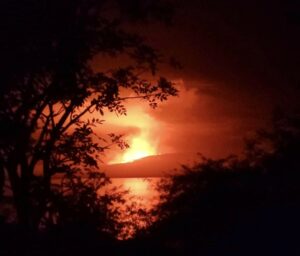
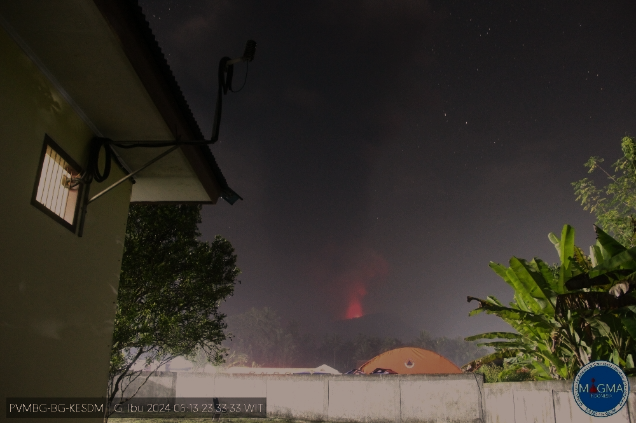
An eruption of Mount Ibu occurred on Thursday, June 13, 2024 at 11:15 p.m. WIT with the height of the ash column observed at ±5,000 m above the summit (±6,325 m above sea level) . The ash column was observed to be gray to black in color with thick intensity, oriented to the West and Northwest. At the time of writing, the eruption was still ongoing.
VOLCANO OBSERVATORY NOTICE FOR AVIATION – VONA
Issued : June 13 , 2024
Volcano : Ibu (268030)
Current Aviation Colour Code : RED
Previous Aviation Colour Code : orange
Source : Ibu Volcano Observatory
Notice Number : 2024IBU027
Volcano Location : N 01 deg 29 min 17 sec E 127 deg 37 min 48 sec
Area : North Maluku, Indonesia
Summit Elevation : 4240 FT (1325 M)
Volcanic Activity Summary :
Eruption with volcanic ash cloud at 14h15 UTC (23h15 local).
Volcanic Cloud Height :
Best estimate of ash-cloud top is around 20240 FT (6325 M) above sea level or 16000 FT (5000 M) above summit. May be higher than what can be observed clearly. Source of height data: ground observer.
Other Volcanic Cloud Information :
Ash cloud moving from west to northwest. Volcanic ash is observed to be gray to dark. The intensity of volcanic ash is observed to be thick.
Remarks :
Eruption recorded on seismogram with maximum amplitude 28 mm and maximum duration 126 second.
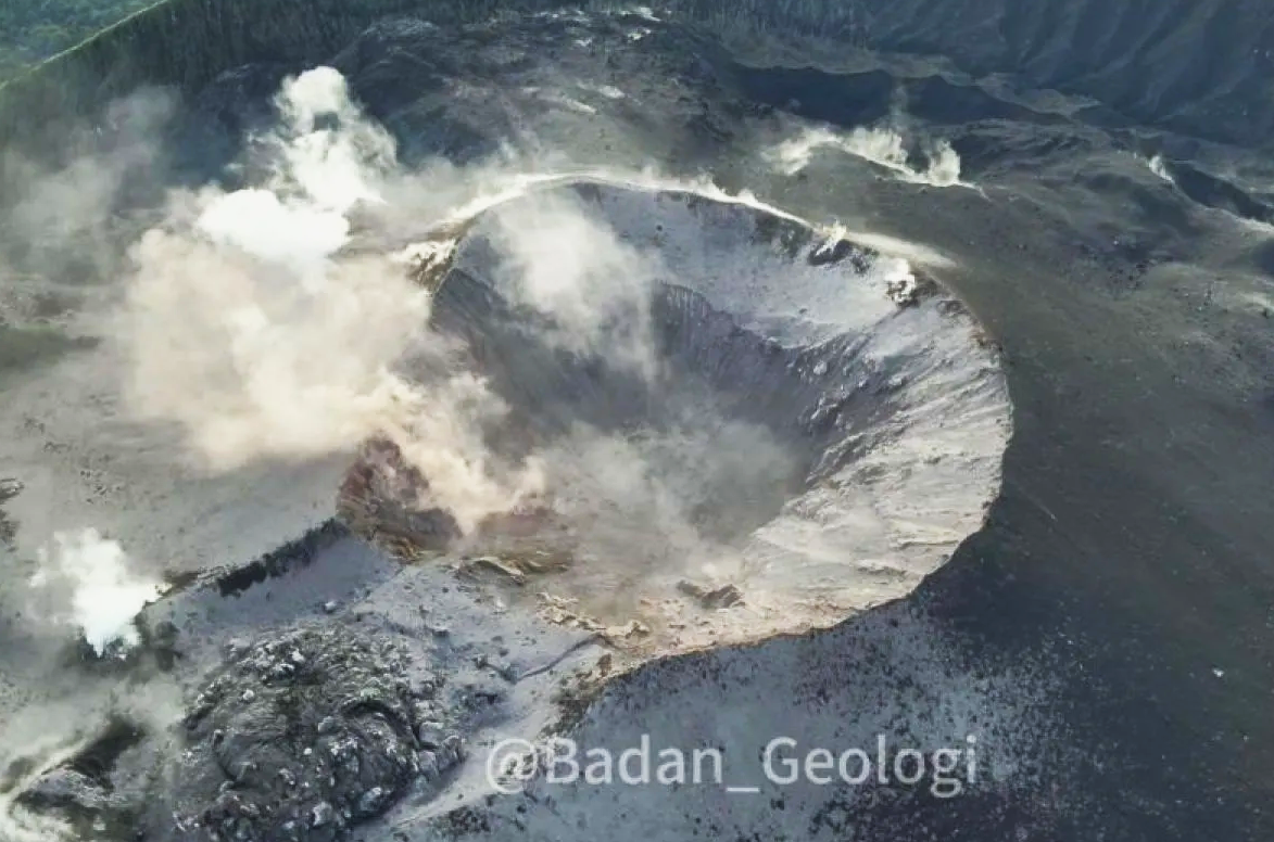
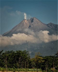
The geological agency of the Ministry of Energy and Mineral Resources (ESDM) reports the appearance of a lava dome in the western part of the crater of Mount Ibu located on Halmahera Island, in the province of North Maluku .
Center for Geological Disaster Volcanology and Mitigation (PVMBG) volcano team chairman Heruningtyas Desi Puritamasari said this is a new dome that did not previously exist on Mount Ibu.
“(The lava dome) formed from previous eruptions, which did not happen in an instant,” Tyas said in contact on Thursday in Jakarta.
Lava domes are circular, mound-like protrusions formed from the slow extrusion of thick lava over volcanoes.
Source : Magma Indonésie, Antara news.
Photos : Magma Indonésie , ANTARA / HO-Agence géologique
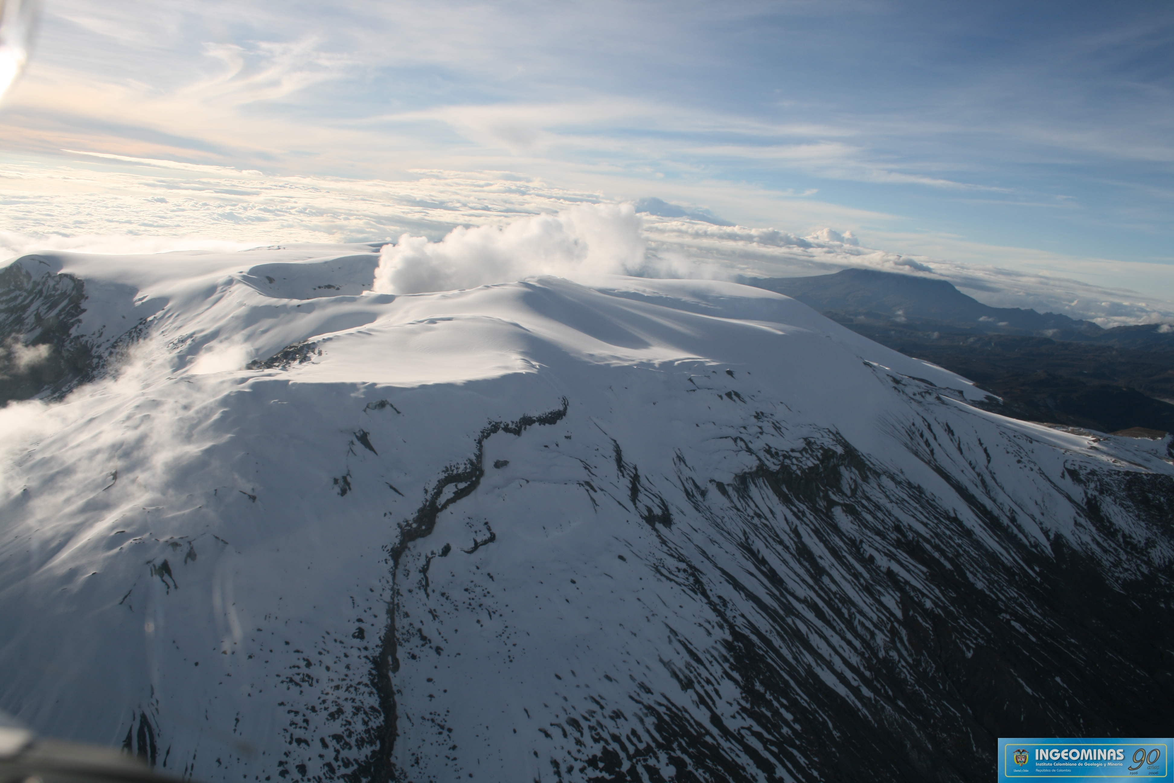
Colombia , Nevado del Ruiz :
Manizales, June 11, 2024, 7:00 p.m.
Weekly activity bulletin: Nevado del Ruiz Volcano
Regarding the monitoring of the activity of the NEVADO DEL RUIZ VOLCANO, the COLOMBIAN GEOLOGICAL SERVICE (SGC), an entity attached to the MINISTRY OF MINES AND ENERGY, reports that:
In the week of June 4 to 10, 2024, the volcano continued with unstable behavior. Compared to the previous week, the main variations in the monitored parameters
were:
– Seismicity linked to fluid dynamics inside volcanic conduits increased in the number of earthquakes recorded and decreased in the seismic energy released. Some seismic signals were associated with pulsatile emissions of ash and gas into the atmosphere. These seismic signals presented variable energy levels with generally low values. Long period signals were occasional. Although high cloudiness persists in the volcanic area, it has been possible to confirm several ash emissions and changes in the temperature of the emitted materials, thanks to the cameras used to monitor the volcano, associated with some of these seismic events.
– Seismic activity associated with the fracturing of rocks within the volcanic edifice has increased in the number of earthquakes recorded and in the levels of seismic energy released. The earthquakes were located mainly in the Arenas crater and, to a lesser extent, on the East, North-East, South-East, North-West and South-South-West sides, at distances less than 9 km from the crater. The depths of the events varied between less than 1 and 7 km from the volcano summit. The highest magnitude of the week was 1.1, corresponding to the earthquake recorded on June 6 at 10:17 a.m., located approximately 3 km east-southeast of the crater, at 4 km depth.
In addition, an increase in seismicity was recorded linked to the activity of the lava dome (protuberance or mound) located at the bottom of the crater. Episodes of this type of seismicity were of low energy and of short to moderate duration.
– On the volcano, the emission of water vapor and gas into the atmosphere from the Arenas crater continues.
Sulfur dioxide (SO₂) outgassing rates were variable and increased compared to the previous week. The maximum height of the gas column, estimated above the summit of the volcano, was 900 m vertically on June 5, and 1,500 m dispersed on June 9. The direction of dispersion of the gas column during the week was variable with a preferential trend towards the northwest flank of the volcano. In the first days of the week, several reports of sulfur smells were received from the Valley of the Tombs sector of the Nevados National Natural Park, this due to the preferential direction of the wind which concentrated the gases emitted by the volcano.
– When monitoring surface activity from satellite monitoring platforms, the detection of thermal anomalies at the bottom of Arenas Crater continued to be limited by the heavy cloudiness conditions in the area. During the week, no detected anomalies were reported.
Source et photo : Ingeominas
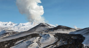
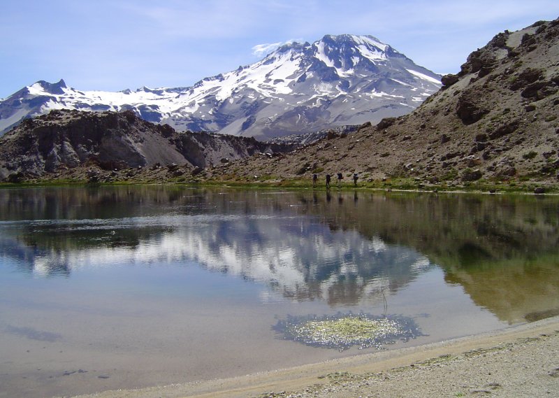
Chile , Descabezado Grande :
Seismology
The seismological activity of the period was characterized by the recording of:
52 seismic events of type VT, associated with the fracturing of rocks (Volcano-Tectonics). The most energetic earthquake had a Local Magnitude (ML) value equal to 1.9, located 3.0 km north-northeast of the volcanic edifice, at a depth of 3.9 km from the crater .
7 LP type seismic events, associated with fluid dynamics inside the volcanic system (Long Period). The size of the largest earthquake evaluated from the Reduced Displacement (RD) parameter was equal to 3 cm2.
1 TR type seismic event, associated with the dynamics maintained over time of fluids inside the volcanic system (TRemor). The size of the earthquake evaluated from the Reduced Displacement (RD) parameter was equal to 3.14 cm2.
Fluid geochemistry
No anomalies have been reported in the emissions of sulfur dioxide (SO2) into the atmosphere in the area near the volcanic group, according to data published by the Troposphere Monitoring Instrument (TROPOMI) and the Tropospheric Monitoring Instrument (TROPOMI). ozone monitoring (IMO) Sulfur dioxide group.
Thermal anomalies by satellites
During the period, no thermal alerts were recorded in the area associated with the volcanic group, according to the analytical processing of Sentinel 2-L2A satellite images, in combination of false color bands.
Surveillance cameras
The images provided by the fixed camera, installed near the volcanic group, did not record degassing columns or variations linked to surface activity.
Activity remained at levels considered low, suggesting stability of the volcanic complex. The technical volcanic alert is maintained in:
GREEN TECHNICAL ALERT: Active volcano with stable behavior – There is no immediate risk.
Source : Sernageomin
Photo : Wikiheinz
Hawaii , Kilauea :
Thursday, June 13, 2024, 8:43 AM HST (Thursday, June 13, 2024, 18:43 UTC)
19°25’16 » N 155°17’13 » W,
Summit Elevation 4091 ft (1247 m)
Current Volcano Alert Level: ADVISORY
Current Aviation Color Code: YELLOW
Activity Summary:
Kīlauea volcano is not erupting. The eruption that began on Monday, June 3, southwest of Kaluapele (Kīlauea caldera) within Hawai’i Volcanoes National Park has ended. Incandescence from the fissure vents is no longer visible in nighttime webcam images. Volcanic gas emissions at the eruption site have decreased significantly and are approaching background levels. Earthquake counts in the summit region remain slightly elevated, while tremor has dropped to background levels. Inflationary ground deformation of the summit continues. Although the eruption has ended, renewed pulses of seismicity and deformation could result in new eruptive episodes within the area or elsewhere within the summit region.
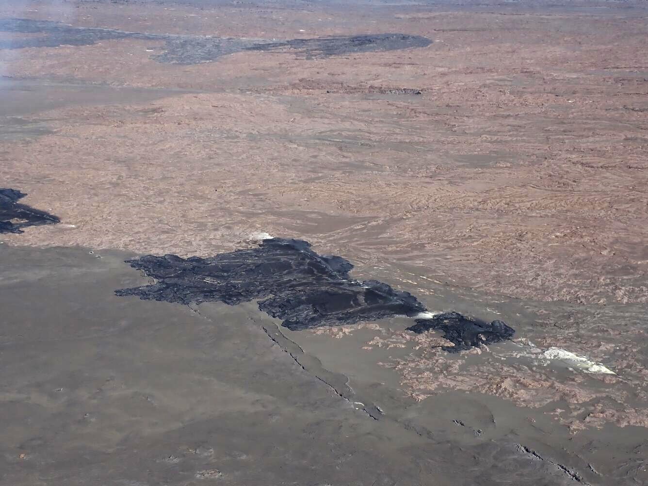
During the June 3, 2024, Southwest Rift Zone eruption, Fissures 1 and 2 (pictured here) had low erupted volumes compared to fissures 3 and 4. Fissures 1 and 2 were located closer to Kalupele (Kīlauea summit caldera), whereas fissures 3 and 4 are on the southwest section of the fissure system.
Eruption Site Observations:
No lava is erupting. Glow from fissure vents is no longer visible in webcam imagery. Volcanic gas emissions at the eruption site are approaching background levels (100 tonnes per day or less). Total SO2 emission rates for the summit and recent eruption site of approximately 350 t/d were measured on June 10. Seismic activity remains low at the eruption site.
Summit and Upper Rift Zone Observations:
Rates of seismicity beneath the summit, upper East Rift Zone, and upper Southwest Rift Zone were slightly elevated over the past day. Over 40 earthquakes occurred over the past 24 hours. Earthquakes were mostly located beneath the south caldera region and upper East Rift Zone, at depths of 1.5-3 km (1–1.8 miles), with magnitudes under M2.5. Tremor has decreased to background levels across the summit region. Inflationary ground deformation of the summit continued over the past day. The Uēkahuna tiltmeter northwest of the summit recorded overall inflation of approximately 2 microradians over the past 24 hours. The Sand Hill tiltmeter southwest of the summit recorded approximately 3 microradians of inflation over the past 24 hours.
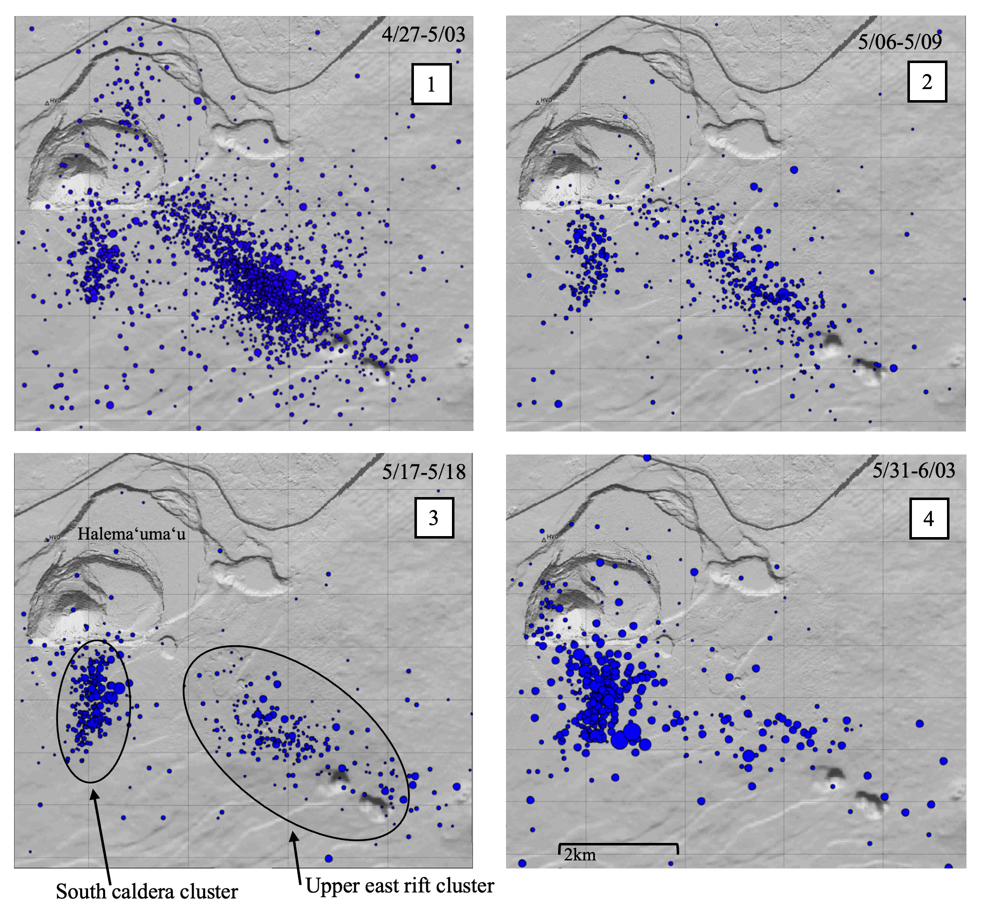
The two distinct clusters of earthquakes at Kīlauea during the four recent time periods of swarm activity. The event counts at the south caldera cluster increase while the counts at the upper East Rift Zone cluster diminish from the first to the fourth time periods.
Lower Rift Zone Observations:
Rates of seismicity and ground deformation beneath the middle and lower East Rift Zone and lower Southwest Rift Zone are low. Eruptive activity and unrest have been restricted to the summit and upper rift zone regions. Measurements from continuous gas monitoring stations downwind of Puʻuʻōʻō in the middle East Rift Zone remain below detection limits for SO2, indicating that SO2 emissions from Puʻuʻōʻō are negligible.
Source : HVO
Photos : USGS / A.R. Nalesnik , HVO.
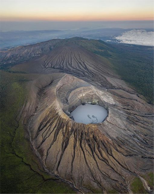
Costa Rica , Rincon de la Vieja / Poas :
Rincón de la Vieja Volcano
Latitude: 10.83
Length:-85.324
Altitude: 1,916 meters above sea level
Activity observed:
No eruptions or expirations have been recorded in the last 24 hours. The background tremor remains variable in energy with a frequency range between 1 and 7 Hz. Sometimes there are segments of higher intensity in the tremor. Sporadic long-period (LP) signals and proximal and distal volcano-tectonic earthquakes associated with rock rupture are recorded. Geodetic measurements show that the extension of the base of the volcano is not significant, as is the uplift of the summit.
Environmental conditions:
The wind blows from the North-East and the summit is cloudy.
Activity Level: Caution (3)
Poas Volcano
Latitude: 10.2
Length: -84,233
Altitude: 2,687 meters above sea level
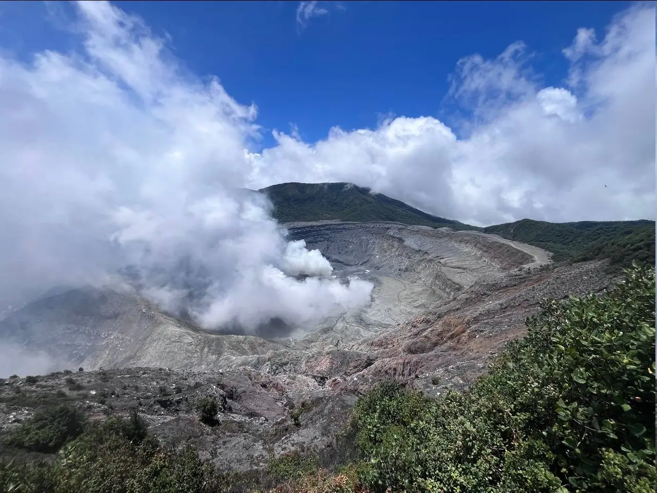
Activity observed:
No eruptions have been recorded in the last 24 hours. Due to wind conditions, there are no favorable measurements of gas rates and S02 concentrations at the Multigas station. SO2 concentrations at the wiewpoint remain stable below 2 ppm throughout the morning. Seismic activity is maintained with a background tremor. This tremor has had a slight upward trend since the beginning of June. Sporadic long-period (LP) signals are observed. During last night, an incandescence was observed at two points coming from the mouth A and to the east of the mouth A (near the dome), linked to the combustion of compounds rich in sulfur. In recent days, a contraction of the crater continues to be observed with a more pronounced subsidence of the massif to the north of the crater.
Environmental conditions:
The wind blows from the North-East and the summit remains cloudy.
Activity Level: Warning (2)
Source : Ovsicori
Photos : Soy Tico , RSN / Dr. Paulo Ruiz