June 13 , 2024.
Philippines , Kanlaon :
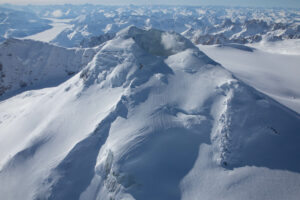
PHIVOLCS reported that intense rain on 6 June mobilized ash deposited during the 3 June eruption at Kanlaon causing lahars to descend the S flank and impact local communities. The lahars began at around 13h00 and lasted 25 minutes based on seismic data. They deposited cohesive gray mud, plant debris, and gravel in at least four stream channels including Tamburong Creek, which courses through Biak-na-bato and Calapnagan, La Castellana; Intiguiwan River in Guinpanaan and upstream Baji-Baji Falls in Cabacungan, La Castellana; Padudusan Falls, Masulog, Canlaon City; and the Binalbagan River, which drains the S flank of the volcano. Lahars overflowed parts of Tamburong Creek and deposited material a few centimeters thick along a section of the main road in Biak-na-Bato, making it impassable to motorists. Thunderstorms continued and channel-confined lahars on the S and W flank were detected the next day. The lahars began at around 14h50 on 7 June and lasted 80 minutes based on seismic data. They were described as cohesive and cement-like and carried tree debris along the Baji-Baji Falls and Ibid Creek, in Cabacungan, La Castellana. Lahars also descended the Santo Guintubdan, Ara-al, La Carlota City and muddy waters were observed in the Buslugan, Busay Oro, Busay Abaga, Busay Mayor, Busay Kapid, Kabkaban, Ezzy, Busay Ambon, and Labi Labi falls. Voluminous gas-and-steam emissions rose 1.5-2 km above the summit and drifted NE and SW during 6-8 June.
A special notice was issued on 8 June due to elevated sulfur dioxide levels. During a field survey sulfur dioxide flux averaged of 4,397 tonnes per day (t/d) which was the highest level recorded so far this year and the second highest land-based measurement for Kanlaon. Sulfur dioxide emissions were elevated in 2024, averaging 1,458 t/d, though after the 3 June eruption the daily average increased to 3,347 t/d. Emisisons had decreased on 9 June, averaging 3,304 t/d. The rate of volcanic earthquakes persisted at above-background levels with an average of 33 events per day. Moderate steam-and-gas emissions rose 300-500 m above the summit and drifted NE and SW during 9-11 June. At least 1,237 families or 4,190 residents of five barangays remained in evacuation shelters according to a 12 June news article; many had health problems from exposure to sulfur dioxide gas and ash. The Alert Level remained at 2 (on a scale of 0-5) and PHIVOLCS reminded the public to remain outside of the 4-km-radius Permanent Danger Zone.
Sources: Philippine Institute of Volcanology and Seismology (PHIVOLCS), The Philippine Star , GVP.
Photo : Sunstar.
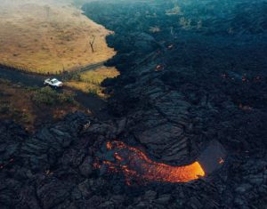
Japan , Suwanosejima :
JMA reported that eruptive activity at Suwanosejima’s Ontake Crater continued during 3-10 June and produced volcanic plumes that rose as high as 700 m above the crater rim. Crater incandescence was observed nightly in webcam images. No explosions were recorded. The Alert Level remained at 2 (on a 5-level scale) and the public was warned to stay at least 1.5 km away from the crater.
The 8-km-long island of Suwanosejima in the northern Ryukyu Islands consists of an andesitic stratovolcano with two active summit craters. The summit is truncated by a large breached crater extending to the sea on the E flank that was formed by edifice collapse. One of Japan’s most frequently active volcanoes, it was in a state of intermittent Strombolian activity from Otake, the NE summit crater, between 1949 and 1996, after which periods of inactivity lengthened. The largest recorded eruption took place in 1813-14, when thick scoria deposits covered residential areas, and the SW crater produced two lava flows that reached the western coast. At the end of the eruption the summit of Otake collapsed, forming a large debris avalanche and creating an open collapse scarp extending to the eastern coast. The island remained uninhabited for about 70 years after the 1813-1814 eruption. Lava flows reached the eastern coast of the island in 1884. Only about 50 people live on the island.
Source: Japan Meteorological Agency (JMA) , GVP.
Photo : Masanori Genko
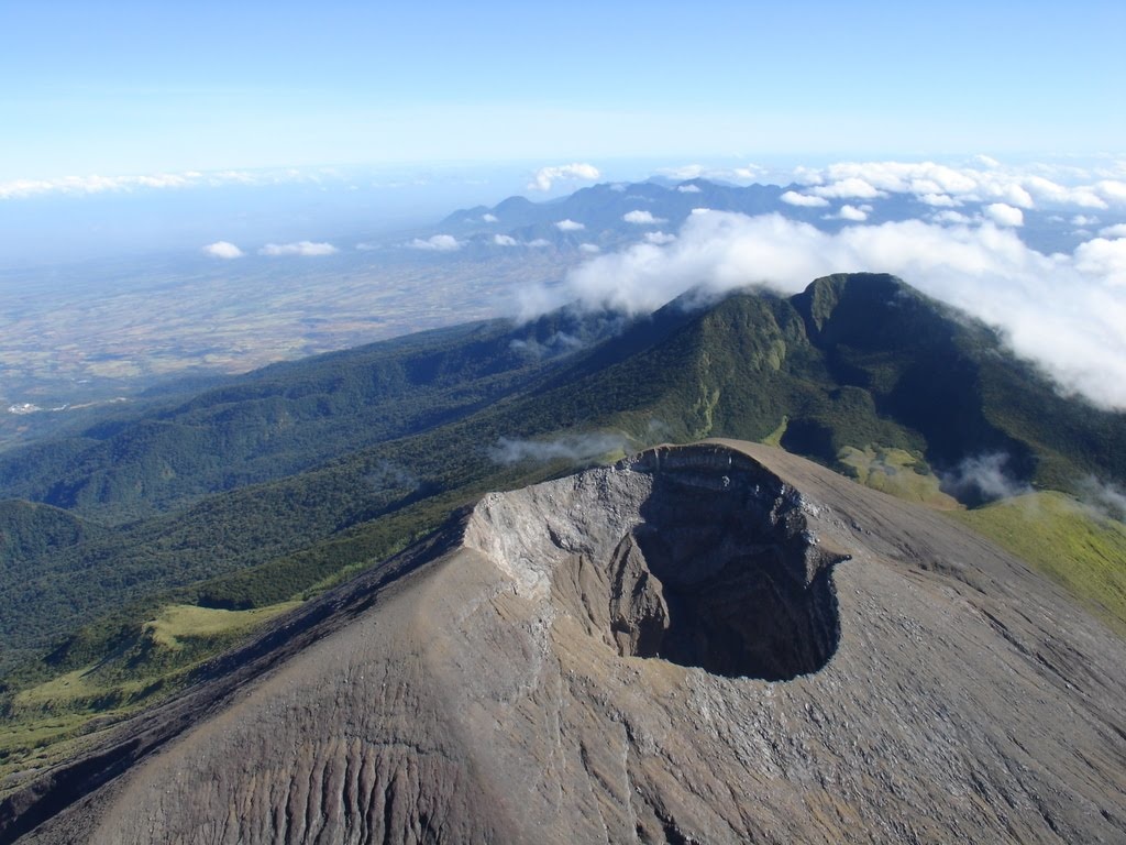
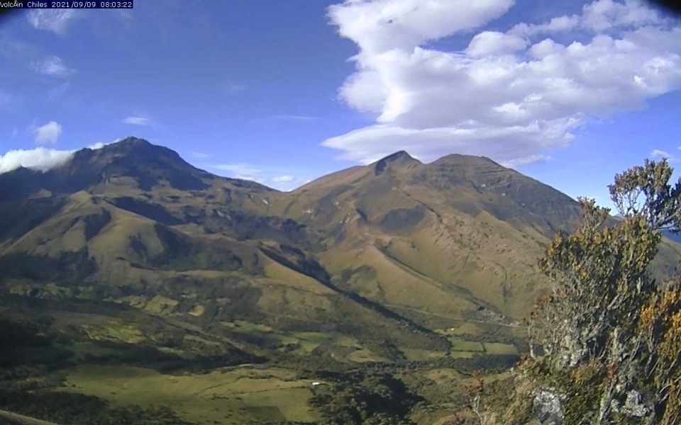
Colombia , Chiles / Cerro Negro :
San Juan de Pasto, June 11, 2024, 3:25 p.m.
Weekly Activity Bulletin: Chiles Volcanic Complex and Cerro Negro (CVCCN)
Regarding the monitoring of the activity of the CHILES AND CERRO NEGRO VOLCANOES, the COLOMBIAN GEOLOGICAL SERVICE (SGC), an entity attached to the MINISTRY OF MINES AND ENERGY, reports that:
Within a fluctuating behavior observed in previous weeks both in seismic occurrence and energy levels, during the week evaluated, between June 4 and 10, 2024, an increase in both parameters was recorded . The predominance of seismicity associated with rock fracture has remained, both in terms of occurrence and energy, and the recording of some earthquakes associated with fluid movement continues, some of them with lower frequencies very low dominants and high energy levels.
Fracture earthquakes were preferentially located in 3 sources. The first at the summit and in the collapse zone existing to the north of the summit of the Chiles volcano, at distances less than 1.2 km, with depths between 2 and 5 km compared to the reference height (4,700 m above sea level) and a maximum magnitude of 2.3. The second source was located south-southeast of the summit of Chiles Volcano, at distances between 0.3 and 3.5 km, with depths between 3 and 5 km and a maximum magnitude of 2.6. The third source was located south of the Chiles volcano at distances between 5 and 9 km, with depths between 7 and 8 km and a magnitude
maximum of 2.4. A few other earthquakes were located scatteredly in the region of the two volcanoes, at distances of up to 10 km, with depths between 2 and 12 km from the summit of Chiles (4,700 m a.s.l. ) and a maximum local magnitude of 1.7. No reports of felt earthquakes have been received.
Volcanic deformation processes recorded by sensors installed on the ground and by remote satellite sensors continue. The evolution of CVCCN activity is the result of
internal processes derived from the complex interaction between the magmatic system, the hydrothermal system and the geological faults of the area. Therefore, the probability of the occurrence of energetic earthquakes that can be felt by residents in the region of influence of the CVCCN persists.
Volcanic activity remains in a YELLOW ALERT state: active volcano with changes in the behavior of the base level of monitored parameters and other manifestations.
Source et photo : SGC
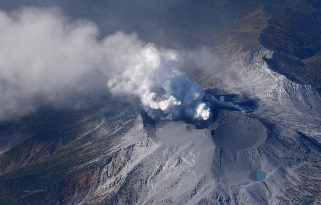
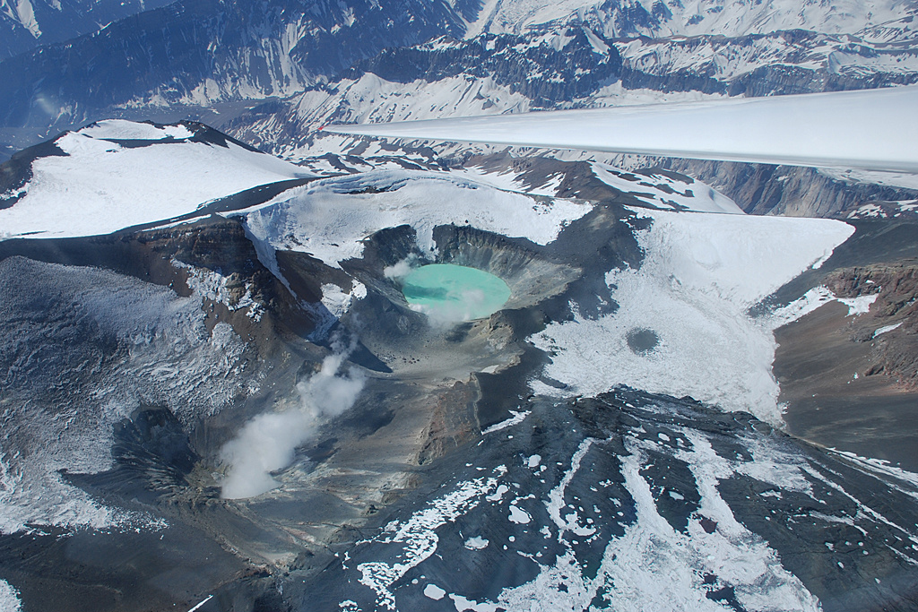
Chile , Tupungatito :
Seismology
The seismological activity of the period was characterized by the recording of:
71 seismic events of type VT, associated with the fracturing of rocks (Volcano-Tectonics). The most energetic earthquake had a Local Magnitude (ML) value equal to 0.2, located 11.4 km north-northeast of the volcanic building, at a depth of 0.3 km in reference to the crater.
51 LP type seismic events, associated with fluid dynamics inside the volcanic system (Long Period). The size of the largest earthquake evaluated from the Reduced Displacement (RD) parameter was equal to 3 cm2.
1 HB type seismic event, associated with both rock fracturing and fluid dynamics within the volcanic system (Hybrid). This earthquake had a Reduced Displacement (DR) value of 13 cm2 and a Local Magnitude (ML) value equal to 2.0, located 4.3 km to the West-South-West of the volcanic edifice, at a depth of 21.6 km from the crater.
Fluid geochemistry
No anomalies have been reported in emissions of sulfur dioxide (SO2) into the atmosphere in the area near the volcano, according to data published by the Tropospheric Monitoring Instrument (TROPOMI) and Sulfur Dioxide Group of the Ozone Monitoring Instrument (OMI).
Thermal anomalies by satellites
During the period, no thermal alerts were recorded in the area associated with the volcano, according to the analytical processing of Sentinel 2-L2A satellite images, in combination of false color bands.
Activity remained at levels considered low, suggesting stability of the volcano.
The technical volcanic alert is maintained in:
GREEN TECHNICAL ALERT: Active volcano with stable behavior – There is no immediate risk.
Source et photo : Sernageomin
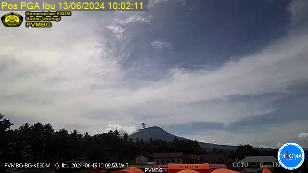
Indonesia , Ibu :
An eruption of Mount Ibu occurred on Thursday, June 13, 2024 at 10:01 a.m. WIT with the height of the ash column observed at ±500 m above the summit (±1825 m above sea level). The ash column was observed to be gray with thick intensity, oriented towards the North. This eruption was recorded on a seismograph with a maximum amplitude of 26 mm and a duration of 60 seconds.
Observation of seismicity:
1 eruption earthquake with an amplitude of 26 mm and a seismic duration of 60 seconds.
10 emission earthquakes with an amplitude of 2 to 26 mm and duration of the earthquake from 15 to 45 seconds.
632 shallow volcanic earthquakes with an amplitude of 2 to 17 mm and a seismic duration of 4 to 14 seconds.
27 deep volcanic earthquakes with an amplitude of 2 to 28 mm, and an earthquake duration of 8 to 14 seconds.
RECOMMENDATION
1. Communities around Mount Ibu and visitors/tourists should not carry out activities within a radius of 4 km with a sectoral extension of 7 km towards the crater opening in the northern part of the active Mount Ibu crater.
2. In the event of ash falling, people who carry out activities outside the house are advised to protect their nose, mouth (mask) and eyes (glasses).
Source et photo : Magma Indonésie .