June 12 , 2024.
Iceland , Reykjanes Peninsula :
Considerable pollution measured from the eruption. Measurements indicate that uplift has resumed
Updated 11. June at 16:00 UTC
The eruption has lasted for 13 days. One crater active which remains relatively stable
Considerable pollution from the eruption in many parts of the capital area and in the western part of South Iceland
It is not recommended to engage in outdoor activities in the areas where pollution is detected. Air quality can be monitored here
Measurements indicate that land uplift has resumed
Lava still collects in a lava pond just southeast of Sýlingarfell
The eruption at the Sundhnúkur crater row that started 13 days ago remains stable. One crater is active, and the activity has been similar in the last few days. Seismicity has been very low in the last week, only a few earthquakes have been detected.
As reported in our news over the weekend, the flow of lava began to increase at the roots of Sýlingarfell to the west and Grindavík road was inundated by lava for the third time since the volcanic activity began at Sundhnúkur last November. The lava tongue still progresses and is now flowing to the northwest along a similar channel as the one that flowed over Grindavík road on Saturday. However, its active flow front is still a few hundred meters away from the road and moves very slowly. Lava is still accumulating in a lava pond just southeast of Sýlingarfell and could burst again and trigger another surge of lava in the next few days.
Measurements suggest that land uplift has started again during last weekend and the subsidence that was detected in the first days of the eruption has stopped. The rate of uplift cannot be estimated yet, but it can be assumed that the inflow of magma into the magma reservoir has exceeded the outflow from the crater.
Gas concentration in air exceeds the level of health effect limits.
Considerable pollution from the eruption is now measured in many parts of the capital area and in the western part of South Iceland. According to data from the Environment Agency of Iceland, the highest levels of SO2 in the capital area have exceeded 500 μg/m3 and the pollution is expected to persist throughout the day. People with sensitive respiratory system may experience discomfort. It is preferable to limit physical activity outdoors and avoid letting infants sleep outdoors during such high concentrations of gas in the air.
This morning, fog clouds have settled over the western part of the country, and there has also been visible volcanic smog caused by the conversion of SO2 gas into SO4. Volcanic smog is composed of very fine sulphur particles (SO4) that have been formed as a result of the chemical reaction of the volcanic plume with moisture and oxygen in the atmosphere with the aid of sunlight. When the day is long, as it is now, there is an increased chance that volcanic smog will form. Volcanic smog is not measured on SO2 gas detectors, but is visible as a blue mist when a certain concentration is reached. An increase in very fine particles (PM1 and PM2.5) may be an indication of the presence of SO4. Air quality can be monitored on the Environment Agency’s air quality detectors.
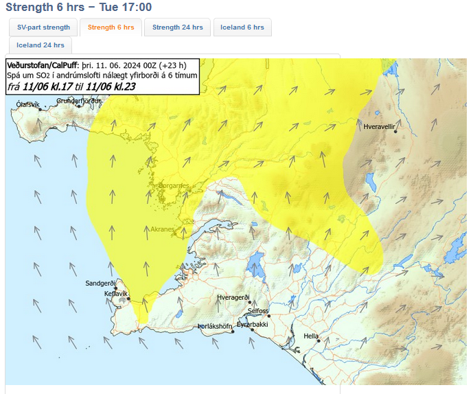
The weather watch’s forecast of gas distribution is rather slow, variable direction and gas pollution can be seen in many parts of the southwest corner. Turning southerly in the afternoon, gas blowing to the north and pollution could be felt in Vogar and Reykjanesbær. Southeasterly winds tomorrow, gas blowing to the northwest.
Source : IMO
Photos : Webcam , IMO.
Colombia , Nevado del Huila :
Popayan, June 11, 2024, 4:00 p.m.
Weekly activity bulletin: Nevado del Huila Volcano
Regarding the monitoring of the activity of the NEVADO DEL HUILA VOLCANO, the COLOMBIAN GEOLOGICAL SERVICE (SGC), an entity attached to the MINISTRY OF MINES AND ENERGY, reports that:
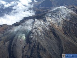
In the week from June 4 to 10, 2024, more precisely from June 7 to 9, the seismic activity of this volcano presented a significant increase, both in energy and in the number of events and was characterized by events associated with the fluid dynamics inside the volcanic structure, as indicated in the extraordinary bulletin of the 8th at 10:00 a.m.
On June 8, in the sectors of Yusayú and Tóez (municipality of Páez, department of Cauca), a seismic signal generated by a flood of the Páez river was recorded, as well as an increase in the flow of the river with a content of appreciable mud, as reported in the extraordinary bulletin from 8 a.m. to 1 p.m.
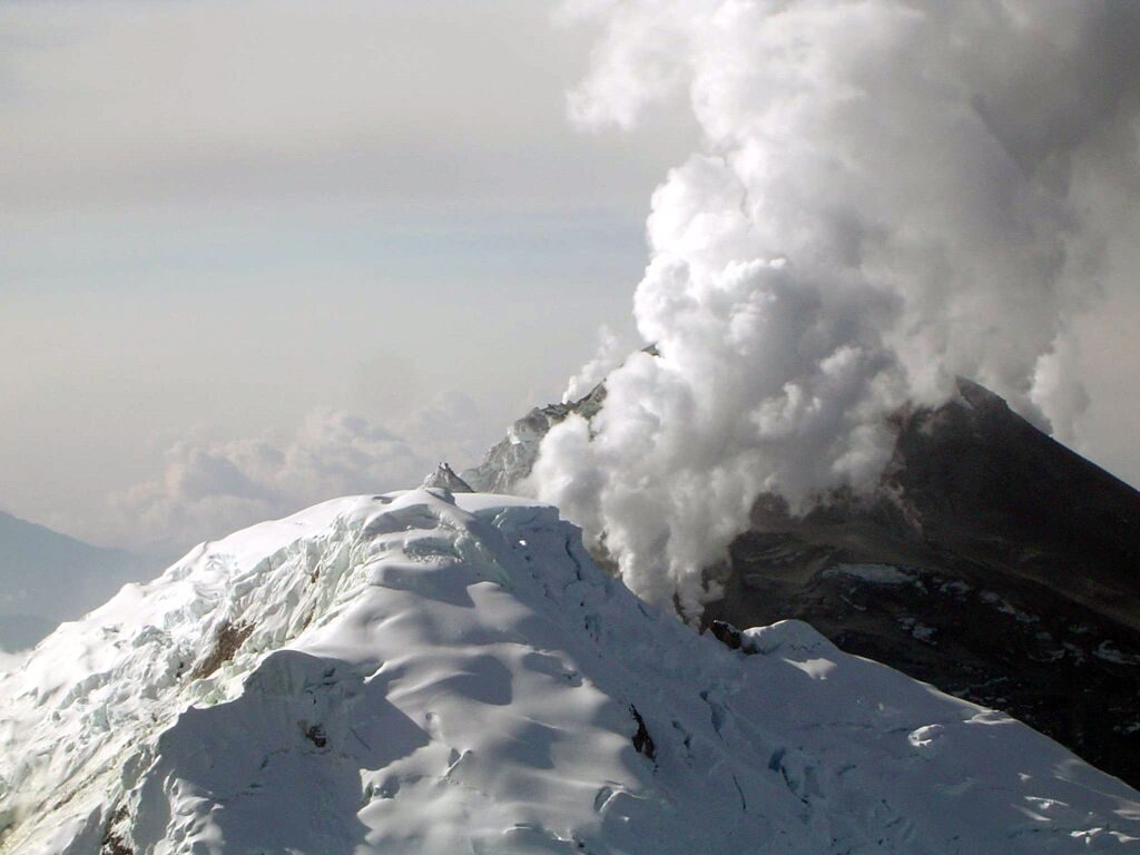
Thanks to webcams, it was not possible to show the degassing processes of the volcano due to the poor weather conditions in the area. Other parameters measured for the assessment of volcanic activity did not show significant changes.
The remainder of the period studied, the volcano continued to exhibit stable behavior.
The alert status for volcanic activity remains at: YELLOW ALERT: active volcano with changes in the behavior of the base level of monitored parameters and other manifestations.
Source et photo : SGC
Chile , Laguna del Maule :
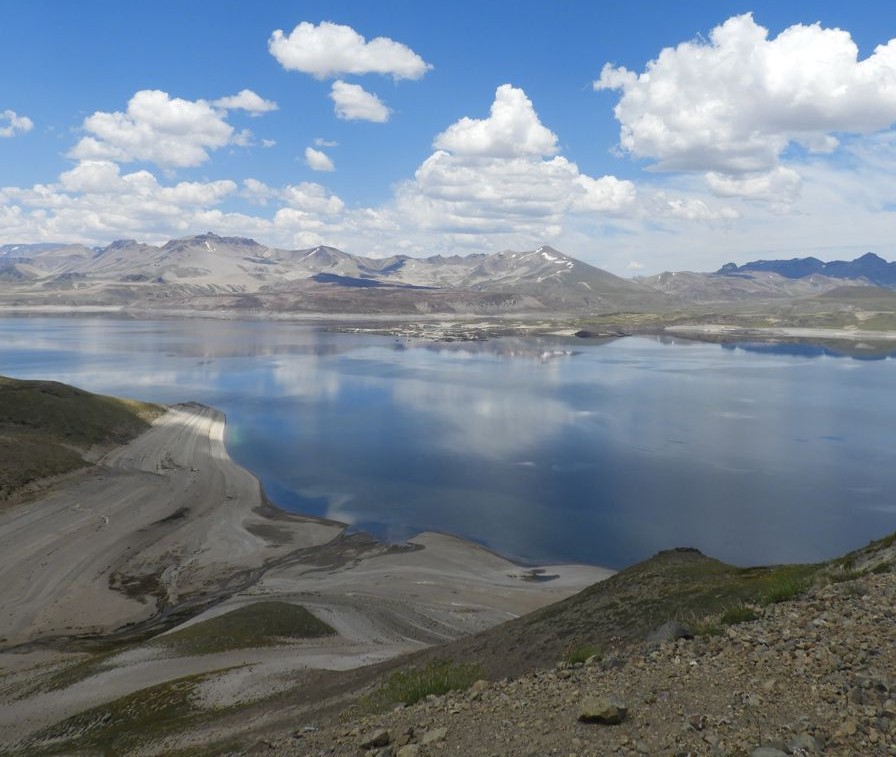
Special Report on Volcanic Activity (REAV), del Maule regions, Laguna del Maule volcanic complex, June 11, 2024, 5:50 p.m. local time (mainland Chile)
The National Geology and Mining Service of Chile (Sernageomin) announces the following PRELIMINARY information, obtained through the monitoring equipment of the National Volcanic Monitoring Network (RNVV), processed and analyzed at the Southern Andean Volcano Observatory (Ovdas):
On Tuesday, June 11 at 4:22 p.m. (8:22 p.m. UTC), monitoring stations installed near the Laguna del Maule volcanic complex recorded a volcano-tectonic seismic swarm (associated with fracturing of rocks). At the time of issuing this report, more than 100 events have been recorded.
The characteristics of the largest earthquake after its analysis are as follows:
ORIGINAL TIME: 4:33 p.m. local time (8:33 p.m. UTC)
LATITUDE: 36.127°S
LONGITUDE: 70.542°E
DEPTH: 4.3 km
LOCAL MAGNITUDE: 0.3
Observation :
At the time of issuing this report, the occurrence of volcano-tectonic seismicity continues with low to moderate energy events.
The technical volcanic alert is maintained at YELLOW level.
Source et photo : Sernageomin
Hawaii , Kilauea :
Tuesday, June 11, 2024, 8:10 AM HST (Tuesday, June 11, 2024, 18:10 UTC)
19°25’16 » N 155°17’13 » W,
Summit Elevation 4091 ft (1247 m)
Current Volcano Alert Level: ADVISORY
Current Aviation Color Code: YELLOW
Activity Summary:
Kīlauea volcano is not erupting. The eruption that began on Monday, June 3, southwest of Kaluapele (Kīlauea caldera) within Hawai’i Volcanoes National Park has ended. Incandescence from the fissure vents is no longer visible in nighttime webcam images. Volcanic gas emissions at the eruption site have decreased significantly and are approaching background levels. Earthquake counts in the summit region remain slightly elevated, while tremor has dropped to background levels. Inflationary ground deformation of the summit continues. Although the eruption has ended, renewed pulses of seismicity and deformation could result in new eruptive episodes within the area or elsewhere within the summit region.
Eruption Site Observations:
No lava is erupting. Glow from fissure vents is no longer visible in webcam imagery. Volcanic gas emissions at the eruption site are approaching background levels (100 tonnes per day or less). Total SO2 emission rates for the summit and recent eruption site of approximately 350 t/d were measured on June 10. Seismic activity remains low at the eruption site.
During an overflight at approximately 8:15 a.m. HST on June 6, 2024, USGS Hawaiian Volcano Observatory scientists observed the extensive crack features on either side of the now inactive fissures from the June 3 Kīlauea Southwest Rift Zone eruption. Cracks range in length and are parallel to the fissure system.
Summit and Upper Rift Zone Observations:
Rates of seismicity beneath the summit, upper East Rift Zone, and upper Southwest Rift Zone were slightly elevated over the past day. Over 35 earthquakes occurred over the past 24 hours. Earthquakes were mostly located beneath the south caldera region and upper East Rift Zone, at depths of 1.5-3 km (1–1.8 miles), with magnitudes under M2.5. Tremor has decreased to background levels across the summit region. Inflationary ground deformation of the summit continued over the past day. The Uēkahuna tiltmeter northwest of the summit recorded overall inflation of approximately 1.5 microradian over the past 24 hours. The Sand Hill tiltmeter southwest of the summit recorded approximately 6 microradians of inflation over the past 24 hours.
Lower Rift Zone Observations:
Rates of seismicity and ground deformation beneath the middle and lower East Rift Zone and lower Southwest Rift Zone are low. Eruptive activity and unrest have been restricted to the summit and upper rift zone regions. Measurements from continuous gas monitoring stations downwind of Puʻuʻōʻō in the middle East Rift Zone remain below detection limits for SO2, indicating that SO2 emissions from Puʻuʻōʻō are negligible.
Source : HVO
Photo : USGS / A.R. Nalesnik.
Indonesia , Lewotobi Laki-laki :
An eruption of Mount Lewotobi Laki – Laki occurred on Tuesday June 11, 2024, at 8:18 p.m. WITA with the height of the ash column observed at ± 500 m above the summit (± 2084 m above the level of the sea). The ash column was observed to be gray in color with thick intensity, oriented towards the South-West. This eruption was recorded on a seismograph with a maximum amplitude of 37 mm and a duration of 316 seconds.
VOLCANO OBSERVATORY NOTICE FOR AVIATION – VONA
Issued : June 11 2024
Volcano : Lewotobi Laki-laki (264180)
Current Aviation Colour Code : ORANGE
Previous Aviation Colour Code : orange
Source : Lewotobi Laki-laki Volcano Observatory
Notice Number : 2024LWK050
Volcano Location : S 08 deg 32 min 20 sec E 122 deg 46 min 06 sec
Area : East Nusa Tenggara, Indonesia
Summit Elevation : 5069 FT (1584 M)
Volcanic Activity Summary :
Eruption with volcanic ash cloud at 12h18 UTC (20h18 local).
Volcanic Cloud Height :
Best estimate of ash-cloud top is around 6669 FT (2084 M) above sea level or 1600 FT (500 M) above summit. May be higher than what can be observed clearly. Source of height data: ground observer.
Other Volcanic Cloud Information :
Ash cloud moving to southwest. Volcanic ash is observed to be gray. The intensity of volcanic ash is observed to be thick.
Remarks :
Eruption recorded on seismogram with maximum amplitude 37 mm and maximum duration 184 second.
Source et photo : Magma Indonésie.


