March 11 , 2024.
Indonesia , Semeru :
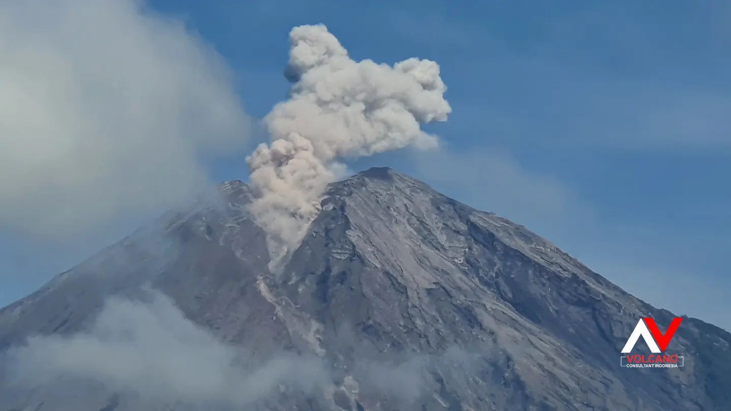
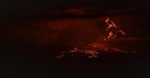
Mount Semeru erupted on Sunday, March 10, 2024 at 11:42 p.m. WIB. The height of the eruptive column was not observed. The eruption was recorded on a seismograph with a maximum amplitude of 22 mm and a duration of 114 seconds.
VOLCANO OBSERVATORY NOTICE FOR AVIATION – VONA
Issued : March 10 , 20240310/1642Z
Volcano : Semeru (263300)
Current Aviation Colour Code : ORANGE
Previous Aviation Colour Code : orange
Source : Semeru Volcano Observatory
Notice Number : 2024SMR194
Volcano Location : S 08 deg 06 min 29 sec E 112 deg 55 min 12 sec
Area : East java, Indonesia
Summit Elevation : 11763 FT (3676 M)
Volcanic Activity Summary :
Eruption at 16h42 UTC (23h42 local).
Volcanic Cloud Height :
Ash-cloud is not observed.
Other Volcanic Cloud Information :
Ash-cloud is not observed.
Remarks :
Eruption recorded on seismogram with maximum amplitude 22 mm and maximum duration 114 second.
Recommendation
1. Do not carry out any activities in the South-East sector along Besuk Kobokan, 13 km from the summit (center of the eruption). Apart from this distance, people do not carry out activities within 500 meters of the river bank along Besuk Kobokan as they are likely to be affected by the expansion of hot clouds and snow flows. lahars up to a distance of 17 km.
2. Do not carry out activities within a 5 km radius of the crater/summit of the Mount Semeru volcano as it is subject to the danger of stone throwing.
Source : Magma Indonésie.
Photo : Andi volcanist
Ecuador / Galapagos Islands , Fernandina :
DAILY REPORT ON THE ACTIVITY OF THE FERNANDINA VOLCANO. Quito, Sunday March 10, 2024.
From March 9, 2024 11:00:00 to March 10, 2024 11:00:00
Activity level:
Surface: High; Surface trend: Descending
Internal: High; Internal trend: Descending
Emissions/ash column:
Over the last 24 hours, no ash emissions have been recorded.
Gas:
The Mounts satellite system detected 1,865.9 tonnes of sulfur dioxide (SO2) at 1:12 p.m. TL.
Other monitoring parameters:
Over the past 24 hours, the FIRMS satellite system has recorded dozens of thermal anomalies. MIROVA-MODIS detected 1 thermal anomaly, while MIROVA-VIIRS recorded 4 thermal anomalies.
Observation:
It is important to note that Fernandina Island has no human settlements, so there is no risk to the population. However, if lava flows enter the sea, it is recommended to keep your distance as contact can generate small explosions and, therefore, the release of toxic gases. Likewise, it is recommended not to approach the eruption area, due to the risk of being affected by the products of this event or by possible secondary phenomena such as fires.
Source : IGEPN
Photo : Infobae
Costa Rica , Poas :
Latitude: 10.2
Longitude: -84,233
Altitude: 2,687 meters above sea level
Activity observed:
No eruption is recorded and the tremor remains stable, dominating low frequencies between 1 and 4 Hz. The water level of the lagoon continues to drop, which generates a constant flow of gas and water vapor in the lagoon. atmosphere through underwater fumaroles. Few low-frequency, low-amplitude volcanic earthquakes are recorded. The SO2 concentration at the lookout reached a maximum value of 3 parts per million today at 11:00 a.m., while measurements through the multigas do not exceed 15 parts per million.
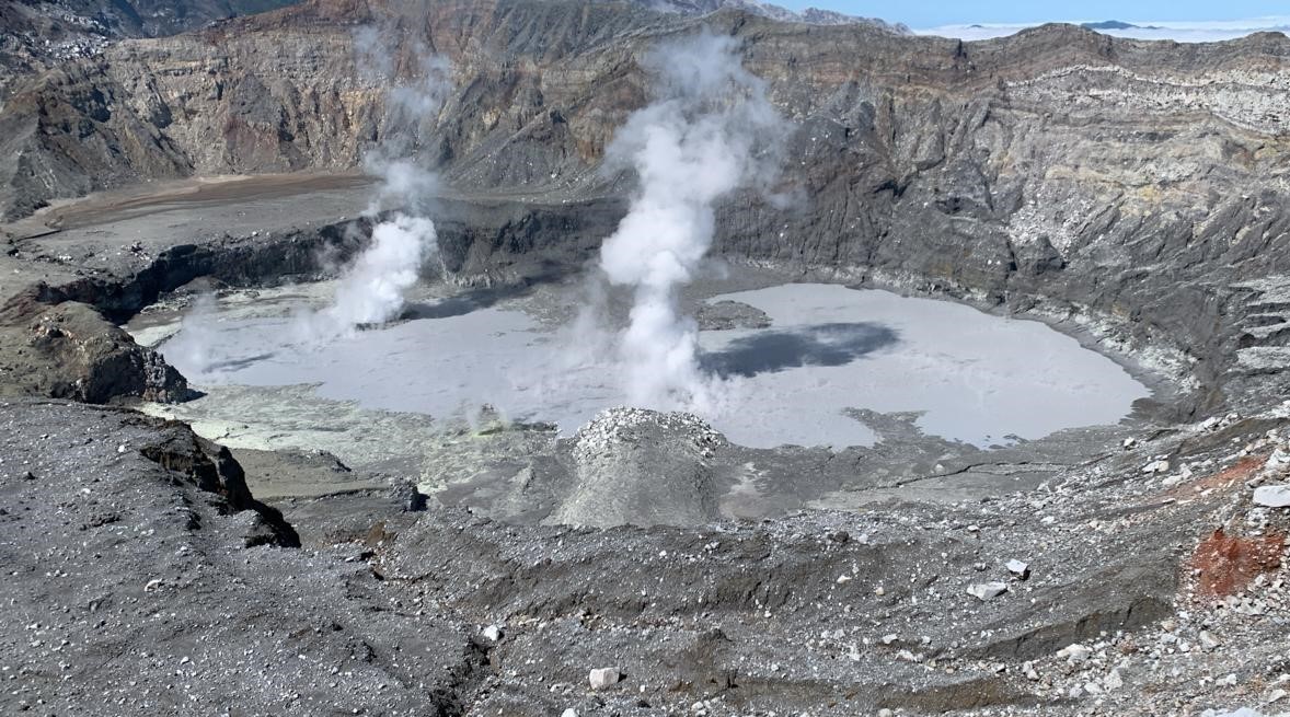
Since 8 a.m. yesterday, the small hydrothermal eruptions that had been recorded very frequently over the previous days were no longer observed and recorded. A few small, low-frequency volcanic earthquakes are recorded. Underwater fumaroles from vent C remain at a lower intensity than previous days, as do aerial fumaroles from vent A, which continue to emit burning sulfur, generating incandescence during the night. The volcanic edifice continues to experience slight contraction. Concentrations of SO2 gas remain between 200 and 300 tonnes per day, while yesterday when the Sentinel satellite passed over the Poás volcano it detected 56 tonnes of SO2.
Environmental conditions:
The winds direct the gases and particles emitted by the volcano towards the South-West and the summit remains clear.
Activity Level: Warning (2)
Source : Ovsicori
Photo : Maarten de Moor / Ovsicori. ( archive).
Chile , Hudson :
Seismology
The seismological activity of the period was characterized by the recording of:
35 seismic events of type VT, associated with the fracturing of rocks (Volcano-Tectonics). The most energetic earthquake had a Local Magnitude (ML) value equal to 1.7, located 4.4 km south-southeast of the volcanic building, at a depth of 4.8 km in reference to the crater.
24 LP type seismic events, associated with fluid dynamics inside the volcanic system (Long Period). The size of the largest earthquake evaluated from the Reduced Displacement (RD) parameter was equal to 17 cm2.
1 HB type seismic event, associated with both rock fracturing and fluid dynamics within the volcanic system (Hybrid). The size of the earthquake evaluated from the Reduced Displacement (RD) parameter was equal to 2 cm2.
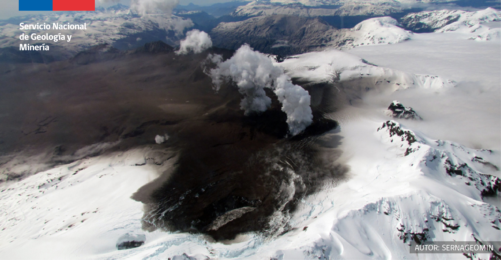
Fluid geochemistry
No anomalies have been reported in the emissions of sulfur dioxide (SO2) into the atmosphere in the area near the volcano, according to data published by the Tropopheric Monitoring Instrument (TROPOMI) and the Ozone Monitoring Instrument (OMI) Sulfur Dioxide Group.
Satellite thermal anomalies
During the period, no thermal alerts were recorded in the area associated with the volcano, according to the analytical processing of Sentinel 2-L2A satellite images, in combination of false color bands.
Geodesy
Geodetic activity was characterized by low deformation rates, which do not exceed 0.3 cm/month in its horizontal components and 0.2 cm/month in the vertical. In conclusion, there is no evidence of changes following the deformation of the volcanic system.
Surveillance cameras
The images provided by the fixed camera, installed near the volcano, did not record degassing columns or variations linked to surface activity.
Activity remained at levels considered low, suggesting stability of the volcanic system. The technical volcanic alert is maintained in:
GREEN TECHNICAL ALERT: Active volcano with stable behavior – There is no immediate risk
Source et photo : Sernageomin.
Alaska , Great Sitkin :
Slow eruption of lava in the summit crater of Great Sitkin Volcano likely continues. Seismicity was low over the past day. No unusual activity observed in satellite or web camera data over the past day.
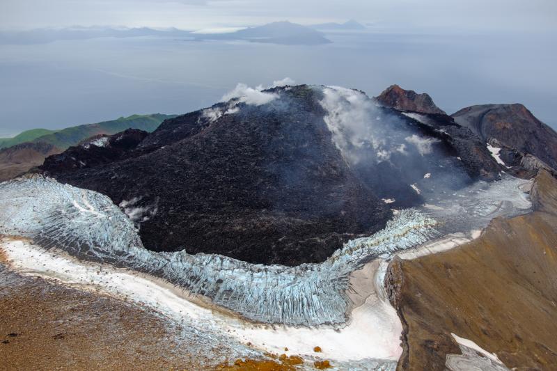
The current lava flow began erupting in July 2021. No explosive events have occurred since a single event in May 2021.
Local seismic and infrasound sensors and web cameras are used to monitor Great Sitkin along with regional infrasound and lightning networks and satellite data.
Source : AVO
Photo : Loewen, Matt / AVO / U.S. Geological Survey.