October 25 , 2019.
La Réunion : Piton de la Fournaise ,
Activity Bulletin of 23 October 2019 at 18:00 (local time).
Following the seismic crisis of 21/10/2019, even though the number of earthquakes decreased sharply from 207 volcano-tectonic earthquakes (located above sea level directly above the summit) during the 21 October 10 earthquakes October 22 and 11 earthquakes October 23 (until 13h local time), it persists.
Meanwhile, the inflation (swelling) of the volcano, observed since October 11 continues. This testifies to the continued re-feeding of the superficial reservoir by deeper magma.
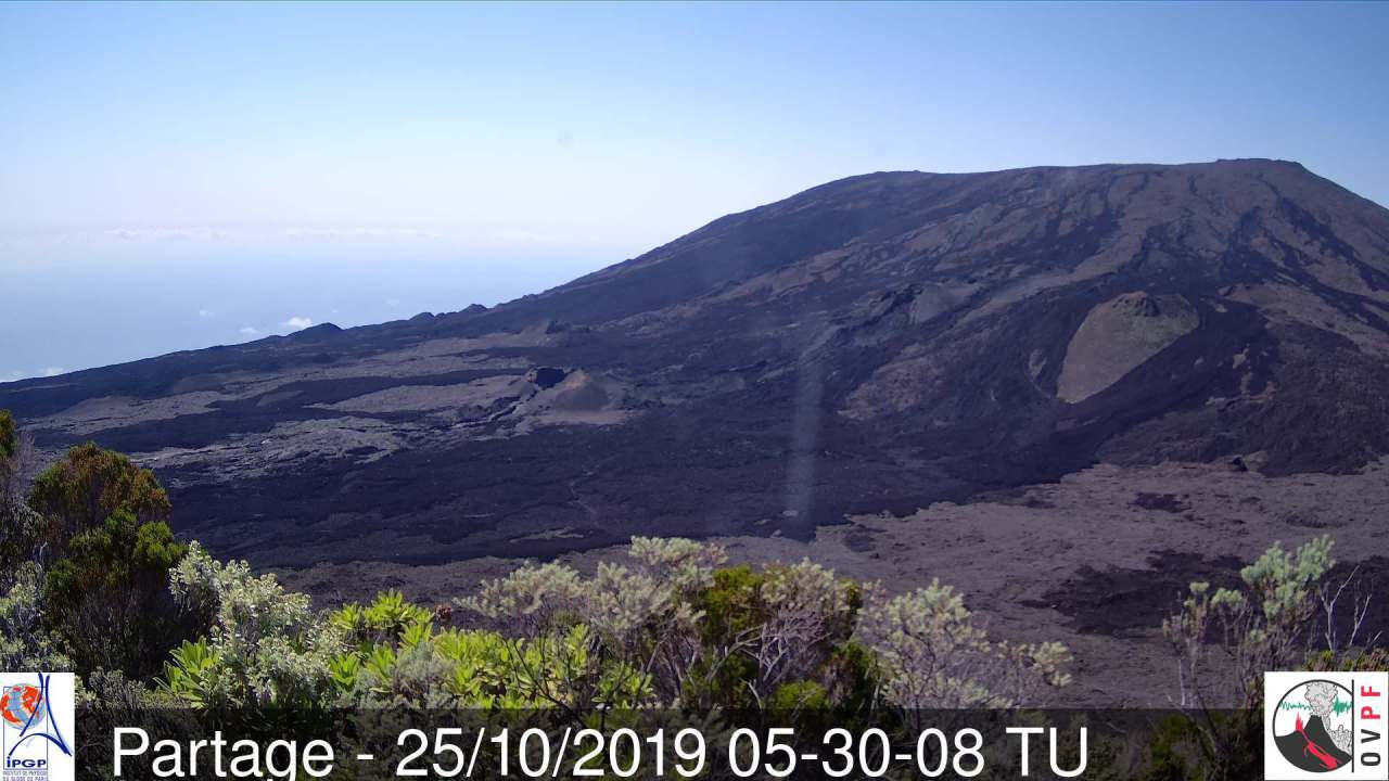
Alert level: Vigilance.
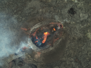
Activity bulletin of October 25, 2019 at 04:45 (local time).
Since 4:15 am local time, a seismic crisis is recorded on the instruments of the Volcanological Observatory of Piton de la Fournaise.
This seismic crisis is accompanied by rapid deformation. This indicates that the magma is leaving the magma reservoir and is spreading to the surface. An eruption is likely in the near future in the next minutes or hours.
Further information will follow regarding the area impacted by this magmatic spread to the surface.
Source : OVPF.
Photo : OVPF.
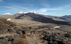
Alaska , Shishaldin :
54°45’19 » N 163°58’16 » W,
Summit Elevation 9373 ft (2857 m)
Current Volcano Alert Level: WATCH
Current Aviation Color Code: ORANGE
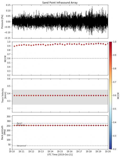
Infrasonic tremor from likely Strombolian eruptive activity at Shishaldin volcano as registered on AVO’s newly upgraded infrasound array in Sand Point, AK. The calculated back azimuth is pegged strongly in the direction of Shishaldin. Infrasound is low-frequency (inaudible) sound energy that propagates long distances in the atmosphere.
Satellite data from the past day show that lava now fills the summit crater and is beginning to flow over the northern crater rim in two locations. One 200 m (600 ft) long lava flow has melted snow and produced a large ~2.9 km (~1.8 mile) long lahar extending down the north flank reaching ~1230 m (~4000 ft) elevation and a smaller lava flow has caused a ~1 km (~0.6 mile) long lahar down the northeast flank. Spatter from low-level explosive activity is accumulating around the crater rim and melting snow, as well. This activity has coincided with strongly elevated surface temperatures, elevated seismicity, and infrasound detections. There has been no evidence of any significant ash-bearing volcanic plumes over the past day in cloudy satellite imagery and web camera views.
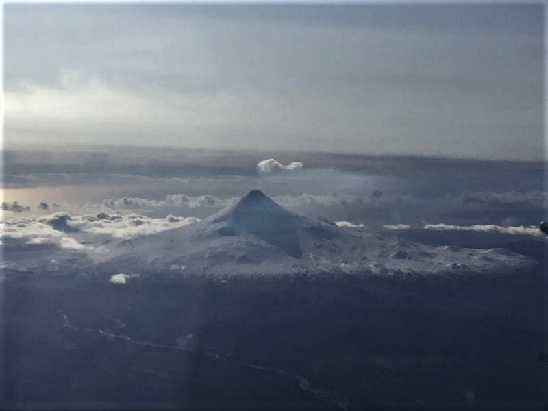
Photograph of a steam plume at Shishaldin taken by an ACE Air Cargo pilot from flight AER963 into Cold Bay on October 21, 2019.
Shishaldin is monitored by local seismic and infrasound sensors, satellite data, a web camera, a telemetered geodetic network, and distant infrasound and lightning networks.
Source : AVO.
Photo : Kaufman, Max , Mosier, Ben.
Peru , Sabancaya :
Period of analysis: 14-20 October 2019. Arequipa, October 21, 2019.
Alert level: ORANGE
The Geophysical Institute of Peru (IGP) reports that the eruptive activity of the Sabancaya volcano has remained at moderate levels; that is, with the recording of continuous moderate explosions and resulting ash emissions. Therefore, for the following days, no significant change is expected.
The analysis of the recordings obtained from the seismic network of the Sabancaya volcano for the period from 14 to 20 October 2019 has made it possible to identify the occurrence of 2084 earthquakes of volcanic origin, the highest percentage of which is associated with movements of magmatic fluids. During this week, an average of 44 explosions per day of mild to moderate intensity were observed.
The monitoring of the deformation of the volcanic structure, using GNSS data (processed with fast orbits), presents no significant anomalies. Visual surveillance, using surveillance cameras, identified the appearance of columns of gas and ash up to 2.5 km high at the top of the volcano, which dispersed in the South and South sectors. East of Sabancaya. Satellite monitoring has identified 15 volcanic anomalies on the volcano, ranging from 1 MW to 53 MW, associated with the presence of a hot body inside the volcano’s crater.
Source et photo : IGP Pérou .
Italy / Sicily , Etna :
Weekly activity bulletin, October 14, 2019 – October 20, 2019. (issue date October 22 , 2019).
SUMMARY OF THE STATUS OF THE ACTIVITY:
In light of the surveillance data, we highlight:
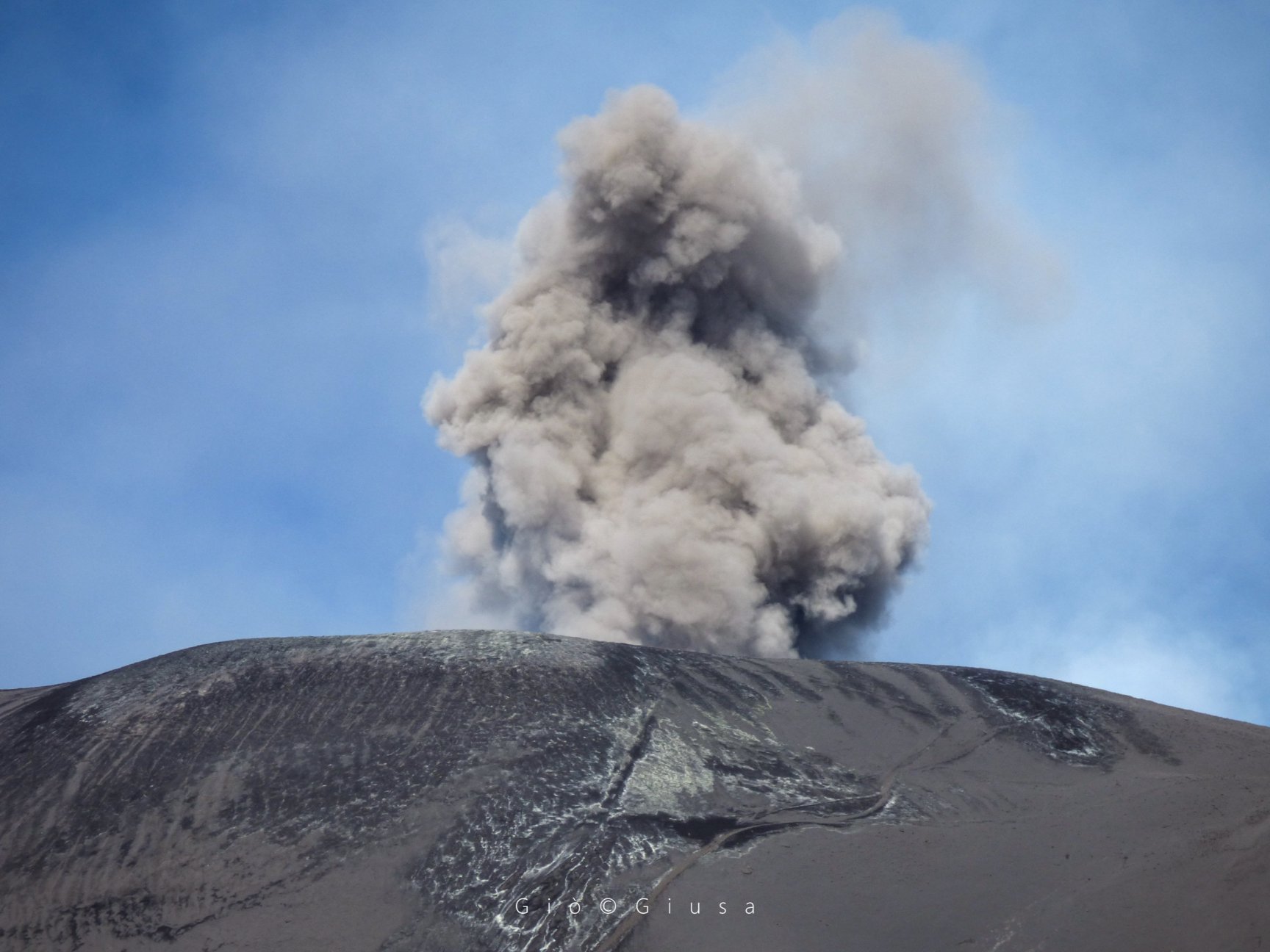
1) VOLCANOLOGICAL OBSERVATIONS: Strombolian intra-crateric activity with alternation of ash emissions from the Northeast crater, this activity resulted in the formation of ash clouds. Decreased activity in the crater of Voragine with low ash emission. The crater of Bocca Nuova has deep strombolian intra-crateric activity. Finally, ordinary degassing activity of the New Southeast Crater with sporadic ash emissions.
2) SISMOLOGY: Seismic activity of moderate fracture; stationary parameters of volcanic tremor.
3) INFRASONS: Infrasound activity maintained during the last two days of the week in question.
4) DEFORMATIONS: The inclination and GPS networks did not show any significant changes in the trends previously reported.
5) GEOCHEMISTRY: SO2 fluxes are at a medium-low level. CO2 flows to the ground confirm a slightly downward trend, stabilizing at low-middle levels. The partial pressure of CO2 in the soil does not show any significant changes. Helium isotope ratio values show a further increase, reaching medium-high values (latest data available on October 15).
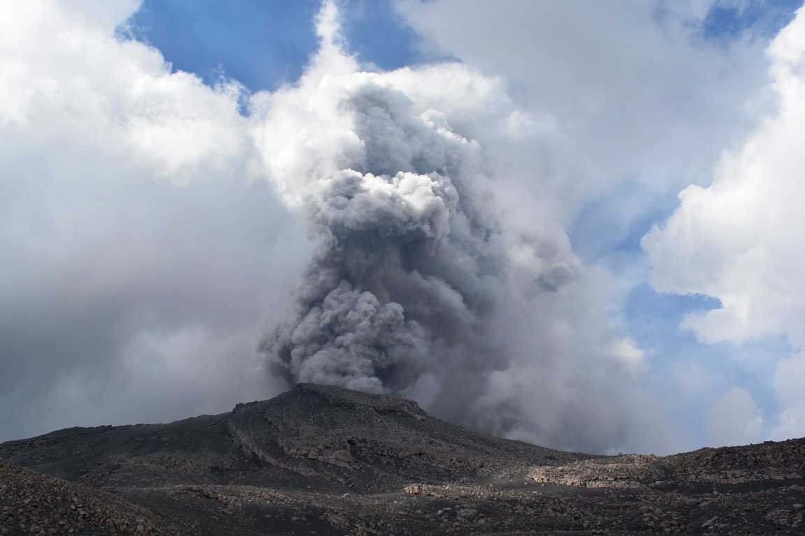
Explosions in the crater of Voragine (center) continue, but with less force than in recent weeks.
Etna South 23 October 2019
VOLCANOLOGICAL OBSERVATIONS:
The monitoring of volcanic crater activity at the summit of Mount Etna during the week was carried out by analyzing the images of the network of surveillance cameras of the INGV section – Catania, Osservatorio Etneo (INGV-OE). ). The Northeast Crater produced ashes during alternating phases in which very dilute ash dispersed rapidly in the summit zone, and phases in which abundant fine material was continuously emitted for several hours. During these phases, light gray ash clouds formed that the wind also dispersed in the southern quadrants of the volcano. Spillages of fine materials have been reported in Pedara, Mascalucia, Nicolosi, San Giovanni La Punta and Catania. The Voragine with a lower frequency produced a light gray ash emission with a rapid dispersion in the region of the summit.
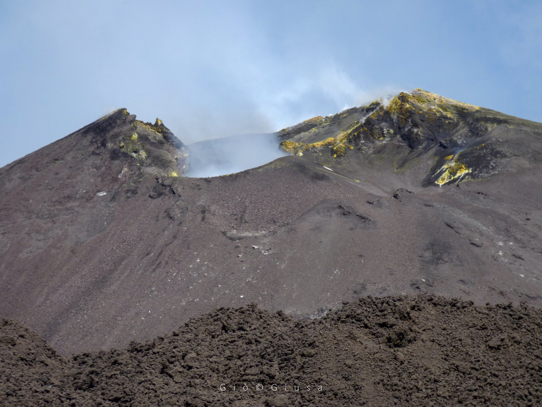
a close-up of the « Bocca della Sella », the cone formed between the old and the new south-east cone between February and April 2017.
Etna South 23 October 2019
Seismicity:
During the week in question, 7 seismic events of magnitude greater than or equal to M2 were recorded. These earthquakes were located in the summit area, on the southwestern and eastern slopes of the volcano. The strongest event (Ml = 3.2), recorded on October 18 at 01:06 UTC, was located about 2 km east of Monte Fontane, at a depth of about 6.3 km below the level of the sea.
Source : INGV.
Read the article : file:///C:/Users/Utilisateur/AppData/Local/Packages/Microsoft.MicrosoftEdge_8wekyb3d8bbwe/TempState/Downloads/Bollettinoetna20191022%20(1).pdf
Photos : Gio Giusa .