November 17 , 2023.
Iceland , Reykjanes Peninsula :
Sulfur dioxide detected in a drilling hole in Svartsengi power plant.
Yesterday, magma gas, or sulfur dioxide, was measured from a drilling hole in Svartsengi power plant, located just north of Mt. Þorbjörn. The drilling hole is located in the east under Grindavík road and extends into the crust towards Sundhnúkar crater row.
This is reported in a notice from the Icelandic Met Office.
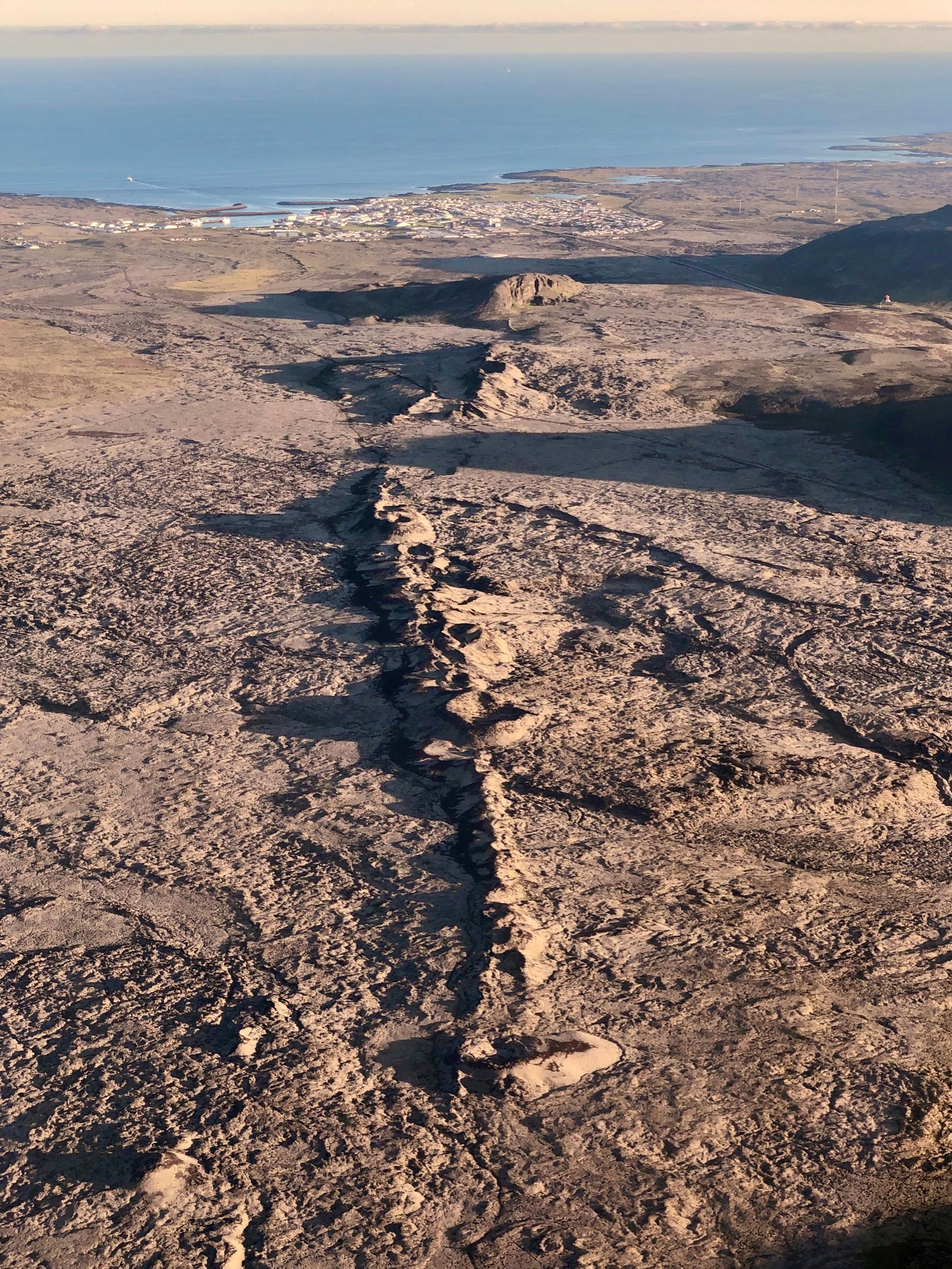
Confirmation of magma north of Hagafell
This means that the end of the well is extended close to the point in the crust where the magma channel is estimated to be. Further measurements will be made tomorrow. The presence of magma gas from the well is a confirmation of the presence of magma north of Hagafell, as models have indicated.
The seismic activity at the magma channel has been relatively stable between days. At 17 am, about 1,300 earthquakes had been measured since midnight, the largest of which was 2.6 magnitude and was measured at Hagafell before five o’clock yesterday morning. Most of the earthquakes were less than two magnitude and the most intense activity is at Hagafell.
Chance of eruption still high
“Deformation related to the magma channel continues to be measured, although it has slowed slightly since yesterday. The latest models calculated from GPS measurements and satellite data indicate that the most breakage of the magma channel is north of Grindavík near Hagafell. If magma is able to break its way to the surface, it is still most likely to occur in that area.”
It is noted that the likelihood of a volcanic eruption is still considered high.
“The signals of subsidence of small-swarm activity and sudden glide are continuing to be observed, which may be a predictor of magma breaking to the surface. However, there are no signs of this.”
Source : MBL IS.
Photo : Siggi Anton
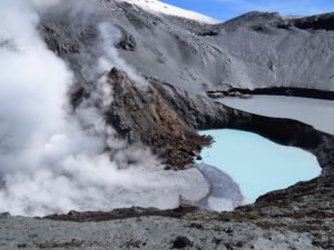
Colombia , Purace :
Popayan, November 16, 2023, time 8:40 p.m.
Concerning the monitoring of the activity of the PURACE VOLCANO, the COLOMBIAN GEOLOGICAL SERVICE (SGC), an entity attached to the MINISTRY OF MINES AND ENERGY, reports that:
As of 7:29 p.m. A seismic signal is being recorded, possibly associated with an emission of gas and ash into the atmosphere, which continues to be recorded at the time of publication of this bulletin.
Due to the lack of visibility at this time of night, this phenomenon could not be confirmed by the webcams installed in the upper part of the volcano, so the height reached by the column cannot be determined.
It is very likely that the volcano will continue to emit gases and ash, which will disperse depending on the wind regime prevailing at the time of emission, which would imply ash falls in towns located in the direction of the prevailing wind. . Another possibility is that an acceleration of the volcanic process occurs, leading to changes in the level of volcano activity.
For the moment, the alert status of the Puracé volcano remains at YELLOW ALERT: active volcano with changes in the behavior of the base level of the monitored parameters and other manifestations.
It is important to clarify that ash emissions are phenomena considered in the yellow alert state, as well as felt earthquakes, seismicity due to rock fracturing and associated with fluid dynamics, emissions of gases, deformation, odors, noises, temperature changes and pressure waves.
From the SGC we recommend that the community continue to pay attention to any changes that occur in the activity of the volcano through bulletins and other information published through our official channels, as well as follow the instructions of local and departmental authorities , and the National Disaster Risk Management Unit (UNGRD).
Source et photo : SGC
Italy , Vulcano :
WEEKLY BULLETIN, from November 6, 2023 to November 12, 2023. (issue date November 14, 2023)
SUMMARY STATEMENT OF ACTIVITY
In light of the monitoring data, it appears:
1) Temperature of the crater fumaroles: The temperatures recorded on the edge of the crater remain stable. The maximum temperature recorded is 336°C.
2) CO2 fluxes in the crater area: CO2 fluxes during the week showed limited variations at low outgassing values.
3) SO2 flux in the crater area: Average daily values on an average and decreasing level
4) Geochemistry of fumarole gases: No update is available.

5) CO2 flux at the base of the La Fossa cone and in the Vulcano Porto area: The values do not show significant variations.
6) Geochemistry of thermal aquifers: In the Camping Sicilia well, temperature values are still high but stable in the short term. The conductivity shows constant values.
In the Bambara well, a slight increase in the phreatic level and constant conductivity values are observed.
7) Local seismicity: Low rate of occurrence of local microseismicity.
8) Regional seismicity: No earthquake of Ml>=1.0 was located, in the week in question, in the area of the island of Vulcano.
9) Deformations – GNSS: The permanent GNSS network did not record any significant variations.
10) Deformations – Inclinometry: The inclinometer network did not record any significant variations.
11) Gravimetry: No significant variation was recorded.
TEMPERATURE OF THE CRATER FUMEROLES.
In the sector of predominantly convective emissions (Fumeroles), surface temperatures appear stable, with a constantly downward trend. Along the summit edge, the maximum temperature range for the week was between 332 and 339 °C and was calculated after a sensor replacement (from 89 valid data).
Source et photo : INGV.
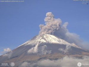
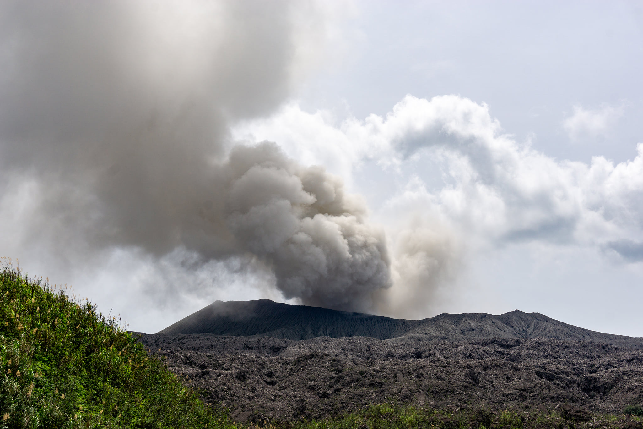
Indonesia , Dukono :
An eruption of Mount Dukono occurred on Friday, November 17, 2023, at 1:33 p.m. WIT, with an ash column height observed at ±2,600 m above the summit (±3,687 m above sea level). the sea). The ash column was observed to be white, gray to black with thick intensity, oriented towards the Northeast. At the time of writing, the eruption was still ongoing.
VOLCANO OBSERVATORY NOTICE FOR AVIATION – VONA
Issued : November 17 , 2023
Volcano : Dukono (268010)
Current Aviation Colour Code : ORANGE
Previous Aviation Colour Code : orange
Source : Dukono Volcano Observatory
Notice Number : 2023DUK019
Volcano Location : N 01 deg 41 min 35 sec E 127 deg 53 min 38 sec
Area : North Maluku, Indonesia
Summit Elevation : 3933 FT (1229 M)
Volcanic Activity Summary :
Eruption with volcanic ash cloud at 04h33 UTC (13h33 local).
Volcanic Cloud Height :
Best estimate of ash-cloud top is around 12253 FT (3829 M) above sea level or 8320 FT (2600 M) above summit. May be higher than what can be observed clearly. Source of height data: ground observer.
Other Volcanic Cloud Information :
Ash cloud moving to northeast. Volcanic ash is observed to be white to dark. The intensity of volcanic ash is observed to be thick.
Remarks :
Eruption and ash emission is continuing.
Source : Magma Indonésie.
Photo : Claudio Jung.
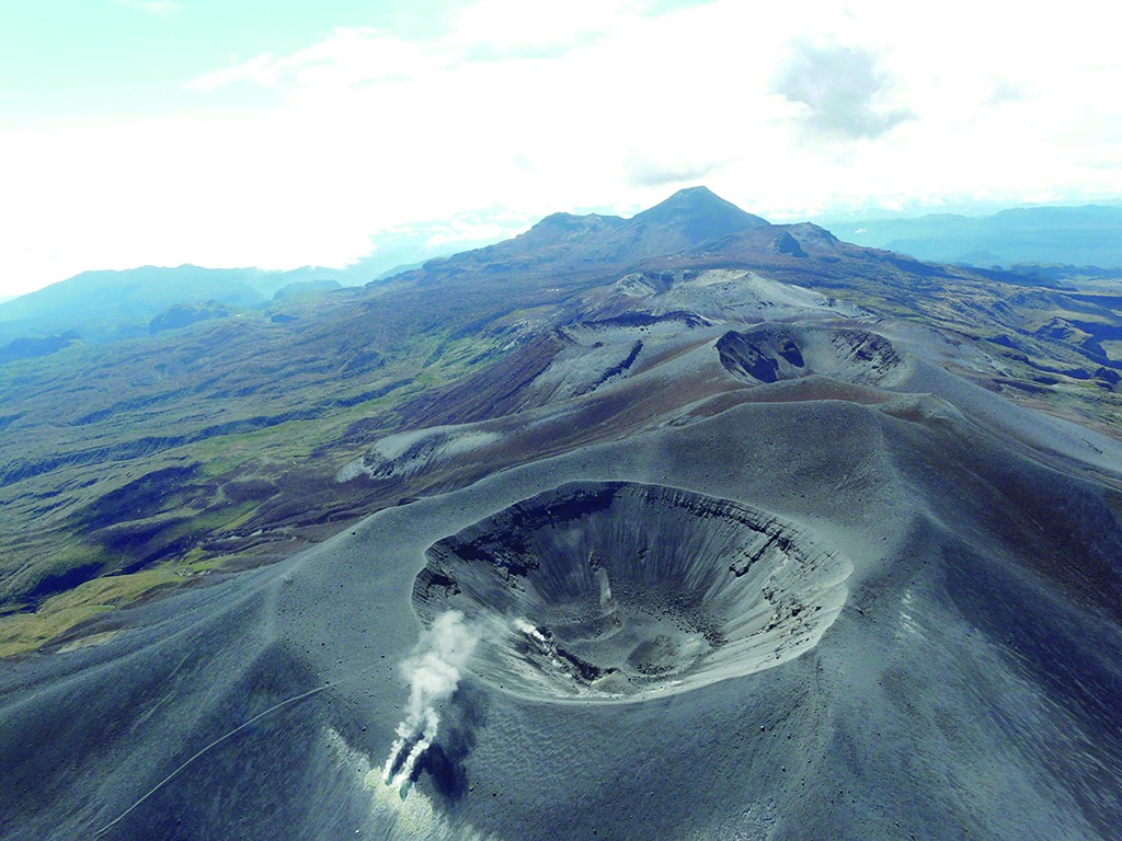
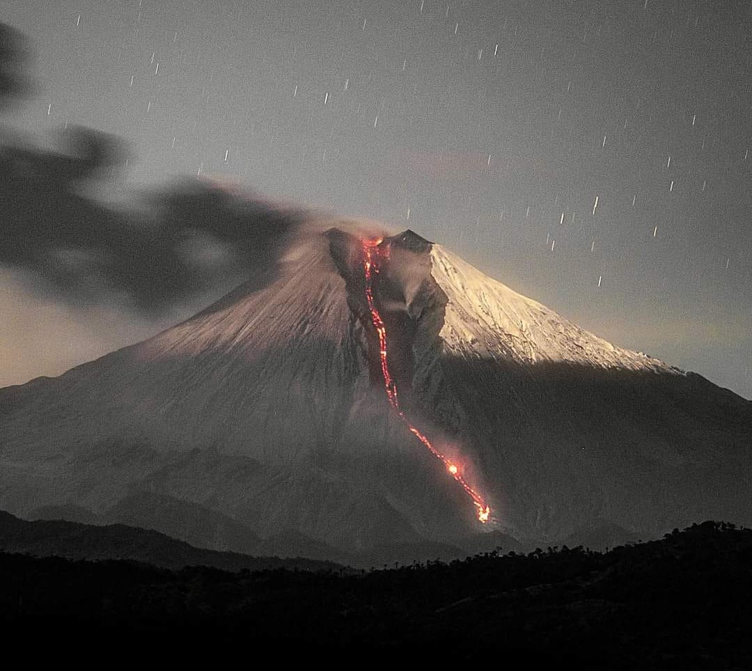
Ecuador , Sangay :
DAILY REPORT ON THE STATE OF THE SANGAY VOLCANO, Thursday November 16, 2023.
Information Geophysical Institute – EPN.
Surface activity level: High, Surface trend: No changes
Internal activity level: High, Internal trend: No changes
Seismicity: From November 15, 2023, 11:00 a.m. to November 16, 2023, 11:00 a.m.:
The number of seismic events recorded at the reference station over the past 24 hours is shown below. The level of seismic activity of the volcano remains high.
Explosion Event (EXP): 954
Precipitation/Lahars:
No rain was recorded in the volcano area. *In the event of heavy rains, these could remobilize the accumulated materials, generating mud and debris flows which would descend the sides of the volcano and flow into adjacent rivers.
Emissions/ash column:
Yesterday afternoon until the closing of this report, thanks to the network of surveillance cameras, several gas and ash emissions were recorded in the southwest direction and at heights between 1000 and 2300 meters above the crater level. Additionally, the Washington VAAC released 3 reports of gas and ash emissions with heights between 1,780 and 2,390 meters above the crater level in the West, Northwest, and Southwest directions.
Gas:
The MOUNTS system recorded 219.9 tonnes of sulfur dioxide (SO2), measured on 11/15/2023 at 1:30 p.m. TL.
Other monitoring parameters:
The MIROVA-VIIRS satellite system recorded 2 moderate thermal anomalies, the MIROVA-MODIS system recorded 1 moderate thermal anomaly and the FIRMS satellite system recorded 2 thermal anomalies, over the last 24 hours.
Observation:
During the night of yesterday and early today, several episodes of expulsion of incandescent material were observed, which descended through the Southeast ravine up to 1000 meters below the level of the crater. From morning until the close of this report, the volcano is partly cloudy.
Alert level: yellow
Source : IGEPN.
Photo : Eqphos fotografía