September 27 , 2018.
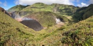
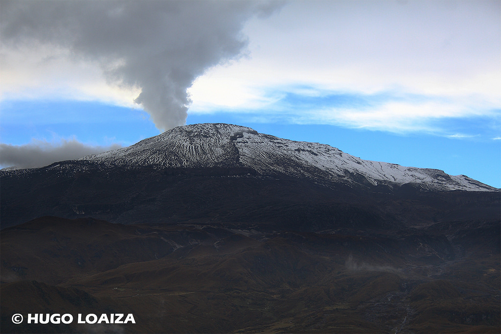
Colombia , Nevado del Ruiz :
Subject: Activity bulletin of the Nevado del Ruiz volcano.
The level of activity continues at the level: Yellow activity level or (III): changes in the behavior of volcanic activity.
With regard to monitoring the activity of the Nevado del Ruiz volcano, the COLOMBIAN GEOLOGICAL SERVICE informs that:
During the past week, the seismicity caused by the fracturing of the rocks composing the volcano has shown an increase in the number of earthquakes and a decrease in seismic energy released compared to the previous week. The earthquakes were mainly located in the northern, southern, northeast, southeast and Arenas crater distal zones, at depths between 0.6 and 6.2 km. The maximum magnitude recorded during the week was 0.8 ML (local magnitude) corresponding to two earthquakes on September 17 at 08:30 and 22:02 (local time), north and south of Arenas Crater, at depths of 3.5 km and 3.7 km respectively.
Seismicity related to fluid dynamics within the volcanic structure ducts showed a similar level in the number of earthquakes and released seismic energy compared to the previous week. This activity was characterized by the occurrence of earthquakes with variable energy levels of long period type (LP), very long period (VLP), pulses of volcanic tremor and episodes of continuous volcanic tremor. The earthquakes were mainly in the crater Arenas and its surroundings.
Some of these seismic signals have been associated with low emissions of gas and ash in the atmosphere, as confirmed by the Los Nevados National Park (PNNN) officials, the images captured by the cameras installed in the volcano area. residents near the volcano, civil aviation and the Washington Ash Monitoring Center (W-VAAC). Asbestos emissions have been opportunely reported to civil aviation through VONA notifications (Aviation Volcano Observatory Notice).
Volcanic deformations measured from electronic inclinometers, Global Navigation Satellite System (GNSS) stations and radar images show until now a stability behavior without recording any important process of deformation of the volcanic structure.
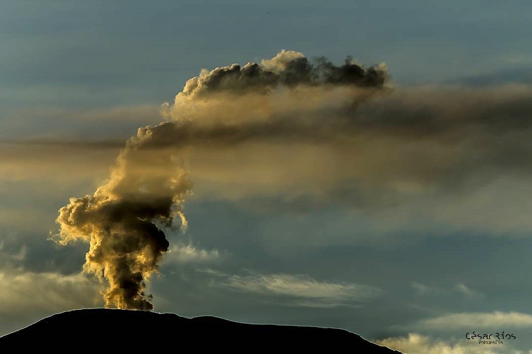
The volcano continues to emit into the atmosphere water vapor, ashes and gases, including sulfur dioxide (SO2) which is highlighted, as shown by the values obtained by the SCANDOAS stations installed in the volcano area and satellite image analysis. During the week, the MIROVA portal reported a thermal anomaly with a very low energy level.
The column of gas, steam and ash reached a maximum height of 1400 m measured at the summit of the volcano on September 22nd. The direction of dispersal of the column was governed by the direction of the wind in the area, which during the week predominated to the northwest relative to the crater Arenas.
The Nevado del Ruiz volcano continues at the Yellow activity level.
Source : SGC
Photos : Hugo Loaiza , Cesar Rios.
La Réunion , Piton de la Fournaise :
Activity Bulletin Wednesday, September 26, 2018 at 17:00 (local time)
The eruption started on September 15th at 4:25 am local time continues. The intensity of the volcanic tremor (indicator of surface eruptive intensity) has remained relatively stable over the last 24 hours (Figure 1).
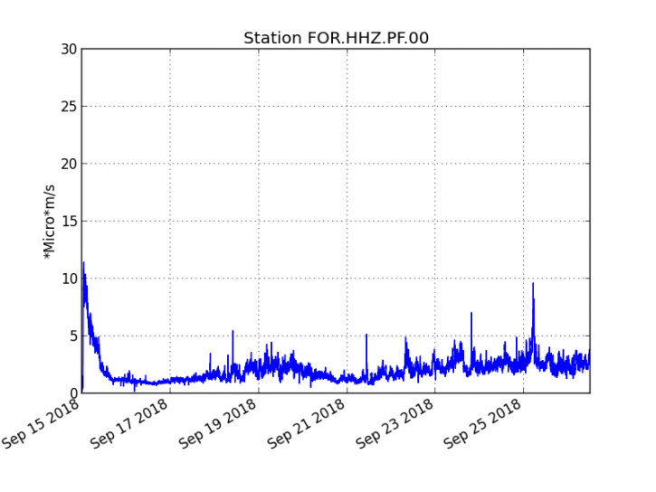
Figure 1: Evolution of the RSAM (indicator of the volcanic tremor and the intensity of the eruption) between 04h00 (00h UTC) on September 15th and 16h00 (12h00 UTC) on September 26th on the seismic station FOR, located near the crater Chateau Fort (2000 m altitude on the southeast flank of the terminal cone).
– No volcano-tectonic earthquake was recorded during the day of 25 September or during the current day.
– No significant deformation is noticeable.
– The surface flows estimated from the satellite data, via the HOTVOLC platform (OPGC – University Clermont Auvergne) are maintained and are always between 1 m3 / s and 2 m3 / s over the last 24 hours.
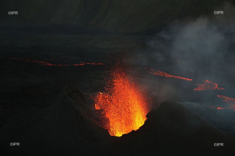
The cone continues to build, the notch to the south from which lava flowed since the beginning of eruption is now frozen (Figure 2). The area of active fountains is now closed and the lake is isolated in a single summit mouth (Figure 2). The flows are led by a tunnel and emerge by resurgences located about 150m downstream of the cone.
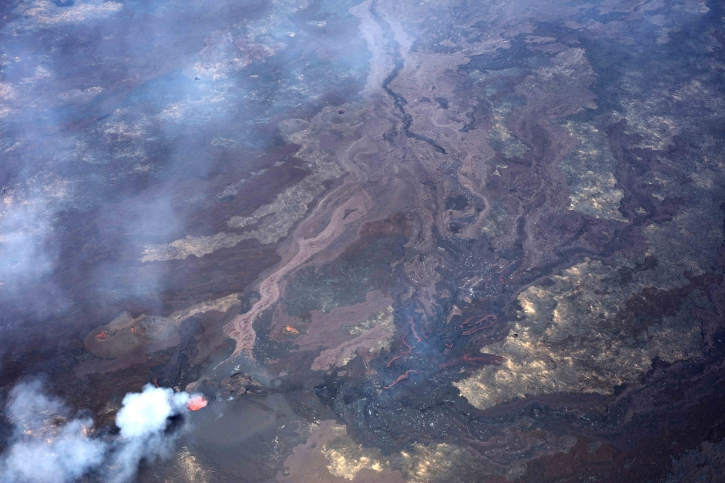
Figure 2: Aerial photography of the eruptive site on September 25, 2018 at 15:00 local time. (OVPF / IPGP)
Alert level: Alert 2-2 – Eruption in the Enclos .
Source : OVPF
Photos : OVPF , IPR
Mexico , Popocatepetl :
In the last 24 hours, thanks to the surveillance systems of the Popocatépetl volcano, 107 exhalations have been identified, accompanied by water vapor, gas and light amounts of ash, the most important being recorded yesterday at 16h12 and 17h03. Similarly, there were three explosions, 430 minutes of low amplitude harmonic tremor and three volcano-tectonic earthquakes, ranging in magnitude from M1.4 to M1.8.
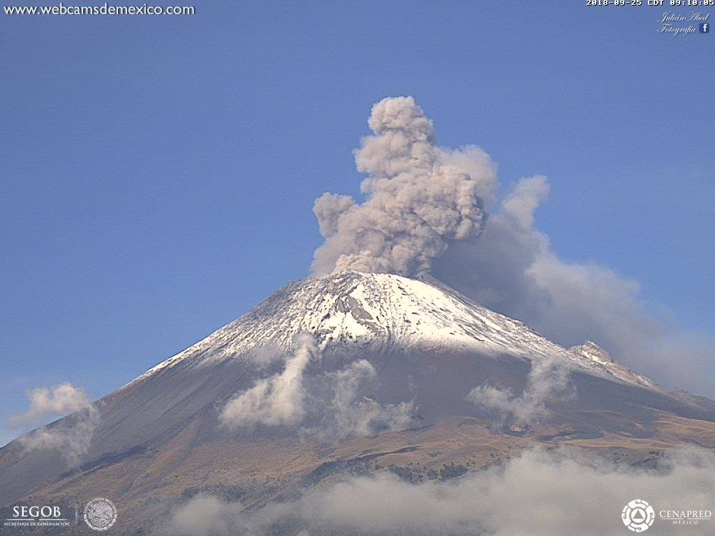
During the night, a slight incandescence was observed on the crater. At the time of writing, there was no visibility on the volcano, but early in the morning, the continuous emission of volcanic gases, which winds dispersed to the west, was observed.
CENAPRED asks not to approach the volcano and in particular the crater, because of the danger of falling projectiles and in case of rain to stay away from the bottom of the ravines because of the risk of landslides and mudslides.
The warning light of the Popocatepetl volcano is located at Amarillo Phase 2.
Source : Cenapred .
Photo : Segob/webcamdemexico
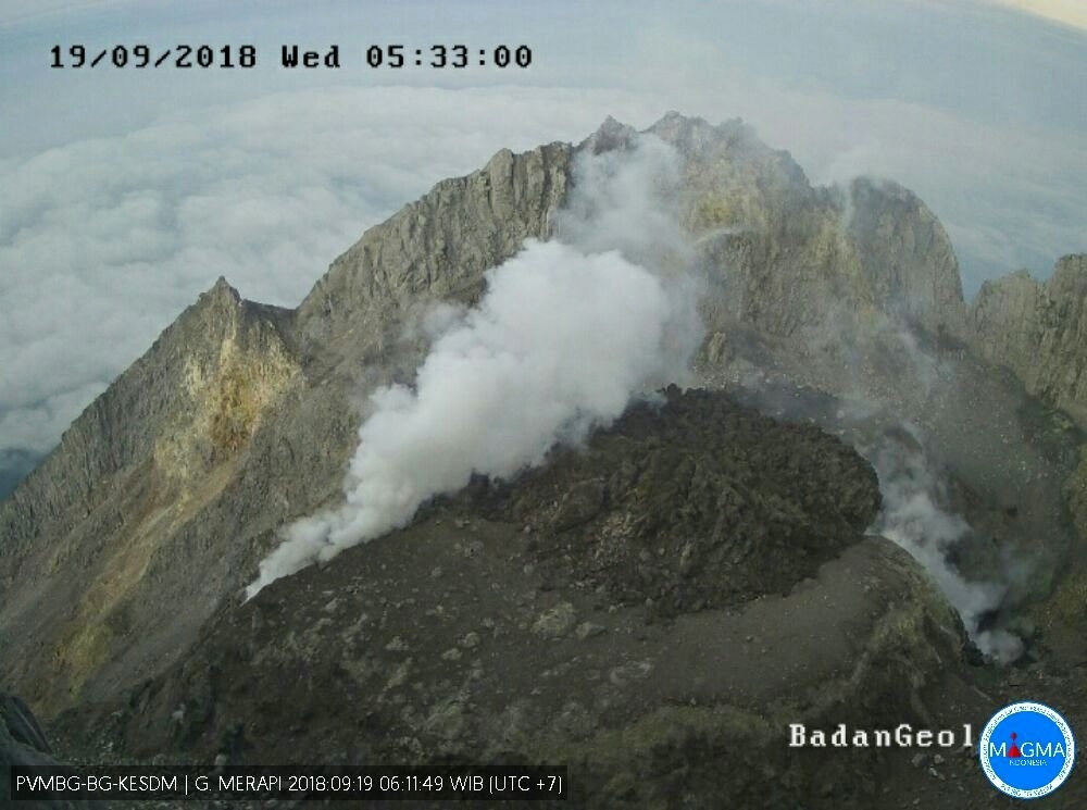
Indonesia , Merapi :
7.54°S, 110.446°E
Elevation 2910 m
PVMBG reported that during 17-23 September the new lava dome in Merapi’s summit crater continued to slowly grow. By 22 September the volume of the lava dome was an estimated 113,000 cubic meters, and the growth rate was 3,000 cubic meters per day. White emissions of variable density rose 100 m above the summit. The Alert Level remained at 2 (on a scale of 1-4), and resident were warned to remain outside of the 3-km exclusion zone.
Level of activity at Level II (Waspada). The Merapi (2968 m altitude) does not experience a continuous eruption.
Since yesterday and until this morning, the images of the volcano were clear until the appearance of the fog. Smoke from the crater was observed to be white with a moderate intensity up to 40 m above the peak. The wind is blowing slightly north and west.
The seismographic recording of September 26, 2018 noted:
21 avalanche earthquake
26 emission earthquakes
3 low frequency earthquakes
4 hybrid earthquakes
3 distant tectonic earthquakes
Recommendations:
Climbing activities on Mount Merapi are temporarily not recommended, except for investigation and research related to disaster mitigation efforts.
An area with a radius of 3 km around the summit is prohibited for the activities of the population.
People living in the area need to know more about Mount Merapi’s activities.
If there is a significant change in Mount Merapi activity, the status of Mount Merapi activity will be immediately reviewed.
Local governments are invited to socialize the current state of Mount Merapi to the public.
Source : PVMBG