October 13 , 2023.
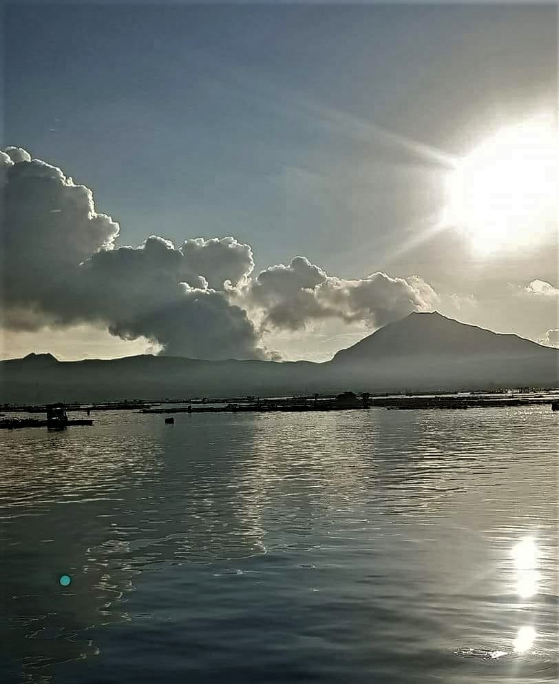
Philippines , Taal :
TAAL VOLCANO ADVISORY 12 October 2023 06:00 PM
This is a notice of increased and continuous degassing activity from Taal Volcano.
A total of 9,762 tonnes/day of volcanic sulfur dioxide or SO2 gas emission from the Taal Main Crater was measured today, 12 October 2023. This is the highest recorded SO2 emission from Taal for the year. Visual monitors show continued pronounced upwelling of volcanic fluids in the Main Crater that generated rather short and weak to moderate volume degassing plumes. Strong winds drifted the plumes to the southwest, consistent with PAGASA air trajectory forecasts. No volcanic smog or vog over Taal Caldera was observed by visual monitors throughout the day. However, PAGASA forecasts wind speeds over the Taal region to significantly decrease in the coming weekend, and should elevated SO2 degassing continue, the chances for volcanic SO2 to accumulate and generate vog would increase. Taal has been continuously degassing high concentrations of volcanic SO2 since March 2021; emissions since September 2023 have averaged 3,781 tonnes/day.
As a reminder, vog consists of fine droplets containing volcanic gas such as SO2 which is acidic and can cause irritation of the eyes, throat and respiratory tract with severities depending on the gas concentrations and durations of exposure.
DOST-PHIVOLCS reminds the public that Alert Level 1 prevails over Taal Volcano, which means that it is still in abnormal condition and should not be interpreted to have ceased unrest nor ceased the threat of eruptive activity. At Alert Level 1, sudden steam-driven or phreatic explosions, volcanic earthquakes, minor ashfall and lethal accumulations or expulsions of volcanic gas can occur and threaten areas within TVI.
Source : Phivolcs.
Photo : Onin casal /Agoncillo ERT
Colombia , Nevado del Ruiz :
Manizales, October 12, 2023, 3:45 p.m.
From the monitoring of the activity of the NEVADO DEL RUIZ VOLCANO, the MINISTRY OF MINES AND ENERGY through the COLOMBIAN GEOLOGICAL SERVICE (SGC) reports that:
In the early hours of today, October 12, in the monitoring of satellite monitoring platforms, several reports reported the thermal anomaly existing at the bottom of the Arenas crater, with moderate energy levels. One of them slightly exceeded the maximum value detected so far. Since this parameter was monitored (2007), the highest values observed in the thermal anomalies correspond to 2015, during the process of exit of the lava dome into the crater; to 2017, linked to the growth of this same dome; and, in April this year, when the volcano was on orange alert (previously active level).
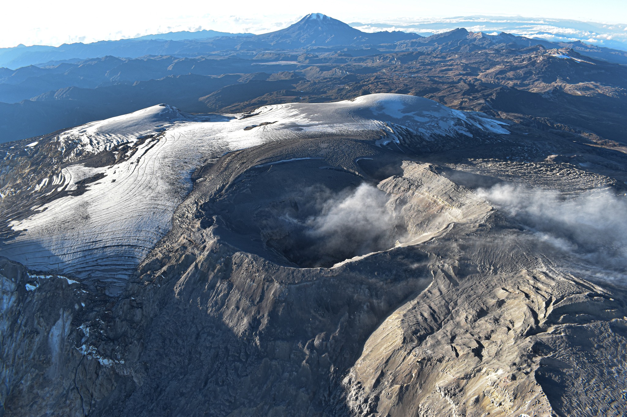
In addition to the increase in thermal anomalies, in recent weeks there has been an upward trend in other monitored parameters, such as seismicity, sulfur dioxide (SO2) outgassing and, in recent days, height and density of the gas columns. , steam or ash, as well as incandescence in the crater generally associated with the release of ash.
Although all these changes in the activity of the volcano are considered within the framework of the yellow alert state and reflect its variable and unstable behavior, it is important not to
normalize them. Although this state of alert for volcanic activity indicates that the volcano is less unstable and, therefore, the probability of a considerable eruption is lower, at any time it can rapidly destabilize, which would lead to the transition to an orange or even red alert state.
The community is recommended to remain calm and pay attention to the information provided by the Colombian Geological Service on the evolution of the state of the volcano.
Source et photo : SGC
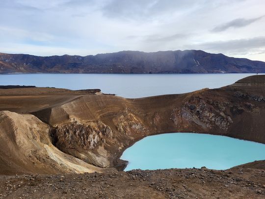
Iceland , Askja :
The uplift in Askja has slowed down . No deformation measured at several stations since the end of August. 3.10.2023
On Friday last week, a scientific meeting was held at the Icelandic Meteorological Office in the presence of IMO specialists, scientists from University of Iceland- Earth Science Department and representatives from the Civil Protection.
There is evidence of recent changes in the deformation data (cGNSS) around Askja. The deformation rate has decreased since the beginning of August and the signal has flattened at several stations within or around the caldera. At this stage it is uncertain what process is causing this pressure reduction, possibly the source of the inflation has been shut off or it could be related to an outflow of magmatic fluids.
View of Askja and Víti from the North. Photo: Michelle Parks/Iceland Meteorological Office
Over the same time period, the seismic activity in the area has not been increasing and there is no evidence of unusual geothermal activity.
Regular geodetic measurements around Askja have showed historic periods of subsidence and a period of uplift which did not result in an eruption. IMO continues monitoring the area which is still in Uncertainty level. The latest data needs to be modelled and interpreted to understand what process is responsible for this recent change. A new seismic station was also installed last week (west of Askja) for improving earthquake relocations.
Source : IMO.
Photo : Michelle Parks/Bureau météorologique d’Islande
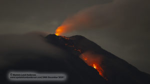
Alaska , Shishaldin :
54°45’19 » N 163°58’16 » W,
Summit Elevation 9373 ft (2857 m)
Current Volcano Alert Level: WATCH
Current Aviation Color Code: ORANGE
Volcanic unrest remains elevated at Shishaldin Volcano, with sulfur dioxide gas emissions and frequent small earthquakes detected over the past day. Elevated surface temperatures were evident in partly clear satellite views yeaterday morning, but no significant explosions or ash clouds have occurred over the past day. Several clear web camera views showed steam/gas emissions at the summit until about mid day yesterday, but since then the volcano has been obscured by clouds.
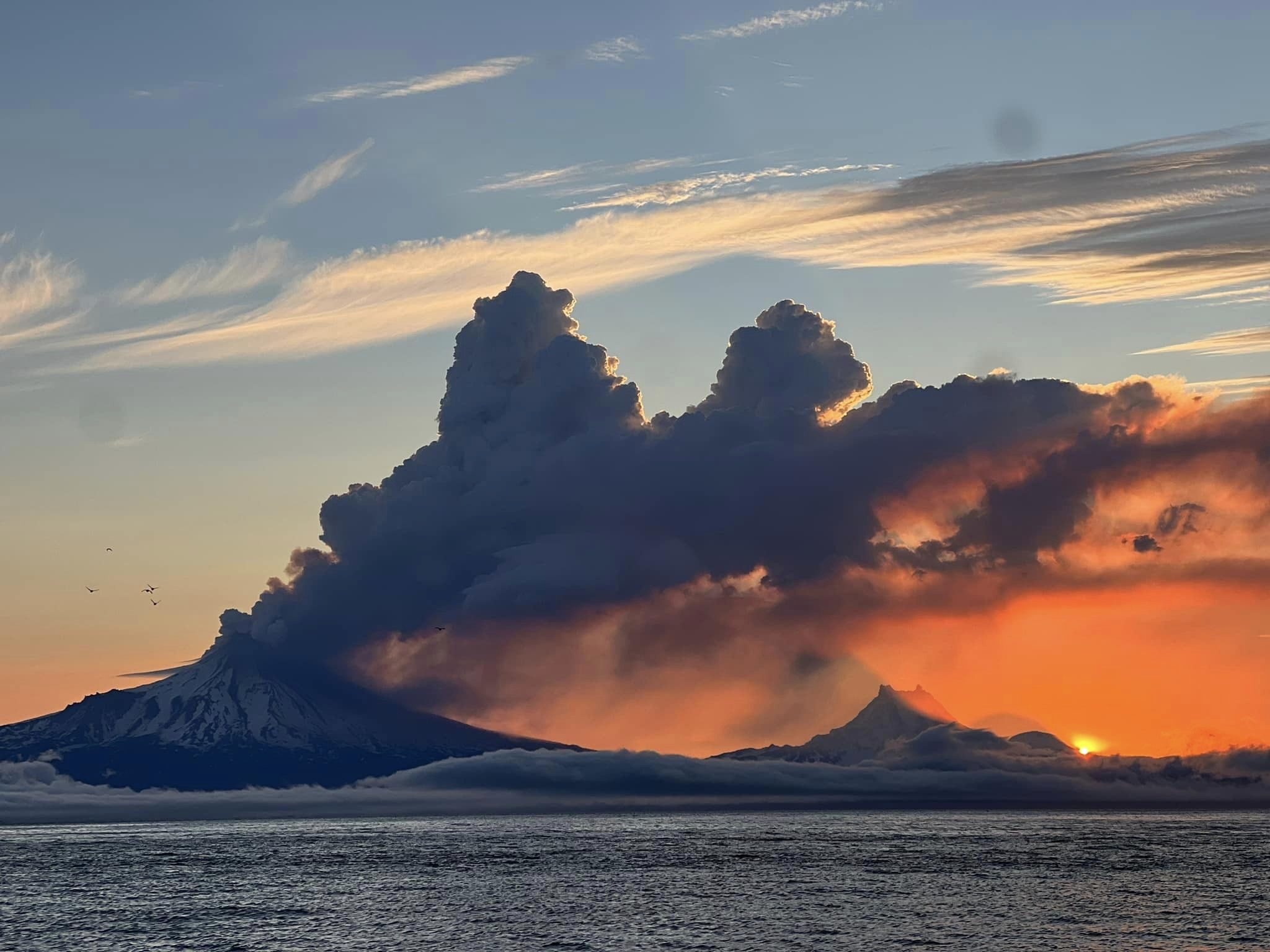
Twelve significant explosive events have occurred at Shishaldin since July 12, 2023. These events have been preceded by increases in seismicity in the hours to days before they occur. It is unknown how long this period of ongoing activity will last. However, previous eruptions of Shishaldin Volcano have lasted weeks to months with repeated cycles of eruptive activity like those seen since July.
Local seismic and infrasound sensors, web cameras, and a geodetic network monitor Shishaldin Volcano. In addition to the local monitoring network, AVO uses nearby geophysical networks, regional infrasound and lighting data, and satellite images to detect eruptions.
Source : AVO
Photo : Nick Enloe
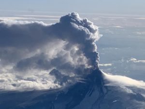
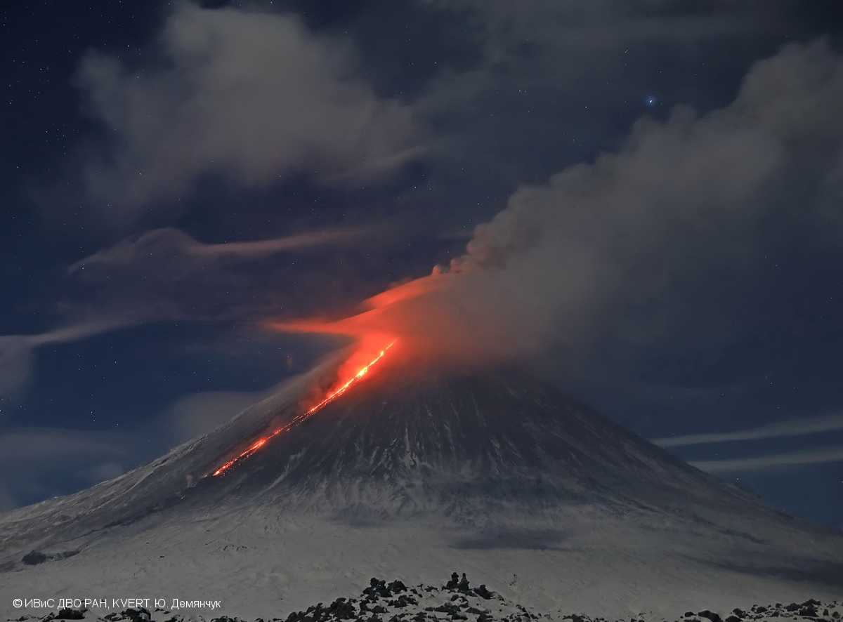
Kamchatka , Klyuchevskoy :
VOLCANO OBSERVATORY NOTICE FOR AVIATION (VONA)
Issued: October 13 , 2023
Volcano: Klyuchevskoy (CAVW #300260)
Current aviation colour code: ORANGE
Previous aviation colour code: orange
Source: KVERT
Notice Number: 2023-107
Volcano Location: N 56 deg 3 min E 160 deg 38 min
Area: Kamchatka, Russia
Summit Elevation: 4750 m (15580 ft)
Volcanic Activity Summary:
The summit explosive-effusive eruption of the volcano continues. Satellite data by KVERT showed a gas-steam plume containing some amount of ash is extending for 90 km to the south-east of the volcano.
The summit explosive-effusive eruption of the volcano continues. Ash explosions up to 7-8 km (23,000-26,240 ft) a.s.l. could occur at any time. Ongoing activity could affect international and low-flying aircraft.
Volcanic cloud height:
5000-5500 m (16400-18040 ft) AMSL Time and method of ash plume/cloud height determination: 20231013/0248Z – Video data
Other volcanic cloud information:
Distance of ash plume/cloud of the volcano: 90 km (56 mi)
Direction of drift of ash plume/cloud of the volcano: ESE / azimuth 111 deg
Time and method of ash plume/cloud determination: 20231013/0220Z – Himawari-9 14m15
Source : Kvert
Photo : Yu. Demyanchuk, IVS FEB RAS, KVERT