April 24 , 2020 .
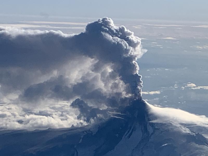
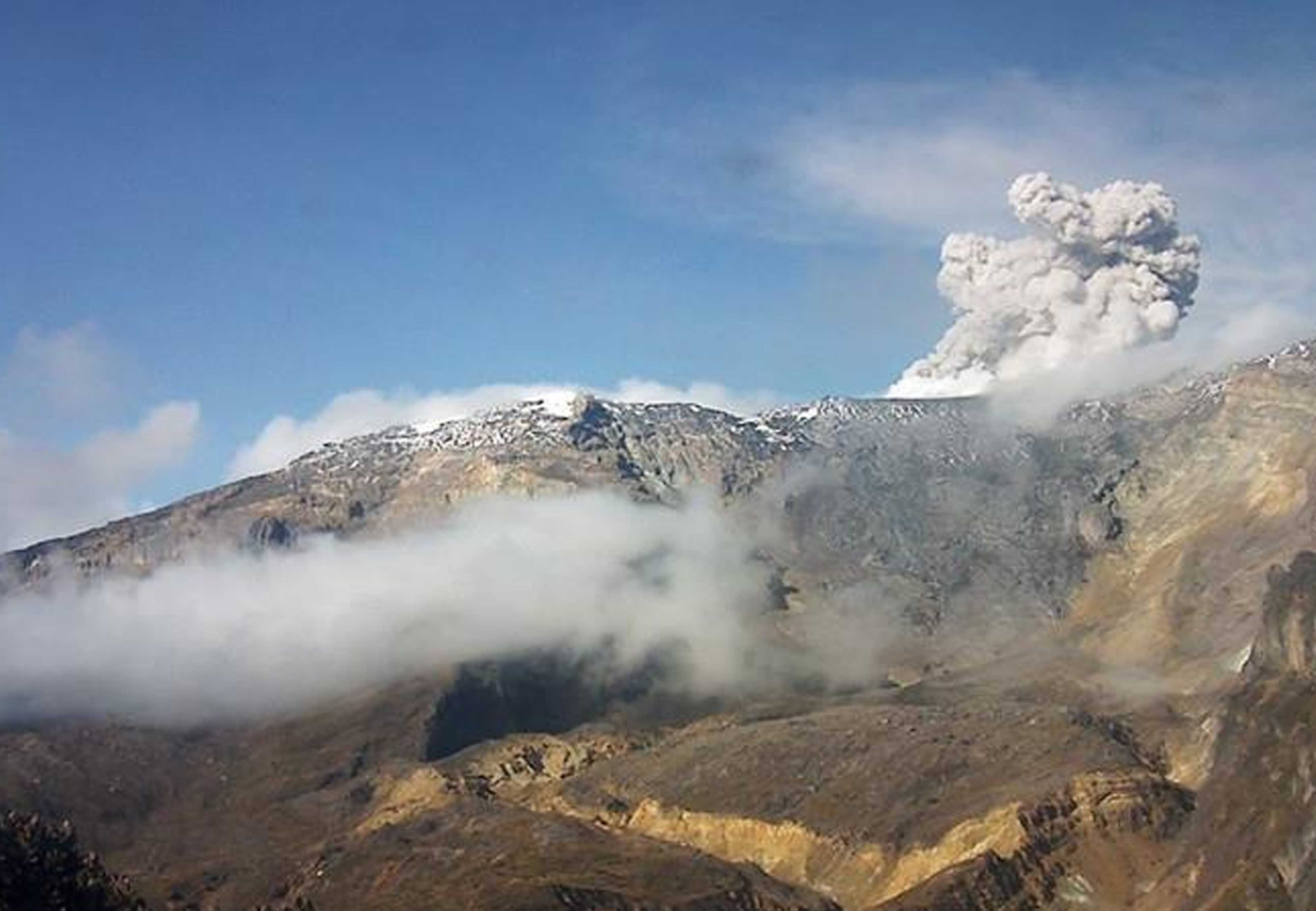
Alaska , Shishaldin :
54°45’19 » N 163°58’16 » W,
Summit Elevation 9373 ft (2857 m)
Current Volcano Alert Level: ADVISORY
Current Aviation Color Code: YELLOW

Shishaldin volcano in eruption, January 19, 2020.
Unrest continues at Shishaldin. Low-level seismic tremor continues and web camera images from the past day show a robust steam plume. No evidence of eruptive activity or deposits on the snow. Satellite observations of the summit crater were obscured by the steam plume. Increased steaming can occur due to favorable atmospheric conditions and does not necessarily mean that activity has increased. Unrest could escalate at any time with little warning, and additional eruptive activity within the summit crater, lava flows, lahars, and ash-producing eruptive events may occur.
Shishaldin is monitored by local seismic and infrasound sensors, satellite data, web cameras, a telemetered geodetic network, and distant infrasound and lightning networks.
Source : AVO.
Photo : AVO , Woodsen Saunders.
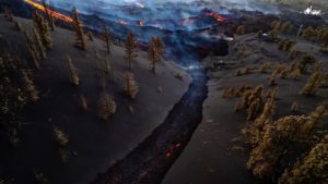
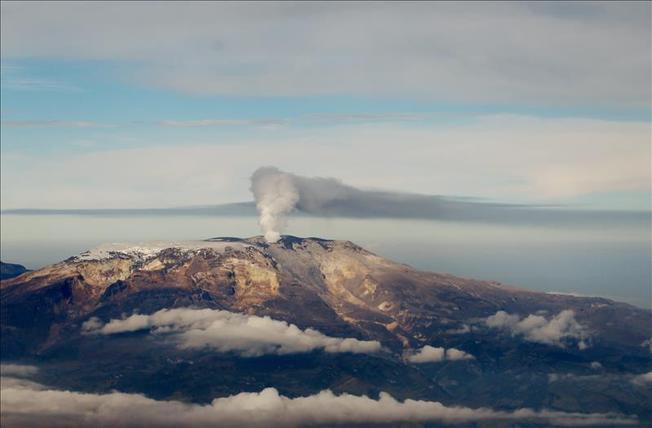
Colombia , Nevado del Ruiz :
Weekly activity bulletin of the Nevado del Ruiz volcano
The level of activity continues at the level of yellow activity or (III): changes in the behavior of volcanic activity.
With regard to monitoring the activity of the Nevado del Ruiz volcano, the COLOMBIAN GEOLOGICAL SERVICE reports that:
The seismicity linked to the dynamics of the fluids inside the volcanic conduits presented similar levels as well in the number of recorded events as in the seismic energy released, compared to the previous week. This seismic activity has been characterized by the occurrence of continuous volcanic tremors, tremor pulses, long period and very long period earthquakes. These earthquakes exhibited varying energy levels and spectral content. Some of these signs were associated with small emissions of gas and ash, which were confirmed by cameras installed in the volcano area and by reports from officials of the Los Nevados National Natural Park in the region.
The seismicity generated by the fracturing of the rocks showed a decrease in the number of earthquakes and similar levels of released seismic energy, compared to the previous week. This type of seismicity was mainly located in the Arenas crater and in the northeast and southwest sectors of the volcano, at depths between 0.5 and 6.0 km. The maximum magnitude recorded during the week was 1.1 ML (local magnitude) corresponding to the earthquake recorded on April 19 at 05:47 (local time), located in the crater Arenas, 1.7 km deep .
The deformation of the volcanic surface, measured from GNSS stations (Global Navigation Satellite System), showed some changes, associated with volcanic activity, consistent with those recorded by the other volcanic monitoring parameters, used during the evaluation complete of the Nevado del Ruiz Activity.
By monitoring the information provided on the Mirova and NASA FIRMS web portals, low-energy thermal anomalies on the volcano have been reported in the past week.
The gas and vapor column reached a maximum height of 1540 m measured above the summit of the volcano on April 19.
The Nevado del Ruiz volcano continues at a yellow activity level.
Source : SGC.
Photos : Unknown Author, National Park.
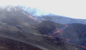
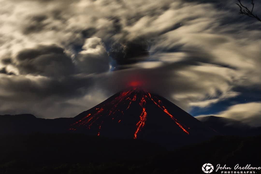
Ecuador , Reventador :
DAILY REPORT OF THE STATE OF THE VOLCANO REVENTADOR, Thursday April 23, 2020.
Information Geophysical Institute – EPN.
Surface activity level: High, Surface trend: No change.
Internal activity level: High, Internal trend: No change.
Seismicity: From April 22, 2020, 11:00 a.m. to April 23, 2020, 11:00 a.m.
Long Period Type (LP): 45 events
Explosions (EXP): 29 events
Emission limits: (TE): 12.
Harmonic tremors: (TA): 7.
Rains / lahars: Not recorded.
Emission / ash column: Today in the morning, an emission of vapor and ash was observed, which reached 900 meters above the summit in a northern direction. Using satellite images reported by the Washington VAAC, 2 emissions were reported: the first at 988 m and the other at 1338 m, their direction was Northwest and West respectively.
Other monitoring parameters: no change.
Observations: During the morning, an incandescence was observed at the level of the crater.
Alert level: Orange.
Source : IGEPN.
Photo : John Orellano .
Hawaii , Mauna Loa :
19°28’30 » N 155°36’29 » W,
Summit Elevation 13681 ft (4170 m)
Current Volcano Alert Level: ADVISORY
Current Aviation Color Code: YELLOW
Activity Summary:
Mauna Loa Volcano is not erupting. Rates of deformation and seismicity have not changed significantly over the past week and remain above long-term background levels.

Observations:
During the past week, HVO seismometers recorded 78 small-magnitude earthquakes on the volcano’s summit and upper-elevation flanks. Most of these earthquakes occurred at shallow depths of less than 8 kilometers (~5 miles) below ground level. The largest earthquake was a magnitude 2.3 under the south caldera.
Global Positioning System (GPS) measurements show continued slow summit inflation, consistent with magma supply to the volcano’s shallow storage system.
Gas concentrations at the Sulphur Cone monitoring site on the Southwest Rift Zone remain stable. Fumarole temperatures as measured at both Sulphur Cone and the summit have not changed significantly.
Source : HVO.
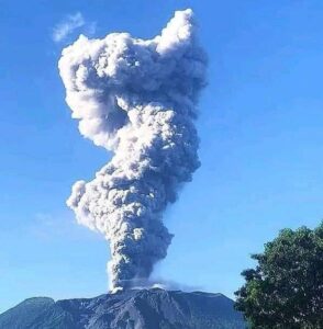
Mexico, Popocatepetl :
April 23, 11:00 a.m. (April 23, 4:00 p.m. GMT)
In the past 24 hours, using the Popocatépetl volcano monitoring system, 136 exhalations have been identified, accompanied by volcanic gases and sometimes ash. In addition, 53 minutes of tremors and two volcano-tectonic earthquakes were recorded today at 03:21 and 05:34 h with a calculated magnitude of 2.8 and 1.7, respectively.
An incandescence was observed at night during certain exhalations.
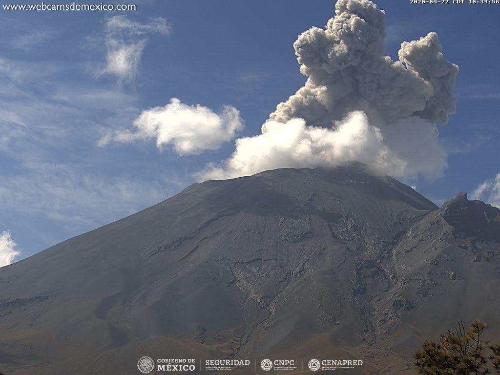
At the time of this report, there is visibility on the volcano, all emissions will be dispersed in a northeast direction.
CENAPRED urges not to get close to the volcano and especially the crater, because of the danger involved in the fall of ballistic fragments and, in the event of heavy rain, to move away from the bottom of the ravines because of the danger of mud and rubble.
The Popocatépetl volcanic alert signaling light is in YELLOW PHASE 2.
Source : Cenapred .